Last Updated: 8th Feb 2024

Intermediate - Experienced

Save Trail Save

I've done it Done

Rees Dart Reverse Run

Glenorchy, Otago

Submitted by Sierra Alef-Defoe

Last Updated: 8th Feb 2024

Intermediate - Experienced

Save Trail Save

I've done it Done

Open

Grunt Factor: 104 ?

Gnarl Factor: 43 ?

63.0km

2815m

2690m

1465m


Login as a VIP to see driving directions, distance and time.

Trail Map

Type of Run

Back country - remote

Point to Point (one way)

Undulating, some big hills

Native bush

Riverside

Open tussock/grasslands

Open ridges/tops

Run Makeup

20%
70%
10%

Easy Single Track

Moderate Single Track

Technical Single Track

Average Uphill Gradient: +8.7%

Average Downhill Gradient: -8.3%

Trailhead

Login as a VIP to see the trailhead information.

Estimated Times to Run

12:00

Slow

10:00

Moderate

8

Fast

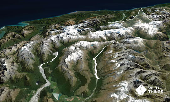
The Rees-Dart! A wee tour of Mt Aspiring National Park, where a well-formed track takes you past stunning views like Dart Glacier and Pikirakitahi/Mt Earnslaw.

Running the track in reverse, as the "Dart-Rees," allows for a more gradual ascent towards Rees Saddle (1471). It also allows you the chance to keep your feet dry until the very end if it's summer conditions; as the head of the Rees trail is a bog where you are guaranteed to get your feet wet and muddy.

The Dart track is undulating, mostly in the forest especially to start. Daleys Flat Hut falls about halfway into the Dart track, providing a good toilet stop. After Daleys you get a bit more open grasslands on the way to Dart Hut.

Just before Dart Hut, views of the Whitbourn Glacier start peaking through the trees. Dart Hut can be considered the halfway point; definitely fill up some water here as you won't get a good chance again for another couple of hours.

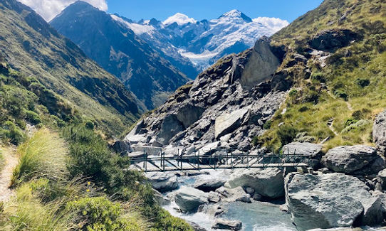
Leaving Dart Hut, you continue onto the Rees track, which starts with decidedly steeper terrain heading up towards the saddle. This section offers some of the most rewarding views of the track. The Upper Snowy Creek Bridge is removed in winter.

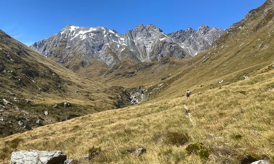
After the bridge, the track becomes more undulating again until Rees Saddle (1471), where there is also a worthwhile side trip up to Pt 1537.

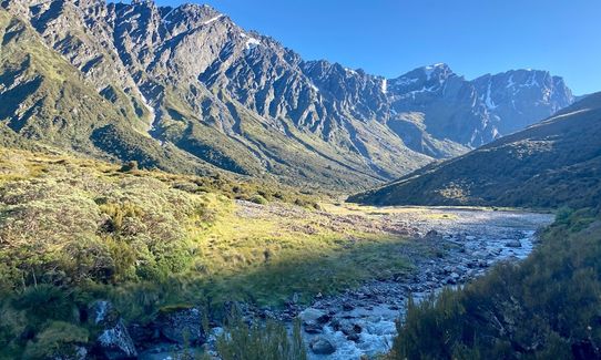
Heading down the Rees Valley from the saddle, take a bit of care on the rocky terrain. Soon you will meet the Rees river, great if you need to fill up water after the saddle.

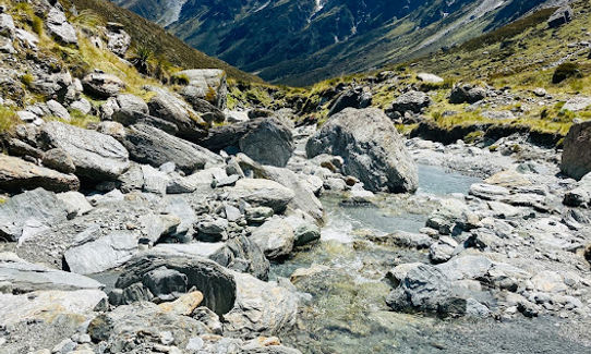
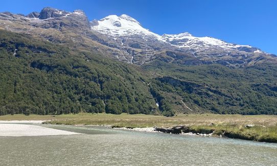
The track takes a steady downhill towards Shelter Rock hut, and you are rewarded with some stunning views of waterfalls and eventually Pikirakatahi/Mt Earnslaw.

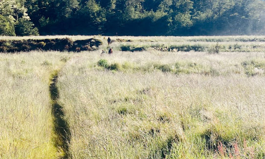
The Rees track is pretty good travel until around the 25-mile bridge, and then the last 6 km out of Rees Valley Station are a true bog.

If the weather is warm and the river is low, some people prefer to just walk in the river and/or on the farm track that crosses the river many times.

There are many worthwhile side trips from the Rees-Dart track, such as Dart Glacier/Cascade Saddle, and Kea Basin/Pikirakitahi-Mt Earnslaw. These could be considered as options for a multi-day mission.

Glaciers, rock bivvies, waterfalls

The Rees-Dart is more of a horse shoe than a loop, so some logistics are required, as there is 34 km of road to travel between carparks. It should also be noted that both these roads include dirt/gravel sections, fords, and parts that are prone to mud or slips. Some very keen people do the shuttle with a mountain bike. The more common solutions are to do a key swap, get a car relocated, or get a nice friend to do pick-up & drop-off.

28 km

150 minutes

Unknown

No

Easy.

Being a popular tramping track, maintained by DOC with serviced huts in the summer, this track is generally well-marked and easy to follow.

Non-existent.

Windproof jacket, Gloves, Personal Locator Beacon (PLB), Whistle, First aid kit, Extra food for emergencies, Cellphone, Map, Headtorch and spare batteries

Water is readily available from side streams, as well as in tanks at the 3 huts along the track. The Dart is not so nice to drink from due to silt, and the Rees not so nice once you've passed the Mt Aspiring National Park boundary due to livestock.

The track crosses many avalanche pathways, so it's best avoided in winter or spring. Additionally, Upper Snowy Creek bridge is removed in winter, and it would make for a really gnarly crossing. Also wouldn't want to go during or after a big rain with slippery/muddy conditions and rising side streams.

Trail Legend

JT

Jake Trinder

has completed Rees Dart Reverse Run once in the last year.

Learn about Trail Legends.

You and Rees Dart Reverse Run

As a VIP member you can record private notes for this trail, see all of your times and more.

Register Now

Already have an account? Login now

Trail Reviews

What a mission.......managed to run this with Trail Legend the good Tim Devine. The first beech forest section is gradual up and down and opens up to an amazing yomp up the Dart Valley; lots of tributary creek crossings and Dart Hut feels a long way along the trail. Saddle climb is epic and poles a real help. Steep down and the leg to shelter rock again takes time. Final leg we took the trail and in places that was tricky on tired legs, the 4WD and River a better option but tough in the dark! Plenty of streams for refills and good single track throughout. Highly recommend and an exercise in mind over matter!

Paul Carman

February 16

An absolute classic!

Sierra Alef-Defoe

April 22, 2022

Login to submit a review

Trail Running Community

Find people who are interested in or have completed this trail run.

You must register or login to view this feature.

Register Now

Overlapping Trails

These overlap with this trail to some degree. You may wish to combine them but please note that to qualify for FKTs on these runs you should record a separate activity for each.

Rees - Cascade

Rees - Cascade

Length: 55.0km

Level: Experienced

Other trails nearby
Earnslaw Burn Circuit

Earnslaw Burn Circuit

Length: 25.0km

Level: Intermediate - Experienced

Ailsa - Humboldt Circuit

Ailsa - Humboldt Circuit

Length: 64.0km

Level: Very Experienced

The Royal Richardson Traverse

The Royal Richardson Traverse

Length: 25.5km

Level: Intermediate - Experienced

Sugarloaf Circuit

Sugarloaf Circuit

Length: 21.7km

Level: Intermediate - Experienced

Find more trails and peaks nearby