Last Updated: 9th Sep 2024
XTERRA Orongorongos Long Course
Last Updated: 9th Sep 2024
Open
Grunt Factor: 27 ?
Gnarl Factor: 29 ?
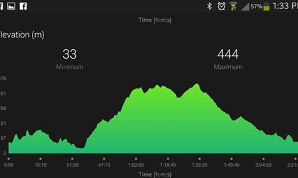
20.5km
780m
780m
448m
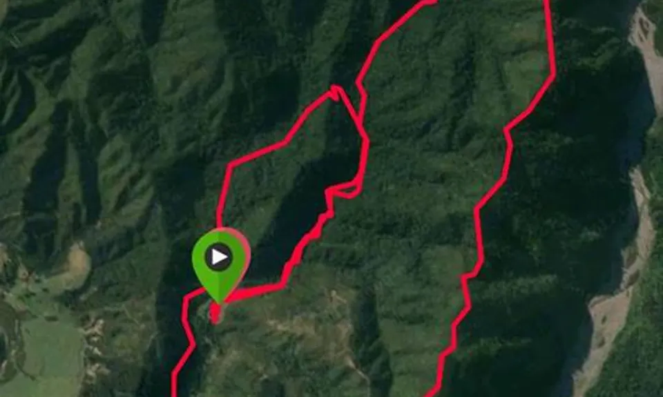
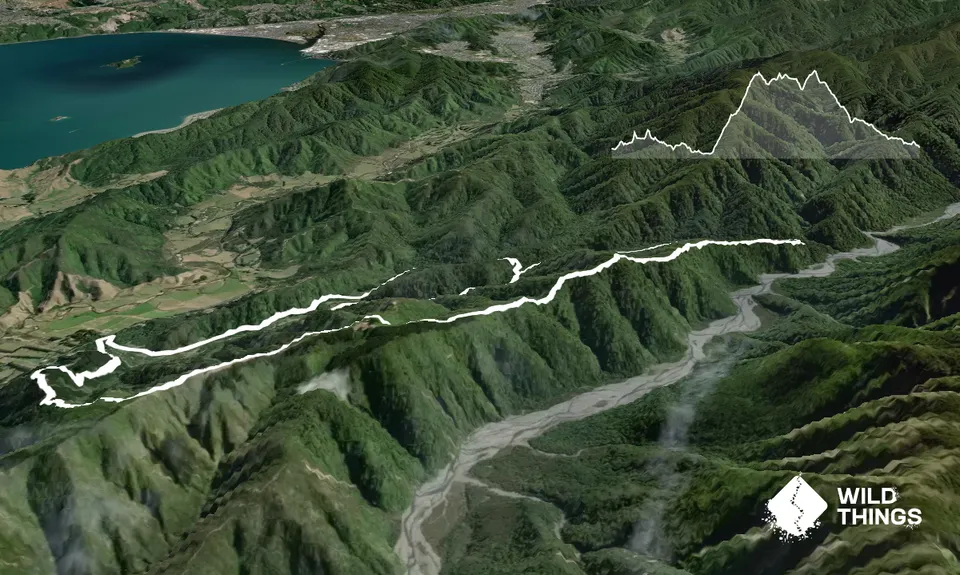
Trail Map
This Topo layer only covers NSW/ACT.
Switch to another map layer when viewing outside this area.
Switch to another map layer when viewing outside this area.


