Wild Things - New Zealand's trail running community
New Zealand's trail running community

Login


don't have an account?

Catchpool Dress Circle, Wellington

Trail Directory proudly supported by Further Faster

Update Your Header Picture

Catchpool Dress CircleIntermediate

Submitted by Jon Peter Hart

Info Info
Map Loading

Trail Information

26.50km

1500m

1500m


Wellington

Wainuiomata

Front country - easily accessible

Loop

Undulating, some big hills

Native bush
Riverside

Intermediate

7:00 (Slow)
5:00 (Moderate)
3:00 (Fast)

-11.6%

+11.9%

Download PDF Guide

Fastest Known Times (FKTs)

Please set your gender to see your position on the FKT leaderboards.

Men

Women

Show more

Filter FKTs

The more , the harder the FKT will be to beat. Learn about Fastest Known Times.

Missing your time?

Register or login as a VIP and get yourself on the FKT leaderboard!

Register Now

Description

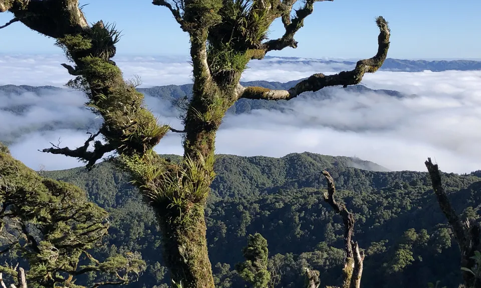
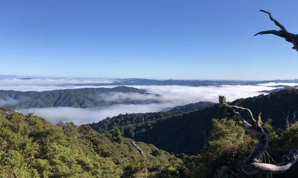
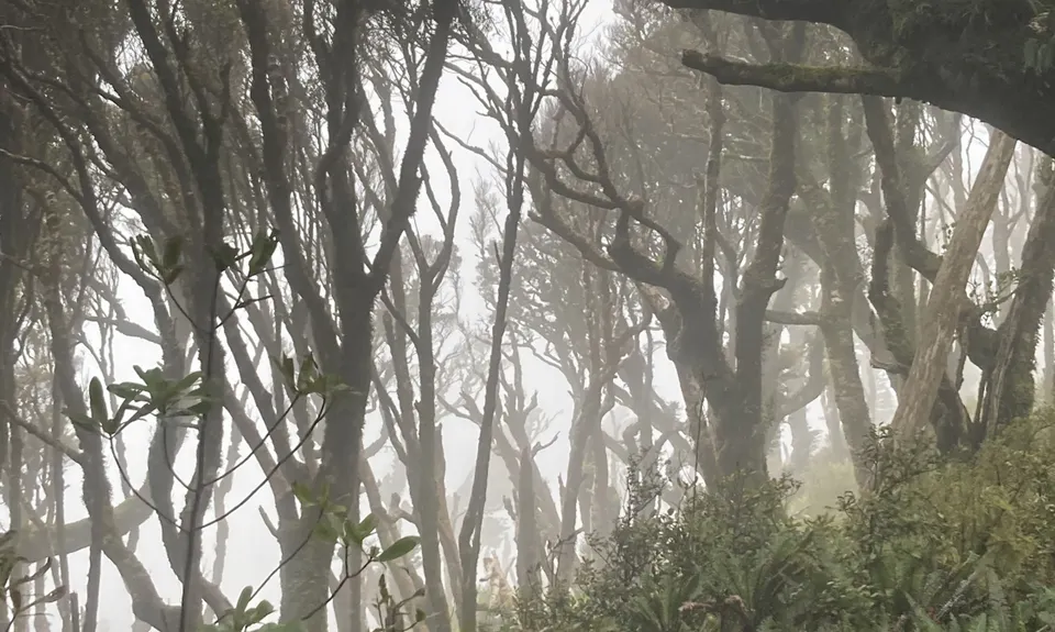
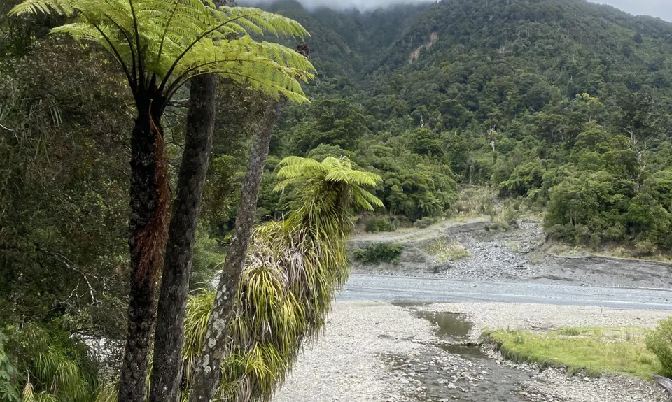
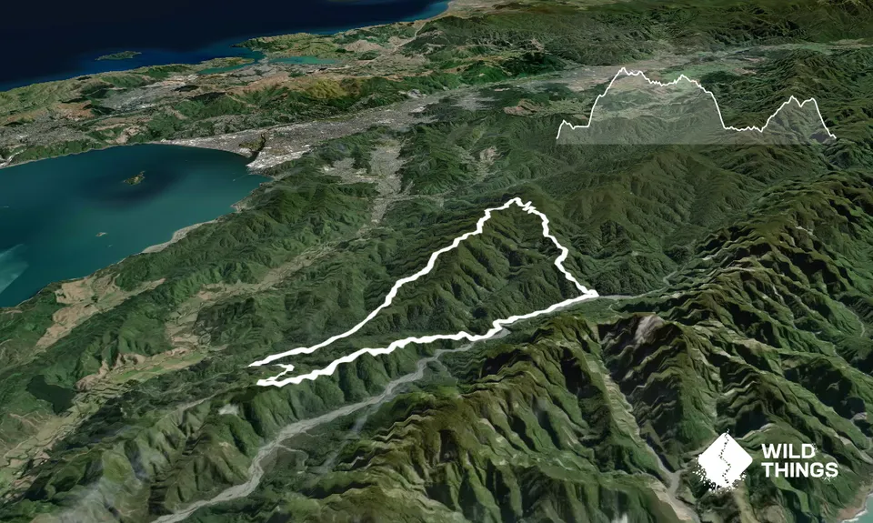
Begin at the Catchpool carpark at the end of the valley road. Follows the signs for the middle ridge track (to the left of the information shelter) for a short sharp climb out of the carpark area. You will shortly come to the clay forks intersection with options to return to the carpark for a much shorter loop. Take the clay ridge track which climbs steadily for the next 5km up to McKerrow which is the highest point of the run (McKerrow does not have a trig point and is marked by a track intersection).

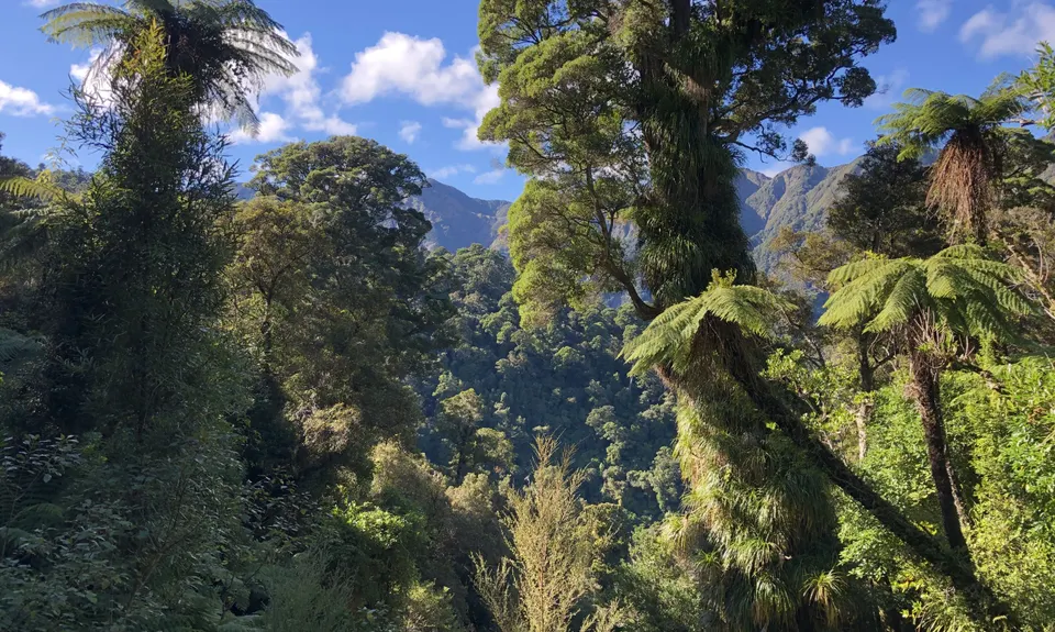
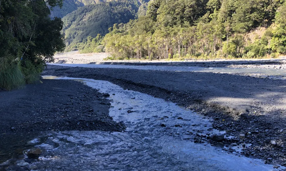
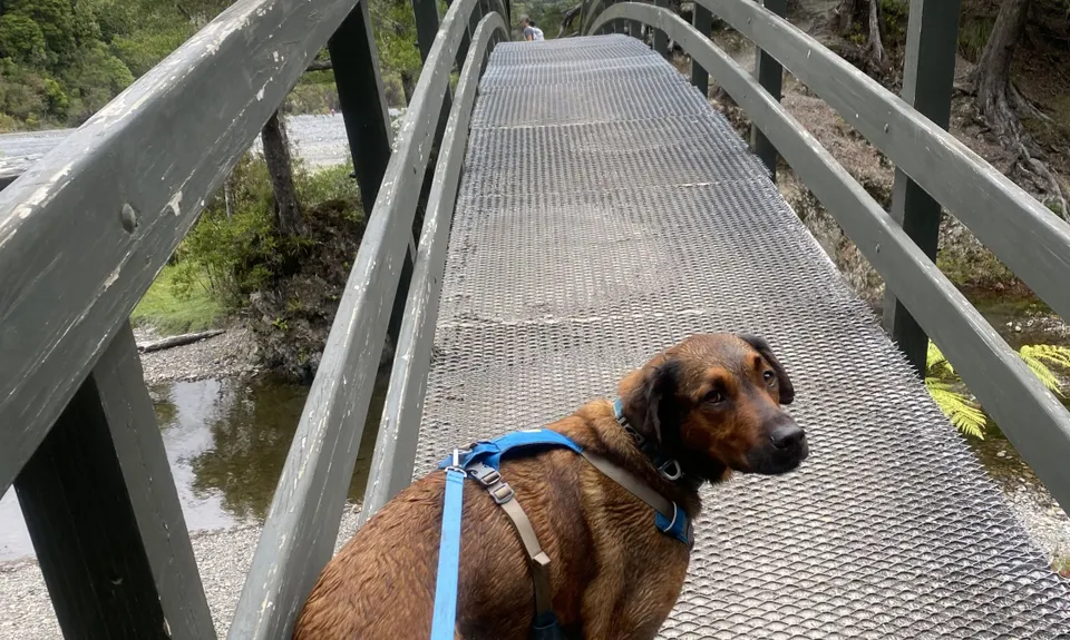
Continue straight on the Mckerrow track for a few more kms towards the Whakanui intersection. The track can be fairly boggy in this section even on a good day but rest assured. it doesn't last long. At the Whakanui track intersection continue straight on the Whakanui track (left takes you towards Wainuiomata). Shortly after this there is an unmarked entrance to the East Whakanui track if you want to extend by a few kms, however, this run continues following the orange markers on Whakanui track which will lead you down to the Orongorongo river (great place to refill water).

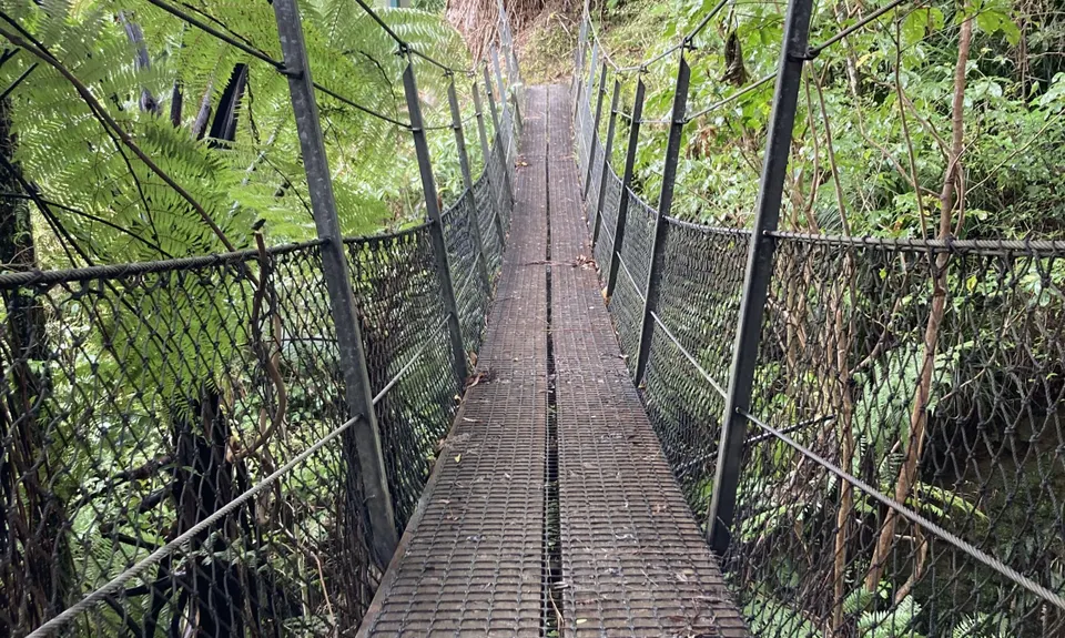
At the end of the Whakanui track you will meet the Big Bend track which will lead you back down the valley past several huts towards the start of the Orongorongo track. Stay on this track for approximately 2km before you will see a sign indicating the start of the Cattle Ridge track on your left (at this point you could continue along the Orongorongo track back to the carpark, for a slightly shorter run with less ascent). Slog your way up a fairly decent ascent to Cattle Ridge to be rewarded by some decent ridge running on a fairly well-maintained track. After approximately 5kms you will reach the Butcher track which will lead you on a fairly quick descent back to the Orongorongo track and the Catchpool carpark.


Trail Community

Find people who are interested in this run.

You must register or login to view this content.

Features of interest

Orongorongo river, good views of Mt Mathews and Wellington CBD, potential for Kiwi sightings


Make Up of Run

Moderate Single Track: 100%


Route Data

Reviews:

You must register or login to view this content.


Overlapping Runs

The following trails overlap with this run to some degree. You may wish to combine them but please note that to qualify for FKTs on these runs you should record a separate Strava activity for each

Mt Matthews

Mt Matthews

Length: 27.00km

Where in the Whakanui?

Where in the Whakanui?

Length: 17.20km


Photos:

You must register or login to view this content.

Your Trail Wishlist

All the runs that are on your To Do list (no limit).

Add to wishlist view wishlist

Your Trail Dreamlist

The runs you most want to do (limited to 10).

Add to dreamlist view dreamlist

Wild Explorers

I did it!
  • Access

    Start at the Catch Pool Valley carpark off of Coast Road.

    Plenty of parking available and generally fairly safe with large amounts of people flocking to the area to tramp on sunny weekends.

    14 km

    19 minutes

    No

    No

  • Staying Safe

    Moderate.

    The topomap indicates more route options on the Whakanui track than are visible when running it. Continue following the orange markers and the obvious track through this section and you will be fine.

    Patchy.

    Long-sleeved thermal top, Seam-sealed waterproof jacket, Personal Locator Beacon (PLB), Whistle, First aid kit, Extra food for emergencies, Cellphone, Map.

    Water is available at the Orongorongo river. There are also several small streams crossing the Whakanui track, however, water will likely need to be filtered on the go.

    Can be very windy along the ridges.

    Some sections of the track have quite a few roots to dodge.

  • Post run indulgence

    Anywhere on Jackson St, Petone

  • Sponsor this trail

    If you are interested in learning about sponsorship opportunities, please get in touch below:

    Submit

Got a favourite trail? Tell us about it.

Share the love and add your favourite trail(s) to our growing trail directory.

Submit A Trail

Become a member today

Start enjoying the many benefits to becoming a member of our thriving community.

Become a member

Great brands at great prices with our VIP member's discount

Stay up to date

Sign up to our newsletter for latest offers and trail guides

Share this trail with a friend:

VIP Membership

Please register as a VIP or login to your VIP account to view this content.

Cancel Login Register

Membership Required

You can see up to three trail guides without being logged in but after that we require you to be logged in to your Free or VIP account. If you don’t yet have an account you can register here.

Login Register