NOT RECOMMENDED FOR WET CONDITIONS. If it's expected to rain a lot, or has been recently, save this trail for another day as there is a fair amount of river and stream travel. There are some wet weather deviations but you'll potentially just dig yourself further into a hole.
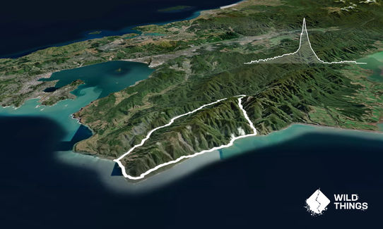
Starting at the car park, cross the bridge and then go straight down to the river jumping the fence. This lower section of the Orongorongo River crosses through private land so stay in or near to the river until you pass the houses to the north. It's a wide river so the best advice is to pick the straightest lines between bends for the next 15.5km. After about 10km you'll start seeing huts before you spot the arched Turere Stream bridge off to your left about 12km in. This marks the start of the Big Bend Track which may be easier travel than the river but is slower.
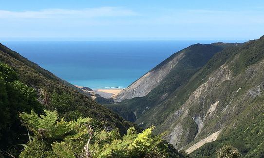
About 15km in keep an eye out for the orange triangle markers heading up Matthews Stream. If you don't have great navigation skills, you could take the Big Bend Track to the end where it spits you out almost opposite Matthews Stream. Follow the poles with orange triangles until you reach the DOC sign for the Mt Matthews Track and the start of the first actual trail of this run. Here you go straight up for over 200m before taking the signposted South Saddle track off to the right. South Saddle is a grassy open saddle that leads you down the Mukamuka Stream. Whilst the route is marked, make sure you are find the orange triangles before heading towards the coast. Here you follow the orange triangles on a rough goat track all the way down to the coast.
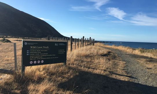
At the coast, hang a right and follow the 4WD tracks that are marked with blue poles for the Rimutaka Cycle Trail all the way back to the car park.
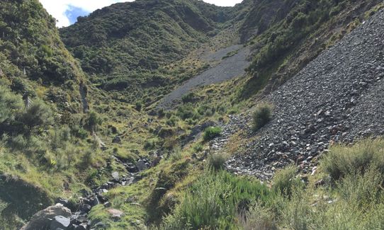
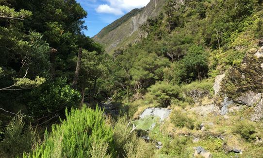
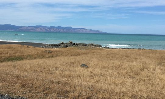
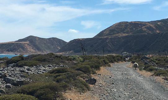
Over this run you will cover a large range of scenery from river travel surrounded by farm through to mature native forest, up to an exposed saddle through beech forest, down a scruby stream gully, past huge scree slopes, and around the rugged southern coast.
The wide Orongorongo River starts off as a working farm. As you head up the bush becomes more mature as you enter the Rimutaka Forest Park with tall emergent trees and historical huts littered everywhere. At the South Saddle of Mt Matthews you get a few views off towards Wellington and over the South Coast. Down the Mukamuka Stream, the mountains feel like they're falling down on to you with large scree slopes and narrow valleys before opening up at the mouth into pasture. The coastal section is along the Wild Coast Track and is pretty wild and barren. Karaka trees mark the sites of old Maori fishing settlements, there's the odd grave head stone, you cross three large shingle fans past Windy Point, and at the Turakirae Scientific Reserve there is a seal colony and boulders popular with rock climbers.
The famed Mukamuka Munter trail race runs in the opposite direction from the car park, up the Mukamuka Stream and then out to Catchpool Valley.
Public toilets are at the carpark at the beginning of the track.
Car park is isolated but large. Safe as long as you are sensible and don't leave valuables in sight. No public transport available.
29 km
37 minutes
No
No
Hard.
Whilst it's relatively easy to navigate, most of this route has no trail so treat it with caution if you aren't familiar with river travel. Make sure to get down to the river STRAIGHT AFTER crossing the big road bridge at the car park. Basically you follow the really big river for a long way before turning off. This is a Forest Park with plenty of places to get lost. If you have a GPS, keep an eye on the km's and start looking for the orange triangles from about 15km in, marking the turn off up Matthews Stream. At South Saddle, keep an eye open for the orange markers heading down the Mukamuka Stream and then pick the easiest route between markers.
Plenty of water everywhere, but best to take some purification tablets to get rid of any giardia that may be lurking. Filling up half way down the Mukamuka Stream is a good halfway fill up point.
If it's been raining, best avoid as there are a lot of rivers and streams.
If windy (especially a southerly), the south coast section may destroy your soul.
The Orongorongo River is safe when low, but deadly when high. The Mukamuka Stream gully is steep and slippery. The shingle fans past Windy Point can be uncross-able if raining.
Do you have a suggestion on where to go afterwards for the best coffee / cake / breakfast / brunch / beer?
These overlap with this trail to some degree. You may wish to combine them but please note that to qualify for FKTs on these runs you should record a separate activity for each.
We don't store or share your location; it's only used for these features. You can continue without it, just without distance sorting and live map features.
Send to your phone
Scan the below QR code to open this trail on your phone.
Tip: position the QR code in your phone camera screen.