Start along the Petone Esplanade and cross the Waione St bridge. Head north along Randwick Rd until turning right on White Lines East until you reach Te Whiti park. There are toilets and water available here.
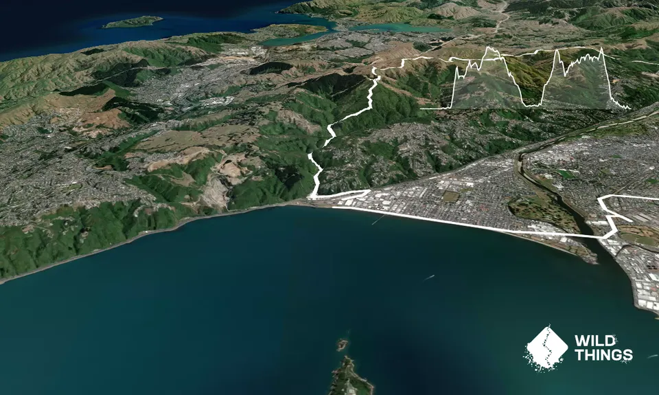
Commence a steep climb directly up the Te Whiti firebreak to the ridge/4wd track. Follow the firebreak (ECNZ track) north for approximately 12km until the descent towards Silverstream retreat via Kingsley Street firebreak. There are multiple routes off the firebreak so it's recommended to keep your situational awareness and follow a gpx route.
Descend through Silverstream Retreat and cross the road to join the Hutt River trail. Continue north and cross the Silverstream bridge turning left to follow the Manor Park cycle trail alongside the golf course. Cross the Manor Park railway bridge and head south to the Dry Creek entrance of Belmont Regional Park. Toilets and water are available at the campsite. Fill up as no drinking water is available in the park.
Follow The Puke Ariki traverse (see guide here) until exiting at Cornish Street, Petone. Head north to cross the Petone Rail bridge before returning to the start.
See the Hutt Valley (and beyond) in all its glory.
Public Toilets: Silverstream & Dry Creek.
Petone railway station nearby. Plenty of public carparking available along The Esplanade and at the dog exercise zone.
0 km
0 minutes
Yes
No
Moderate.
Recommend following a GPX route as there are multiple routes off the ECNZ firebreak and poor signage along the way. Similarly in Belmont Regional Park there are orange markers and signage for Puke Ariki Traverse but a GPX is handy here.
Water is available along Petone Esplanade (start), at Te Whiti park and Dry Creek campsite (just over halfway). There isn't any readily available drinking water along the firebreaks or along the Puke Ariki Traverse.
In winter it can be very exposed on the tops so be prepared and dress appropriately. Similarly in summer you are exposed to sun and should take extra fluid.
Do you have a suggestion on where to go afterwards for the best coffee / cake / breakfast / brunch / beer?
These overlap with this trail to some degree. You may wish to combine them but please note that to qualify for FKTs on these runs you should record a separate activity for each.
We don't store or share your location; it's only used for these features. You can continue without it, just without distance sorting and live map features.
Send to your phone
Scan the below QR code to open this page on your phone.
Tip: position the QR code in your phone camera screen.