Wild Things - New Zealand's trail running community
New Zealand's trail running community

Login


don't have an account?

Belmont Tadpole Loop, Wellington

Trail Directory proudly supported by Further Faster

Update Your Header Picture

Belmont Tadpole LoopBeginner

Submitted by Conon Ford

Info Info
Map Loading

Trail Information

14.10km

545m

545m


Wellington

Lower Hutt

Front country - easily accessible

Combo

Undulating, some big hills

Native bush
Open tussock/grasslands
Open ridges/tops

Beginner

2:15 (Slow)
1:45 (Moderate)
1:15 (Fast)

-10.1%

+9.2%

Download PDF Guide

Fastest Known Times (FKTs)

Please set your gender to see your position on the FKT leaderboards.

Men

Show more

Women

Show more

Filter FKTs

The more , the harder the FKT will be to beat. Learn about Fastest Known Times.

Missing your time?

Register or login as a VIP and get yourself on the FKT leaderboard!

Register Now

Description

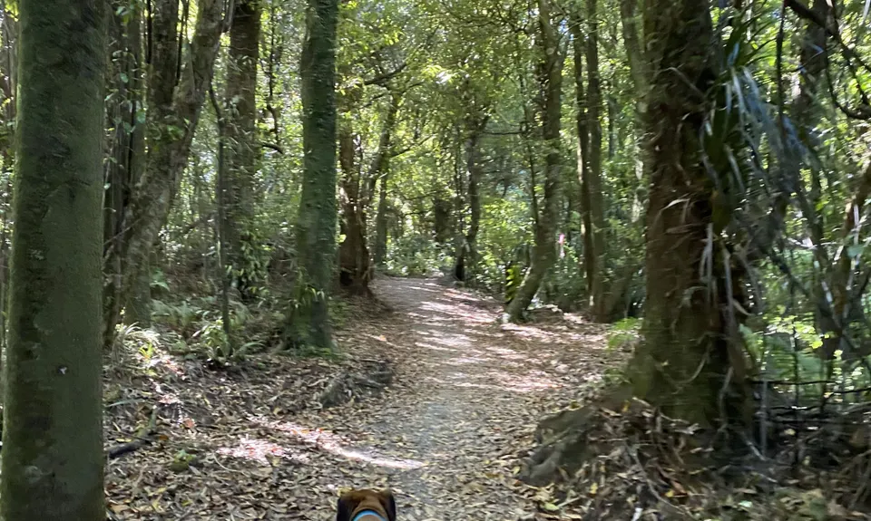
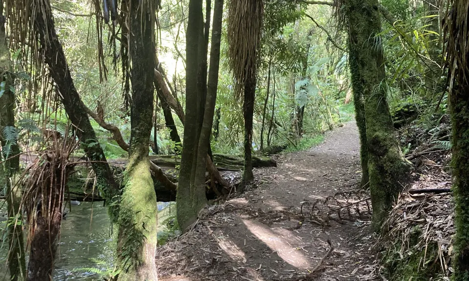
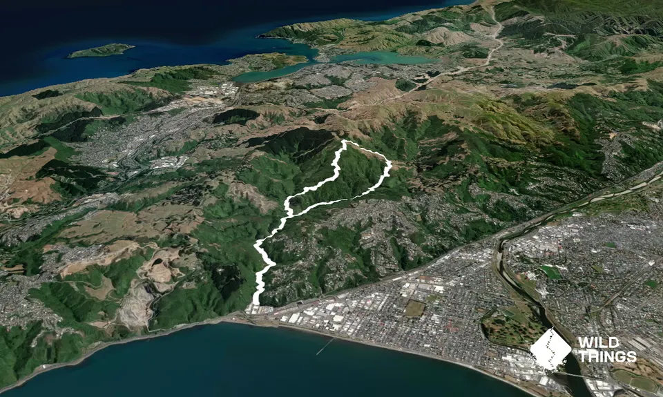
As soon as you cross the small footbridge, you are on your way. You follow the Korokoro stream for the next 2.5km, crossing it several times on purpose built footbridges. This is a shared public track, so be aware and courteous to fellow walkers, runners, bikers and the occassional dog. Dogs are required to be on the lead at all times. They are used to runners and others being on the track but is still a good idea to announce your arrival if approaching people/dogs from behind. Your last bridge crossing for a while leads you straight to the fork that signals left for the trig or straight ahead to the dam.

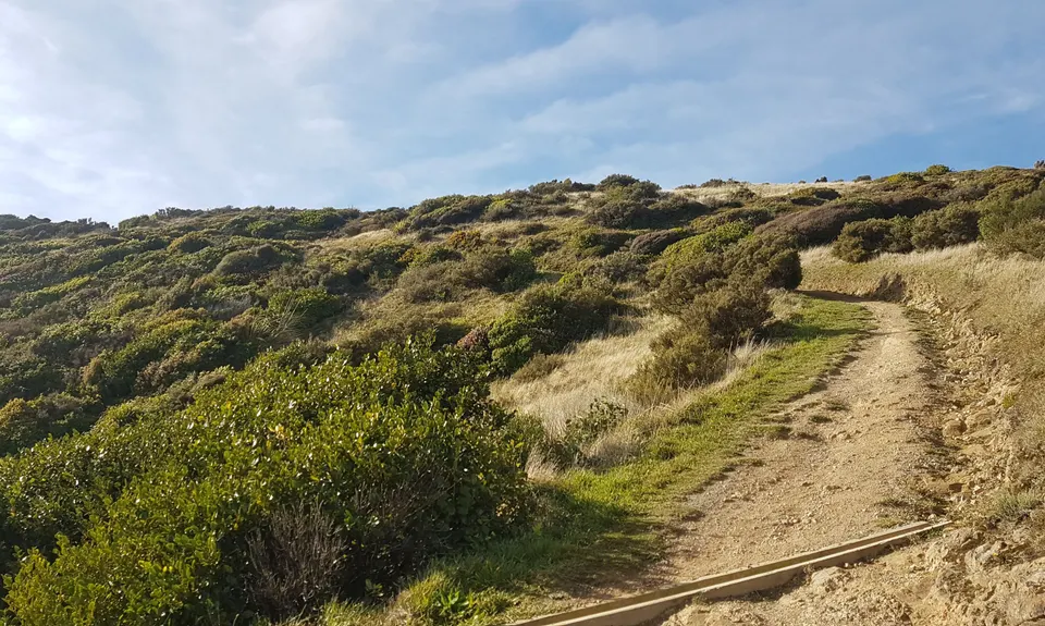
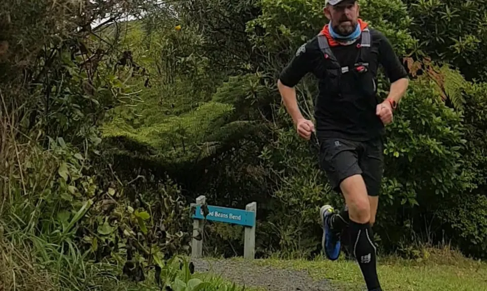
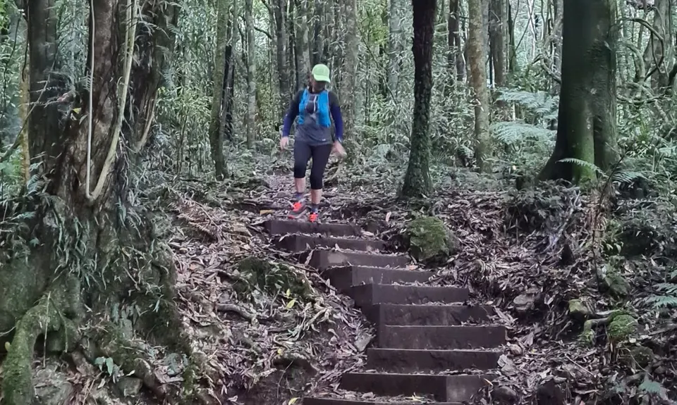
Take a hard left and prepare yourself for a 'fairly gentle' climb for about 700m (distance not elevation!) to Baked Beans Bend. For those that want a bit of a rest, this is a good place. You can explore a small track that takes you down to the stream, or just catch your breath before the start of the main climb. A few hundred metres into this climb, you will see a signposted track that leads off to the left. Don't follow that. Stay on the main track. That track takes you another (steeper) way up to the trig or up to the roads of Horokiwi. So carry on up the track which is beautifully surrounded by native bush and birdsong. On a hot, sunny day this is a very welcome relief from the heat and also sheltered during wetter days.

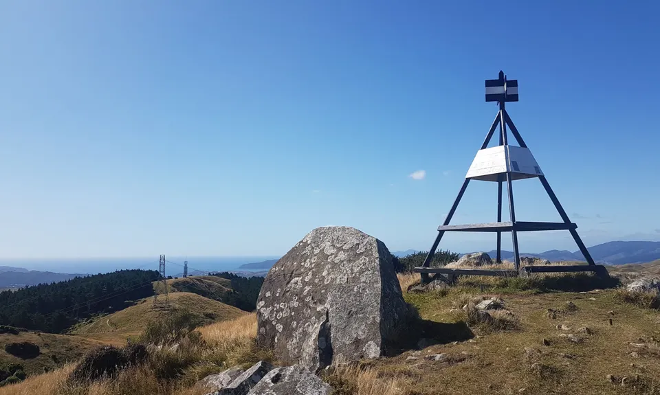
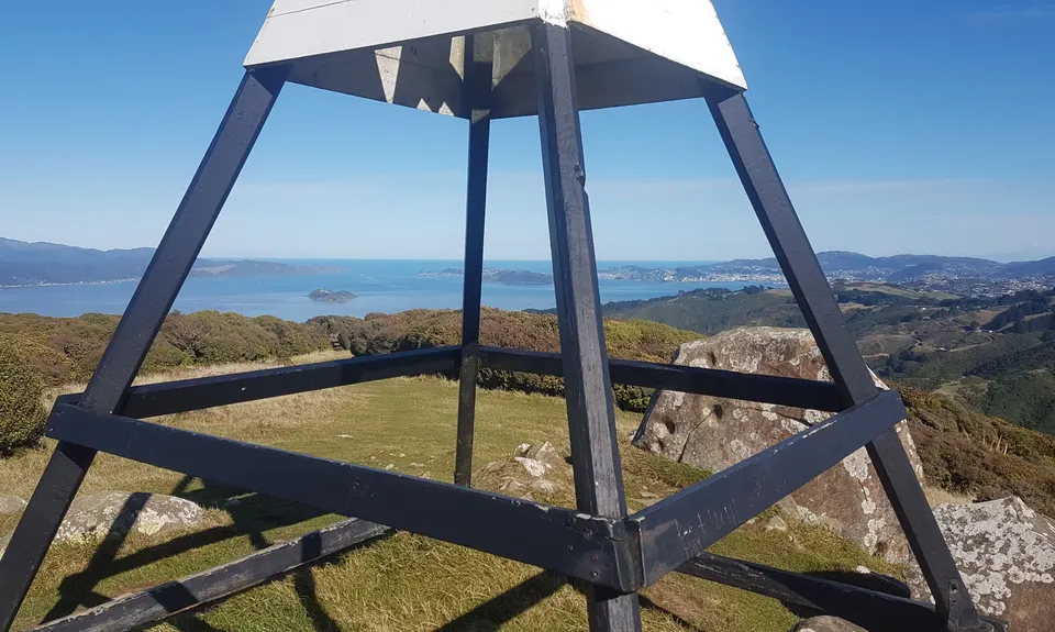
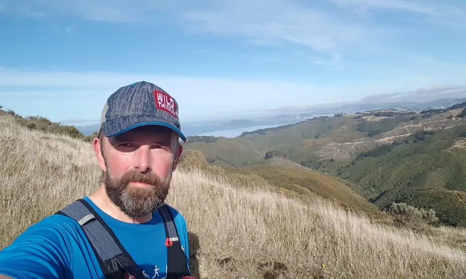
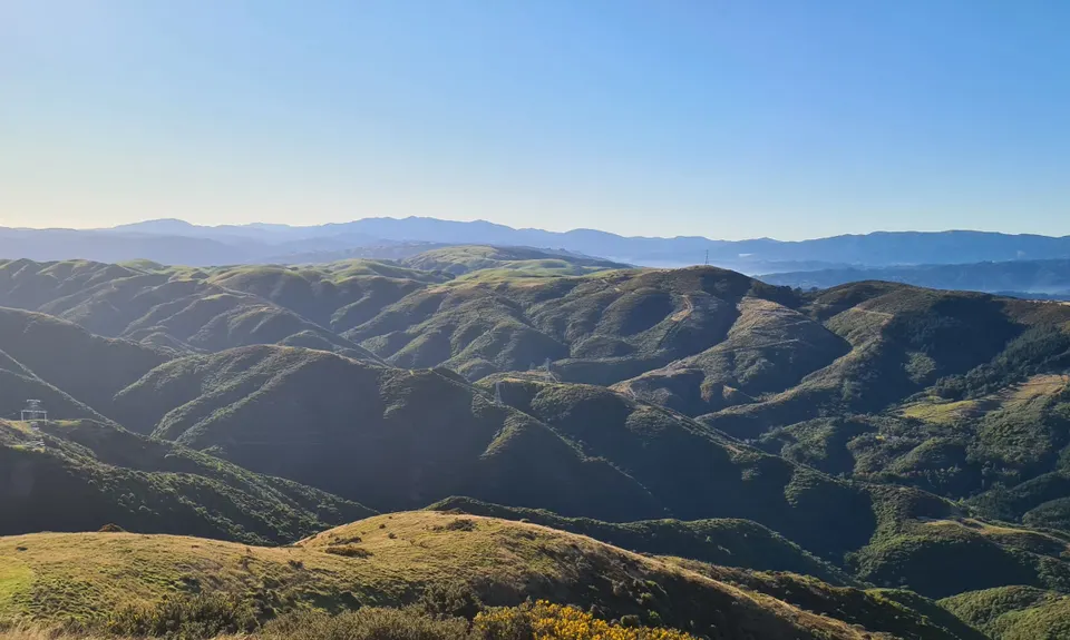
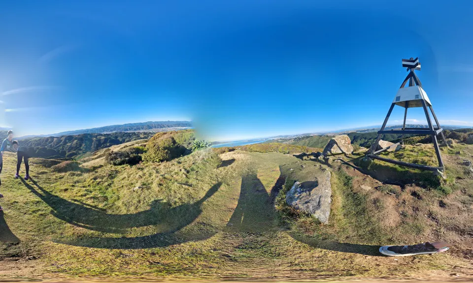
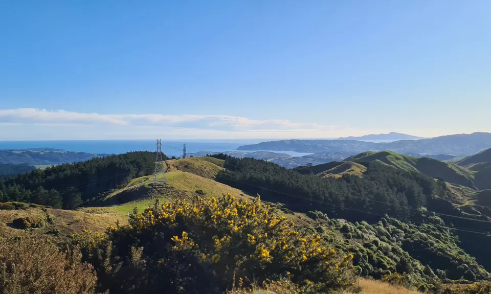
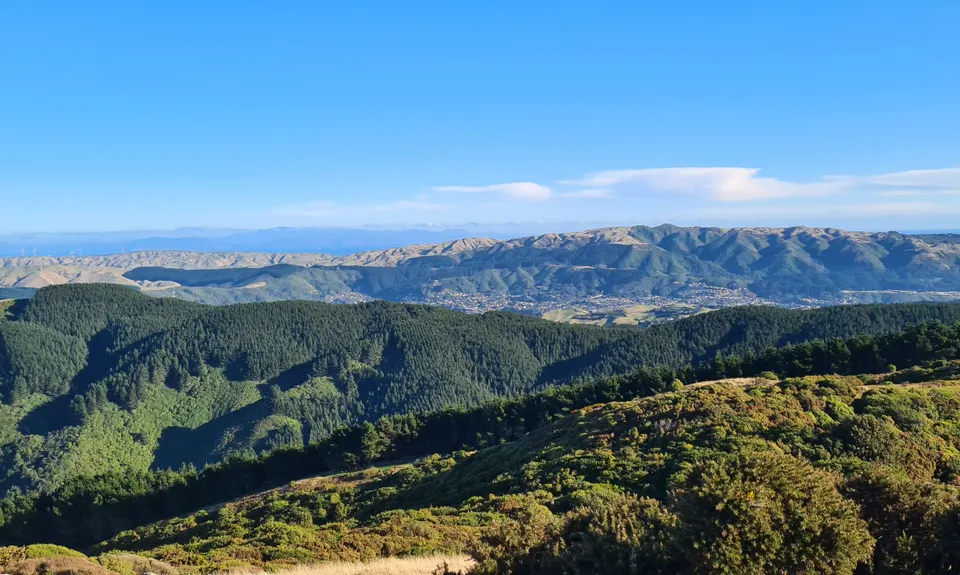
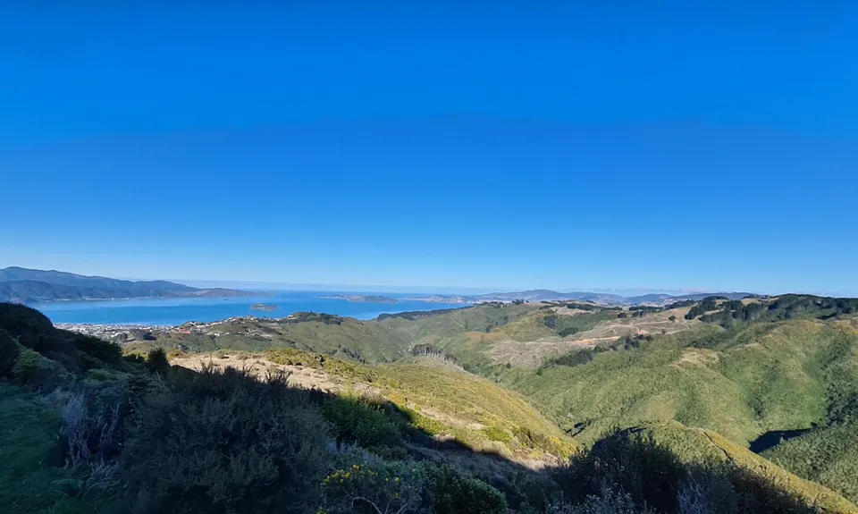
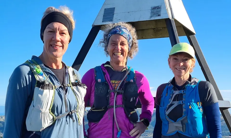
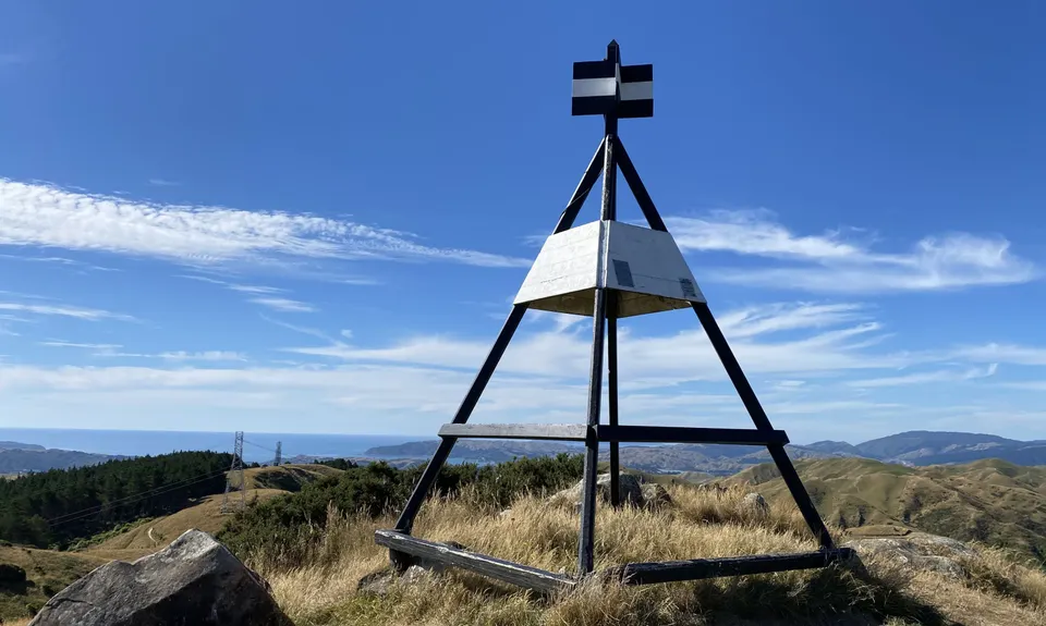
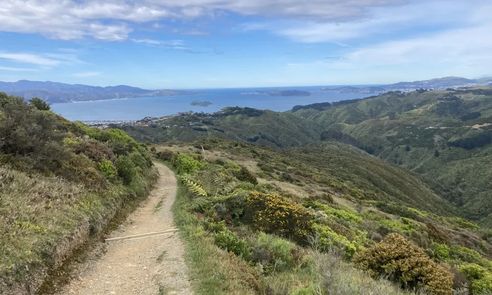
After a while, you will come out onto open track that is exposed to all elements so be prepared if travelling in cooler weather as it can get windy and cold up here pretty quick. The climb is mostly made up of zig zag tracks so it isn't too much further before you emerge from a grass covered soft trail and spy the summit and the trig. Selfie time. You've earned it.

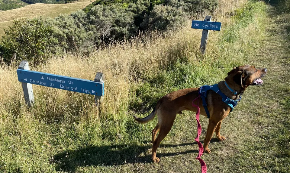
After a quick breather, or snack, follow the trail north as it zig zags down and inbetween a small patch of trees. Again, here you will see a sign that says Bridleway path. This is that steep track that takes you back down towards Baked Beans Bend. Avoid that and go straight ahead. You will come to one of many information boards scattered throughout Belmont Regional Park that tells you where you are. You want to be following the wide 4WD track down towards Stratton Street.

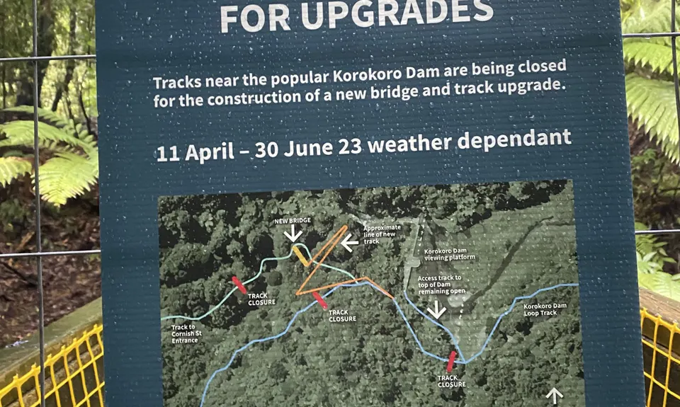
This is a great downhill run if your legs are up to it, but keep an eye out for the turn off sign on your right about two thirds of the way down as it is here where you enter the bush to make your way to the dam. There are lots of steps - about 200 - and they all go down. .. well, almost all of them! You will get to a small bridge, work your way around a bend in the stream and then up and out of this small valley via yet another zig zag climb.

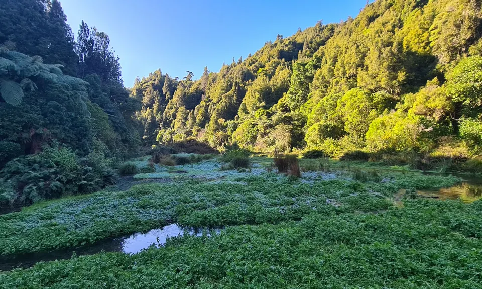
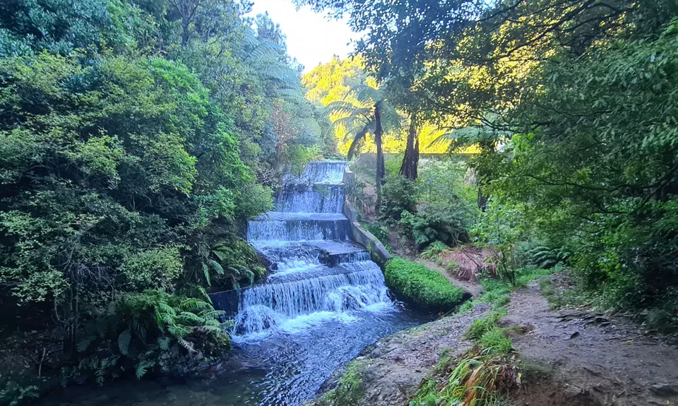
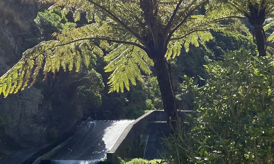
Once again, you will come to a fork in the track indicating right to the dam, or straight ahead to Oakleigh Street. Go right. Another sweet and fast downhill will have you at the top of the steps leading to the dam in a few minutes. Make sure you go down and check out the dam. See if you can spot the eel. Cross the narrow footbridge and head south along the stream track. Look out for those old water pipes, and also be aware of rocks and tree roots. A rolled ankle can easily happen along here.

After a kilometre or so, you will pass the Baked Beans Bend turn off and cross the bridge again. Now you're in familiar territory so enjoy the views and this sometimes narrow trail as you head downstream and back to your start point. I hoped you enjoyed it.


Trail Community

Find people who are interested in this run.

You must register or login to view this content.

Features of interest

The area you are entering is a very special place. The first 3.5km along the Korokoro stream, and then the uphill to Baked Beans Bend, was one of two major routes used by early Maori that linked the Wellington and Porirua harbours. You will pass a smaller dam about 2km into your journey, and again as you head back to the start. This was used to control water for the woollen mills that were once located at the Cornish street entrance.

Tramping clubs climbed up to the Belmont trig as far back as the 1920s, and the historic Korokoro Dam was built to supply water to the Petone borough back in 1903. As you run back along the stream track towards Cornish Street, you are following the original pipes so make sure to watch your step as these are becoming more visible (and tripable) as the years go by. Fantails, tui and kereru are some of many birds you will hear and see throughout this route. Rabbits are frequently seen up near the trig and ducks inhabit the stream towards Cornish. There is also a large eel that lives in the pool at the base of the Korokoro dam. So as you can see, this is a special location so close to everything that offers a challenging but enjoyable walk or run.


Make Up of Run

Technical Single Track: 20%

Moderate Single Track: 20%

Easy Single Track: 40%

Farm Road / 4WD Track: 20%


Route Data

Reviews:

You must register or login to view this content.


Overlapping Runs

The following trails overlap with this run to some degree. You may wish to combine them but please note that to qualify for FKTs on these runs you should record a separate Strava activity for each

Belmont Trig

Belmont Trig

Length: 12.00km

Belmont Bash

Belmont Bash

Length: 11.00km

Pareraho to Cornish

Pareraho to Cornish

Length: 18.00km


Photos:

You must register or login to view this content.

Your Trail Wishlist

All the runs that are on your To Do list (no limit).

Add to wishlist view wishlist

Your Trail Dreamlist

The runs you most want to do (limited to 10).

Add to dreamlist view dreamlist

Wild Explorers

I did it!
  • Access

    This run, along with the Belmont Trig run, starts and finishes at the bridge/entrance to Belmont Regional Park at the end of Cornish Street, Petone.
    You can access Cornish Street directly from SH2 coming north from Wellington, or from Pito-One Road via the Korokoro overbridge turnoff.

    Parking is available at the entrance but these are in high demand during the day time. It is better to park on the left (SH2) side of Pito-One Road. If doing this trail on a week day, you may be competing with work vehicles that use many of the industrial buildings in this area. If arriving by train, hop off at Petone Station and cross the pedestrian overbridge to Pito-One Road. Head south for about 600 metres to the intersection with Cornish Street.

    6 km

    8 minutes

    Yes

    No

  • Staying Safe

    Moderate.

    Generally good.

    Long-sleeved thermal top, Windproof jacket, Beanie/thermal headwear, Whistle, First aid kit, Extra food for emergencies, Cellphone, Map.

    Take your own water. Even though you are beside a quite pretty stream for most of this trip, I would recommend you avoid unless absolutely necessary and then only from the stream area below Baked Beans Bend.

    It can get very windy and cold up on top by the trig, so take another top or light jacket for extra warmth. Coming back through the bush to the dam, it can get quite slippery after heavy rain, especially of those 200 steps, so watch your step.

  • Post run indulgence

    Anywhere along Jackson Street
    Petone
    There are loads of cafes, restaurants and bars along Jackson Street. My favourites would be Caffiend for coffee and light food, Sprig & Fern for beer and Siam Spoon for awesome Thai.

  • Sponsor this trail

    If you are interested in learning about sponsorship opportunities, please get in touch below:

    Submit

Got a favourite trail? Tell us about it.

Share the love and add your favourite trail(s) to our growing trail directory.

Submit A Trail

Become a member today

Start enjoying the many benefits to becoming a member of our thriving community.

Become a member

Great brands at great prices with our VIP member's discount

Stay up to date

Sign up to our newsletter for latest offers and trail guides

Share this trail with a friend:

VIP Membership

Please register as a VIP or login to your VIP account to view this content.

Cancel Login Register

Membership Required

You can see up to three trail guides without being logged in but after that we require you to be logged in to your Free or VIP account. If you don’t yet have an account you can register here.

Login Register