Fog Peak Otago
Show nearby trail routes
Peak Information
2,240m
-44.52292, 168.80440
Extreme
Some very hard rock scrambling and/or severe exposure, and should only be attempted by those experienced in mountaineering and alpine conditions.
No known access issues. If you are aware of any, please let us know
Peak Community
There are currently no members to show for this peak.
Trip Notes:
Tips and tricks regarding route choice etc. Feel free to submit brief trip notes of your own.
Martin Trvaj, 1st July 2022
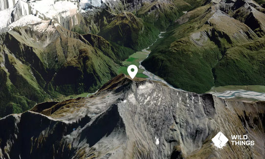
This one is for only the most experienced wild runners. Do not go without a map, Gps and experience (PLB is recommended). Park the car at Raspberry Creek car park. Then walk back approx. 1.5 km. On the topo map, you can see the green strip. There is a gate. Roughly follow Wishbone Creek (the true left). Reach the summit via the west ridge.
Photos:
Peak Baggers
I did it!See other peaks nearby:
Mount Eostre - 10.0km away
Mount Tyndall - 13.0km away
Treble Cone - 13.3km away
Mount Alta - 13.5km away
Buchanan Peaks (West) - 13.5km away
Dragonfly Peak - 14.0km away
Buchanan Peaks (Middle) - 14.4km away
Buchanan Peaks (East) - 15.4km away
Sisyphus Peak - 16.5km away
Trails within 5km of Fog Peak:
Run Rabbit Run
Rock of Ages
French Ridge hut