The Not WILD 50 Mile CourseExperienced
Submitted by Rob Bathgate
Experienced
Not Suitable (Slow)
16:00 (Moderate)
8:00 (Fast)
-15.3%
+15.3%
Please notify The Not WILD team by email at mal@thewild100.co.nz if you intend to run this route and they will sort permissions for you. Tell them the day you intend to run and the names of any others in your party.
Fastest Known Times (FKTs)
Please set your gender to see your position on the FKT leaderboards.
Men
Women
Filter FKTs
The more , the harder the FKT will be to beat. Learn about Fastest Known Times.
Description
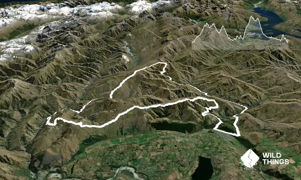
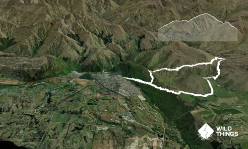
This is the full 50 mile course other than the 6k of MTB trail after Coronet Peak Ski Area. These trails are off limits and instead you will need to run the road to Skippers Saddle (3.5k of seal and 500m of gravel).
Most suitable for:
Experienced mountain runners who are comfortable on technical terrain and capable of route finding over untracked, unmarked terrain. A very high level of fitness required.
Navigation:
Reasonably straightforward in clear visibility but very tricky if the cloud is down over the ridges. Finding the high river route down the Arrow River can also be tricky due to spring growth obscuring the marker poles, but the main 4WD road is an easy alternative if you don’t mind wet feet (lots of shallow river crossings)
Peaks to be bagged:
Mt Dewar 1310m (very short detour), Vanguard Peak 1781m, Advance Peak 1749m (short detour), Brow Peak 1456m
Trail Conditions:
A bit of everything (even some road!) but the defining characteristic is rough, off-track travel and exposed ridges. Go prepared!
Trail Community
Make Up of Run
Untracked / Route only: 40%
Technical Single Track: 30%
Moderate Single Track: 20%
Farm Road / 4WD Track: 5%
Gravel Road: 3%
Sealed Road: 2%
Route Data
Reviews:
Overlapping Runs
The following trails overlap with this run to some degree. You may wish to combine them but please note that to qualify for FKTs on these runs you should record a separate Strava activity for each

Advance Peak (via Big Hill inbound and Macetown Road outbound)
Length: 39.00km
Photos:
Your Trail Wishlist
All the runs that are on your To Do list (no limit).
Add to wishlist view wishlistWild Explorers
I did it!-
Access
The Fork and Tap pub in Arrowtown.
Plenty of parking.
0 km
0 minutes
No
No
-
Staying Safe
Moderate.
Reasonably straightforward in clear visibility but very tricky if the cloud is down over the ridges. Finding the high river route down the Arrow River can also be tricky due to spring growth obscuring the marker poles, but the main 4WD road is an easy alternative if you don’t mind wet feet (lots of shallow river crossings)
Unknown.
Waterproof leggings, Thermal leggings, Lightweight fleece top, Long-sleeved thermal top, Seam-sealed waterproof jacket, Gloves, Beanie/thermal headwear, Personal Locator Beacon (PLB), Whistle, First aid kit, Extra food for emergencies, Survival bag, Cellphone, Compass, Map, Headtorch and spare batteries.
There is limited drinking water on the route. We recommend setting off with at least 2 litres of fluid and topping up at Coronet Peak Ski Area, Greengate Hut (stream crossing), Deep Creek, Vanguard Hut and Soho Creek. There may be clean running water in a few other spots too – use your own judgement!
-
Sponsor this trail
See other runs nearby:
Big Hill Circuit
Sawpit Gully - German Hill
Mt Rosa Loop
Queenstown Trail Anticlockwise
Macetown
Bush Creek Banger and The Steiger!
New Chums Loop
Miners Trail
Brow Peak Mini Mission
Crown Peak Traverse
Lake Hayes Circuit
Beat Beetham
Coal Crown Arrowtown
Glenroy Water Race Track
Arrowtown Gold
Mt Sale via Crown Peak and Mt Scott
Advance Peak (via Big Hill inbound and Macetown Road outbound)
The Not WILD 20 Mile Course
All The New Chums
Brow Peak and Big Hill
Mt Soho Marathon
Cardrona to Arrowtown
Hilly Delight
Fast and Flat in Arrowtown
Crown Peak and Mt Sale
The Beast of Beetham