Sawpit Ridgeline, Otago, New Zealand - Trail Running Directory - Wild Things

Last Updated: 6th May 2026

Intermediate

Save Trail Save

I've done it Done

Sawpit Ridgeline

A steep climb above Sawpit Gully

Sawpit big brother, Ridge pt758

Submitted by Anna Browne

Last Updated: 6th May 2026

Intermediate

Save Trail Save

I've done it Done

Open

Grunt Factor: 18 ?

Gnarl Factor: 44 ?

9.0km

565m

560m


Become a VIP to see driving directions, distance and time.

Trail Map

This Topo layer only covers NSW/ACT.
Switch to another map layer when viewing outside this area.

Type of Run

Front country - easily accessible

Loop

Undulating, some big hills

Dog Friendly

Native bush

Open tussock/grasslands

Open ridges/tops

Run Makeup

40%
43%
15%
2%

Easy Single Track

Moderate Single Track

Technical Single Track

Untracked / Route only

Average Uphill Gradient: +12.60%

Average Downhill Gradient: -12.40%

Garmin Course

VIP Feature: Send this route to your Garmin account so you can follow the course on your Garmin device.

Send to Garmin

Learn about sending to Garmin.

Trailhead

Become a VIP Member to see the trailhead information.

Estimated Times to Run

3:00

Slow

1:45

Moderate

1:20

Fast

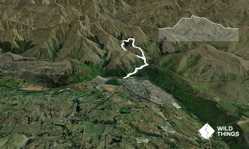
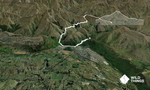
Leave Arrowtown Chinese Village over the short bridge by the toilet block, then head anticlockwise on the Sawpit track following the pipeline track alongside Arrow River.

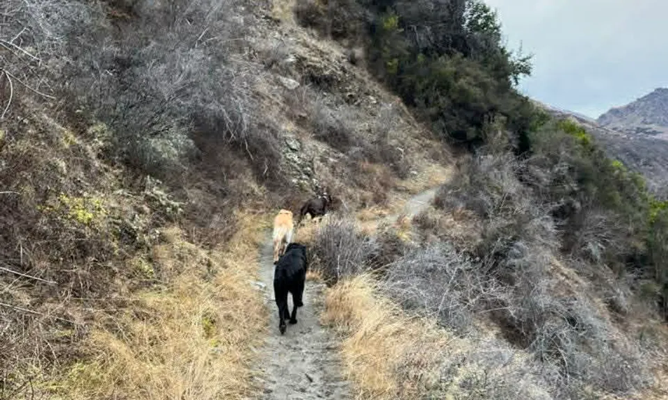
Head up approx 2km to the junction, left up Sawpit track - an easy amble. Follow up the climbing switchbacks until the track levels out and you're sidling along about Sawpit Gully. You will get to a rock step; on your right you'll see a narrow single trail, follow it and turn a quick left to the big tree. Climb above the tree on the rock, once on top of the tree trunk you will see a single trail leading between two rocks. The track will turn hard left and lead you up the ridgeline, parallel with the Sawpit track below. Follow up the ridge - the single trail is obvious.

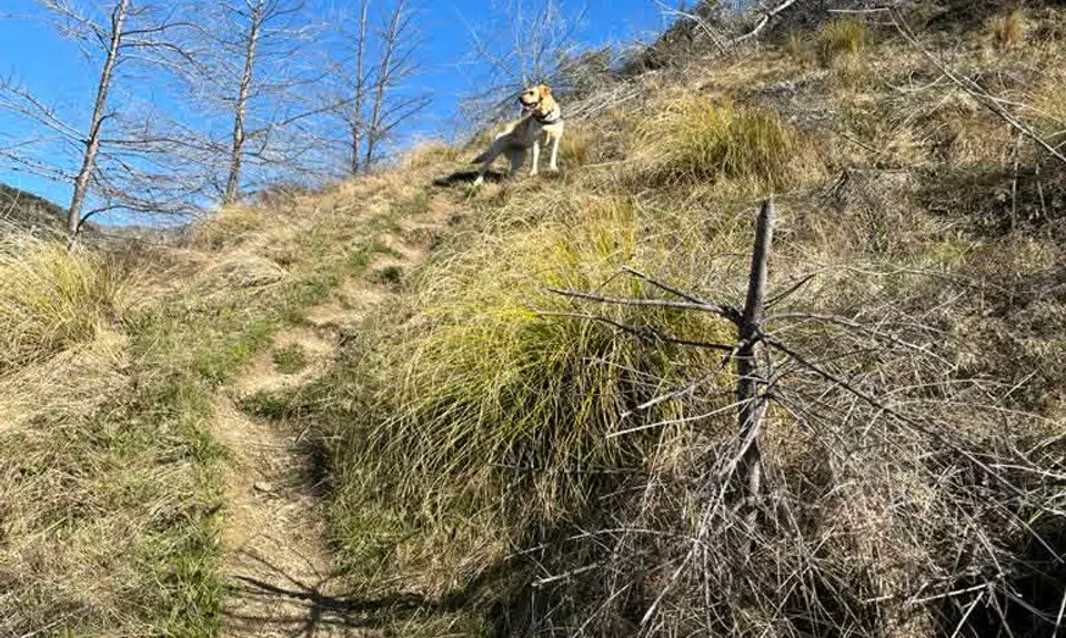
It's a steady climb up until you get to the top of the ridge. The single track leads you across the top with an obvious path until it drops down slightly, sidling down to the bottom of the shingle face. Climb up the steep shingle face; at the top short track leads you to join Big Hill Saddle Track. Turn left on to Big Hill Saddle Track, this is also part of the Te Araroa track that comes over from the Motatapu Track.

Follow Big Hill Saddle Track down through two beech forest areas, both have small stream crossings. The second has a large log that has been placed and is easy to cross.

Once out of the beech forest you can follow the Big Hill Track back to Eichardts flat, meet the Sawpit track and back to the Chinese Village

...OR about 500m from the edge of the beech forest you will see a big spur on your left with a single trail leading down to where the spur flattens off - follow to the bottom and you will end up back on Sawpit Gully track near the derelict hut, now named "Lesters Hut" with a homemade sign. Turn left onto Sawpit Gully Track, follow back to Arrow River and the Chinese Village. You will have a number of small stream crossings, if it has been wet you will get wet feet, the stream is known to change course and can get muddy if there's been rain or icy through winter. Enjoy!

Views across Sawpit Gully and back to Arrowtown. Views around surrounding hills and high peaks.

Toilets at Chinese Village.

Chinese Village Carpark or Arrowtown

2 km

10 minutes

Yes

No

Moderate.

Turn off from Sawpit Track up on to the ridgeline.
Turn off from Big Hill track to the spur to the derelict hut back onto Sawpit Gully Track.

Patchy.

Lightweight fleece top, Short-sleeved thermal top, Long-sleeved thermal top, Seam-sealed waterproof jacket, Windproof jacket, Gloves, Beanie/thermal headwear, Personal Locator Beacon (PLB), Whistle, First aid kit, Extra food for emergencies, Survival bag, Survival blanket, Cellphone, Compass, Map, Crampons / microspikes (for winter conditions)

Lots, some say it should be boiled first but there are some good streams along the way.

Ice and frost in winter

Steep drop off along the ridgeline.

The Dishery
Arrowtown Chinese Village
Hot drinks & food

Provisions
Arrowtown
Good food and hot drinks

Fork & Tap
Great food, hot drinks & cold beer!

Do you have another suggestion on where to go afterwards for the best coffee / cake / breakfast / brunch / beer?

Trail Legend

AB

Anna Browne

has completed Sawpit Ridgeline once in the last year.

Login as a VIP to become a Trail Legend. Learn about Trail Legends.

You and Sawpit Ridgeline

As a VIP member you can record private notes for this trail, see all of your times and more.

Become a Member

Already have an account? Login now

Trail Reviews

Be the first to submit a review for Sawpit Ridgeline!

Login to submit a review

Trail Running Community

Find people who are interested in or have completed this trail run.

You must register or login to view this feature.

Register Now

Overlapping Trails

These overlap with this trail to some degree. You may wish to combine them but please note that to qualify for FKTs on these runs you should record a separate activity for each.

Sawpit Gully - German Hill

Sawpit Gully - German Hill

Length: 7.6km

Level: Beginner - Intermediate

Brow Peak Mini Mission

Brow Peak Mini Mission

Length: 21.0km

Level: Intermediate - Experienced

The Not WILD 20 Mile Course

The Not WILD 20 Mile Course

Length: 35.5km

Level: Intermediate

All The New Chums

All The New Chums

Length: 14.2km

Level: Beginner - Intermediate

Brow Peak and Big Hill

Brow Peak and Big Hill

Length: 19.0km

Level: Intermediate

Hilly Delight

Hilly Delight

Length: 26.7km

Level: Intermediate

Hayes Creek Loop

Hayes Creek Loop

Length: 17.8km

Level: Beginner - Intermediate

Big Hill Circuit

Big Hill Circuit

Length: 20.7km

Level: Intermediate

Other trails nearby
Coal Crown Arrowtown

Coal Crown Arrowtown

Length: 17.0km

Level: Beginner - Intermediate

Macetown

Macetown

Length: 27.5km

Level: Beginner - Intermediate

Miners Trail

Miners Trail

Length: 15.5km

Level: Beginner - Intermediate

Mt Sale via Crown Peak and Mt Scott

Mt Sale via Crown Peak and Mt Scott

Length: 18.5km

Level: Intermediate - Experienced

Find more trails and peaks nearby

Wild Things
Wild Things
Explore more

Plan smarter, stay motivated, track your progress, and unlock the full Wild Things experience — while saving along the way.