Crown Peak TraverseIntermediate - Experienced
Submitted by Malcolm Law
Front country - easily accessible
Point to Point (one way)
Mountainous
Open farmlandsOpen tussock/grasslandsOpen ridges/tops
Intermediate - Experienced
4:30 (Slow)
3:15 (Moderate)
2:15 (Fast)
-14.4%
+8.7%
Fastest Known Times (FKTs)
Please set your gender to see your position on the FKT leaderboards.
The more , the harder the FKT will be to beat. Learn about Fastest Known Times.
Description
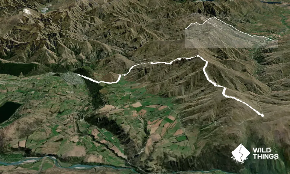
While this could be run in either direction I'd definitely recommend starting at the Crwon Saddle and finishing in Arrowtown as a) there's a big nett descent in this direction and b) you finish right outside the pub! The exception would be for anyone training for the Northburn 100!
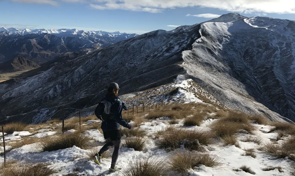
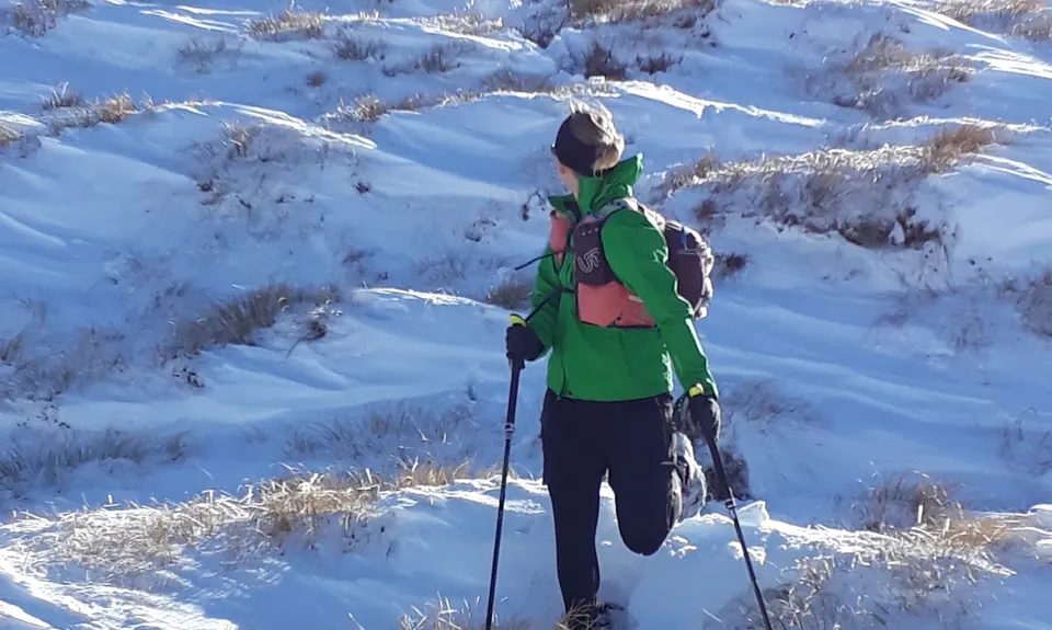
From the Crown Saddle car park, cross the road and start heading uphill aiming for Mt. Scott - there is no trail, so just pick your own lines up this steep, tussocky grunt.
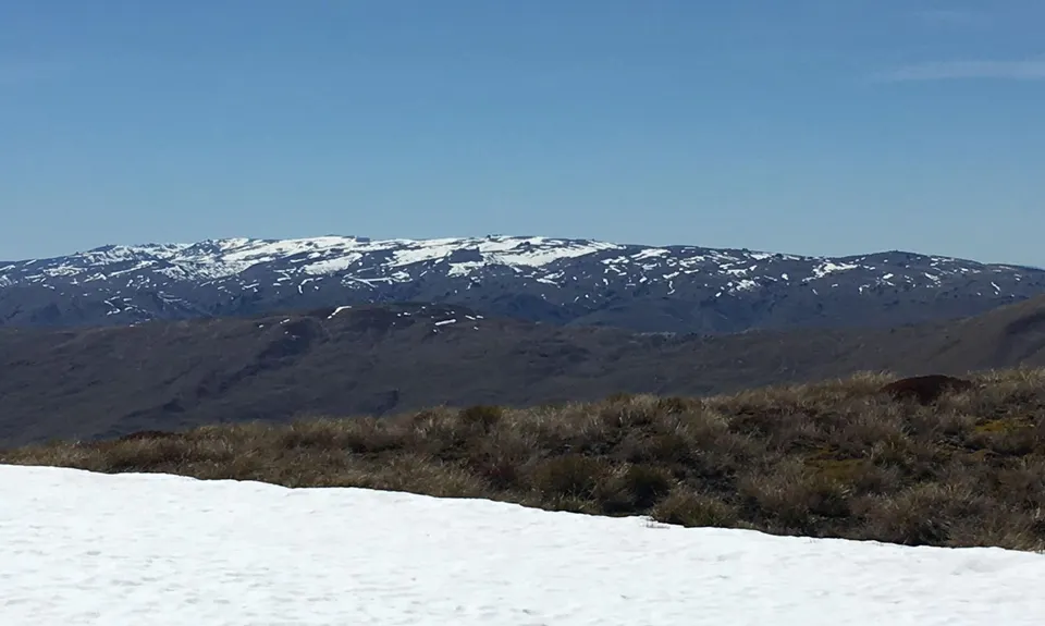
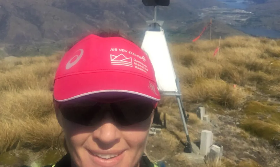
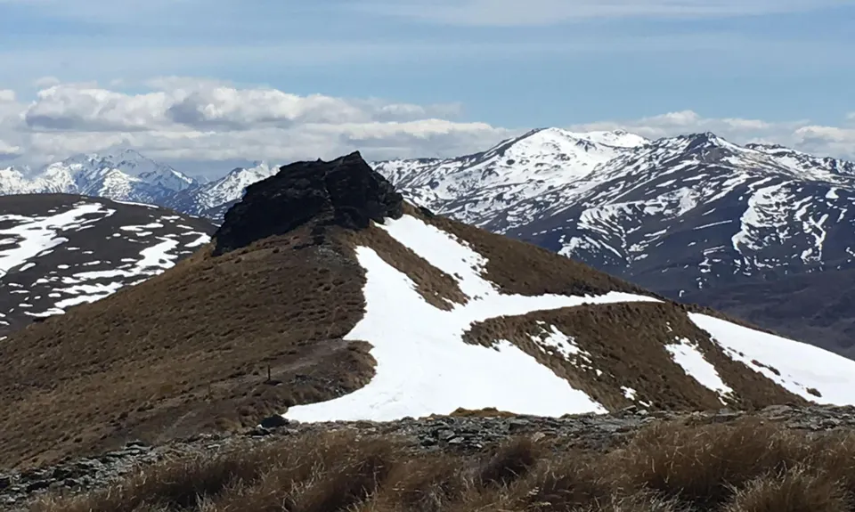
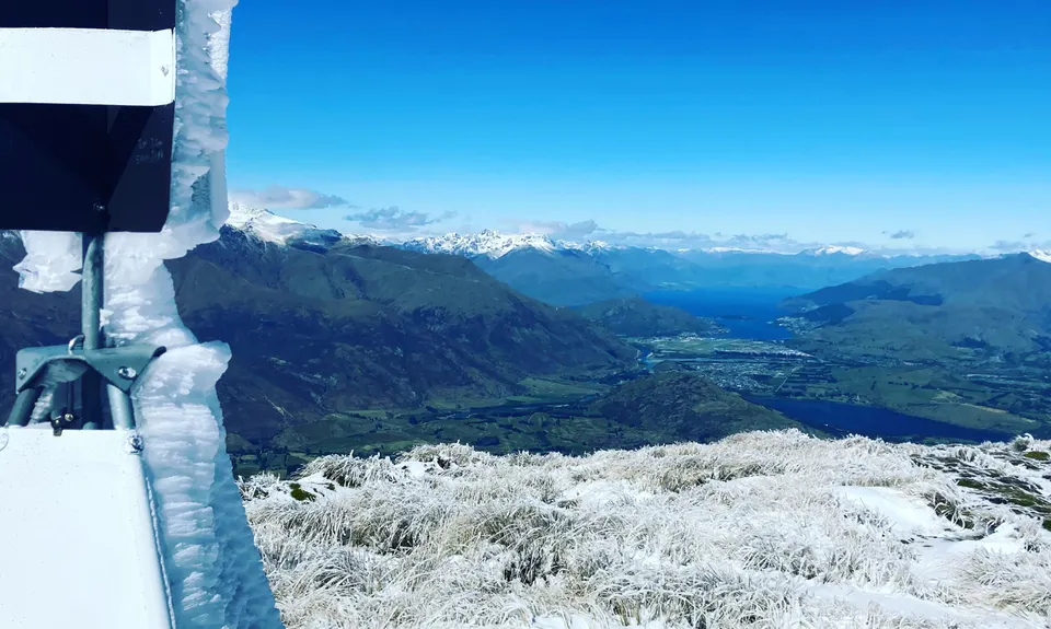
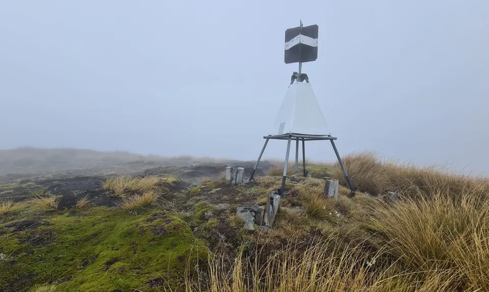
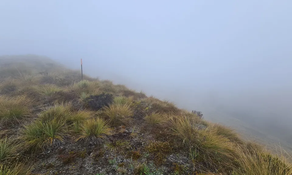
Once on top you'll get great views down into the Queenstown basin and the ridge that you need to follow to Crown Peak is clearly visible. There is still no real trail other than sheep tracks, but stick as close as you can to the ridgeline. After a couple of kms the route becomes poled and this should help you get to the trig point. However this is not the true summit of Crown Peak - that is just a couple of minutes away to the north and is a nice little scramble rewarded with great views.
Having bagged the peak pick up the obvious farm track that descends towards Arrowtown - this is a quad-trashing descent over some 6 or 7 kms, eventually linking up with the Miners Trail. At the bottom of the hill, where there is a large sign showing trails in the Mahu Whenua Covenant area, turn left and follow the poled trail.
You get a couple of kms of beautiful single track before being spat out on to a water race. Follow this for a couple of hundred metres, keeping a look out for a poled stile over the fence to your right. Cross this and run downhill along a fence line to join the gravel road at the bottom. Turn right, follow this uphill for several hundred metres and then branch left on to the broad trail/4WD track that is Tobins Track.
This takes you downhill to the Arrow River - cross this on the footbridge, hand a right and in a few hundred metres branch off left across the reserve and out the other side to reach Centennial Ave, where hopefully you have a pickup or a car parked.
Trail Community
Features of interest
Stunning views from the top of the Crown Range. Remains of mining cottages and workings lower down.
Make Up of Run
Untracked / Route only: 35%
Technical Single Track: 5%
Moderate Single Track: 10%
Easy Single Track: 5%
Farm Road / 4WD Track: 40%
Gravel Road: 5%
Route Data
Reviews:
Overlapping Runs
The following trails overlap with this run to some degree. You may wish to combine them but please note that to qualify for FKTs on these runs you should record a separate Strava activity for each

Coal Crown Arrowtown
Length: 17.00km
Photos:
Your Trail Wishlist
All the runs that are on your To Do list (no limit).
Add to wishlist view wishlistWild Explorers
I did it!-
Access
Crown Saddle, the high point between Wanaka and Queenstown (actually the highest point on a public road anywhere in NZ)
There is a large, safe car park on the Crown Saddle.
This is a point to point run with few options for getting back to the start other than private car - so arrange a pick up or do some shuttling before you start. If shuttling, park on Centennial Ave in centre of Arrowtown, as close as you can to the Fork & Tap!16 km
19 minutes
No
No
-
Staying Safe
Moderate.
Generally good.
Thermal leggings, Long-sleeved thermal top, Seam-sealed waterproof jacket, Gloves, Beanie/thermal headwear, Personal Locator Beacon (PLB), Whistle, First aid kit, Extra food for emergencies, Survival blanket, Cellphone, Compass, Map, Headtorch and spare batteries, Crampons / microspikes (for winter conditions).
No drinkable water on the route - take your own.
The Crown Range is very exposed and can be bitterly cold at any time of the year. In winter expect ice and take microspikes or crampons. In summer it can get very hot, especially at lower levels.
Watch out for mountain bikers when you hit the Miners Trail. Also be aware of fast changing weather on the top and go prepared!
-
Post run indulgence
Fork & Tap
Arrowtown
Great range of craft beers, good food and convivial atmosphere. Nice out door area for summer. -
Sponsor this trail
See other runs nearby:
Big Hill Circuit
Sawpit Gully - German Hill
Mt Rosa Loop
Queenstown Trail Anticlockwise
Macetown
Bush Creek Banger and The Steiger!
New Chums Loop
Miners Trail
Brow Peak Mini Mission
Lake Hayes Circuit
Beat Beetham
Coal Crown Arrowtown
Glenroy Water Race Track
Arrowtown Gold
Mt Sale via Crown Peak and Mt Scott
Advance Peak (via Big Hill inbound and Macetown Road outbound)
Coronet Loop
The Not WILD 50 Mile Course
The Not WILD 20 Mile Course
All The New Chums
Brow Peak and Big Hill
Mt Soho Marathon
Cardrona to Arrowtown
Hilly Delight
Fast and Flat in Arrowtown
Crown Peak and Mt Sale
The Beast of Beetham