Last Updated: 29th Apr 2024

Beginner - Intermediate

Save Trail Save

I've done it Done

Routeburn Flats via Nature Walk Loop

Glenorchy, Otago

Submitted by Sierra Alef-Defoe

Last Updated: 29th Apr 2024

Beginner - Intermediate

Save Trail Save

I've done it Done

Open

Grunt Factor: 26 ?

Gnarl Factor: 14 ?

15.3km

390m

395m

702m


Login as a VIP to see driving directions, distance and time.

Trail Map

Type of Run

Back country - remote

Combo

Undulating, small hills only

Native bush

Riverside

Run Makeup

100%

Easy Single Track

Average Uphill Gradient: +4.9%

Average Downhill Gradient: -5.0%

Trailhead

Login as a VIP to see the trailhead information.

Estimated Times to Run

2:00

Slow

1:40

Moderate

1:15

Fast

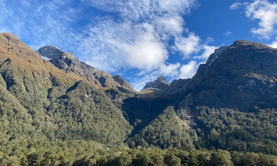
This section of the Routeburn is awesome because it can be done almost any time of year, and in almost any weather.

This route is outside any avalanche pathways, and the forest cover will keep you protected from light rain or from hot sun. It's a great option for beginners or for those just looking for an easy trail run, since the route is extremely well-maintained and has only a small gradual elevation change.

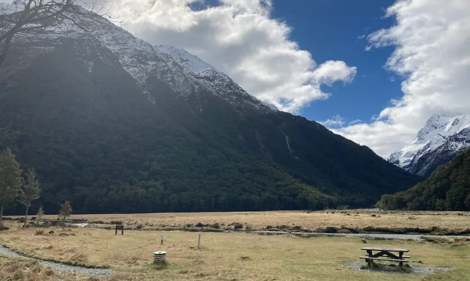
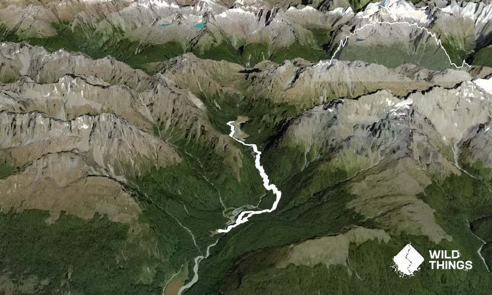
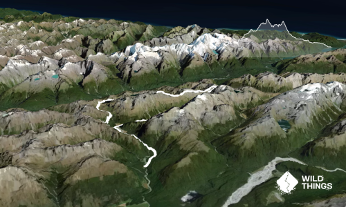
Starting from the Routeburn Shelter carpark, cross the bridge and follow the main track towards Routeburn Flats hut. The track roughly follows the Route Burn the 7.5 km up to the hut. There is one toilet along the way, about halfway through.

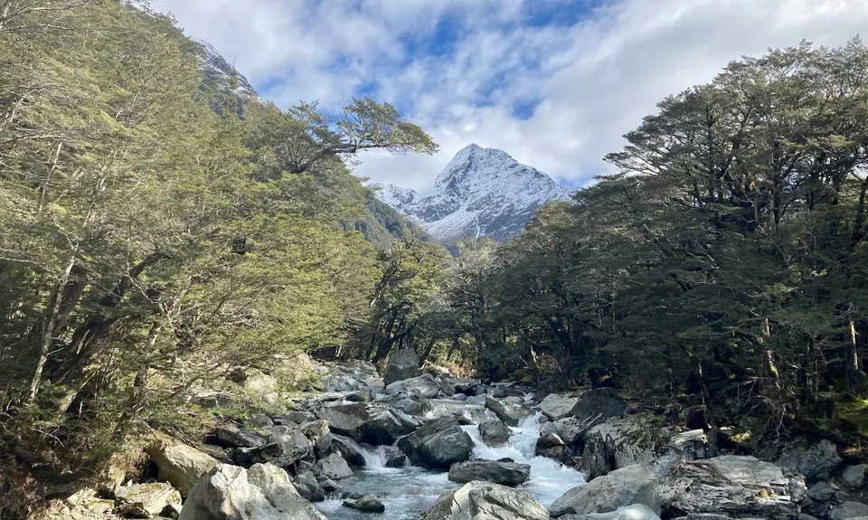
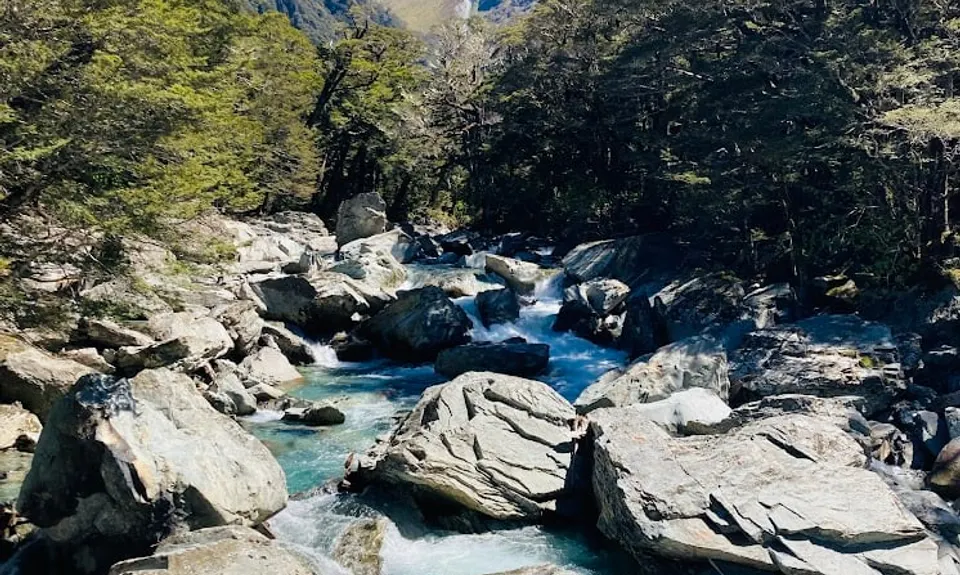
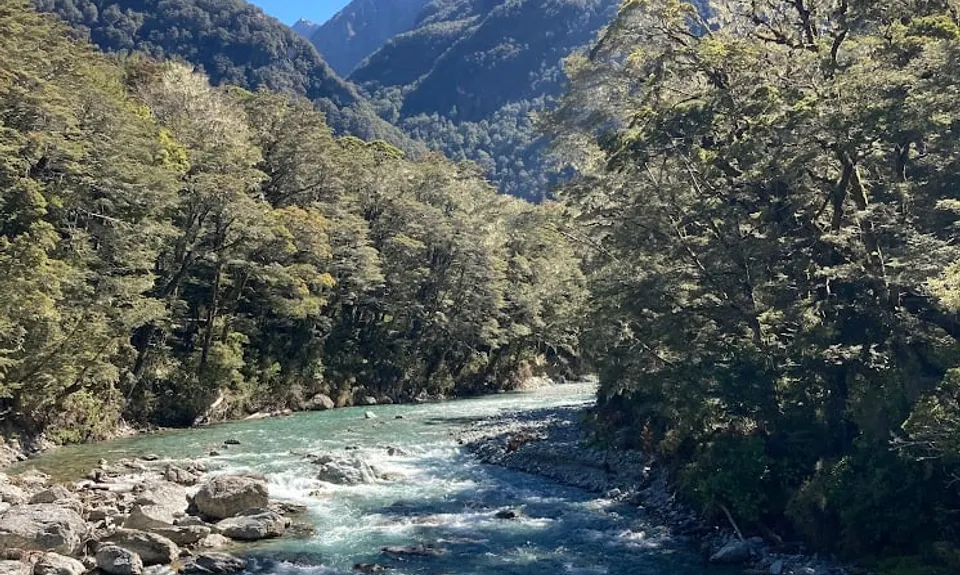
There are a few exceptional viewpoints, such as the canyons below Bridal Veil falls. All river crossings are bridged, and on a fine day you can come out with dry feet! Routeburn Flats Hut is the spot for a toilet/water/snack break. In the summertime it is a fully-serviced Great Walk hut with flush toilets and running water, while in winter it functions as a backcountry hut with a long-drop toilet and a water tank. Water here is normally fine to drink. On a sunny day there are plenty of picnic spots, or on a rainy day you can take refuge inside the hut.

The run back is mostly the way you came, except for a small detour towards the very end just after the bridge over Sugar Loaf Stream where you'll see a sign to take the other side of the Routeburn Nature Walk Loop. This adds a bit of variety to an otherwise out-and-back run!

Plenty of parking available, unfortunately no public transport, although some companies provide shuttle services in the summertime.

0 km

0 minutes

No

No

Easy.

Non-existent.

Seam-sealed waterproof jacket, Gloves, Personal Locator Beacon (PLB), Whistle, First aid kit, Extra food for emergencies, Cellphone, Map

Water from the Route Burn and its side streams, as well as the Routeburn Flats hut, is normally fine to drink -- but you may want to treat/filter/boil it, or just bring all the water you'll need since it's a short run.

You can do this run virtually all year unless it's severely raining. There are no avalanche pathways, it almost never gets snow, and it's well protected in the forest.

Trail Legend

RW

Rachel White

has completed Routeburn Flats via Nature Walk Loop twice in the last year.

Learn about Trail Legends.

You and Routeburn Flats via Nature Walk Loop

As a VIP member you can record private notes for this trail, see all of your times and more.

Register Now

Already have an account? Login now

Trail Reviews

Be the first to submit a review for Routeburn Flats via Nature Walk Loop!

Login to submit a review

Trail Running Community

Find people who are interested in or have completed this trail run.

You must register or login to view this feature.

Register Now

Overlapping Trails

These overlap with this trail to some degree. You may wish to combine them but please note that to qualify for FKTs on these runs you should record a separate activity for each.

Ailsa - Humboldt Circuit

Ailsa - Humboldt Circuit

Length: 64.0km

Level: Very Experienced

Conical Hill and Return

Conical Hill and Return

Length: 27.4km

Level: Beginner - Intermediate

Whisky Trail and Routeburn

Whisky Trail and Routeburn

Length: 58.0km

Level: Experienced

Routeburn-Caples

Routeburn-Caples

Length: 54.0km

Level: Intermediate - Experienced

Other trails nearby
The Royal Richardson Traverse

The Royal Richardson Traverse

Length: 25.5km

Level: Intermediate - Experienced

Earnslaw Burn Circuit

Earnslaw Burn Circuit

Length: 25.0km

Level: Intermediate - Experienced

Sugarloaf Circuit

Sugarloaf Circuit

Length: 21.7km

Level: Intermediate - Experienced

Rising Trout

Rising Trout

Length: 5.7km

Level: Beginner

Find more trails and peaks nearby