Last Updated: 21st Sep 2023

Intermediate - Experienced

Save Trail Save

I've done it Done

Sugarloaf Circuit

Glenorchy, Otago

Submitted by Kat Bulk

Last Updated: 21st Sep 2023

Intermediate - Experienced

Save Trail Save

I've done it Done

Open

Grunt Factor: 48 ?

Gnarl Factor: 58 ?

21.7km

1270m

1270m

1154m


Login as a VIP to see driving directions, distance and time.

Trail Map

Type of Run

Back country - remote

Loop

Very hilly

Native bush

Riverside

Open ridges/tops

Run Makeup

21%
17%
62%

Gravel Road

Easy Single Track

Technical Single Track

Average Uphill Gradient: +12.5%

Average Downhill Gradient: -11.2%

Trailhead

Login as a VIP to see the trailhead information.

Estimated Times to Run

6:00

Slow

4:30

Moderate

3:15

Fast

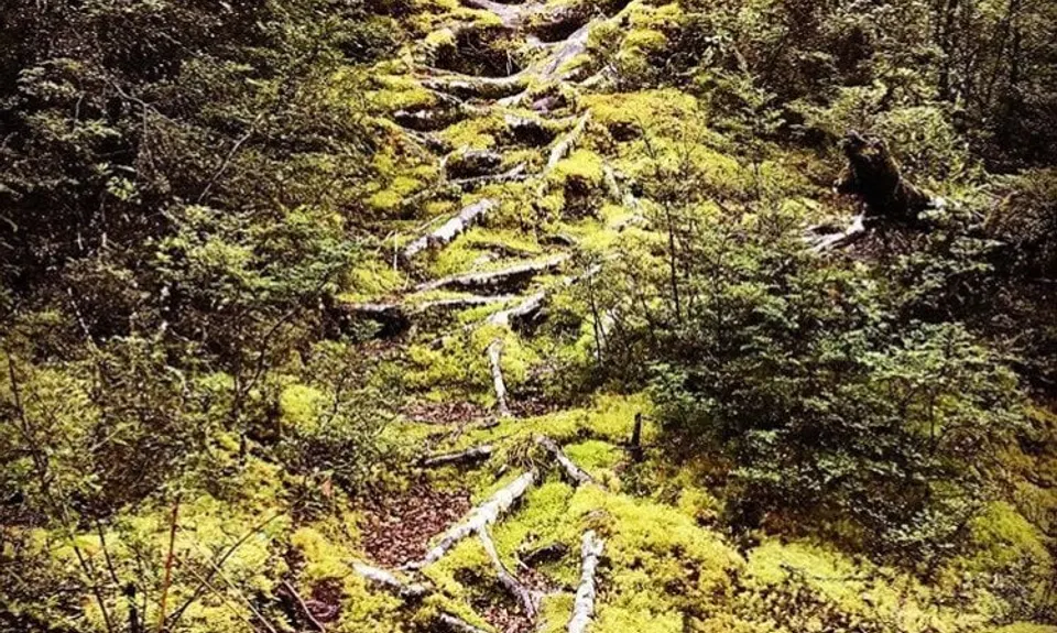
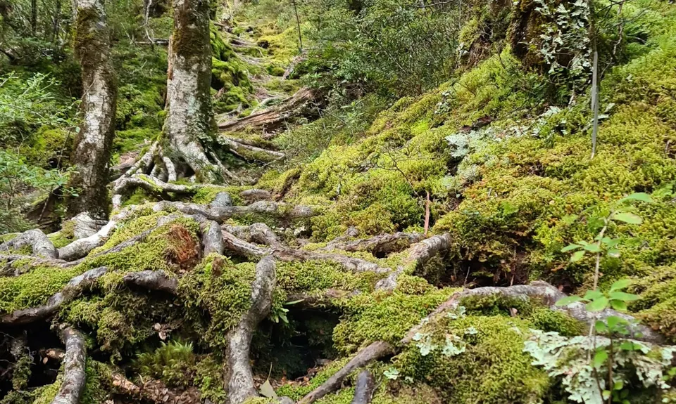
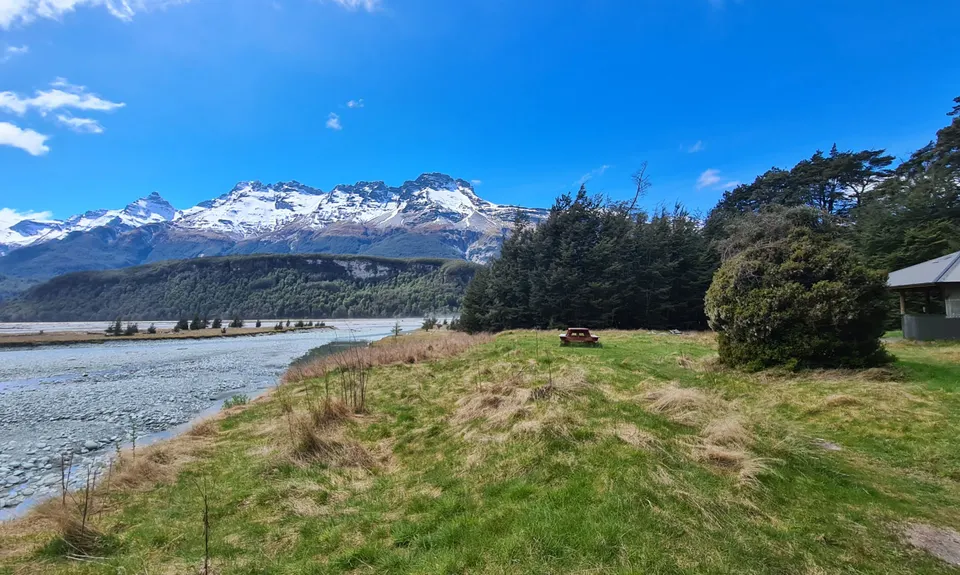
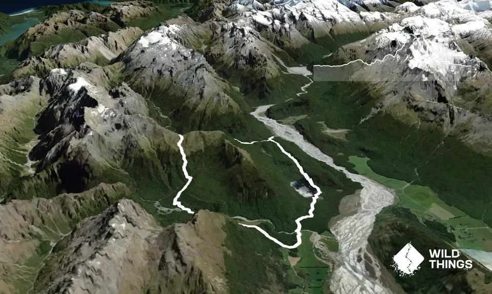
Starting at the Lake Slyvan Carpark, cross the river by swing bridge. The track to Lake Sylvan is very easy, following the shores of the lake, before traversing moraine through beech forest. Once you leave the well maintained track of Lake Sylvan the track becomes considerably more technical, very rocky with a plethora of tree roots.

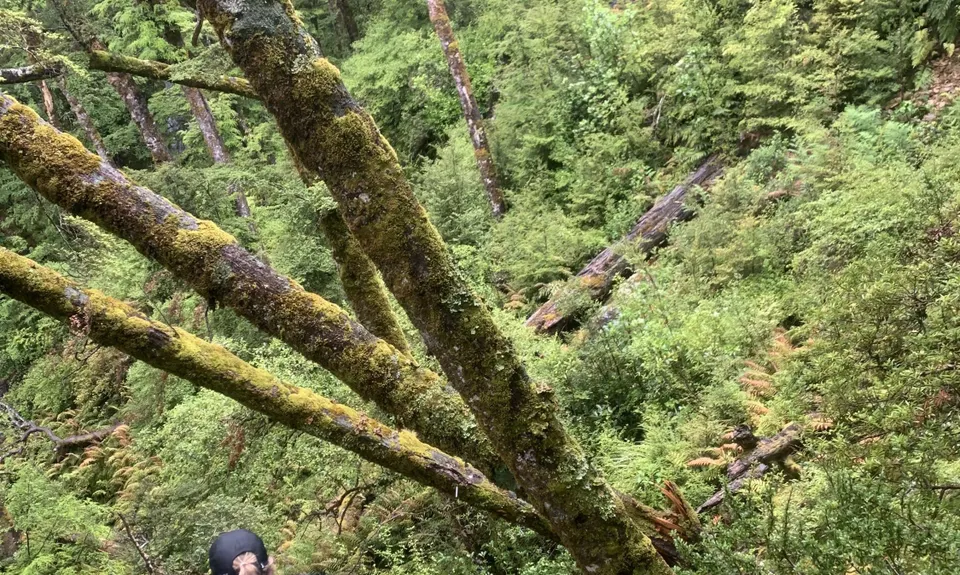
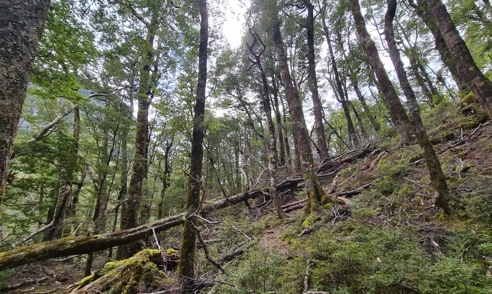
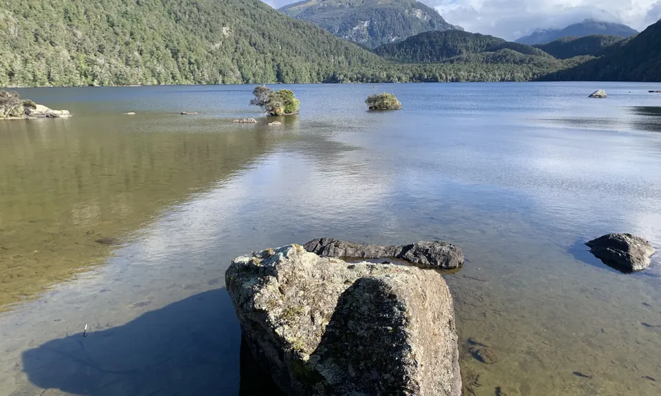
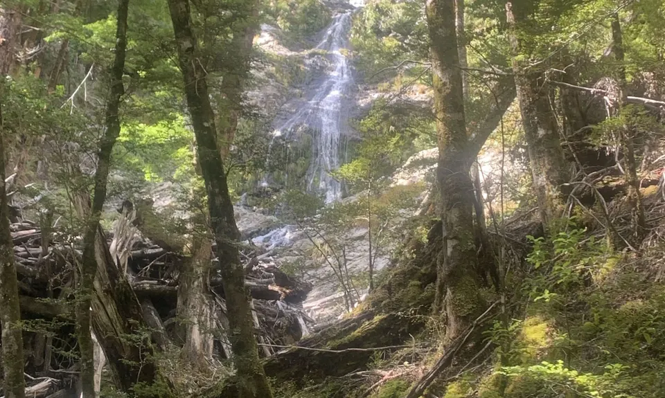
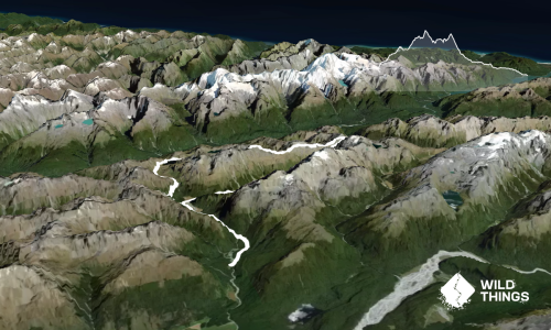
Follow the track to the site of Rockburn Hut, which is nestled in the forest, with a chasm, river beaches and pools closeby. The chasm is a neat wee side trip and there are nice views of the Dart Valley from this area. From Rockburn Hut the track climbs through dense forest. The track has been re-routed due to various slips and fallen trees. The terrain is steep and slippery in places. Waterfalls and river can be glimpsed through the forest. There are various stream crossings to negotiate which can be quite swift during heavy rain events. Take care, especially when crossing the waterfall in wet weather.

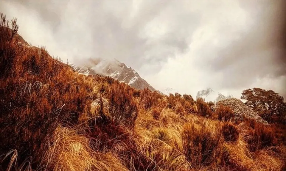
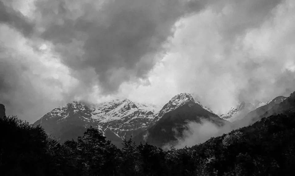
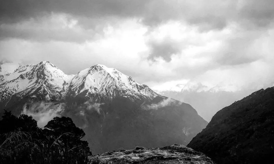
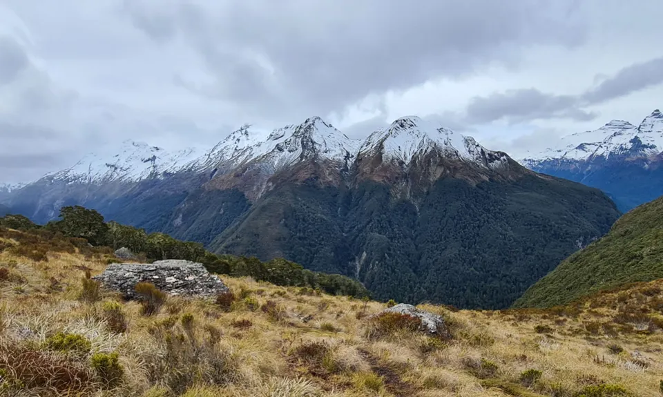
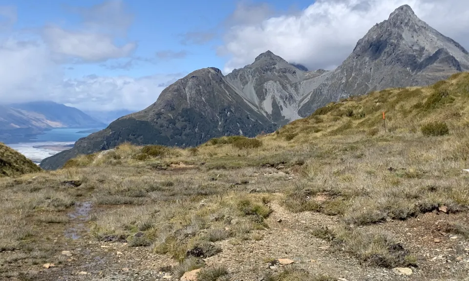
The section between Rockburn and the uphill turn-off to Sugarloaf Saddle is pretty technical underfoot, progress can be slow. The track turns steeply uphill, climbing to the fragile Sugarloaf Saddle where there are great views of the Rockburn and Routeburn Valleys. The expansive views and harsh alpine enviroment are striking above the treeline, but very exposed go properly prepared and equipped. The descent to the Routeburn Track is steep, but mostly runnable, a few slippery-tree rooty parts to negotiate. This take you back to the glorious Routeburn track and then a nice 4km trot along the Routeburn Access road back to the Lake Sylvan Carpark (be aware of traffic and other road users)

Stunning views from the Sugarloaf Saddle to Mt Earnslaw, the Dart Valley and the Southern Alps. The Rockburn Chasm is a striking limestone feature carved out by the river, well worth a side trip for thundering churning water slicing through the rock!

The Lake Sylvan Car Park is also a DOC campsite. There is plenty of parking and toilet facilities.

23 km

26 minutes

Unknown

No

Moderate.

Keep your eyes peeled for track marking and re-routed track along the face above the Rockburn River

Its worth having NZTopo Ap on your phone, or a map if youre not familiar with this area

Non-existent.

Thermal leggings, Lightweight fleece top, Short-sleeved thermal top, Long-sleeved thermal top, Seam-sealed waterproof jacket, Gloves, Beanie/thermal headwear, Whistle, First aid kit, Extra food for emergencies, Cellphone, Map

Plenty of water in the streams when I was there, might be quite a dry route though if its been a while since it rained

Muddy and slippery after rain, creeks/streams/waterfalls to negotiate in rain events, water levels rise quickly

Mrs Wooleys General Store
Glenorchy
https://www.theheadwaters.co.nz/general-store/
Pork pies and coffee to die for

You and Sugarloaf Circuit

As a VIP member you can record private notes for this trail, see all of your times and more.

Register Now

Already have an account? Login now

Trail Reviews

A fun outing in remote country. This is one to avoid if you don't like tree roots but it does add to the interest! If the weather is poor, or likely to close in, it might be worth considering parking at Routeburn and going clockwise, getting the saddle done first. I chose this option and was glad I did as the uphill run back up the road from Lake Sylvan in the rain, was a better option than a finish over Sugarloaf.

Stephen Dunnett

March 12, 2023

Finally ticked this one off after years of thinking about it. It’s a rough one with limited real running opportunities over much of the route (especially the Rockburn side) but a great adventure for all that & the opportunity to really stretch your legs over the final 5-6k on Routeburn track & road. In short: loved it!

Malcolm Law

February 24, 2023

Very unrunnable apart from the ~4km at either end, but given the shorter distance it's all pretty good fun. Cool view from the saddle. No chance of keeping feet dry on this one I don't think :)

Katie Morgan.

December 29, 2021

Especially lovey spring run, not too hot, beautiful view of the saddle after some serious efforts pushing through fallen logs, multitudes if tree root hopping, the path is also a creek bed with slippery green rocks. I was on my hands climbing the sharp up from Rockburn to the sugarloaf saddle is 4 legs become better than 2 in this ancient gondwana woodland, but felt a great achievement to finish under 6 hrs..pick your weather window I would not go here in high winds or heavy rain, phone reception only at the summit, take a nice chippy sandwich as you will build up a big appetite jumping tree roots! Orange markers on the Rockburn side approx 20 to 50 meters apart on the technical track (if you are going anti-clockwise) you will lose them occasionally between 9-11km mark where there is storm damage, and before you climb the saddle; keep the river beside you and they start up again. Happy running

Lynette ELFICK

October 17, 2021

Login to submit a review

Trail Running Community

Find people who are interested in or have completed this trail run.

You must register or login to view this feature.

Register Now

Other trails nearby
Rees - Cascade

Rees - Cascade

Length: 55.0km

Level: Experienced

Earnslaw Burn Circuit

Earnslaw Burn Circuit

Length: 25.0km

Level: Intermediate - Experienced

McIntosh - Judah Loop

McIntosh - Judah Loop

Length: 19.0km

Level: Beginner - Intermediate

Routeburn-Caples

Routeburn-Caples

Length: 54.0km

Level: Intermediate - Experienced

Find more trails and peaks nearby