Last Updated: 5th Jan 2024

Very Experienced

Save Trail Save

I've done it Done

Serpentine Lakes Lasso

Mt Xenicus, Mt Erebu and Conical hill

Routeburn Track

Glenorchy, Otago

Submitted by Daniel Nogueira

Last Updated: 5th Jan 2024

Very Experienced

Save Trail Save

I've done it Done

Open

Grunt Factor: 91 ?

Gnarl Factor: 73 ?

36.4km

2525m

2470m


Login as a VIP to see driving directions, distance and time.

Trail Map

Type of Run

Back country - remote

Combo

Mountainous

Native bush

Riverside

Lakeside

Open tussock/grasslands

Open ridges/tops

Run Makeup

30%
35%
35%

Easy Single Track

Technical Single Track

Untracked / Route only

Average Uphill Gradient: +14.0%

Average Downhill Gradient: -13.7%

Trailhead

Login as a VIP to see the trailhead information.

Estimated Times to Run

Not suitable

Slow

13:00

Moderate

8

Fast

Disclaimer: This route includes a considerable amount of unmarked and not always obvious terrain, with steep drops, exposed traverses, and some serious route finding. The map, GPX file and this guide should be used as general guidance, but make your own decisions. Conditions can change. Be aware some of the route can hold snow until late summer.

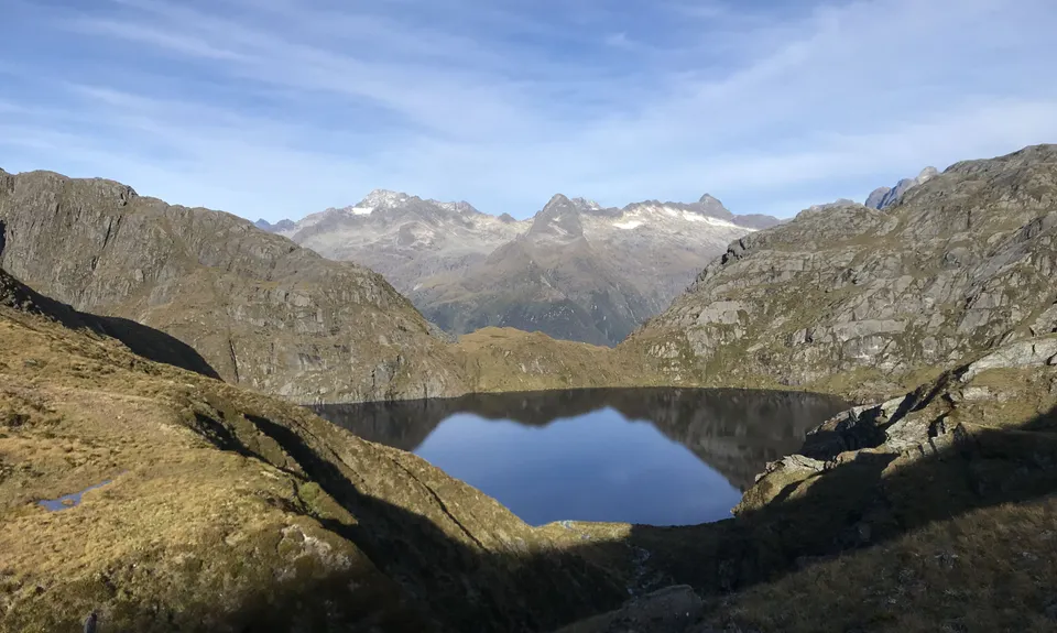
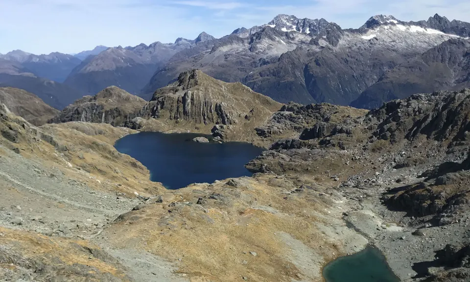
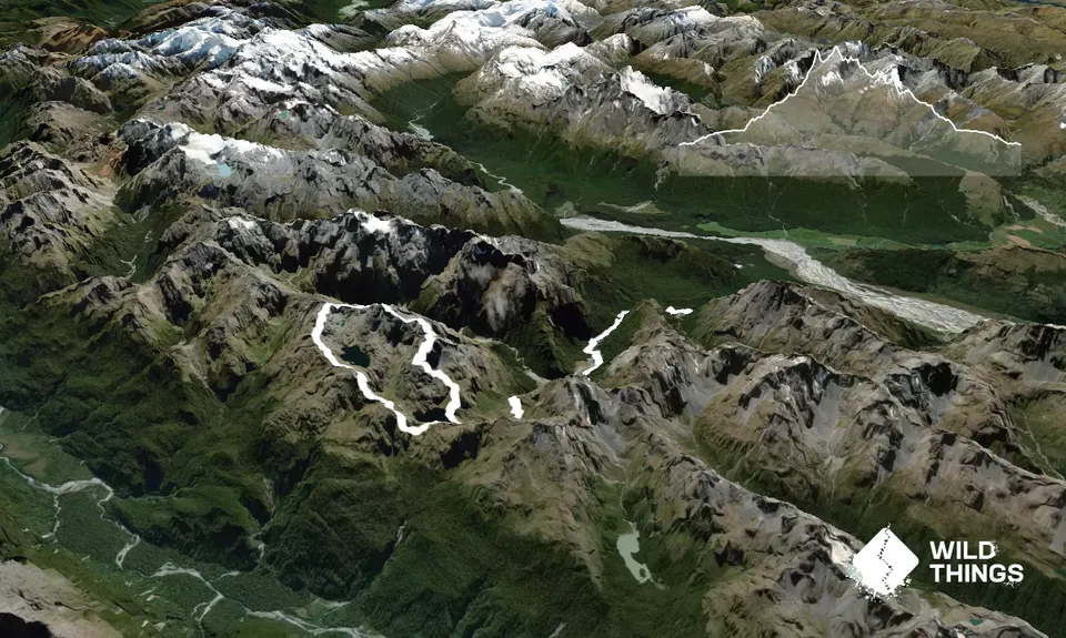
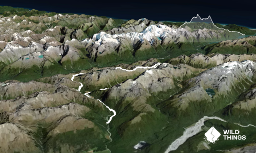
Start from Routeburn carpark on the Routeburn Track and head up towards Harris Saddle. At about 1200m as you gain views of Lake Harris, take the trapline that heads off from the main track towards the lake outlet. From here it's all unmarked terrain until you reach Conical Hill.

Cross the outlet and head up towards point 1455, sliding across on its side towards a creek spring. From here, use your judgment to find a nice route towards the ridge of Xenicus by looking at the terrain and topo lines, aim for the less steep terrain.

As you gain the main ridge at 1600m, head up towards the summit. A few rock cains might help with navigation.

Coming down from the N side of the summit towards Erebus is the trickiest part of the route. Patiently scramble your way down a find one scree gully that will take you down a more gentle slope. From there to Erebus is a more gentle terrain and easier navigation with some nice big boulders.

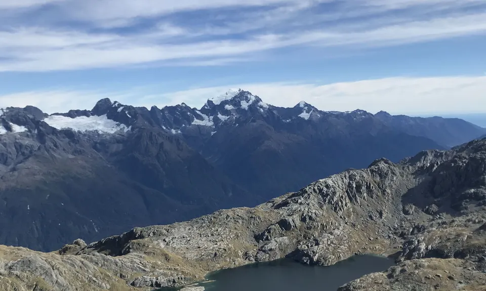
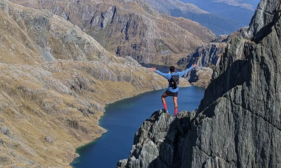
From the Erebus summit again a little tricky section coming down, be patient and look for a steep scree gully on your left, that should take you to more gentle terrain. From here stay on the ridge/high points as much as you can and loop around towards the other side of the lake where you have great views of Hollyford Valley.

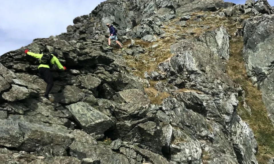
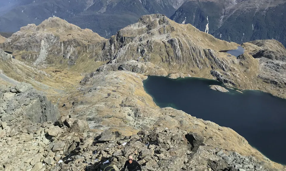
Aim for point 1646, then slide across on the east side of it before reaching its summit. This is quite a tricky section as well as there are some sheer drops to the valley of the trolls.

Once on the other side of point 1646, a steep scree descent towards the little saddle at 1390 with a couple of points you need to find your way down on the sides of it, then head towards Conical Hill.

Once at Conical Hill, enjoy the views and head back to the Routeburn Track.

Be prepared for this route to take you a long time - while a lot of the ridge is fun to run and you can make up good time, it most likely will require you to backtrack a few times to find the right path.

This trail includes the peaks Conical Hill, Mount Xenicus and Mount Erebus.

Incredible views all the way through including Mt Aspiring, Tutoko and Darrans Range, West Coast, etc.

Plenty of parking.

25 km

27 minutes

No

No

Extreme.

A lot of places might seem as "impossible" when you first look at them, but if you take step by step and look around, you will find a way through. Routefinding is a fun skill/practice so take it easy and enjoy. If you expect to just put your head down and follow a path this route is not for you.

Non-existent.

Lightweight fleece top, Long-sleeved thermal top, Windproof jacket, Gloves, Beanie/thermal headwear, Personal Locator Beacon (PLB), Whistle, First aid kit, Extra food for emergencies, Survival blanket, Cellphone, Map, Headtorch and spare batteries

Plenty of water on the Routeburn. NO WATER ON THE RIDGE from km 13 until km 26. Fill up your bottles and drink heaps when you cross the last stream after the lake outlet.

Snow present might make this impassable or dangerous. Snow present until late summer. Late Feb/March is the best option

Steep, exposed drops
Loose scree
Weather and wind - ensure you have clear skies/views for navigation.

You and Serpentine Lakes Lasso

As a VIP member you can record private notes for this trail, see all of your times and more.

Register Now

Already have an account? Login now

Trail Reviews

Be the first to submit a review for Serpentine Lakes Lasso!

Login to submit a review

Trail Running Community

Find people who are interested in or have completed this trail run.

You must register or login to view this feature.

Register Now

Overlapping Trails

These overlap with this trail to some degree. You may wish to combine them but please note that to qualify for FKTs on these runs you should record a separate activity for each.

Conical Hill and Return

Conical Hill and Return

Length: 27.4km

Level: Beginner - Intermediate

Routeburn-Caples

Routeburn-Caples

Length: 54.0km

Level: Intermediate - Experienced

Routeburn Flats via Nature Walk Loop

Routeburn Flats via Nature Walk Loop

Length: 15.3km

Level: Beginner - Intermediate

Other trails nearby
Glenorchy Wetlands

Glenorchy Wetlands

Length: 5.0km

Level: Beginner

Invincible

Invincible

Length: 7.0km

Level: Beginner

Rees Dart Reverse Run

Rees Dart Reverse Run

Length: 63.0km

Level: Intermediate - Experienced

Lake Rere Loop

Lake Rere Loop

Length: 15.3km

Level: Beginner - Intermediate

Find more trails and peaks nearby