Last Updated: 13th Nov 2025
Conical Hill and Return
Last Updated: 13th Nov 2025
Open
Grunt Factor: 46 ?
Gnarl Factor: 44 ?
27.4km
1450m
1450m
1515m
Last Updated: 13th Nov 2025
Last Updated: 13th Nov 2025
Open
Grunt Factor: 46 ?
Gnarl Factor: 44 ?
27.4km
1450m
1450m
1515m
Front country - easily accessible
Out and Back
Mountainous
Native bush
Lakeside
Open tussock/grasslands
Open ridges/tops
Easy Single Track
Moderate Single Track
Technical Single Track
Average Uphill Gradient: +11.90%
Average Downhill Gradient: -12.00%
VIP Feature: Send this route to your Garmin account so you can follow the course on your Garmin device.
Become a VIP Member to see the trailhead information.
7:00
Slow
5:00
Moderate
3:30
Fast
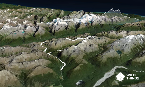
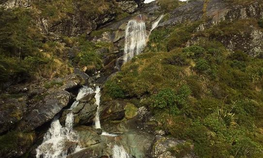
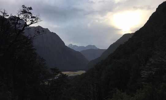
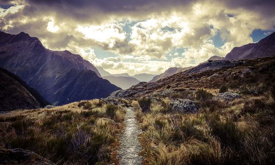
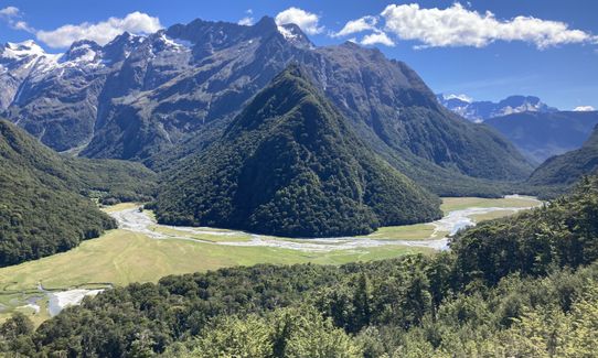
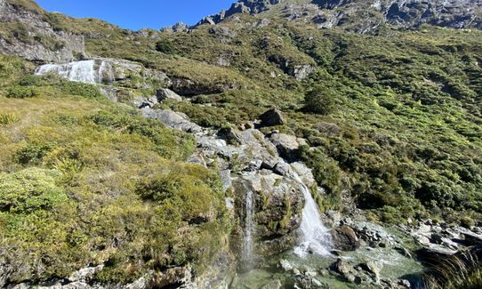
Starting from the shelter, the first 6.5kms are along a very well maintained path. Various bridge crossings and a lovely forest to run through. At 6.5km, you have the option of popping off to your right for a visit to the Routeburn Flats hut. Taking a left, you head up the hill for another 2.5km of uphill before coming to the Routeburn Falls Hut. This is a good place to refill the water bottles and have a chat to people walking the track. The hut sits just below the falls and as you continue you run up past these.
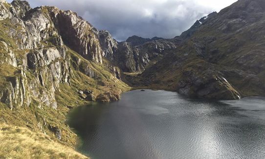
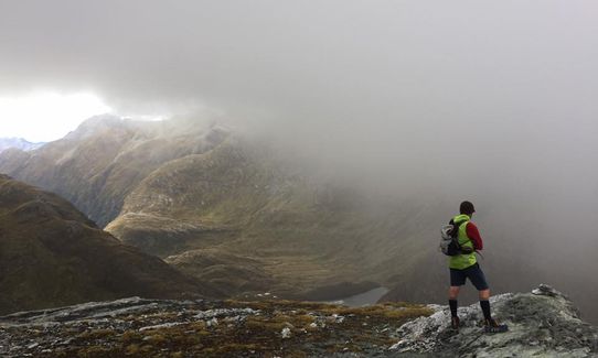
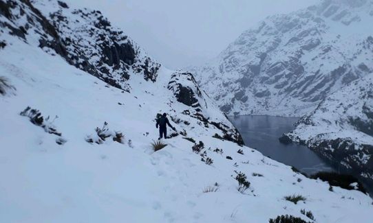
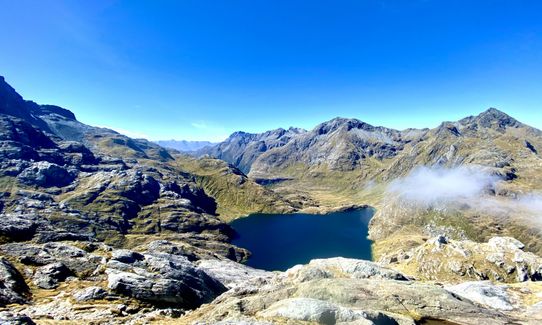
As you continue climbing past the Routeburn Falls Hut the track becomes a little more technical on average, with some uneven footing. Track track continues up and alongside Lake Harris then to the Harris Saddle. At the saddle there is a shelter where you can use the toilet if need. The Concial Hill track leads off from here and is roughly 45min return from this point. After reaching the top of Conical Hill, return at leisure via the path you came up on.
This trail includes the peak Conical Hill.
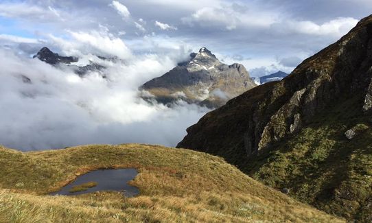
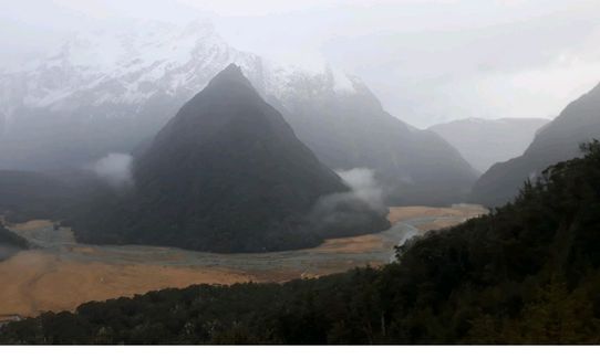
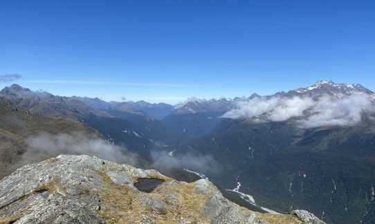
Plenty of waterfalls, bird watching, mountain lakes, view of the West Coast at Martins Bay from top of Conical Hill.
If you know of any public toilets near the trail start or on the route, please login and then let us know so we can update this section.
Plenty of parking space available, pretty public area, but given the number of people moving through the area maybe not leave valuables in car...
25 km
28 minutes
No
No
Easy.
Non-existent.
Short-sleeved thermal top, Long-sleeved thermal top, Seam-sealed waterproof jacket, Gloves, Beanie/thermal headwear, Personal Locator Beacon (PLB), Whistle, First aid kit, Extra food for emergencies, Survival bag, Cellphone, Map, Gaiters
Plenty of water around, drinking from the streams above the track should be ok. Water is at Routeburn Flats and Falls Huts.
During winter there are avalanche paths that cross the track. Check with DOC before venturing out.
Many footing issues given the technical nature at some points above the Falls Hut.
Glenorchy Cafe ad Bar
25 Mull St, Glenorchy
https://www.facebook.com/glenorchycafe/
Fast, friendly and great coffee.
Do you have another suggestion on where to go afterwards for the best coffee / cake / breakfast / brunch / beer?
Trail Legend
Login as a VIP to become a Trail Legend. Learn about Trail Legends.
Fastest Known Times (FKTs)
You and Conical Hill and Return
As a VIP member you can record private notes for this trail, see all of your times and more.
Already have an account? Login now
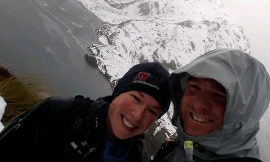
Awesome way to see the Routeburn without the logistical car/key swap issues. The hill at the top is a nice wee bonus.
April 22, 2021
What an absolute stunner of a run and what a great way to see a good half of the Routeburn. Probably my favourite run ever so far ?
January 11, 2021
So cold, yet so amazing the atmoshpere provides the warmth you need. What an amazing piece of our country! Looking forward to being able to get right through to the divide when its been fixed up.
November 17, 2020
All the best of the Routeburn without the logistics of a point to point. Make sure it's a clear day up top as apparently you can see right across to the coast - but I've always been trapped in clouds so can't really verify!
January 30, 2020
These overlap with this trail to some degree. You may wish to combine them but please note that to qualify for FKTs on these runs you should record a separate activity for each.
Send to your phone
Scan the below QR code to open this trail on your phone.

Tip: position the QR code in your phone camera screen.
Plan smarter, stay motivated, track your progress, and unlock the full Wild Things experience — while saving along the way.