Last Updated: 21st Sep 2023
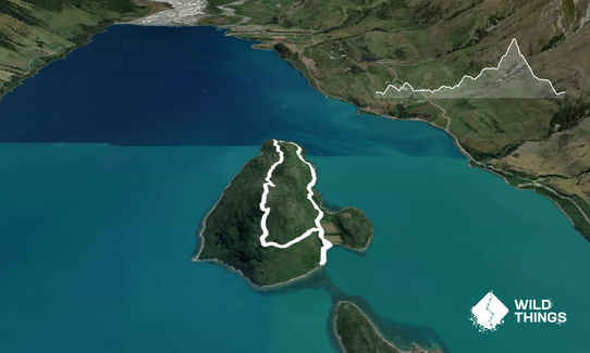
Pigeon Island Loop
Last Updated: 21st Sep 2023
Grunt Factor: 9 ?
Gnarl Factor: 20 ?
5.7km
205m
205m
460m
Last Updated: 21st Sep 2023
Last Updated: 21st Sep 2023
Grunt Factor: 9 ?
Gnarl Factor: 20 ?
5.7km
205m
205m
460m
Front country - easily accessible
Loop
Undulating, small hills only
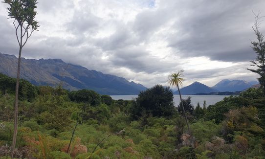
Native bush
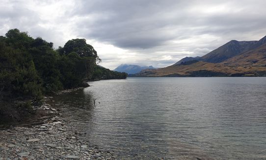
Beach
Coastal
Lakeside
Open ridges/tops
Easy Single Track
Moderate Single Track
Average Uphill Gradient: +8.4%
Average Downhill Gradient: -8.5%
VIP Feature: Send this route to your Garmin account so you can follow the course on your Garmin device.
Login as a VIP to see the trailhead information.
1:00
Slow
0:45
Moderate
0:30
Fast
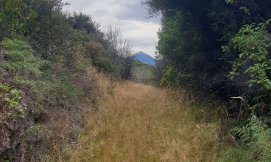
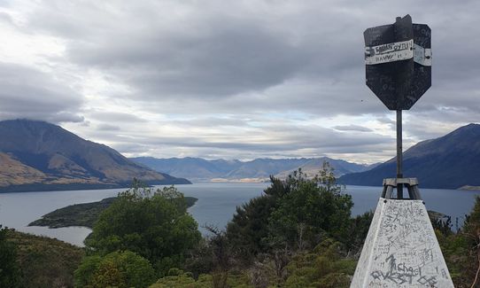
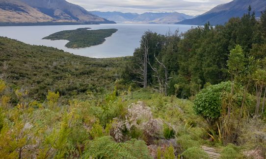
Easy bush route to follow with points to turn down to the rocky beaches. Undulating terrain but easy. Bush bashing a bit sometimes but nothing crazy - might be good to have long pants. Route will take you up to the summit. You can loop either way. Route begins from the Queentown end of the island where the campsite is.
Many native birds on the island as it is mostly predator free. Watch for wekas in particular.
If you know of any public toilets near the trail start or on the route, please login and then let us know so we can update this section.
Room for approximately 10 cars at Lake Face Creek Falls pull in to park. Smithy's Hut on Pigeon Island is first come first serve plus a big camp site for tents. No public transport. Will need a boat of some sort.
9 km
8 minutes
Unknown
No
Easy.
Very patchy.
Long-sleeved thermal top, Whistle, First aid kit, Extra food for emergencies, Cellphone, Map
Only lake water available.
As in all mountainous areas, weather is variable and you are more exposed being on a small island. Prepare appropriately.
Lake can pick up in wind and waves in that area very quickly so bare that in mind for your travels back to the Lake Face Creek car park.
Fastest Known Times (FKTs)
You and Pigeon Island Loop
As a VIP member you can record private notes for this trail, see all of your times and more.
Already have an account? Login now
A fun little mission. On kayak it was 25 minutes casual pace from shore near Lake Face Creek to the bay at the Queenstown end of the island. Run on the grass track was slightly overgrown but not too bad, and all good in shorts. Took the summit turnoff which continues as a loop (sign at start indicates it does not). Nice views along the way and plenty of bird life. Great spot for a swim at start/end of trail just before the old doc hut.
January 3, 2022
A wee gem! Great little loop with the option of a second hill for a different vantage point over the island, I second the long leggings advice. Beautiful views and lots of bird life. The hut/campsite is worth a stay, watch out for the cheeky wekas.
September 14, 2020
Send to your phone
Scan the below QR code to open this trail on your phone.

Tip: position the QR code in your phone camera screen.


