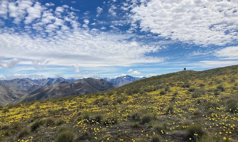
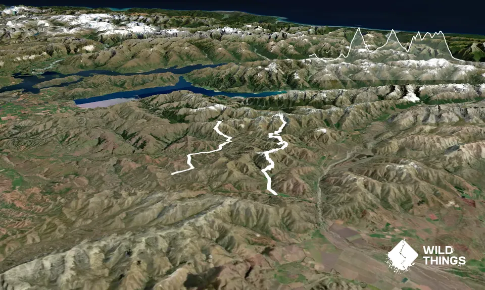
Start on the Melina Ridge track, which starts you off easy with undulating terrain in farm country. After a few hours you start ascending to Mt Prospect, which mostly follows a fenceline.
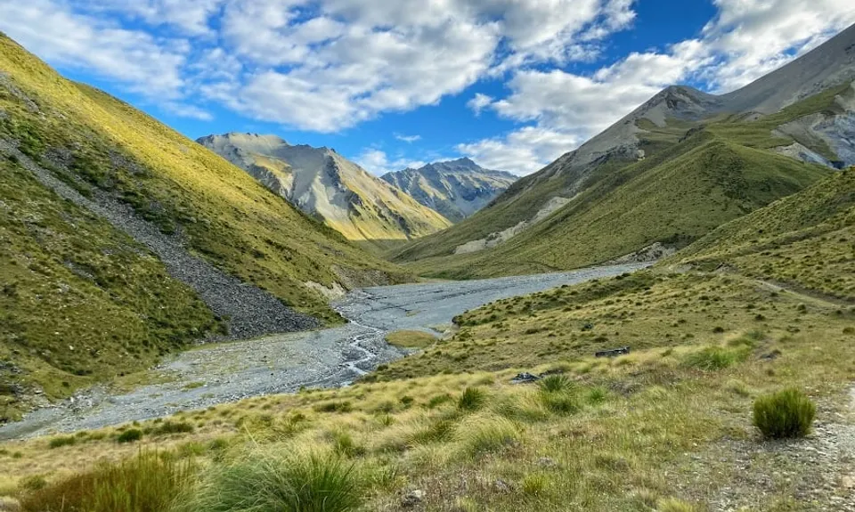
From there descend further fenceline and then some more 4WD track to the lovely rest spot of Top Timaru Hut. From there you join a section of the Te Araroa trail. Follow the Timaru river up towards Mt Martha, a valley with stunning views.
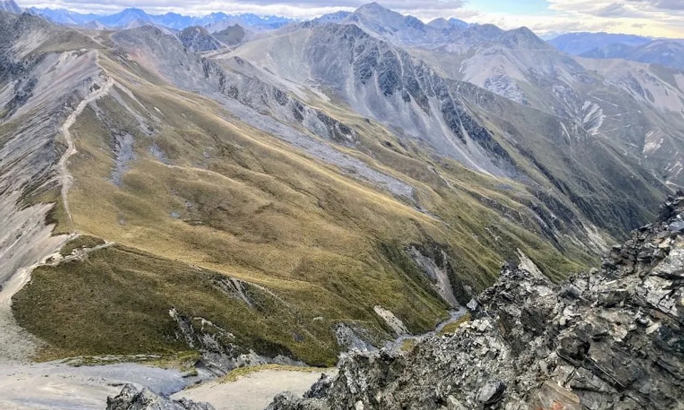
Descend to Avon Burn, where private Tin Hut also makes for a lovely rest spot. From here you leave the Te Araroa trail and start ascending again an easy 4WD track to Pavillion Peak.
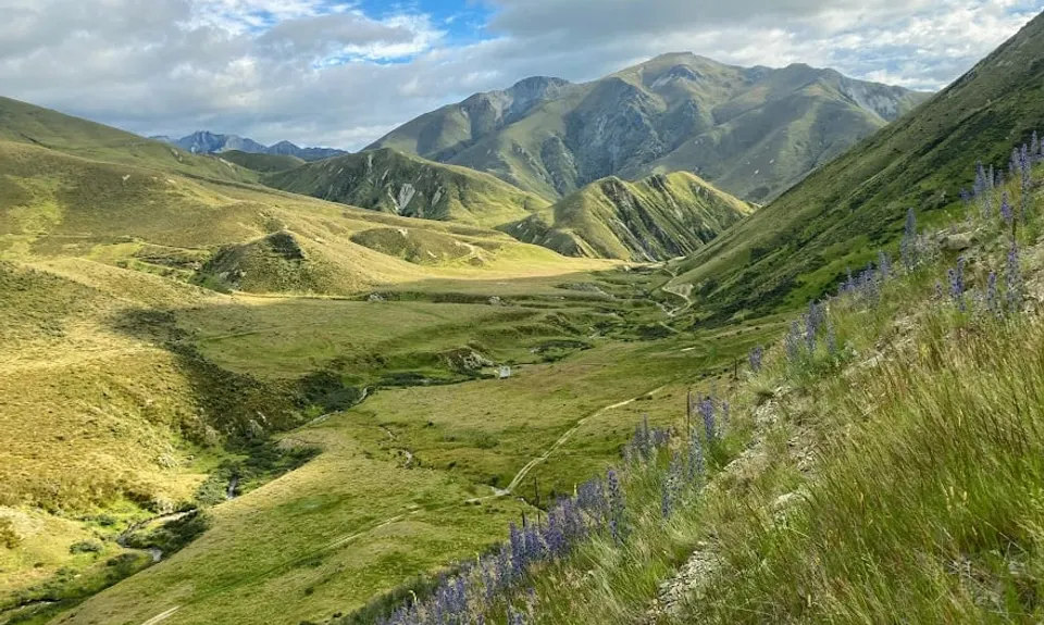
Keep a look at your topo map to make sure you're on the right 4WD track to take you next over Dromedary Hill and then out Delrachney Station. From there it's simple to hitch back about 15 km to the other trailhead.
If you know of any public toilets near the trail start or on the route, please login and then let us know so we can update this section.
Limited parking is available at the Melina Ridge start. If you start from the Delrachney station side, there is more parking.
76 km
53 minutes
Unknown
No
Moderate.
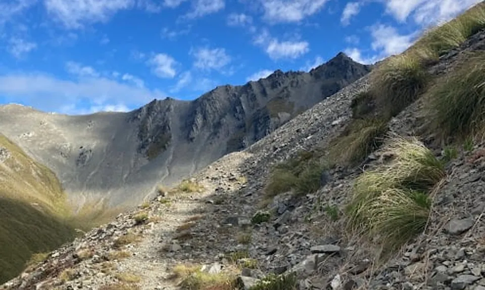
On a track like this it could be easy to think, "It's all 4WD track, how could I get lost?" The problem is that there are many 4WD tracks going all directions in the Lindis area, and there aren't very many DOC signs or orange markers to help guide you for long stretches. Checking a topo app will help ensure you're on the right track.
There are a few streams in the beginning when you're on the Melina Ridge Track, but getting up towards Mt Prospect you won't see water again until you're close to Top Timaru Hut. From Top Timaru Hut to Avon Burn, you will consistently be near water. Between Avon Burn and the flats of Delrachney Station (20 km), there is no water. Finally 5km before you hit the road in the Delrachney Station there is water again.
This track is exposed to weather in that there's no tree cover and often follows ridge lines and peaks. Be aware of sun, wind, rain. Could be prone to extreme hots & colds.
Take care descending Mt Prospect, there's a bit of scree and slips.
Do you have a suggestion on where to go afterwards for the best coffee / cake / breakfast / brunch / beer?
We don't store or share your location; it's only used for these features. You can continue without it, just without distance sorting and live map features.
Send to your phone
Scan the below QR code to open this trail on your phone.
Tip: position the QR code in your phone camera screen.