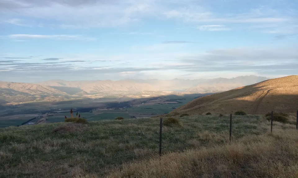
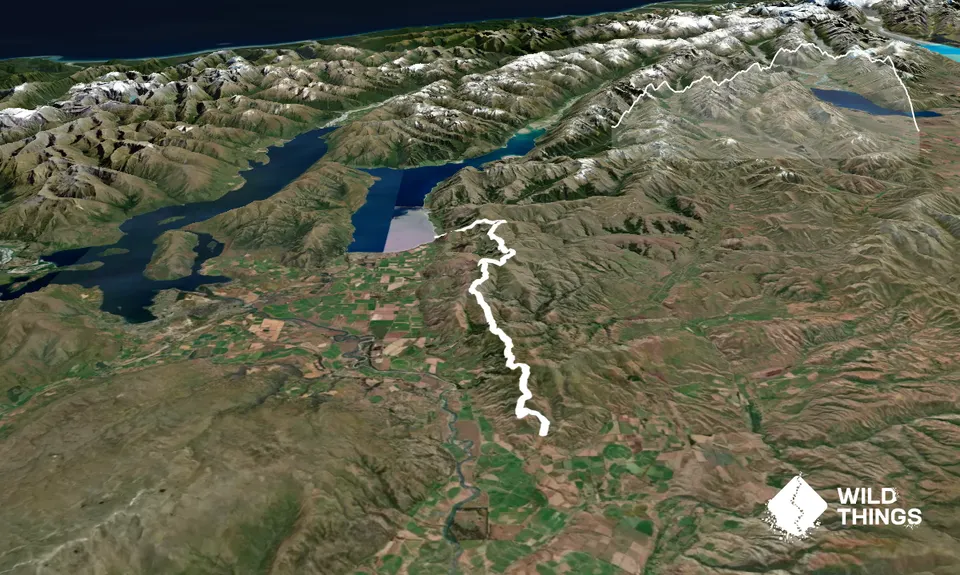
Northbound: Short flat section of 1km at the start, followed by unrelenting uphill for the next 20km to Grandview Peak. Downhill sections, where they are, are short, sharp and rocky. Any downhill is immediately followed by an uphill. Opportunities to actually run are few and far between. Once you past Grandview Peak 21km in, the track flattens out to undulating terrain for 9km where you will ascend almost as much as you descend before a short climb to Pakituhi Hut. From the hut it is a brutal 1000 metre descent over 5km to the lake shore of Lake Hawea. This drop is considerably steep, rocky and covered in schist rock for the first half. There are a dozen or so switchbacks through waist high scrub for the last few hundred metres of drop.
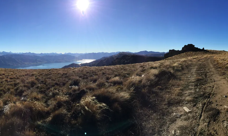
Interesting rock outcrops and formations near the summit of Grandview Peak. Optional run extension of Grandview Peak (approx. 1km extra) and Breast Hill (approx 6km extra)
If you know of any public toilets near the trail start or on the route, please login and then let us know so we can update this section.
There is a grass car park with room for half a dozen cars approximately. It is on a shallow slope and may become boggy after heavy rain.
37 km
27 minutes
No
No
Moderate.
There are many opportunities to take a wrong turn with splits from the main track for side tracks, access routes and farm tracks. It is recommended you take topo maps, a GPS unit or a phone with an app such Topo GPS or Map Toaster.
There is no water available until Pakutuhi hut, which is almost 33km in. Some creeks may be active after heavy rain but this is farmed land and the quality of water would be questionable with regards to contaminants. No water after Pakituhi hut either.
Very exposed for much of the route, although the route does not follow the true ridge. Intense sun in summer with minimal chance of shade and wind chill must be factored in at most other times of the year.
This route should not be attempted in winter due to extreme cold and avalanche risk.
This route should not be attempted when cloud is low as visibility will greatly hinder progress.
Caution on descents as generally steep and rocky with loose schist blended with ice-berg style rocks.
Extreme caution required on final descent from Pakituhi hut - watch for ice in shaded areas year round.
Do not attempt to descend from Pakituhi to track end in the dark - take a head-torch in the event you overrun your expected completion time or stay at the hut.
Do you have a suggestion on where to go afterwards for the best coffee / cake / breakfast / brunch / beer?
These overlap with this trail to some degree. You may wish to combine them but please note that to qualify for FKTs on these runs you should record a separate activity for each.
We don't store or share your location; it's only used for these features. You can continue without it, just without distance sorting and live map features.
Send to your phone
Scan the below QR code to open this trail on your phone.
Tip: position the QR code in your phone camera screen.