Last Updated: 31st Jan 2026
Aurora and Kanuka Loops
Last Updated: 31st Jan 2026
Open
Grunt Factor: 31 ?
Gnarl Factor: 62 ?
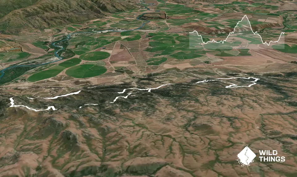
16.0km
895m
895m
769m
Trail Map
This Topo layer only covers NSW/ACT.
Switch to another map layer when viewing outside this area.
Switch to another map layer when viewing outside this area.


