Last Updated: 5th May 2025
Coronet Loop
Last Updated: 5th May 2025
Grunt Factor: 64 ?
Gnarl Factor: 18 ?
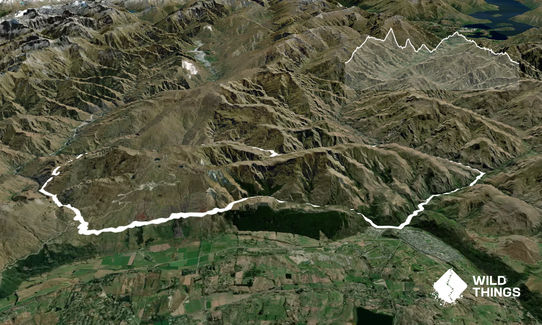
50.0km
1445m
1485m
917m
Last Updated: 5th May 2025
Last Updated: 5th May 2025
Grunt Factor: 64 ?
Gnarl Factor: 18 ?
50.0km
1445m
1485m
917m
Back country - remote
Loop
Undulating, small hills only
Native bush
Riverside
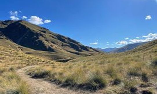
Open tussock/grasslands
Other
Farm Road / 4WD Track
Easy Single Track
Moderate Single Track
Average Uphill Gradient: +5.7%
Average Downhill Gradient: -5.8%
VIP Feature: Send this route to your Garmin account so you can follow the course on your Garmin device.
Login as a VIP to see the trailhead information.
8:30
Slow
7:00
Moderate
5:00
Fast
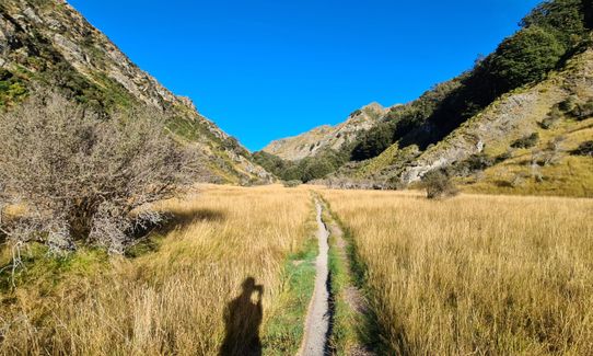
Following the sign ‘Coronet Loop Track’ from the Chinese Village carpark cross the footbridge and turn left. At 1.2kms cross the bridge and turn left onto Bush Creek Track. This track section was upgraded in 2021 with various footbridges.
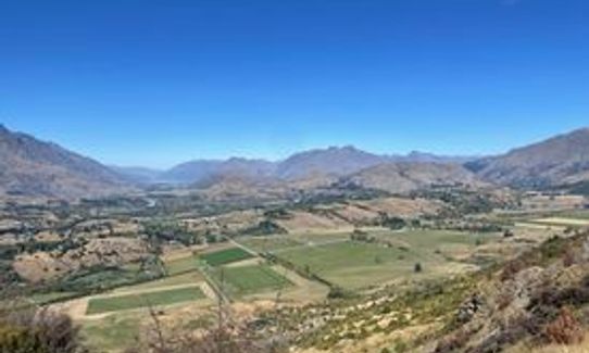
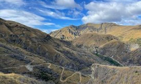
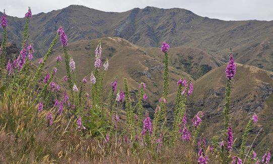
The track gradually climbs through beech forest along the creek and after 6.5kms you will be rewarded with stunning views.
Continue along the Coronet Face Water Race which weaves for 6kms along the front face of Coronet Peak through beech forest and old mining sites to Coronet Peak Road. Be aware, Bush Creek and Coronet Face Water Race are two-way tracks, keep an eye out for downhill bikers.
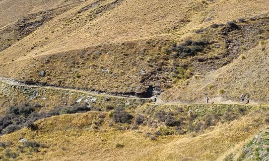
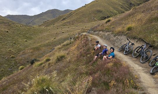
Cross Coronet Peak Road, head up the connector trail for 600m to the start of Pack, Track, and Sack. The downhill mountain track will take you down into Long Gully in Skippers. There are a few steep rock drops on the sections. Be mindful of fast-approaching bikers from behind.
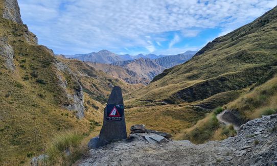
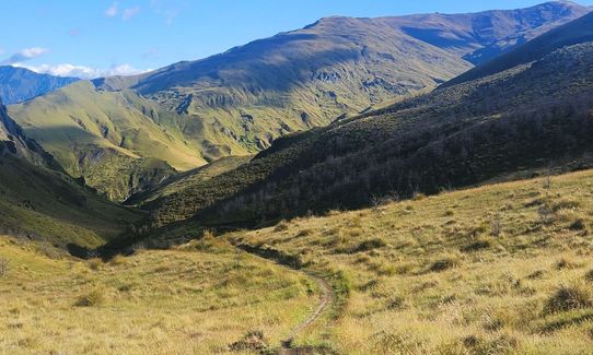
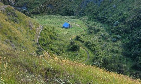
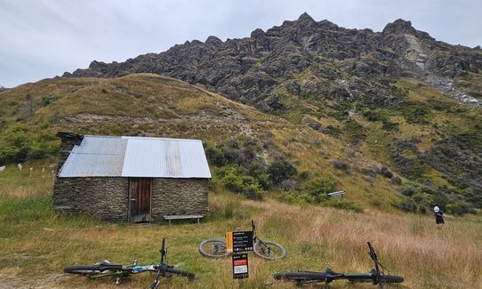
At 17kms turn right, the track starts gradually climbing to Greengate Saddle, which gives great views of Skippers before dropping down to the historic Greengate Hut (21.5kms). There is a creek to fill up water.
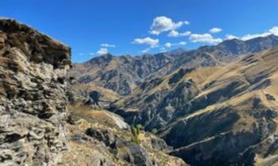
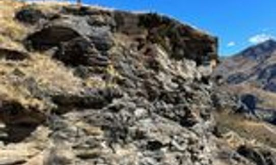
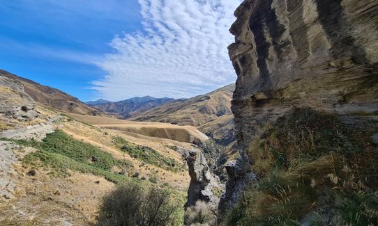
Past the hut, the track starts opening high above Deep Creek overlooking the remains of the Old Greengates Hotel. The loop continues upstream, over Picnic Rock with stunning views of the valley before descending into Deep Creep. This part of the section gives a real sense of remoteness.
Deep Creek marks the halfway point of the loop (25kms) and water refill opportunity.
From here the track sidles in and out of the creek, gradually climbing up to Deep Creek Saddle (33.5kms). From the saddle, the track descends to Eight Mile Hut (39kms). After Eight Mile Hut the tracks turns right to join up with Macetown 4WD Road. From here the track follows the road.
Depending on river levels, at 44kms there is a footbridge on the left or cross the river.
At the 48.5kms use the Norman Spencer bridge to cross the river or continue along the 4WD road involving several river crossings back to the Chinese Village carpark.
The gpx data provided crosses the rivers at the end, you might, however, choose to head across the bridge, go up the stairs, then follow the single track above the river back to the footbridge at Chinese Village. Ignore the junction to Sawpit Gully along the way.
Allow an extra hour to explore the gold mine history of the area and the stunning views along the way.
If you know of any public toilets near the trail start or on the route, please login and then let us know so we can update this section.
Moderate.
Non-existent.
Thermal leggings, Short-sleeved thermal top, Long-sleeved thermal top, Seam-sealed waterproof jacket, Windproof jacket, Gloves, Beanie/thermal headwear, Personal Locator Beacon (PLB), Whistle, First aid kit, Extra food for emergencies, Survival bag, Survival blanket, Cellphone, Map, Headtorch and spare batteries
Water Refills: Bush Creek Track (6kms), Greengate Hut (21.5kms), Deep Creek (25km), various crossing along Deep Creek, Eight Mile Creek (34kms), Arrow River (40kms) and various points along the Macetown Road.
The Deep Creek section of this loop is remote and give an amazing backcountry experience. There is no shelter from the elements. Be adequately prepared, take extra gear including first aid kit and a PLB/Inreach.
Be aware, Bush Creek and Coronet Face Water Race are two-way tracks, keep an eye out for downhill bikers.
There are a few steep rock drops on the downhill mountain bike section into Skippers. Be mindful of fast approaching bikers from behind.
Fork and Tap
51 Buckingham Street, Arrowtown
https://www.theforkandtap.co.nz/
Great selection of beers and the bowl of fries is a real treat over a long run.
Fastest Known Times (FKTs)
You and Coronet Loop
As a VIP member you can record private notes for this trail, see all of your times and more.
Already have an account? Login now
Glorious hot dry day, amazing views, and "a loop" in easy reach of Arrowtown and the pub!!..I was impressed with the trail standard and markings, it could be a nice winter jaunt for the 50km plus wild things, and I am keen to run thus loop at night as well!!
April 16, 2022
Send to your phone
Scan the below QR code to open this trail on your phone.

Tip: position the QR code in your phone camera screen.


