Last Updated: 15th Mar 2024
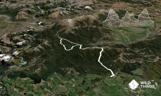
Oxford Odyssey Marathon Route
Last Updated: 15th Mar 2024
Open
Grunt Factor: 96 ?
Gnarl Factor: 75 ?
41.0km
3200m
3200m
1366m


Trail Map
This Topo layer only covers NSW/ACT.
Switch to another map layer when viewing outside this area.
Switch to another map layer when viewing outside this area.


