Youngman Stream - Tarn Hut LoopIntermediate - Experienced
Submitted by Daniel Parkinson
Front country - easily accessible
Combo
Undulating, some big hills
Native bushRiversideOpen farmlandsOpen tussock/grasslands
Intermediate - Experienced
5:30 (Slow)
4:00 (Moderate)
3:00 (Fast)
-8.3%
+8.3%
Fastest Known Times (FKTs)
Please set your gender to see your position on the FKT leaderboards.
Men
Women
There are currently no female FKTs for Youngman Stream - Tarn Hut Loop.
Filter FKTs
The more , the harder the FKT will be to beat. Learn about Fastest Known Times.
Description
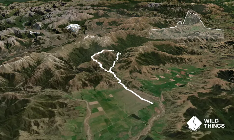
From the car park on the road, run 3.4km to a gate (this bit may be skipped if you drive here). Then, follow the farm 4WD track for around 4km. There is a crossing of the Lilburne River required, but usually this is only calf deep and presents no issues.
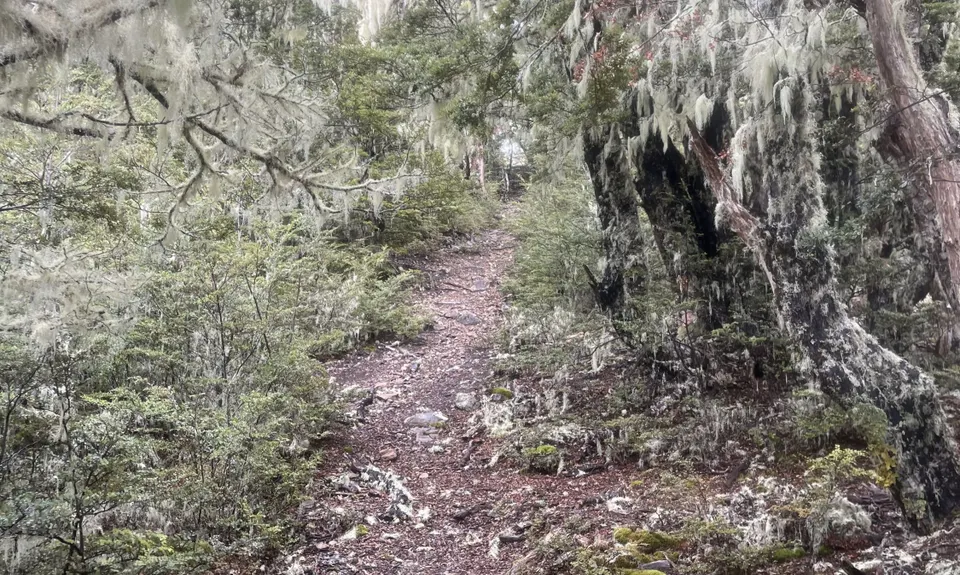
Continue another km to a DoC sign and a Y junction. From here, continue towards Youngman Stream Hut. Be careful to follow the markers and not sheep trails. The trail is relatively flat for a few kilometres, but then ascends steeply to almost reach the bushline, before descending back down to Youngman Stream, where a crossing is required to reach the hut. The stream is probably the best place to refill with water as the huts do not have tanks.
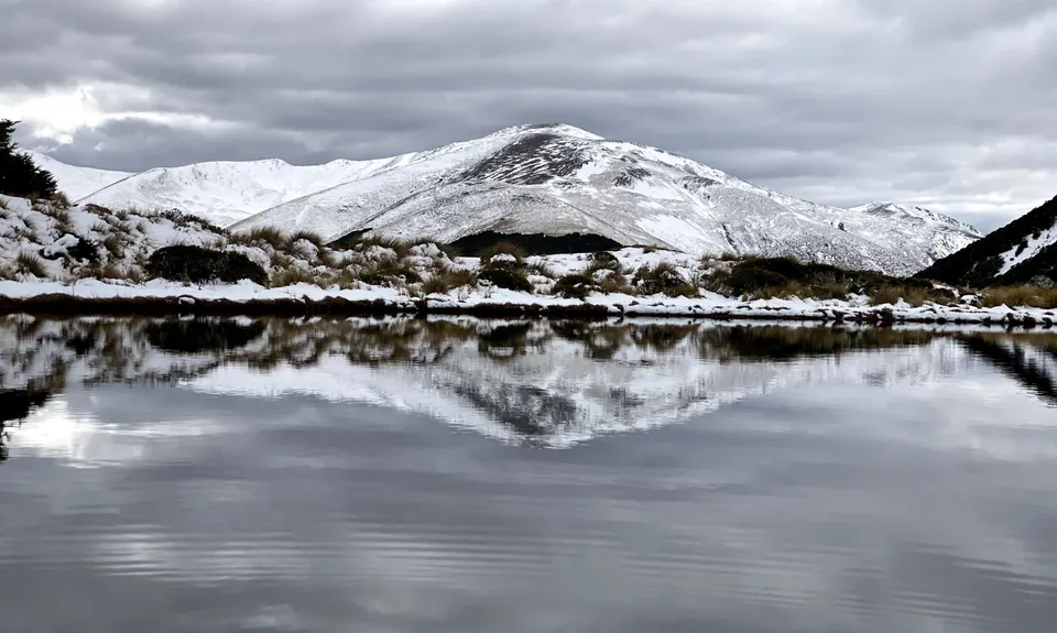
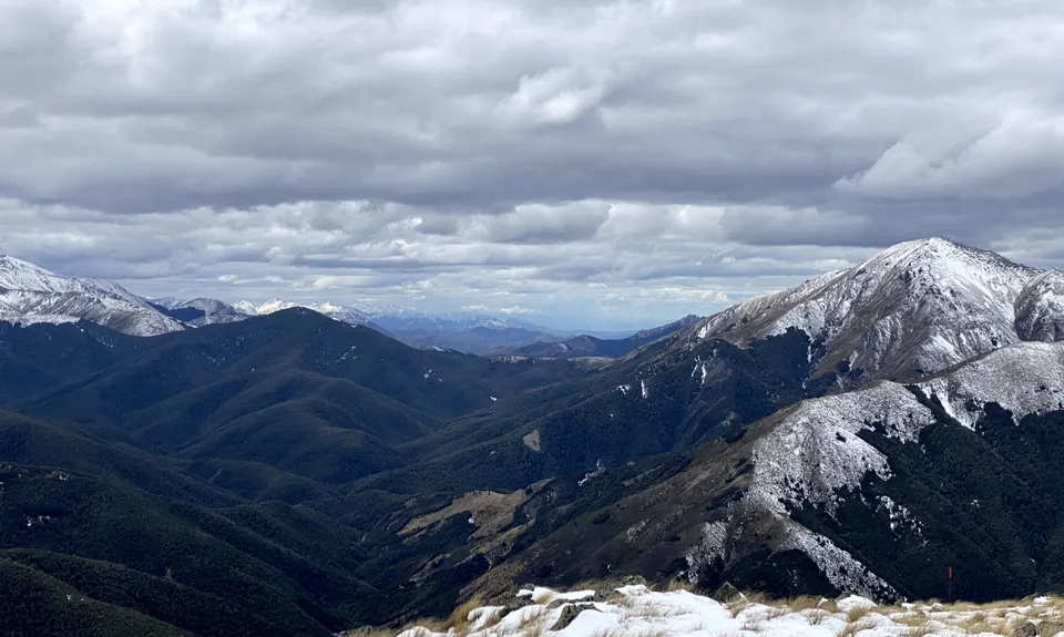
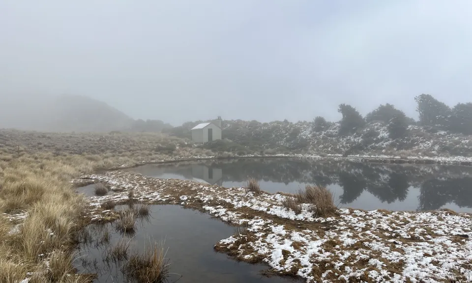
Cross back over the stream to begin a steep grunt to Lilburne Hill, the highest point on the run. From here, the trail descends to the picturesque Tarn Hut. A 4WD track then starts, with a gentle and fast descent back to the Y junction. From here, it is a flat and easy run on the farm track back to the car. Can be run in either direction, but I prefer to run in the described direction, to get the hardest bits out of the way first, and it is nicer to have a less steep downhill section from Lilburne Hill.
Trail Community
Make Up of Run
Moderate Single Track: 45%
Farm Road / 4WD Track: 55%
Route Data
Reviews:
Photos:
Your Trail Wishlist
All the runs that are on your To Do list (no limit).
Add to wishlist view wishlistWild Explorers
I did it!-
Access
From Oxford, head up the Ashley Gorge Road for a few kms, then turn left onto the gravel Lees Valley Road. Follow this for a very windy 30 minutes or so, then continue on the flat to the marked DoC Track 'Youngman Stream'. You can park here, or continue on through a dirt track, which cuts 3.4km off the track in each direction. This is usually 4WD only though and can be very muddy. It may be possible to take a 2WD car up here if it has been dry.
Safe to park cars either at the end of the farm track or on the on the side of the road by the DoC sign.
25 km
35 minutes
No
No
-
Staying Safe
Moderate.
Patchy.
Thermal leggings, Long-sleeved thermal top, Seam-sealed waterproof jacket, Gloves, Beanie/thermal headwear, Whistle, First aid kit, Extra food for emergencies, Survival blanket, Cellphone, Map, Headtorch and spare batteries.
Plenty of streams, but much of these go through farms. No tanks at either hut. Best place is Youngman Stream.
There is a large tarn next to Tarn Hut but this is frozen in winter and could be a bit stagnant.Snow/ ice above the bushline when sufficiently cold.
-
Sponsor this trail
See other runs nearby:
Coopers Creek - Ryde Falls loop
Mt Thomas via Ridge Track
Mt Oxford - Wharfdale Track
Mt Oxford Half
Oxford Odyssey Marathon Route
Mt Richardson Rippa
Mt Thomas Grunt
Mount Oxford Summit Scramble
Blow Hard and back
Mt Thomas Routes and Ridges
Mt Thomas Direct!
Glentui Waterfall Loop
Mt Thomas Forest Loop
Ashley All Terrrain