Wild Things - New Zealand's trail running community
New Zealand's trail running community

Login


don't have an account?

Mt Thomas Direct!, Canterbury

Trail Directory proudly supported by Further Faster

Update Your Header Picture

Mt Thomas Direct!Beginner - Intermediate

Submitted by Lisa Ainley

Info Info
Map Loading

Trail Information

7.60km

750m

745m


Canterbury

Oxford

Front country - easily accessible

Out and Back

Mountainous

Native bush
Plantation/exotic forest
Open ridges/tops

Beginner - Intermediate

2:00 (Slow)
1:35 (Moderate)
1:10 (Fast)

-19.6%

+19.7%

Download PDF Guide

Fastest Known Times (FKTs)

Please set your gender to see your position on the FKT leaderboards.

Men

Show more

Women

Show more

Filter FKTs

The more , the harder the FKT will be to beat. Learn about Fastest Known Times.

Missing your time?

Register or login as a VIP and get yourself on the FKT leaderboard!

Register Now

Description

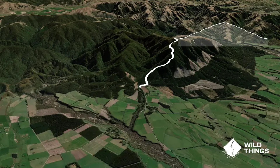
Start at the DOC sign and cross the grassy area. Do not head straight up Wooded Gully, instead take the single track to the right. This may be a bit muddy depending on time of the year. Cross a stile and then the track will veer left and head up hill.

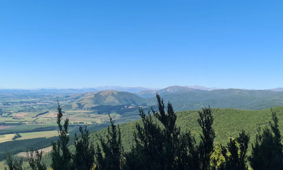
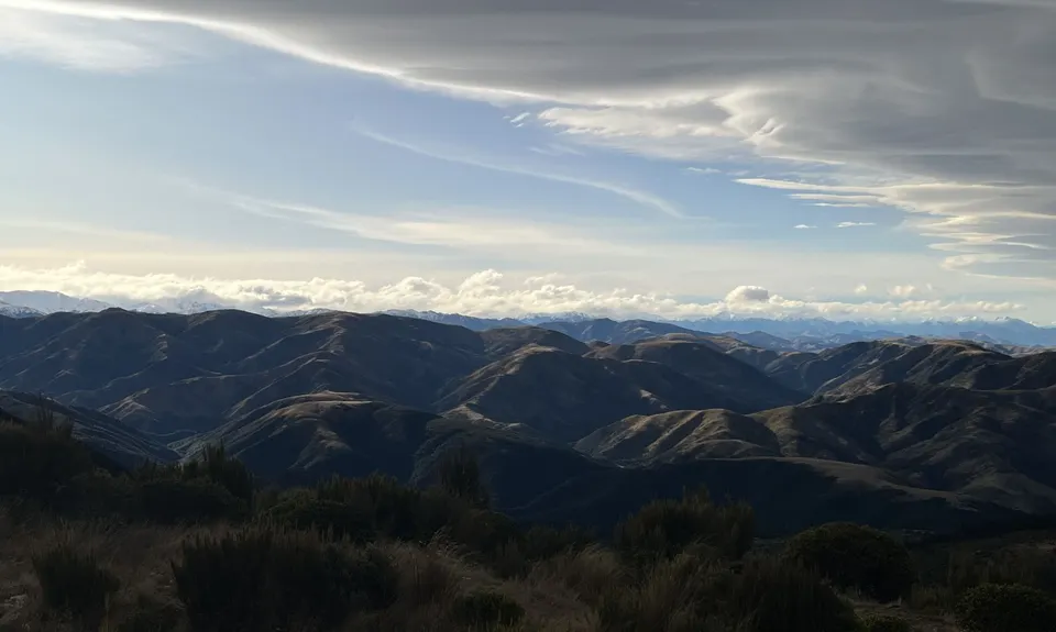
A short climb up and you come out to a 4WD road. (If you choose to turn left here this will eventually lead you back to Wooded Gully and back to the carpark). Cross over this road and continue straight up. At the time of writing this area is open as it has been logged. So as you climb, don't forget to stop and turn around and take in the wonderful views of the Canterbury Plains.

You will continue on into the pine forest and keep on climbing and climbing and climbing. There is a small respite of a teeny down hill for a matter of metres but then straight away you are back climbing. The good news is you will eventually get to a sharp corner in the track (the "Zag") at this point you are about half way - time wise - to the top. Also one more short grunt and you will find the trail, although still climbing, eases off. You have now done the steepest climb on the trail.

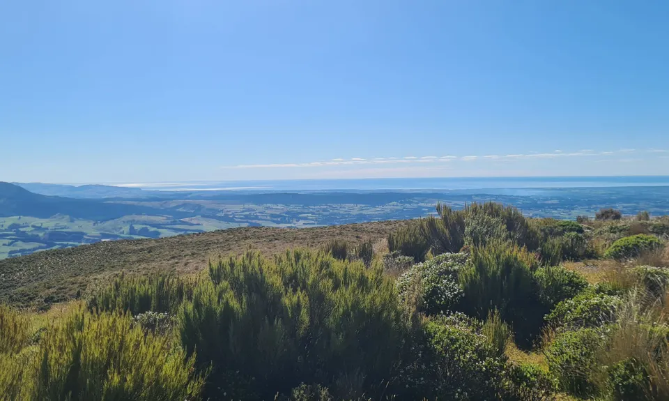
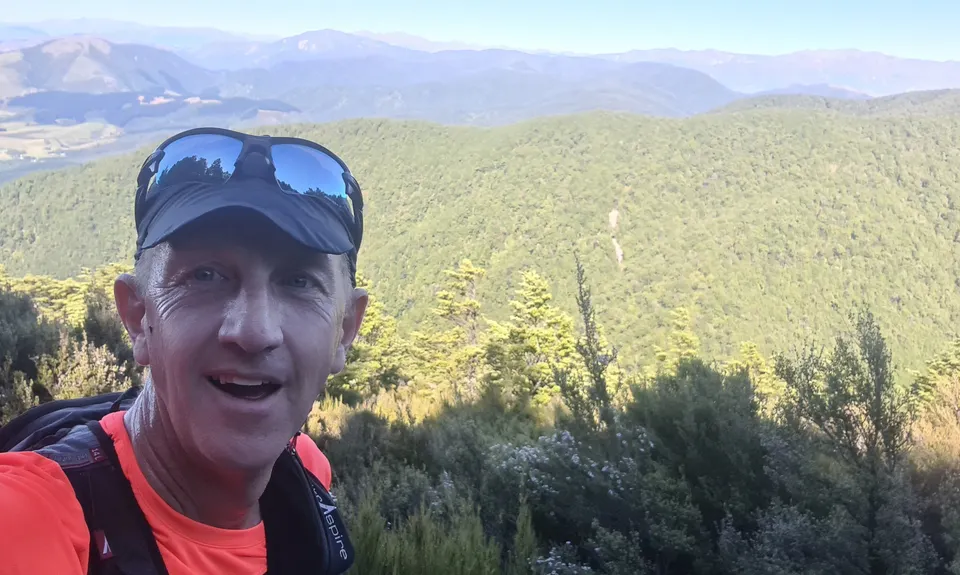
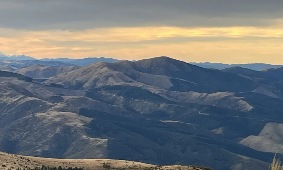
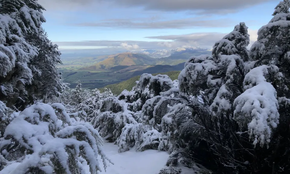
Just keep climbing and then about half a km from the top you emerge out onto a 4wd road. Turn left and after about half a km you reach the trig at the top. If you are lucky and have a clear day you can see for miles. The views are breathtaking.

You then return back down the way you came retracing your steps back to the carpark. For those who want a longer trip the options are endless from here. You can head down Wooded Gully or Ridge track. Maybe take an even longer trip out to Bobs Biv or the Pinchgut Hut. So many choices. One trip to the top of Mt Thomas is not going to satisfy. It is a summit that deserves repeat trips from different directions.


Trail Community

Find people who are interested in this run.

You must register or login to view this content.


Make Up of Run

Technical Single Track: 47%

Moderate Single Track: 35%

Easy Single Track: 5%

Farm Road / 4WD Track: 13%


Route Data

Reviews:

You must register or login to view this content.


Overlapping Runs

The following trails overlap with this run to some degree. You may wish to combine them but please note that to qualify for FKTs on these runs you should record a separate Strava activity for each

Mt Thomas Grunt

Mt Thomas Grunt

Length: 10.00km

Mt Thomas Routes and Ridges

Mt Thomas Routes and Ridges

Length: 28.50km


Photos:

You must register or login to view this content.

Your Trail Wishlist

All the runs that are on your To Do list (no limit).

Add to wishlist view wishlist

Your Trail Dreamlist

The runs you most want to do (limited to 10).

Add to dreamlist view dreamlist

Wild Explorers

I did it!
  • Access

    From Oxford head over the Ashley Gorge Bridge and continue on till you cross the Garry River. Immediately after this turn left onto Hayland Road. Follow Hayland Road approximately 4km till you get to the Wooded Gully Picnic Area.
    From Rangiora head over the Ashley Bridge, continue straight ahead and not turning off the road you are on till you get to Hodgsons Road. Turn left hear. Signs will head you to Okuku, Glentui etc. Just follow this road, straight, go through a dog leg, but stay on this road. Cross the Okuku River and approximately 10km further ahead is Hayland Road on the right.

    This is a DOC parking area. Plenty of space to park and the facility to park just over the culvert in the camping area.

    23 km

    20 minutes

    Yes

    No

  • Staying Safe

    Easy.

    Just keep heading up and up and up till you get to the trig.

    Very patchy.

    Waterproof leggings, Thermal leggings, Long-sleeved thermal top, Seam-sealed waterproof jacket, Gloves, Beanie/thermal headwear, Personal Locator Beacon (PLB), Whistle, First aid kit, Extra food for emergencies, Survival blanket, Cellphone, Map.

    No water available on this route. But there is water in a creek on Wooded Gully track.

    Can get extremely cold on the summit in bad weather or cold winds. Always carry some warm clothing and water. Tell someone where you are heading.

  • Sponsor this trail

    If you are interested in learning about sponsorship opportunities, please get in touch below:

    Submit

Got a favourite trail? Tell us about it.

Share the love and add your favourite trail(s) to our growing trail directory.

Submit A Trail

Become a member today

Start enjoying the many benefits to becoming a member of our thriving community.

Become a member

Great brands at great prices with our VIP member's discount

Stay up to date

Sign up to our newsletter for latest offers and trail guides

Share this trail with a friend:

VIP Membership

Please register as a VIP or login to your VIP account to view this content.

Cancel Login Register

Membership Required

You can see up to three trail guides without being logged in but after that we require you to be logged in to your Free or VIP account. If you don’t yet have an account you can register here.

Login Register