Last Updated: 21st Sep 2023

Beginner

Save Trail Save

I've done it Done

Glentui Waterfall Loop

Oxford, Canterbury

Submitted by Lisa Ainley

Last Updated: 21st Sep 2023

Beginner

Save Trail Save

I've done it Done

Grunt Factor: 7 ?

Gnarl Factor: 47 ?

2.8km

185m

185m

420m


Login as a VIP to see driving directions, distance and time.

Trail Map

Type of Run

Front country - easily accessible

Loop

Undulating, small hills only

Dog Friendly

Native bush

Run Makeup

20%
80%

Easy Single Track

Moderate Single Track

Average Uphill Gradient: +13.8%

Average Downhill Gradient: -18.5%

Trailhead

Login as a VIP to see the trailhead information.

Estimated Times to Run

0:40

Slow

0:25

Moderate

0:15

Fast

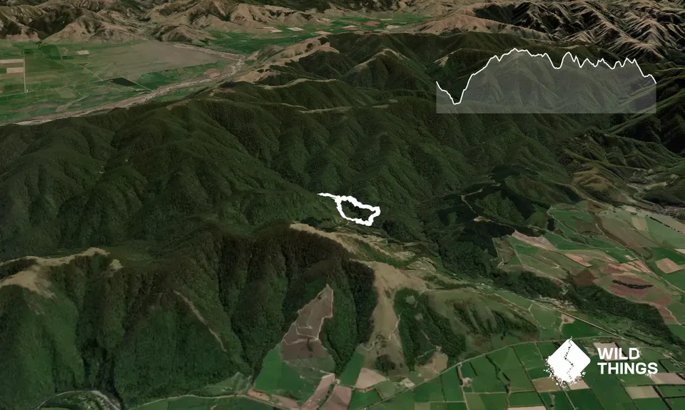
From the car park follow the DOC signs for the Glentui Bush Loop. It starts with a short sharp decent, crosses the bridge and follows with a short sharp ascent. Then it undulates after that.

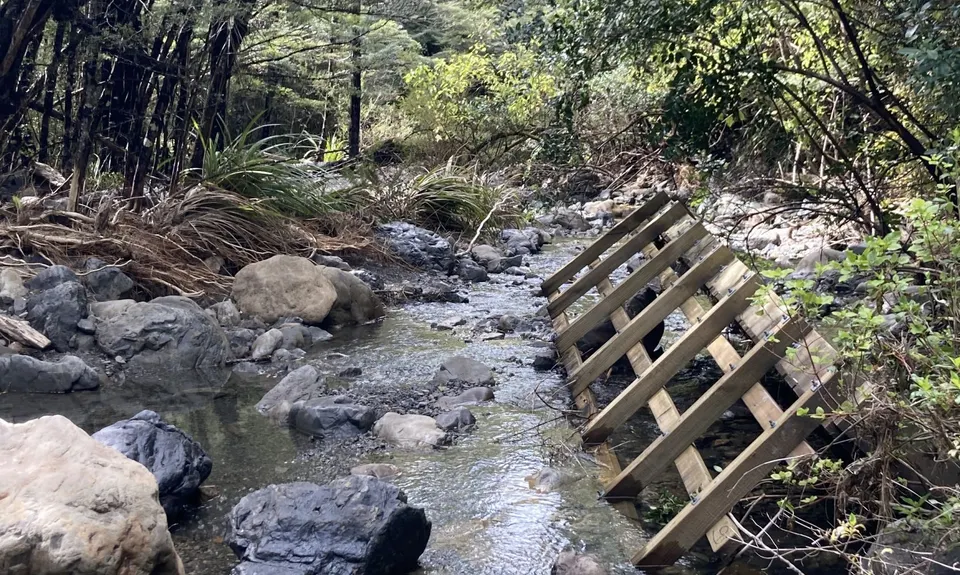
At the first junction continue straight ahead - the left branch. (The right branch is signed and takes you up the By Pass track to the summit of Mt Richardson). Cross a small bridge and continue on to the river crossing of the Glentui River. At the time of writing the ridge had been washed away in the floods of '21' but it was still only ankle deep during the wet season. But check the levels first as it can rise quickly after heavy rain.

Continue across the river and the track will climb up to the main Richardson track. Turn left (right heads up to the Summit of Mt Richardson) and about 200m further along the track take the unmarked track to the left.

Follow this to a lovely waterfall. Stop and have a look. Enjoy the view. Then continue on and you will come back onto the main Richardson track again (the whole detour is only about 300m). Turn left and continue down to the car park. A nice short loop for after work, or if you have more time turn around and do the loop the other direction.

Waterfall

No public transport. Plenty of parking.

17 km

19 minutes

Yes

No

Easy.

Non-existent.

Thermal leggings, Long-sleeved thermal top, Seam-sealed waterproof jacket, Gloves, Beanie/thermal headwear, Personal Locator Beacon (PLB), Whistle, First aid kit, Extra food for emergencies, Cellphone, Map

Water Available in the River

Beware after heavy rain if bridge not replaced

Bees and wasps may be present in season

Trail Legend

Lisa Ainley

Lisa Ainley

has completed Glentui Waterfall Loop 3 times in the last year.

Learn about Trail Legends.

You and Glentui Waterfall Loop

As a VIP member you can record private notes for this trail, see all of your times and more.

Register Now

Already have an account? Login now

Trail Reviews

Be the first to submit a review for Glentui Waterfall Loop!

Login to submit a review

Trail Running Community

Find people who are interested in or have completed this trail run.

You must register or login to view this feature.

Register Now

Other trails nearby
Mt Thomas Direct!

Mt Thomas Direct!

Length: 7.6km

Level: Beginner - Intermediate

Mt Thomas via Ridge Track

Mt Thomas via Ridge Track

Length: 15.2km

Level: Beginner - Intermediate

Mt Thomas Routes and Ridges

Mt Thomas Routes and Ridges

Length: 28.5km

Level: Intermediate

Mount Oxford Summit Scramble

Mount Oxford Summit Scramble

Length: 14.0km

Level: Beginner - Intermediate

Find more trails and peaks nearby