Last Updated: 26th Feb 2024

Beginner - Intermediate

Save Trail Save

I've done it Done

Mt Thomas Long Loop

Ridge Track, Summit Track

Oxford, Canterbury

Submitted by Lisa Ainley

Last Updated: 26th Feb 2024

Beginner - Intermediate

Save Trail Save

I've done it Done

Grunt Factor: 25 ?

Gnarl Factor: 47 ?

11.4km

965m

940m


Login as a VIP to see driving directions, distance and time.

Trail Map

Type of Run

Front country - easily accessible

Loop

Mountainous

Dog Friendly

Native bush

Plantation/exotic forest

Open tussock/grasslands

Open ridges/tops

Run Makeup

15%
85%

Gravel Road

Moderate Single Track

Average Uphill Gradient: +17.0%

Average Downhill Gradient: -16.6%

Trailhead

Login as a VIP to see the trailhead information.

Estimated Times to Run

3:00

Slow

2:30

Moderate

1:45

Fast

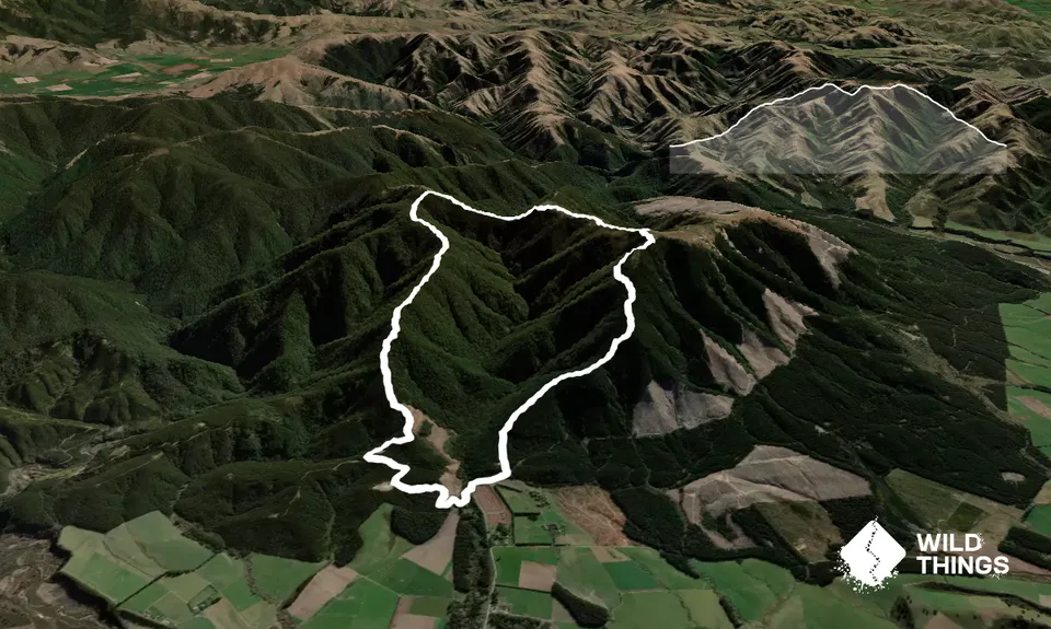
From the DOC carpark head over the grassy area and take the track on the right, Summit Track. Follow this, crossing a style and then start to ascend.

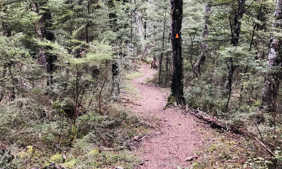
Cross a small vehicle track, and continue up crossing a more defined forest road. (Left is the Forest Loop).

Continue going up and up till a few hundred meters from the summit you emerge onto a forest road, go left still ascending.

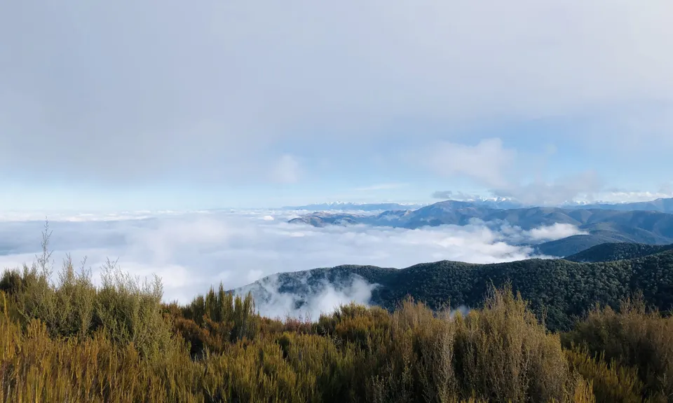
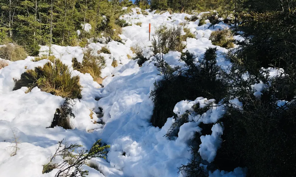
Once at the Mt Thomas summit take the track west heading across the ridge. You will start descending before you re-enter the trees. Descend down to the junction with Wooded Gully track, however do not take this track. Continue ahead, ascending once again, heading toward the second (unofficial) summit of Mt Thomas.

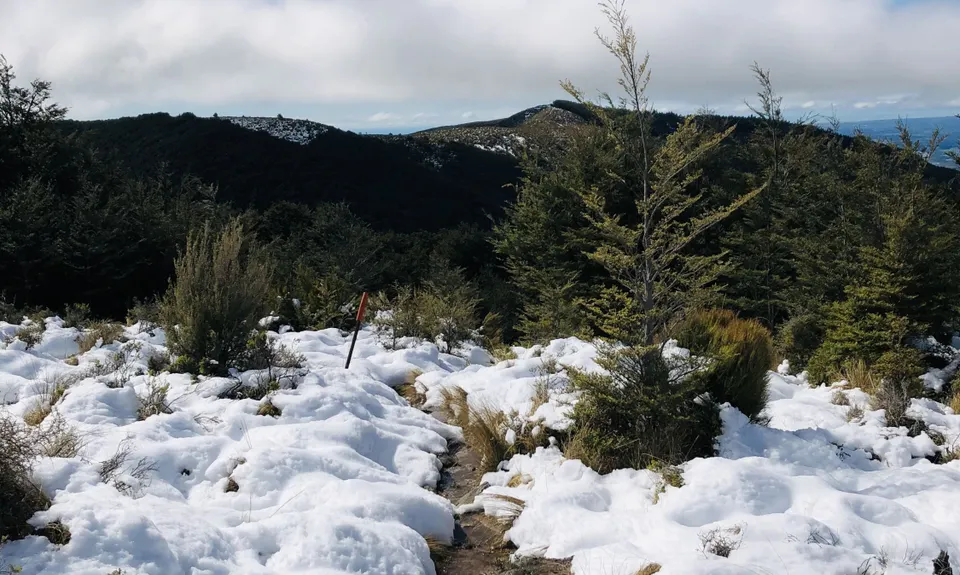
Not long after emerging from the trees is the junction of this track and two more tracks. One track leads to multiple destinations including Pinchgut Hut and Bob's Biv. The other track, the one you want to take at this junction, is the Ridge Track heading left and descending down.

Follow this all the way until you emerge on a forest road. Head left on the road, then another left at the next road junction. Follow this all the way down back to the carpark.

This trail includes the peak Mount Thomas.

This is a DOC parking area. Plenty of space to park, and more parking over the culvert.

13 km

18 minutes

Yes

No

Easy.

Fully DOC marked.

Very patchy.

Lightweight fleece top, Long-sleeved thermal top, Seam-sealed waterproof jacket, Gloves, Beanie/thermal headwear, Whistle, First aid kit, Extra food for emergencies, Cellphone, Map

None.

Wasps in season.

Trail Legend

Sia Svendsen

Sia Svendsen

has completed Mt Thomas Long Loop 4 times in the last year.

Learn about Trail Legends.

You and Mt Thomas Long Loop

As a VIP member you can record private notes for this trail, see all of your times and more.

Register Now

Already have an account? Login now

Trail Reviews

Awesome loop. Great views from the summit and along the ridge to 2nd summit. Lots of storm damage on the descent which involved climbing through and around fallen trees. Surprised the track hadn't been closed. Some route finding challenges at a couple of big fallen trees and lots of debris on the trail. Took longer than expected to get down. Nevertheless, a thoroughly enjoyable adventure.

Anne-Louise Robertson

October 27, 2023

Login to submit a review

Trail Running Community

Find people who are interested in or have completed this trail run.

You must register or login to view this feature.

Register Now

Overlapping Trails

These overlap with this trail to some degree. You may wish to combine them but please note that to qualify for FKTs on these runs you should record a separate activity for each.

Mt Thomas via Ridge Track

Mt Thomas via Ridge Track

Length: 15.2km

Level: Beginner - Intermediate

Mt Thomas Grunt

Mt Thomas Grunt

Length: 10.0km

Level: Beginner - Intermediate

Mt Thomas Routes and Ridges

Mt Thomas Routes and Ridges

Length: 28.5km

Level: Intermediate

Mt Thomas Direct!

Mt Thomas Direct!

Length: 7.6km

Level: Beginner - Intermediate

Other trails nearby
Mt Oxford Half

Mt Oxford Half

Length: 20.5km

Level: Beginner - Intermediate

Glentui Waterfall Loop

Glentui Waterfall Loop

Length: 2.8km

Level: Beginner

Blow Hard and back

Blow Hard and back

Length: 23.0km

Level: Beginner - Intermediate

Youngman Stream - Tarn Hut Loop

Youngman Stream - Tarn Hut Loop

Length: 33.2km

Level: Intermediate - Experienced

Find more trails and peaks nearby