Quest for Mt RichmondExperienced
Submitted by Philip Taylor
Back country - remote
Point to Point (one way)
Mountainous
Native bushRiversideOpen tussock/grasslandsOpen ridges/tops
Experienced
8:30 (Slow)
6:00 (Moderate)
3:30 (Fast)
-14.8%
+15.8%
Fastest Known Times (FKTs)
Please set your gender to see your position on the FKT leaderboards.
Men
Women
There are currently no female FKTs for Quest for Mt Richmond.
Filter FKTs
The more , the harder the FKT will be to beat. Learn about Fastest Known Times.
Description
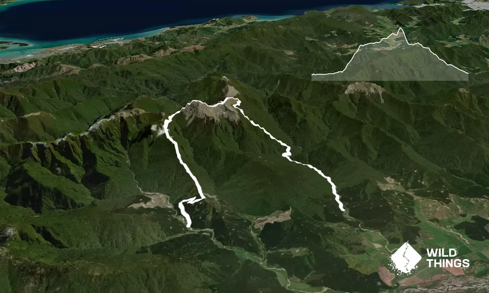
From the car park take the Timms Creek track along the side of the river. The track has plenty of tree roots and steep ups and downs including numerous stream crossings and is technical underfoot. After 5.1km cross over the river. This is a substantial river crossing, about knee high (depending on river flow of course).
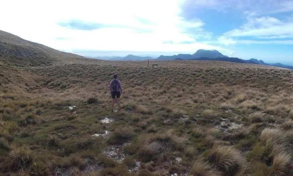
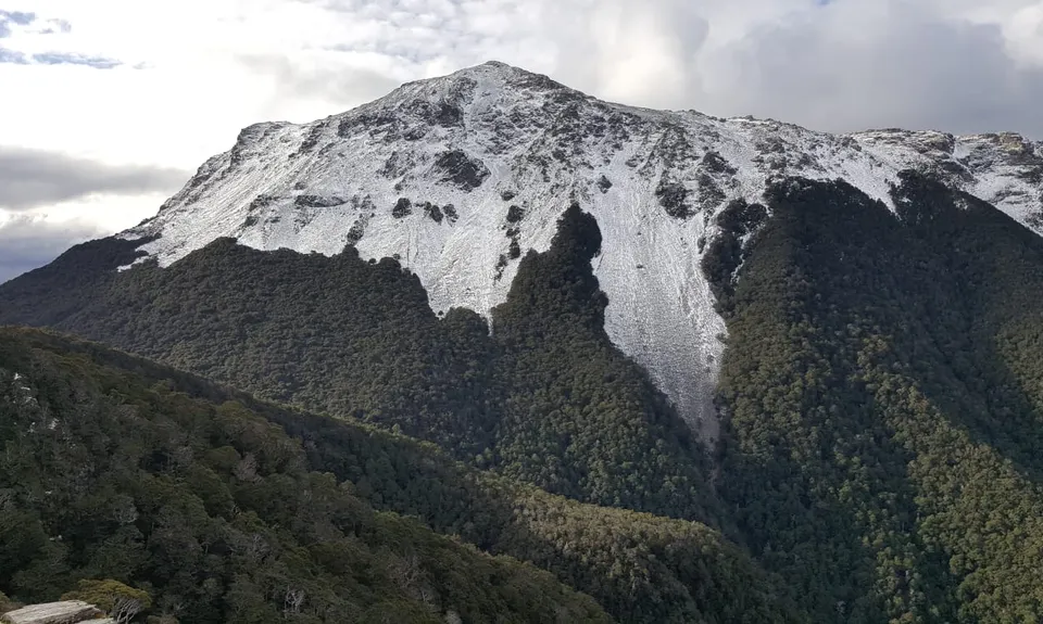
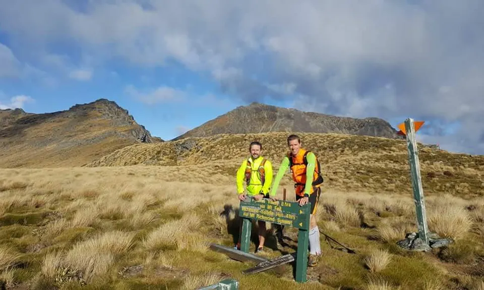
Once over the river the ascent starts. Climb out of the river onto a spur and up a prominent ridge keeping an eye out for the orange triangles that lead the way up to Mt Fell Hut. The vertical gain is around 1000m over 5km so take your time, no need to burn yourself out. Once the hut is in view, carry on past the hut, keeping the hut on your immediate left and the track goes out the back of the hut and then around to the left to pop out of the trees and onto the tops. In good visibility once out of the bush cover you will be able to see Mt Fell on your right and both Johnston Peak and in the distance our objective Mt Richmond to your left.
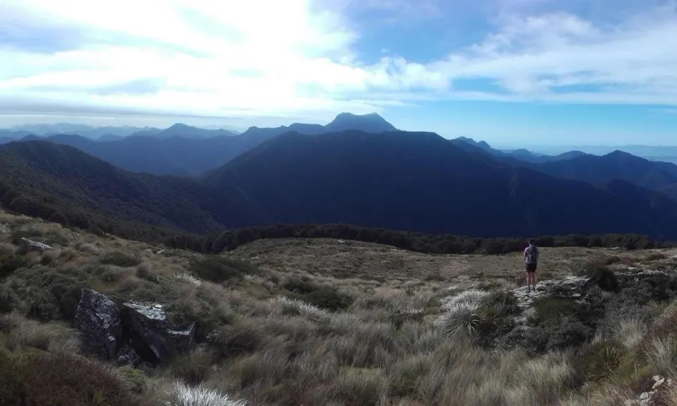
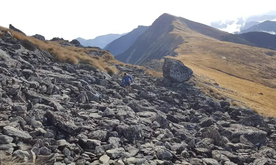
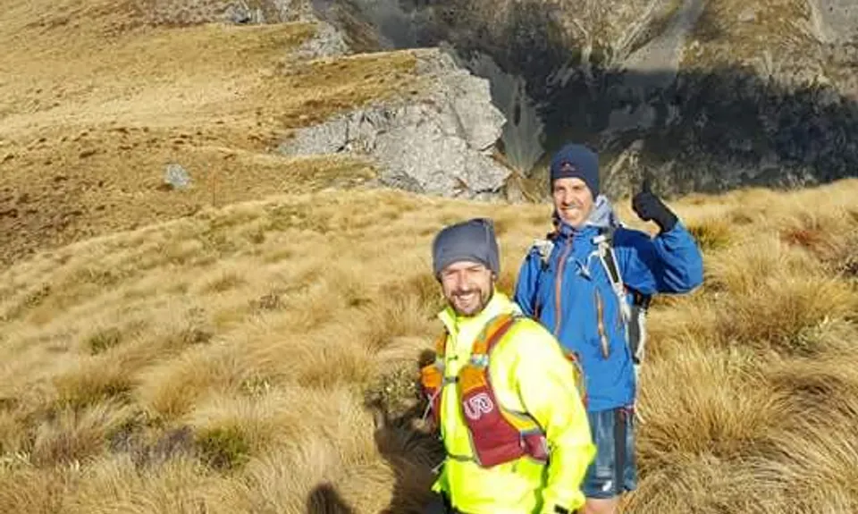
Carry on up to the main ridge, take a left at the signage and take the pencil trails, rock gardens, boulders and tussock leading along the ridge following the warratahs, cairns and orange triangles for about 1.5km until you get to a saddle with Johnston peak in front of you. Note - There is a rock cave bivvy at 13km if desperate. Once near Johnston Peak the track veers right. At this stage the summit of Mt Richmond is 300-400m above you and the markers show the way up to the summit. Hop over a rock garden and over a tussock saddle to commence the final steep climb.
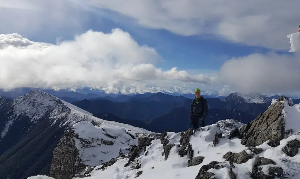
Keep going and once your thighs start complaining you're almost at the top! Stick at it for the final push and then celebrate at being at the highest point in the Richmond Range!
Now for the descent - follow the ridge line down and away from the summit for about 0.5km keeping an eye out for the markers that point to a track that descends steeply down a scree face. This is perhaps the most hazardous part of the course. If in doubt lower your centre of gravity and slide down on your backside! Airing on the side of caution for roughly 400m vertical descent will bring your down safely to Mt Richmond Saddle Hut, just below the bush line.
The down hill is tantalisingly close. First, however, there is still about 2km of undulations, technical sidling and staccato style running before gaining the main ridge downwards. Once stood in a rocky clearing with expansive views of Mt Richmond to your left, this is where the real fun downhill starts! Let gravity assist your descent but you still need to stay agile and light on your feet as it's sometimes steep and mostly technical bush running. After 4km you exit the bush and out onto a well formed 4x4 access road - a welcomed change in terrain after the few hours that have just passed by!! This is where the DOC trail has ended and we are now on a public road open to vehicles and other park users so be aware. Take this road all the way downhill for about 3.5km enjoying the pace and easier running all the way to another substantial river crossing to finish on the far side of the river bed.
Trail Community
Features of interest
Two huts to be bagged en-route and for those who make time, you can search for the remains of a twin-engine Lockheed Electra aeroplane, the Kereru, that crashed into Johnston Peak in 1942. There's also a memorial plaque.
Make Up of Run
Untracked / Route only: 20%
Technical Single Track: 60%
Moderate Single Track: 10%
Farm Road / 4WD Track: 10%
Route Data
Reviews:
Photos:
Your Trail Wishlist
All the runs that are on your To Do list (no limit).
Add to wishlist view wishlistWild Explorers
I did it!-
Access
If travelling North, take the first left after crossing the bridge over the Wairau bridge on SH6. If travelling South, take a right before the bridge over the Wairau. The road is signposted Northbank Rd. Take this road for 4.9km and then take a left to stay on Northbank Rd (Do not carry straight on as this will take you to Onamalutu). Then drive for another 26km where you will see a right hand turn for Te Rou and a DOC sign for the Timms Creek Route. Next, drive for another 3.3km to a small car park which is at the trailhead.
It might pay to travel in two cars and drop one off at the end of the trail so that when you're finished you can drive the 17km road back to the start. Either that or drop some push bikes off or rely solely on getting a hitch - but be warned that it is a quiet road!
51 km
58 minutes
No
No
-
Staying Safe
Hard.
It is only really across the tops that route finding will become an issue. However, it is very well marked but could be a problem in poor visibility. Both Timms Creek and Richmond Saddle Routes are easier to navigate.
Patchy.
Waterproof leggings, Long-sleeved thermal top, Seam-sealed waterproof jacket, Gloves, Beanie/thermal headwear, Personal Locator Beacon (PLB), Whistle, First aid kit, Extra food for emergencies, Survival blanket, Cellphone, Map, Crampons / microspikes (for winter conditions).
There are two huts en-route but no toilets or facilities at the trail heads other than a place to park your car.
The two river crossings at both ends of the trail could run high after heavy rain fall. Subject to cold winds on the tops any time of year. The trail can be laden with snow and ice depending on the time of year.
Wet, slippy rocks along Timms Creek. A steep scree face descent off Mt Richmond. Low hanging trees down Richmond Saddle Route.
-
Post run indulgence
Moa Brewery
258 Jacksons Road
http://www.moabeer.com/
40km from the trailhead!! You can sit outside and see Mt Richmond from the beer garden. - Blog Posts and Articles
-
Sponsor this trail
See other runs nearby:
Vernon Ridgeline
Wairau Lagoons Loop
Tokomaru, Mt Robertson Circuit
Wairau Lagoons Loop v2
King and Queen of the Withers
Mt Sunday - Mt Riley Loop
Mt Vernon Grand Traverse
Northbank to Nelson Traverse
Havelock to Picton Link Pathway
A Full Chalice
Patriarch Road and Goulter Valley
Dam Dam
Lagoon-a-Seeker
Pukaka Valley Track
The golden Waikakaho trail
Pelorus Loop Track
Torea Bay to Picton Loop
A taste of the Richmond Ranges TA Alpine route
Takorika Bites!