Last Updated: 21st Sep 2023

Beginner - Intermediate

Save Trail Save

I've done it Done

Mt Vernon Grand Traverse

Blenheim, Marlborough

Submitted by Philip Taylor

Last Updated: 21st Sep 2023

Beginner - Intermediate

Save Trail Save

I've done it Done

Open

Grunt Factor: 21 ?

Gnarl Factor: 10 ?

18.1km

700m

700m

422m


Login as a VIP to see driving directions, distance and time.

Trail Map

Type of Run

Front country - easily accessible

Loop

Undulating, some big hills

Plantation/exotic forest

Open farmlands

Open tussock/grasslands

Open ridges/tops

Run Makeup

90%
10%

Farm Road / 4WD Track

Easy Single Track

Average Uphill Gradient: +9.6%

Average Downhill Gradient: -9.3%

Trailhead

Login as a VIP to see the trailhead information.

Estimated Times to Run

3:00

Slow

2:15

Moderate

1:30

Fast

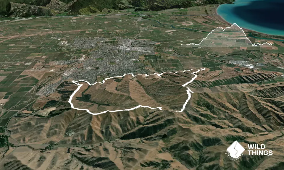
Be sure to print off or download a copy of the Wither Hills Farm Park map. 

In short, the route is as follows: Redwood St car park - Lower Farm Park Track - Forest Hills Track - Gentle Annie Track - Twin Tank Walk - Taylor View Track - Split Apple Peak Track - Mt Vernon Track - Cob Cottage Track - Mapp Track - Redwood St car park

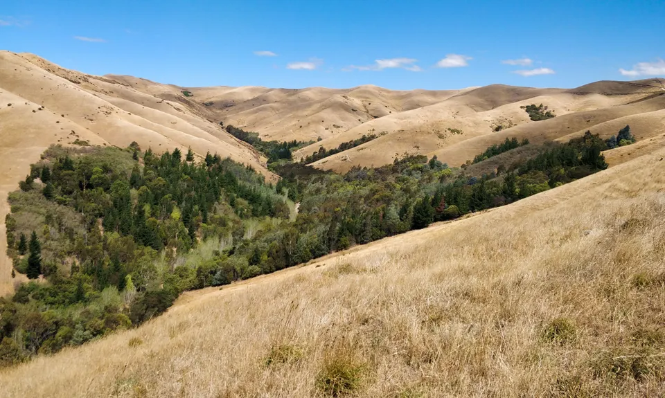
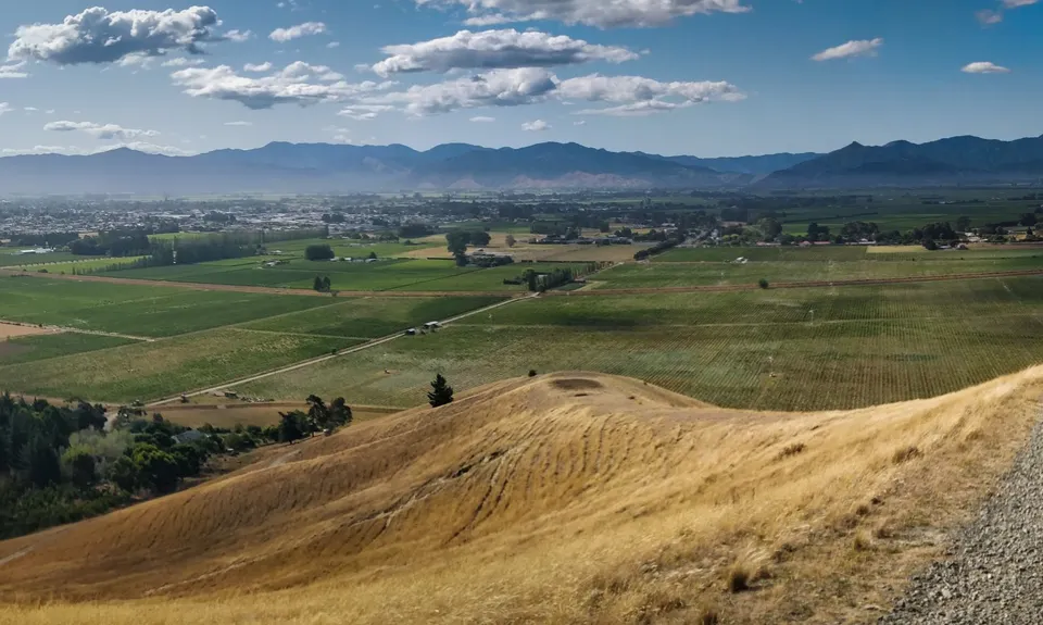
More detailed route described as follows: From the car park at top of Redwood St head out on to the road and run towards town for 200m to a sign on the left-hand side saying 'Lower Farm Track to Taylor Pass Road' next to a cattle grid. This is the main track that will take you all along the bottom of the Wither Hills for just over 3km before making our bid to gain a ridge and head out the back and over the tops.

There are a few times where other tracks intersect this track but as long as you eyeball Lower Farm Track signage and don't start running up hills too much, you'll be fine. After 2km Total Distance Covered (TDC) the Harling Park track intersects the track you're on. Stay on your track, head down the hill (about 300m long with car park and toilets on your right) and go straight over the wooden bridge and take a sharp right taking the right-hand side track through the trees.

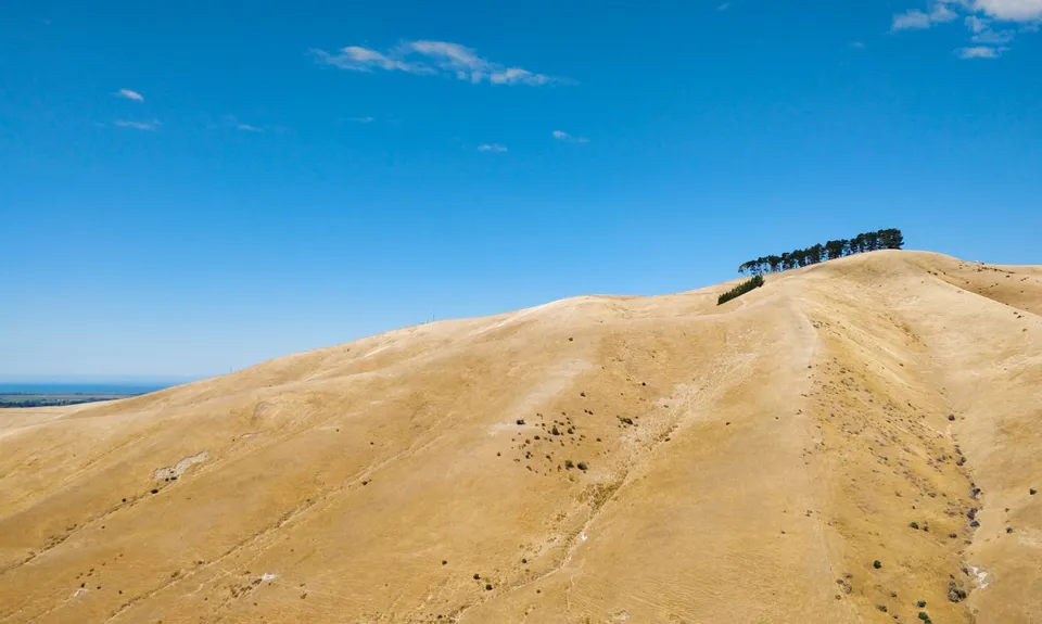
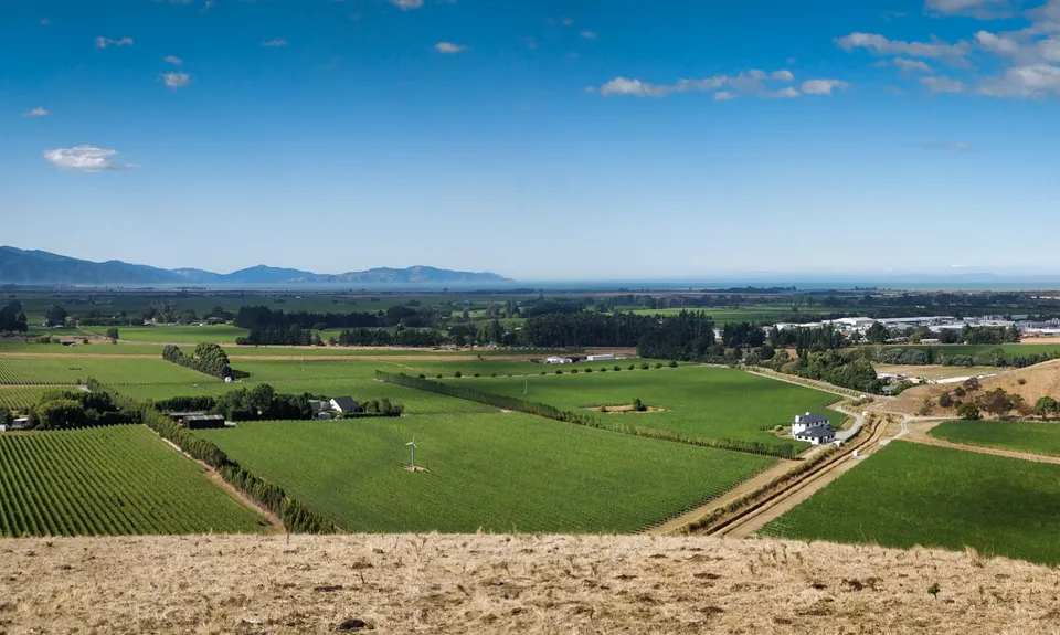
Keep on this track through gates and intersection until you see a sign for Gentle Annie Track to Rotary Lookout at about 3.3km TDC. Take this left-hand turn through a field to a gate. From this point the climbing starts with many undulations ahead before being able to claim the Mt Vernon summit. Pace yourself! At 4.4km TDC you arrive at the Rotary Lookout (affectionately referred to as the Witches Hat by the township). Go straight on at this point and look to the distant ridgeline occupying the horizon. This is where we're going.

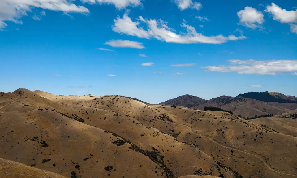
At 5.5km TDC take the right hand (not the well formed) track on the left. Now on the main ridgeline this takes us all the way around to Mt Vernon - as long as you take the tracks closest the fence-line and don't take any tracks that run in the direction of town. Go past the intersection for Reservoir Ridge Track (water available here) and Sutherland Stream Track and at 10.1km TDC the Split Apple Tracks intersects with the Mt Vernon ridge track. Take a sharp right here for 300m to arrive at the top of Mt Vernon.

Take a breather, enjoy the 360 degree views including Mt Tapuae-o-uenuku, Wellington and the Richmond Ranges. Once done head downhill. Go past the junction where we turned right and to the Airstrip and Fertiliser storage unit. At this point take a right down Cob Cottage Track. This is a fast descent but can be rocky and loose underfoot. Grassy verges on the left and right hand side of the track are sometimes good but beware of your ankles! After 2km of downhill with 14.3km TDC take a left onto the Mapp Track. There's now only 3.8km separating you from the finish but it's an undulating 3.8km that will take from you all you have left. Once rounding the top of the final undulation you will spot the car park. Charge down the hill and over the little wooden bridge to finish.

This trail includes the peak Mount Vernon .

360 degree views including Mt Tapuae-o-uenuku, Wellington and the Richmond Ranges

Plenty of parking and if car park full then can park out on street

3 km

6 minutes

Unknown

No

Moderate.

Generally good.

Long-sleeved thermal top, Seam-sealed waterproof jacket, Beanie/thermal headwear, Whistle, First aid kit, Extra food for emergencies, Cellphone, Map

No water at Redwood St car park.
Water at junction of Reservoir Ridge Track.
Water at junction of Mt Vernon Ridge Track.

Summer can be very very hot with fire risk so not recommended.
Also strong winds can be a problem as not much vegetation so are exposed to the elements.

The Wither Hills Farm Park is a working farm so need to be aware of cattle and grazing sheep.

Ritual Cafe
Primo coffee

Trail Legend

CS

Christo Saggers

has completed Mt Vernon Grand Traverse 7 times in the last year.

Learn about Trail Legends.

You and Mt Vernon Grand Traverse

As a VIP member you can record private notes for this trail, see all of your times and more.

Register Now

Already have an account? Login now

Trail Reviews

Great trail , really well marked and loved the water fountains along the way!

Kristen Diederich

October 8, 2020

Really enjoyed this trail - lots to see and nice terrain. Bonus of drink fountains along the way.

Richele McKenzie

December 28, 2019

I've done this awesome local harrier event twice now. 18k of testing hill farm with outstanding views across Cook Strait as compensation for the uphill. Character building little up and downs at the end! Pretty chuffed with this year's effort of 2hrs 1min in my Luna sandals.

Tim Lovejoy

June 16, 2018

Login to submit a review

Trail Running Community

Find people who are interested in or have completed this trail run.

You must register or login to view this feature.

Register Now

Overlapping Trails

These overlap with this trail to some degree. You may wish to combine them but please note that to qualify for FKTs on these runs you should record a separate activity for each.

Vernon Ridgeline

Vernon Ridgeline

Length: 16.0km

Level: Beginner - Intermediate

King and Queen of the Withers

King and Queen of the Withers

Length: 10.3km

Level: Intermediate

Other trails nearby
Patriarch Road and Goulter Valley

Patriarch Road and Goulter Valley

Length: 25.0km

Level: Intermediate - Experienced

Mt Sunday - Mt Riley Loop

Mt Sunday - Mt Riley Loop

Length: 17.0km

Level: Intermediate

Goat Hill Track

Goat Hill Track

Length: 6.9km

Level: Beginner - Intermediate

Northbank to Nelson Traverse

Northbank to Nelson Traverse

Length: 45.5km

Level: Experienced

Find more trails and peaks nearby