Wild Things - New Zealand's trail running community
New Zealand's trail running community

Login


don't have an account?

A taste of the Richmond Ranges TA Alpine route, Marlborough

Trail Directory proudly supported by Further Faster

Update Your Header Picture

A taste of the Richmond Ranges TA Alpine routeIntermediate

Submitted by Kieran Burton

Info Info
Map Loading

Trail Information

31.00km

2480m

2485m


Marlborough

Blenheim

Back country - remote

Loop

Mountainous

Native bush
Lakeside
Open ridges/tops

Intermediate

12 (Slow)
9 (Moderate)
7 (Fast)

-14.3%

+14.2%

Prone to high river levels after heavy rain and snow. Lots of wind fall so following trail markers can be difficult. In summer, water can be hard to find, especially along the top ridges.

Download PDF Guide

Fastest Known Times (FKTs)

Please set your gender to see your position on the FKT leaderboards.

Men

There are currently no male FKTs for A taste of the Richmond Ranges TA Alpine route.

Women

There are currently no female FKTs for A taste of the Richmond Ranges TA Alpine route.

Filter FKTs

The more , the harder the FKT will be to beat. Learn about Fastest Known Times.

Missing your time?

Register or login as a VIP and get yourself on the FKT leaderboard!

Register Now

Description

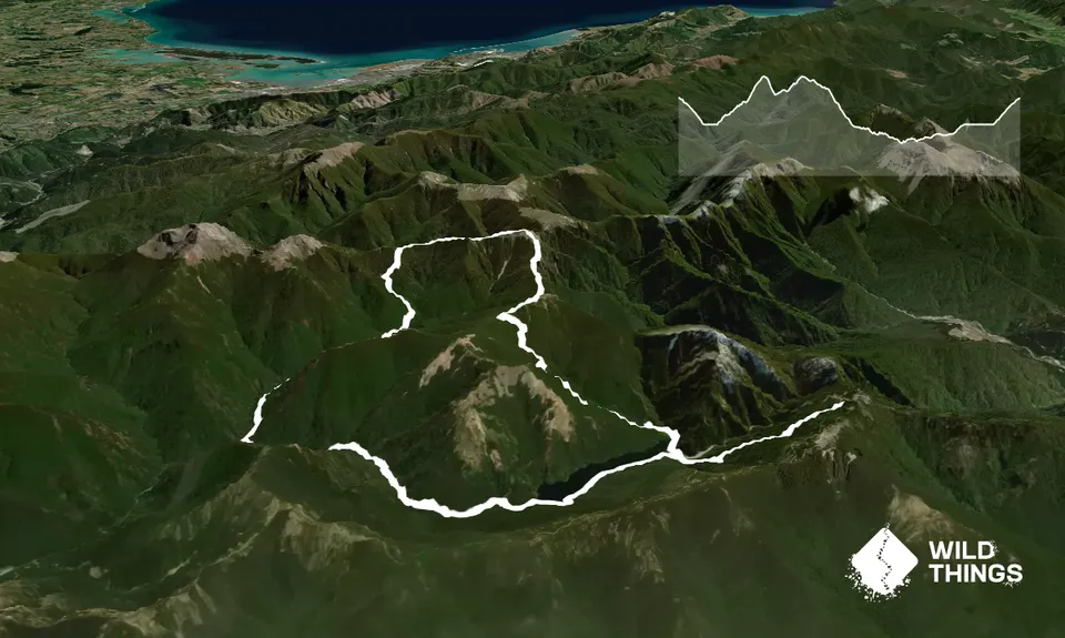
From the Lake Chalice carpark. Drop steadily down to the Lake Chalice Hut. This is a nice DOC hut to stay in to make a base for further exploration of the Richmond Ranges. From the hut, make your way across the dry riverbed following the orange markers to the track on the far side, sign posted 'Old Man hut track'. The track then follows along the side of the lake. Caution: after heavy rain, as the lake level can rise significantly covering the track. The track then drops down on to dry riverbed again. Making sure to follow the oranges markers up the riverbed 200m to the start of the climb out of the riverbed.

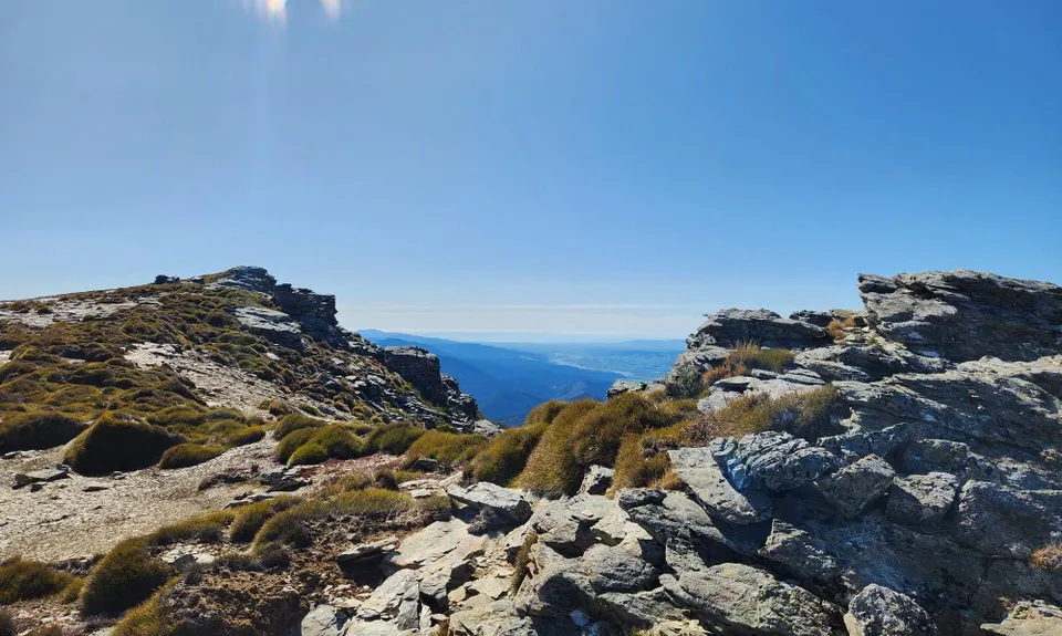
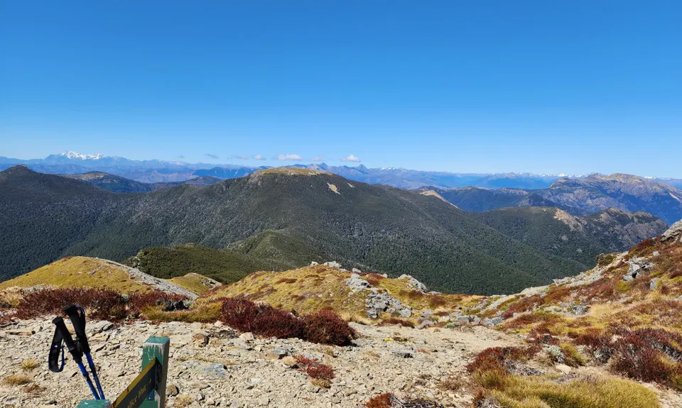
The track climbs up over technical single track through native bush with plenty of windfall making following the orange markers, making its way out of the bush line and up to the top of an unnamed peak at 1500m. Take in the views back from where you have just climbed and look ahead to Old Man, Little Rintoul and Mt. Rintoul. Dropping 200m metres over a very short distance back below the bush line to start the climb back up to the summit of Old Man and the junction for the Te Araroa trail.

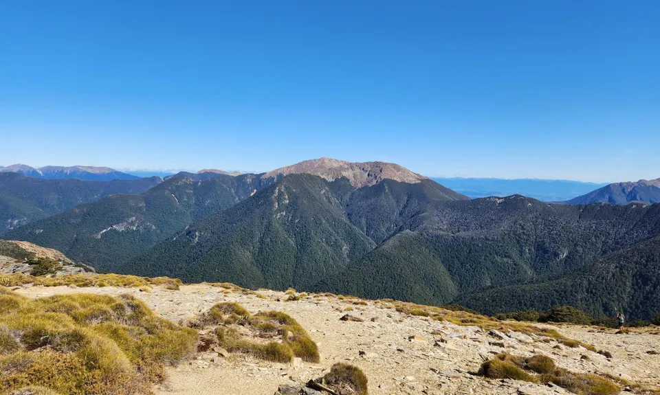
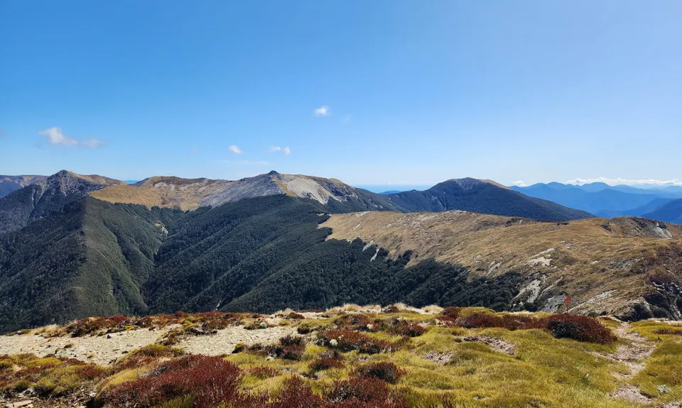
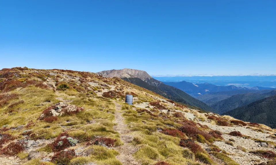
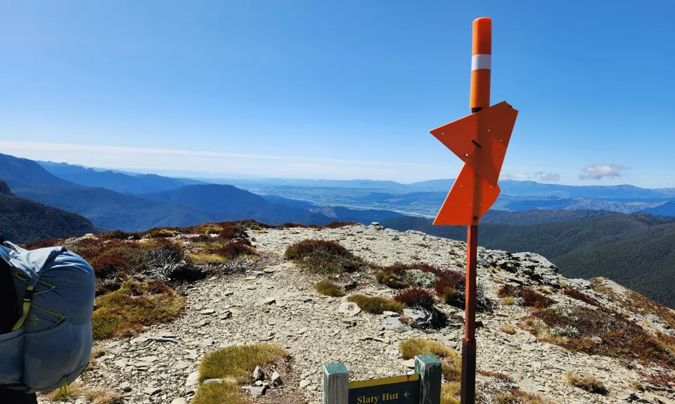
Right goes North to Slatty Hut and down to the Pelorus valley. Take a left at the junction toward Old Man hut and Mt Rintoul. This section is amazing, with views over Tasman, out to St Arnaud and the Wairau valley. It is very runnable as you take in the view but watch your step as there are steep drops on both sides and a few rock climb sections. Take care in poor conditions as it is extremely exposed to the elements. There is no water along the top so make sure you are prepared. As you make you way along you will come across a DOC sign for Old Man hut to the left and Mount Rintoul straight ahead. If you have the time I would recommend continuing to Mount Rintoul to bag that peak but this can add a significant amount of time to your trip.

Turning towards Old Man hut, you will descend very quickly down to the hut. Continue the descent down the valley to the Goulter River. This can be very slow going with lots of tree fall and a few river crossings. Once you get to the Goulter River, cross the river and continue up again to the junction of the Goulter track. Turn left to make your way back to Lake chalice. This trail follows along the Goulter river and then up to the slip that created Lake Chalice. At the junction of at Lake Chalice, you can choose which ever way to go back around the lake. The shorter being the on the right. Follow this trail up above the lake back to the Lake Chalice hut. One final climb back up to the Carpark and finish.


Trail Community

Find people who are interested in this run.

You must register or login to view this content.

Features of interest

Lake Chalice. Te Araroa Richmond Alpine route. Mount Rintoul, Old Man. Views of Tasman.


Make Up of Run

Technical Single Track: 50%

Moderate Single Track: 25%

Easy Single Track: 25%


Route Data

Reviews:

You must register or login to view this content.


Overlapping Runs

The following trails overlap with this run to some degree. You may wish to combine them but please note that to qualify for FKTs on these runs you should record a separate Strava activity for each


Photos:

You must register or login to view this content.

Your Trail Wishlist

All the runs that are on your To Do list (no limit).

Add to wishlist view wishlist

Your Trail Dreamlist

The runs you most want to do (limited to 10).

Add to dreamlist view dreamlist

Wild Explorers

I did it!
  • Access

    Lake Chalice carpark, Northbank, Richmond ranges.

    From Blenheim, drive towards Nelson on SH6. After crossing the Wairau River, turn left onto Northbank road for 33km. Turn on to Top Valley road with sign posts for Mount Richmond national park and Lake Chalice. Follow the signage up to the Lake Chalice car park. Plenty of room for parking and safe. The road up can be rough after heavy rain or snow in winter, take caution during these times.

    60 km

    57 minutes

    Yes

    No

  • Staying Safe

    Moderate.

    Take care watching for the orange DOC markers. Some were missing to be found on the ground in the tree fall. The trail is well used so is easily spotted.

    Patchy.

    Waterproof leggings, Long-sleeved thermal top, Seam-sealed waterproof jacket, Gloves, Beanie/thermal headwear, Personal Locator Beacon (PLB), Whistle, First aid kit, Extra food for emergencies, Cellphone, Map, Crampons / microspikes (for winter conditions).

    Minimal during summer. The huts can tend to run out over the summer months. Few small creeks on the way up and back down again.

    The road up the Lake Chalice can be covered in snow during the winter months and so will the alpine section.
    Lake Chalice and the tributary levels can rise quickly.

  • Sponsor this trail

    If you are interested in learning about sponsorship opportunities, please get in touch below:

    Submit

Got a favourite trail? Tell us about it.

Share the love and add your favourite trail(s) to our growing trail directory.

Submit A Trail

Become a member today

Start enjoying the many benefits to becoming a member of our thriving community.

Become a member

Great brands at great prices with our VIP member's discount

Stay up to date

Sign up to our newsletter for latest offers and trail guides

Share this trail with a friend:

VIP Membership

Please register as a VIP or login to your VIP account to view this content.

Cancel Login Register

Membership Required

You can see up to three trail guides without being logged in but after that we require you to be logged in to your Free or VIP account. If you don’t yet have an account you can register here.

Login Register