The Southern Pinnacles Intermediate - Experienced
Submitted by Tony Sharpe
Back country - remote
Out and Back
Very hilly
Native bushRiversideOpen tussock/grasslandsVolcanic
Intermediate - Experienced
6:00 (Slow)
4:30 (Moderate)
3:00 (Fast)
-18.0%
+18.0%
Fastest Known Times (FKTs)
Please set your gender to see your position on the FKT leaderboards.
Men
Women
Filter FKTs
The more , the harder the FKT will be to beat. Learn about Fastest Known Times.
Description
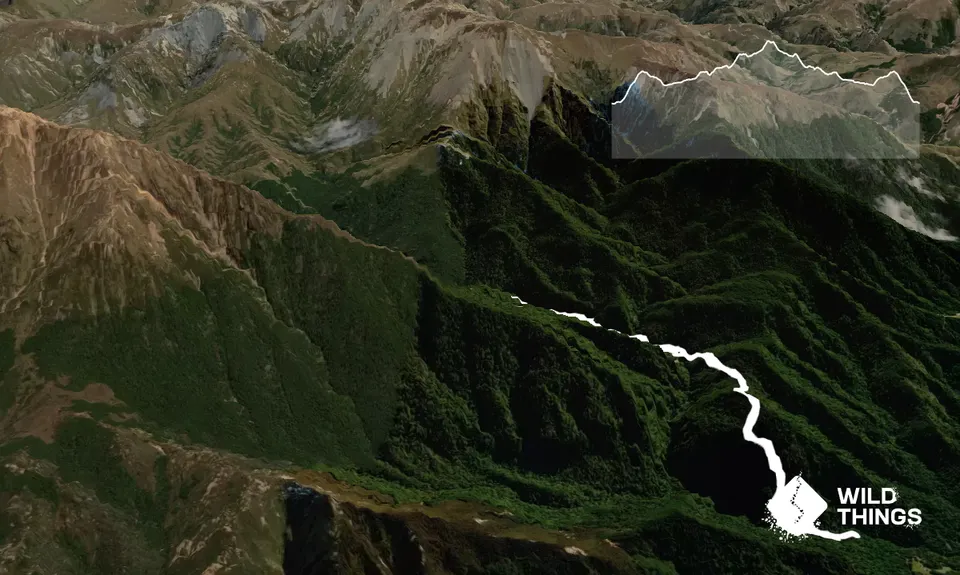
This is an out and back up to the popular rock climbing site above Pinnacles Hut. This is pretty technical country to run in, but pretty straight forward for tramping. It's a great introduction to the proper South Island Backcountry
Head out from the carpark and cross the Bowyer Stream bridge and stretch your legs on an initial short flat section before things rapidly turn uphill, and steeply so as you spend a good half hour (at least) grovelling up Duke Knob. There won't be many people who can run the whole way up here, so relax and enjoy the walk
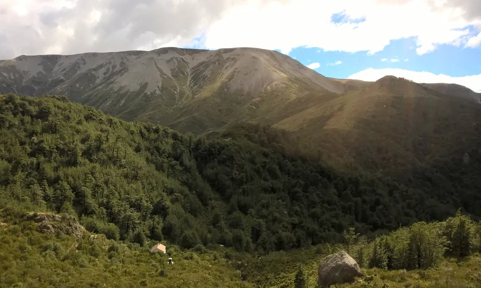
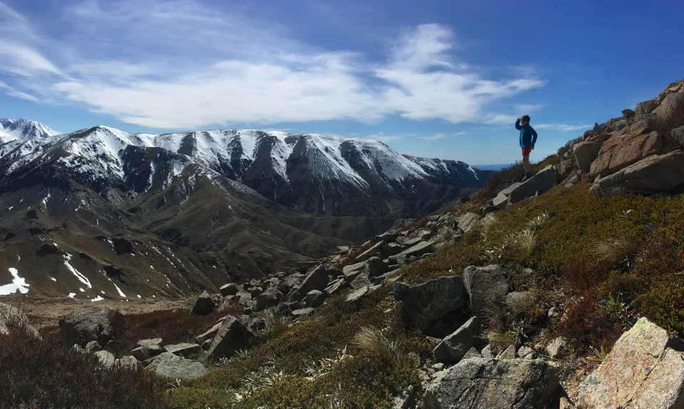
As the trail tops out onto Duke Knob there is a rock outcrop - make sure you stop here and take in the great views of both where you are heading, but also of the NE Ridgeline of Mt Somers. You can really make out its ancient volcanic form from here.
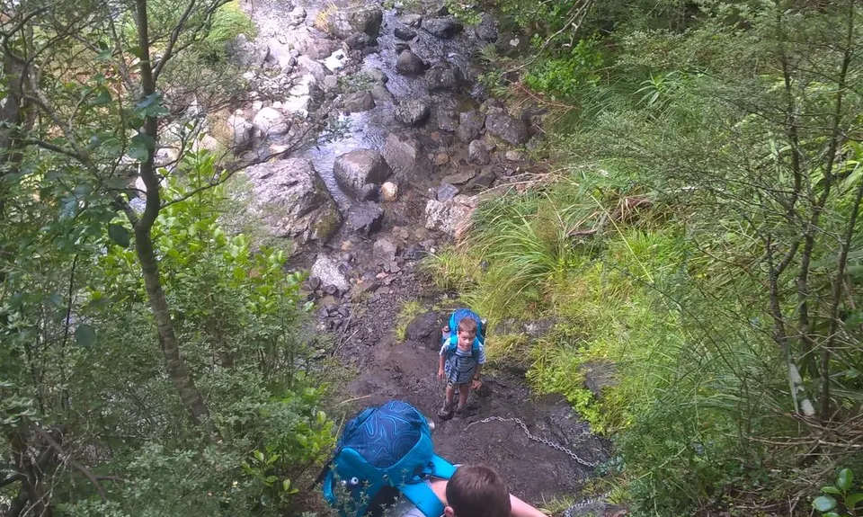
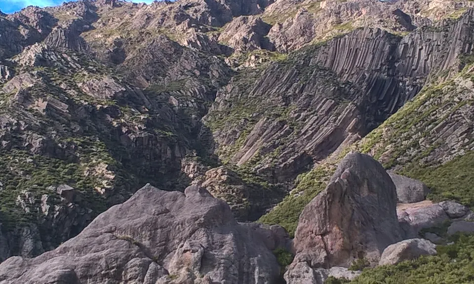
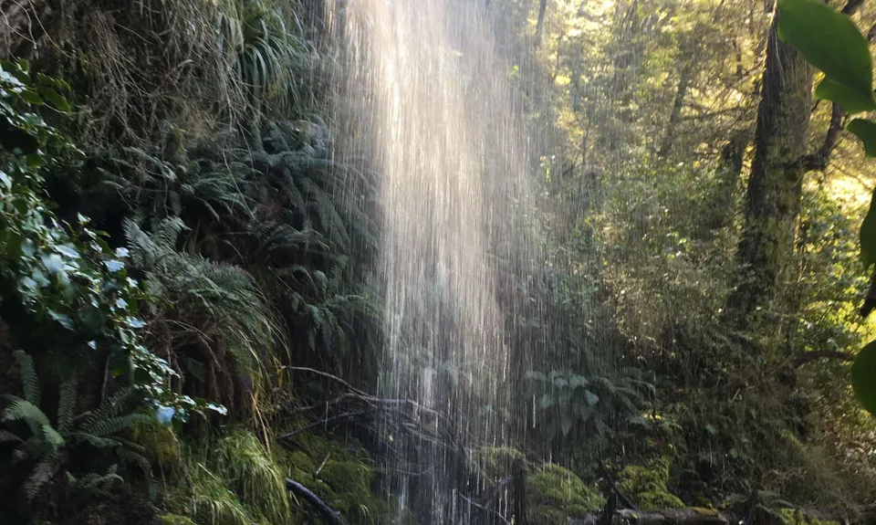
From Duke Knob there is a short sharp descent to pick up Bowyer Stream again. The trail dives in and out of the bush as it staggers up the true left of the stream (some great swimming holes too), until you eventually reach a substantial swingbridge. Cross this - it's a potential lifesaver in flood conditions. Past the bridge you head into the bush and begin climbing again. Sometimes steadily, but occasionally steeply and with the aid of fix chains to help haul you up steep rocky sections. There's an incredible overhanging waterfall to go under as well - you can stay dry, but its a great cool down spot if its a hot day. As things head further up valley there's a steeper section again that tops out to another rock outcrop and gives you a great view of the Pinnacles and surrounding volcanic cliff faces. You'll spot the hut and quickly dash down, round and up to reach the front door.
To reach the Pinnacles proper pick up the unmarked but obvious trail that carries on past the loo behind the hut. Ten minutes or so of steep up will lead to the Pinnacles, which are well worth an explore. This location affords wonderful views of Mt Winterslow and out across the plains to Banks Peninsula on a good day. A place to linger, and if you are into rock climbing bring a rope as there's heaps of routes and fixed anchor points.
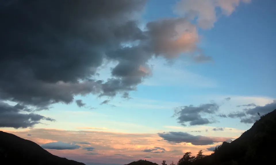
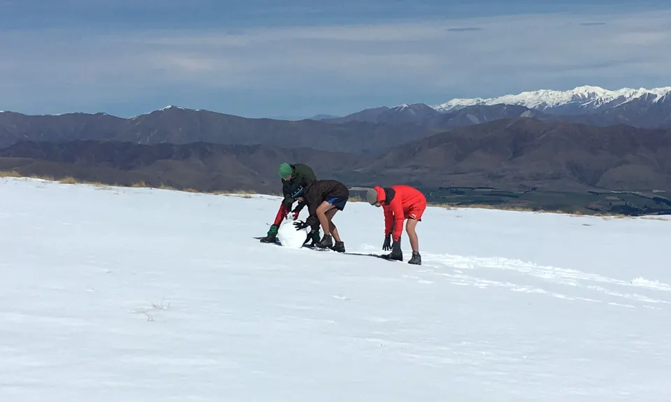
If you have time overnighting in the hut is great as the sun sets the plains and hills of Banks Peninsula light up and give a great show. You can get hut tickets at the Staveley Store
The route out is to retrace your steps, although options abound if carrying on around the mountain or up and over the summit - see the Trail Directory for these routes.
Trail Community
Features of interest
Pristine beech forest
Volcanic rock formations
Great technical trails
Make Up of Run
Technical Single Track: 90%
Moderate Single Track: 5%
Easy Single Track: 5%
Route Data
Reviews:
Overlapping Runs
The following trails overlap with this run to some degree. You may wish to combine them but please note that to qualify for FKTs on these runs you should record a separate Strava activity for each

Mt Somers - Round The Mountain
Length: 26.00km

Mount Somers Summit Loop via Pinnacles Hut
Length: 15.00km
Photos:
Your Trail Wishlist
All the runs that are on your To Do list (no limit).
Add to wishlist view wishlistWild Explorers
I did it!-
Access
At the End of Flynns Road, a few km's up from Staveley Village
DOC carpark at track end. Note if overnighting, don't leave valuables in the car as the scumbags occasionally visit here
29 km
25 minutes
No
No
-
Staying Safe
Hard.
Track is well marked and formed
Very patchy.
Thermal leggings, Lightweight fleece top, Long-sleeved thermal top, Seam-sealed waterproof jacket, Gloves, Beanie/thermal headwear, Personal Locator Beacon (PLB), Whistle, First aid kit, Extra food for emergencies, Survival blanket, Cellphone, Map, Headtorch and spare batteries, Gaiters.
Water abounds all over the place, in the river or at Pinnacles Hut
It's alpine around here so pack gear according to the season and forecast.
Its surprisingly rugged country when you get in here, make sure you have a first aid kit in case you take a slide. Expect snow on the ground at times from Autumn to Spring and even very occasionally in summer
-
Post run indulgence
Panthers Rock Pub
Mayfield
https://www.facebook.com/panthersrockmayfield/
Feed and a pintStavely Store
Staveley
http://www.staveleystore.co.nz/
Get your supplies and or hut tickets here -
Sponsor this trail
See other runs nearby:
Mt Somers Woolshed Loop
Mt Somers - Round The Mountain
Mt Somers - Over the Top V1
Lake Camp and Clearwater Loop
Trails and Tribulations
Awesome Alford
Lake Lilian Track
Browning Pass - Southern Alps Crossing
Mt. Taylor Dual
Rakaia Rush
Aamped and Clomped
Hakatere Shoe Washer
Mount Somers Summit Loop via Pinnacles Hut
Scotts Pudding Loop
The Lady Lakes
Edoras on Sunday