Last Updated: 16th Mar 2026
Mount Somers Summit Loop via Pinnacles Hut
Last Updated: 16th Mar 2026
Grunt Factor: 44 ?
Gnarl Factor: 78 ?
16.0km
1500m
1500m
1687m

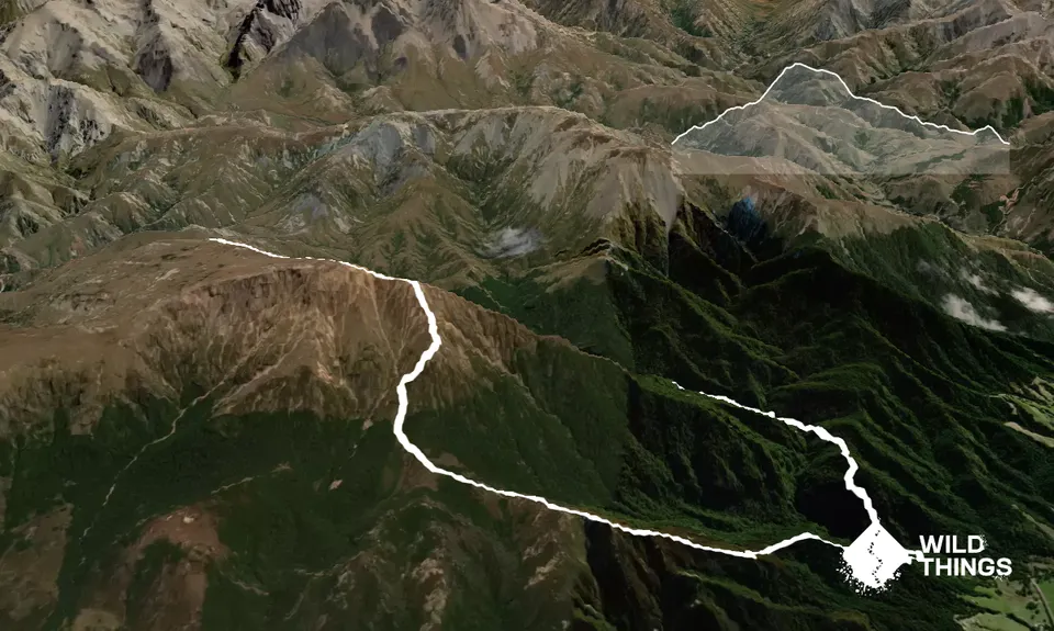
Trail Map
This Topo layer only covers NSW/ACT.
Switch to another map layer when viewing outside this area.
Switch to another map layer when viewing outside this area.


