Last Updated: 21st Sep 2023

Intermediate

Save Trail Save

I've done it Done

Hakatere Shoe Washer

Methven, Canterbury

Submitted by Kevin Holland

Last Updated: 21st Sep 2023

Intermediate

Save Trail Save

I've done it Done

Grunt Factor: 80 ?

Gnarl Factor: 36 ?

60.0km

1525m

1525m

1194m


Login as a VIP to see driving directions, distance and time.

Trail Map

Type of Run

Back country - remote

Loop

Undulating, some big hills

Riverside

Open farmlands

Open tussock/grasslands

Other

Run Makeup

19%
27%
14%
13%
27%

Gravel Road

Farm Road / 4WD Track

Easy Single Track

Moderate Single Track

Untracked / Route only

Average Uphill Gradient: +5.6%

Average Downhill Gradient: -5.5%

Trailhead

Login as a VIP to see the trailhead information.

Estimated Times to Run

Not suitable

Slow

10:00

Moderate

7:30

Fast

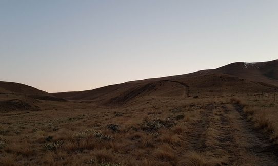
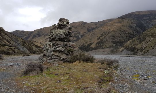
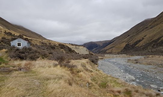
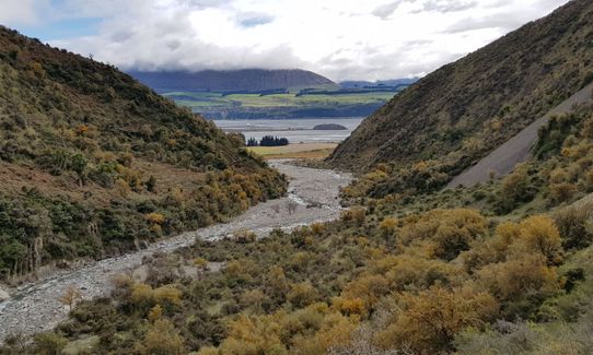
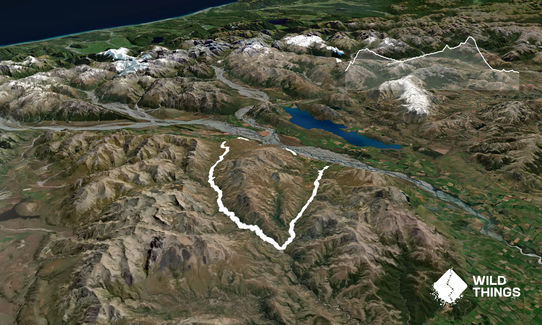
Easy track to follow from the Redcliff reserve start. Initially the track climbs 600m up to the floor of the Redcliff - Cookies valley. You can keep try feet until just before Tribulations Hut, a basic shelter. Stay in the valley floor, heading down Swift River. From Cookies Hut, it is wet foot time. Don't go up the track behind Cookies hut, return to the river bed and continue to Cookies Point - easily found by looking for the Rock Pillar at the junction with the North Branch Ashburton River. Lots of seagulls here for some reason.

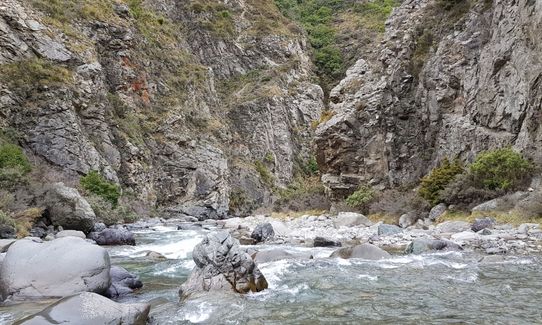
Head up the Ashburton River, 14km of very slow going up a river gorge. The only time it opens out is to grow more matagouri. In Spring the crossing were up to 0.75m deep. Much of the time the only route is walking up the river, against the flow. No running here, not even for an Elite. At Comyns Hut you join the Te Araroa Trail and it is all runnable again. There is a poled 4 wheel drive track that deviates from the river but is easy going. You gain altitude up past A Frame hut and over the 1194m high point. At Turtons Saddle the track drops sharply down hill into the Glenrock station. At a fence junction with a no access private, you leave the 4 wheel drive track and pass through a poles single track public access route to the road. From the road it is undulating back to the start. Feel free to accept a ride back to the start, the 2nd car passing picked me up.

Lots of mountain goats. Remote. Very basic historical tin huts, except for A Frame hut, which has been done up on the inside. More matagouri than you will ever want to see in a lifetime. Basically no trees after the first 3km

If you know of any public toilets near the trail start or on the route, please login and then let us know so we can update this section.

Grass verge space for 4-8 cars. More if you walk a few minutes. No public transport although there will be private providers servicing the Te Araroa trail. Quite a few cars that could give you a ride if you don't want to finish the road section of the loop - the 2nd picked me up.

57 km

75 minutes

Unknown

No

Hard.

Easy to Tribulations hut, follow the track. Keep to the river bed until you get to the Te Araroa Trail. Make sure you leave Swift River and switch to the North Ashburton River at the very distinctive Rock Pillar. Forget the banks unless you can see a clear path or you will end up in matagouri hell. The trail from Comyns is very distinct, I ran it in the dark.

The North Ashburton river had more water than the Swift River. If it is very easy to cross the Swift River, you may have trouble later.

Non-existent.

Waterproof leggings, Thermal leggings, Long-sleeved thermal top, Seam-sealed waterproof jacket, Gloves, Personal Locator Beacon (PLB), Whistle, First aid kit, Extra food for emergencies, Survival bag, Cellphone, Map, Headtorch and spare batteries, Gaiters

More than you want. Much more - I spent a few hours in one river or another

In spring the rivers may just be safely passable, but very cold water. Probably very dry late summer but I can't see the rivers drying up. Cold at altitude - I had 3 long sleeve merino layers, gloves, hat & jacket and struggled for warmth. If you run faster you should be fine.

30+ river crossings - do NOT go if rivers are high.
Cold water
Cold at altitude
No marked (or mapped) route for 15km

Hororata Pie Shop
Hororata Village
Not that kind of place to have a website
Good coffee, great pies.

You and Hakatere Shoe Washer

As a VIP member you can record private notes for this trail, see all of your times and more.

Register Now

Already have an account? Login now

Trail Reviews

Be the first to submit a review for Hakatere Shoe Washer !

Login to submit a review

Trail Running Community

Find people who are interested in or have completed this trail run.

You must register or login to view this feature.

Register Now

Overlapping Trails

These overlap with this trail to some degree. You may wish to combine them but please note that to qualify for FKTs on these runs you should record a separate activity for each.

Trails and Tribulations

Trails and Tribulations

Length: 20.3km

Level: Intermediate

Other trails nearby
Lake Camp and Clearwater Loop

Lake Camp and Clearwater Loop

Length: 14.6km

Level: Beginner - Intermediate

Edoras on Sunday

Edoras on Sunday

Length: 3.7km

Level: Beginner

The Southern Pinnacles

The Southern Pinnacles

Length: 13.2km

Level: Intermediate - Experienced

The Lady Lakes

The Lady Lakes

Length: 12.0km

Level: Beginner - Intermediate

Find more trails and peaks nearby