Last Updated: 18th Oct 2023

Intermediate

Save Trail Save

I've done it Done

Scotts Pudding Loop

Methven, Canterbury

Submitted by Fiona Stechmann

Last Updated: 18th Oct 2023

Intermediate

Save Trail Save

I've done it Done

Grunt Factor: 31 ?

Gnarl Factor: 80 ?

13.8km

800m

800m

1170m


Login as a VIP to see driving directions, distance and time.

Trail Map

Type of Run

Front country - easily accessible

Loop

Undulating, some big hills

Native bush

Plantation/exotic forest

Riverside

Open ridges/tops

Run Makeup

35%
25%
40%

Moderate Single Track

Technical Single Track

Untracked / Route only

Average Uphill Gradient: +11.4%

Average Downhill Gradient: -14.6%

Trailhead

Login as a VIP to see the trailhead information.

Estimated Times to Run

5:00

Slow

3:00

Moderate

2:00

Fast

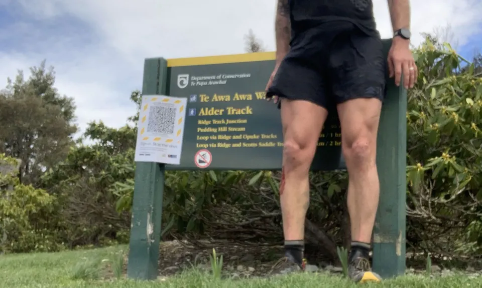
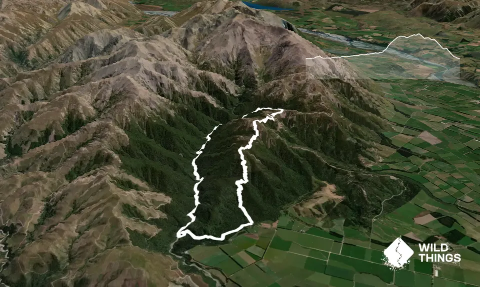
Park near the toilets and then follow the Alder track, this has a pleasant flat warm-up and then slowly climbs up to the ridgeline.

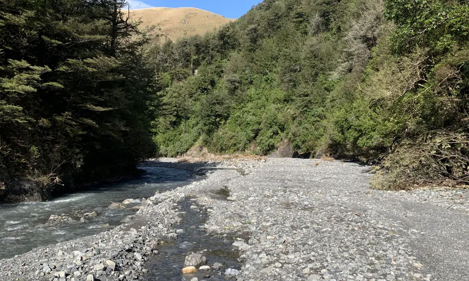
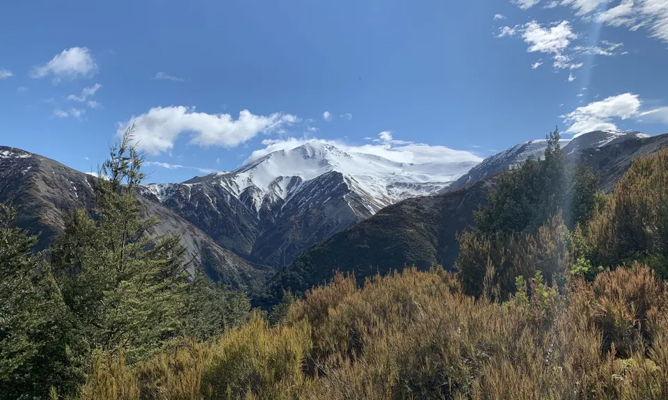
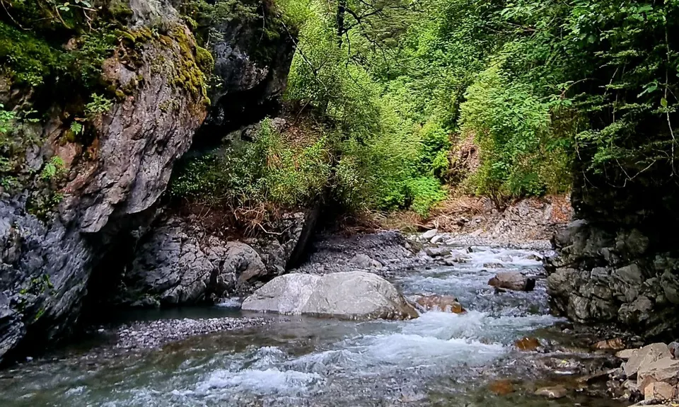
At the ridgeline follow the sign that says Pudding Stream route down into the valley on the other side. From here the trail is not really marked but pretty much just follows the stream upstream. You will need to cross the stream multiple times, pretty much just looking for the path of least resistance. If any of the stream crossings early on are deeper than around mid-calf then the crossings further up may be too deep to negotiate.

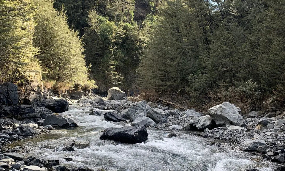
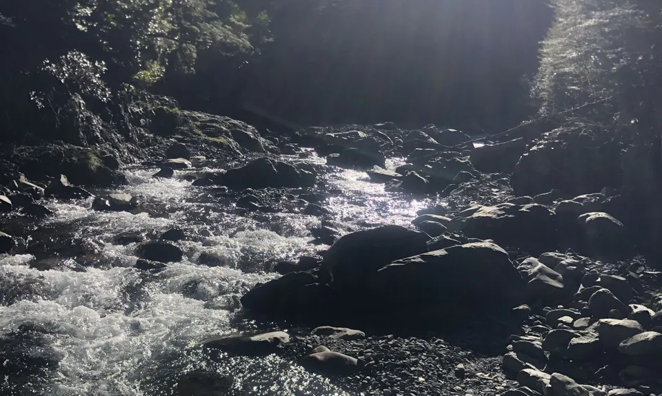
Continue following the stream. There are a number of small animal and human tracks on either side of the river, some of these are good to follow and some not so much. If in doubt stay close to the river. The stream passes through a couple of small gorges which are fairly easy to negotiate in the water.

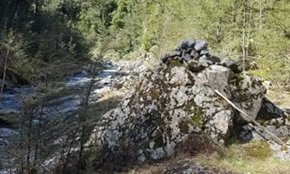
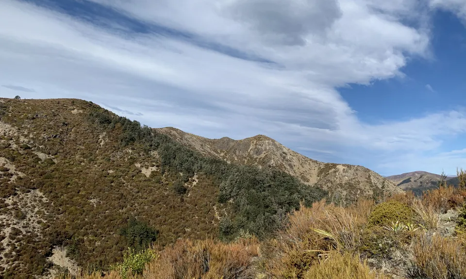
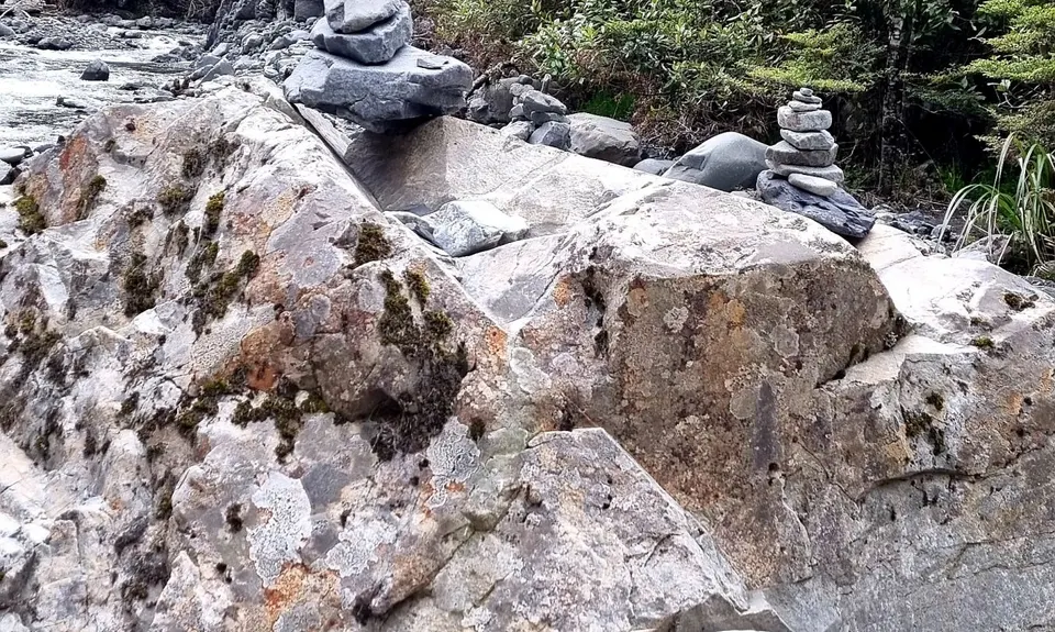
At around 6.7km into the run is the turn off up to Scotts saddle - his could be quite easy to miss. You are looking for a large rock on the true left (climbers right) of the river with a cairn on top of it. Just next to this there is a small orange triangle and then another orange triangle in the bush. Around 20m further in the bush you will see a sign to Scotts Saddle. This track is indistinct but easy enough to follow, there are markers in any spots that it is unclear. It climbs, steeply at times, until you meet the Mt Hutt skifield road.

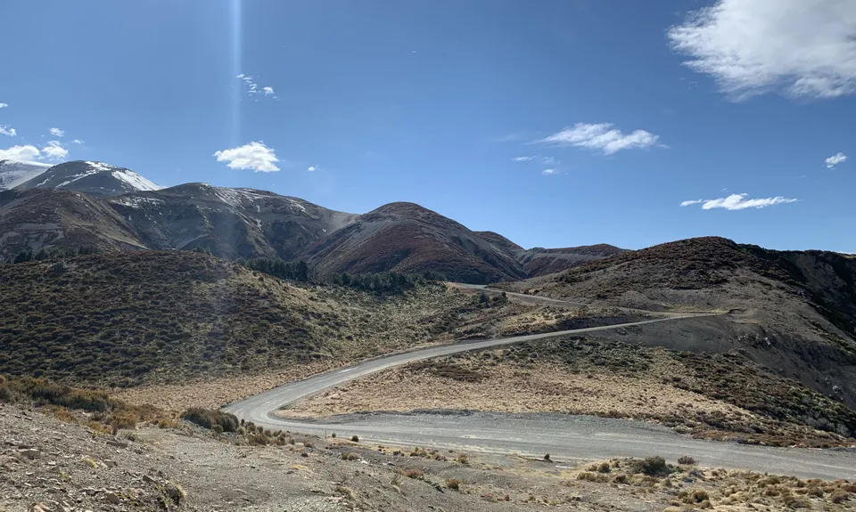
From here turn right and head down the road till you come to the Scotts Saddle trail. This starts as a 4WD tack and then splits. Follow the orange triangle for the walking track rather than the blue Scotts Saddle Express MTB trail. Continue following the Scotts Saddle track all the way back down through some fun technical downhill until it reaches the Awa Awa Rata reserve again.

There is lots of parking including picnic tables, toilets and shelters in the reserve. It appears to be pretty safe. There is no public transport.

14 km

14 minutes

Unknown

No

Moderate.

The turn up to Scotts Saddle from in Pudding Hill Stream can be easy to miss. Look for a large rock with a cairn on top (see photo) and an orange triangle on the bush edge. If unsure the NZ topo map app is really handy to confirm where you are.

Patchy.

Thermal leggings, Lightweight fleece top, Long-sleeved thermal top, Seam-sealed waterproof jacket, Gloves, Beanie/thermal headwear, Personal Locator Beacon (PLB), Whistle, First aid kit, Extra food for emergencies, Survival bag, Cellphone, Map

Water is available all the time you are in Pudding Hill Stream and you cross one stream on the way up to Scotts Saddle, but there is no more after that.

Pudding Hill Stream could easily flood in heavy rain and would be impassable. Check the depth before continuing upstream.
Snow is likely on the tops in winter and Scotts Saddle can be quite exposed to strong Nor-west winds.

Trail Legend

SV

Sonja Vreugdenhil

has completed Scotts Pudding Loop 4 times in the last year.

Learn about Trail Legends.

You and Scotts Pudding Loop

As a VIP member you can record private notes for this trail, see all of your times and more.

Register Now

Already have an account? Login now

Trail Reviews

Great route! The Pudding Stream section is good fun. We went after (and during) quite a bit of rain, and the first creek crossing was almost knee deep, but we had no issues further up. On the Scotts Saddle trail up the top, watch out for the mountain bike track that diverts off to the left - it's a narrow Y junction, and due to wind/sleet/snow we were all running head-down and went down the mountain bike track by mistake. Figured it out after dropping 150 vertical metres - the switchbacks and view of the road were the giveaway! Rather than go back up the mtb track we optimistically tried to sidle along the contour to get back to the walking track, but got bluffed out a couple times and had an interesting off-track adventure getting back up to almost where we left the track in the first place. The rest of the track on the tops is in a clay channel which had a fast little torrent running down it, maybe four inches deep in places. Shortly below the treeline the water drained off the track and it was drier running from there down.

Lesley Pijpker

July 11, 2022

I thought this was a cracker of a run! For a relatively short outing, it's a great adventure. A nice warm up along a well formed Alder track, with a few steeper inclines to get the glutes firing, then into a classic kiwi riverbed run up Pudding Stream. The river gets steeper and more bouldery as you climb - I think it was deeper than recommended when I went in (up to my shins / knees), but at no point did I need to leave the main bed. Mostly just keep on crossing the river to keep as straight a line as possible. There's no cairn anymore for the exit, but I did spot the orange arrow easily enough around the 6-6.5km mark and the sign is still there up in the bush. From there on up the trail is faint, but relatively distinct, with some steep hiking sections and run-oof-walk parts too. Quite a few trees down from winds, but nothing crazy, and this is now similar for the descent down Scott's Saddle Track (which only ruins the flow a little, and adds to the adventure factor). The blast out once back on the well formed Awa Awa Rata gives a nice hero finish. I think with lower river levels, and when the Scott's Saddle Track gets a bit of maintenance, a sub 2 hour run wouldn't be off the books.

Billy Powell

September 13, 2021

Login to submit a review

Trail Running Community

Find people who are interested in or have completed this trail run.

You must register or login to view this feature.

Register Now

Overlapping Trails

These overlap with this trail to some degree. You may wish to combine them but please note that to qualify for FKTs on these runs you should record a separate activity for each.

Aamped and Clomped

Aamped and Clomped

Length: 13.9km

Level: Intermediate

Other trails nearby
Lake Camp and Clearwater Loop

Lake Camp and Clearwater Loop

Length: 14.6km

Level: Beginner - Intermediate

Hakatere Shoe Washer

Hakatere Shoe Washer

Length: 60.0km

Level: Intermediate

The Southern Pinnacles

The Southern Pinnacles

Length: 13.2km

Level: Intermediate - Experienced

Mt Somers - Round The Mountain

Mt Somers - Round The Mountain

Length: 26.0km

Level: Intermediate

Find more trails and peaks nearby