Last Updated: 8th Jul 2024

Intermediate

Save Trail Save

I've done it Done

Mount Somers over the back

Mount Somers Woolshed Creek Carpark to Sharplin Falls Carpark

Mount Somers Track

Mount Somers, Canterbury

Submitted by Sonja Vreugdenhil

Last Updated: 8th Jul 2024

Intermediate

Save Trail Save

I've done it Done

Open

Grunt Factor: 34 ?

Gnarl Factor: 53 ?

17.6km

1085m

1175m


Login as a VIP to see driving directions, distance and time.

Trail Map

Type of Run

Front country - easily accessible

Point to Point (one way)

Very hilly

Native bush

Open tussock/grasslands

Open ridges/tops

Run Makeup

15%
15%
30%
40%

Farm Road / 4WD Track

Easy Single Track

Moderate Single Track

Technical Single Track

Average Uphill Gradient: +11.8%

Average Downhill Gradient: -12.8%

Trailhead

Login as a VIP to see the trailhead information.

Estimated Times to Run

4:30

Slow

3:00

Moderate

2:00

Fast

Begin at Woolshed Creek Carpark and follow the DOC marked track for Blackburn Coal Mine, Woolshed Creek Hut and Sharplin Falls Carpark. The trail begins in native bush with several exploration options along the way of old coal mines.

About 3.5km into the trail there is the option to go left for the 4wd track to Woolshed Creek Hut. Take this option to enjoy some time on less technical trail and stunning views. Enjoy the descent into Woolshed Creek Hut where there is a stream to cross and an option to fill up water if needed.

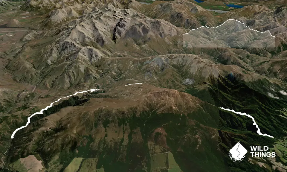
From here there is some undulating terrain and two more stream crossings until reaching the climb to the saddle. This climb is the most aggressive of the day. Once on the saddle there is some stunning views and the great running in some open country. Be careful as it can be cold up here with a breeze.

Follow the DoC markers until the Pinnacles Hut. From here the trail is very technical, lots of tree roots and rocks back in the native bush. The descent from Pinnacles Hut will bring you to the stream. Continue down the right side of the stream until reaching the swing bridge to cross. The trail continues down the stream for 1km before beginning a tough ascent to Dukes Knob. From Dukes Knob the descent is technical and can be very slippery.

Once you hit the stairs it is the home stretch to the carpark.

Woolshed Creek Hut Pinnacles Hut Dukes Knob.

There are public toilets at both ends and at the DOC huts.

Because this is a trail that goes around the back of the mountain, it is best to get dropped off at Woolshed Creek carpark and have a vehicle parked at Sharplin Falls carpark if doing it alone. If with a friend, a vehicle can be parked at each end. There is limited cellphone reception at both carparks

13 km

22 minutes

No

No

Easy.

Follow DOC markers.

Very patchy.

Long-sleeved thermal top, Seam-sealed waterproof jacket, Beanie/thermal headwear, Personal Locator Beacon (PLB), Whistle, First aid kit, Extra food for emergencies, Survival bag, Cellphone, Map

There are several good streams to take water from.

Mount Somers is prone to snowfall over winter. The saddle can often have 1ft of snow

Staveley Store
Staveley
Located 5km from Sharplin Falls Carpark

Trail Legend

SA

Shane Ashley

has completed Mount Somers over the back 4 times in the last year.

Learn about Trail Legends.

You and Mount Somers over the back

As a VIP member you can record private notes for this trail, see all of your times and more.

Register Now

Already have an account? Login now

Trail Reviews

After a freezing winter morning battling Jack Frost, we strapped on our microspikes for the icy climb to the saddle. The trail down the valley turned out to be more technical than we anticipated, with slippery conditions making it quite challenging.

Crossing the river by Woolshed Creek Hut was inevitable, and ended with wet feet—there was just no other way around the icy conditions. The valley was spectacular with icicles everywhere after Pinnacles Hut, but we had to tread carefully due to the icy patches, walking more than running.

Big shoutout to Marylin and Bruce, just 2km down from Sharplin Falls carpark, who relocated our car for $40. They’ve been helping out trampers for over 30 years with car relocations and were very friendly. Their contact details are found on the Mt Somers Walkway Facebook Page or DOC website.

Stewie Stuart

July 15

Login to submit a review

Trail Running Community

Find people who are interested in or have completed this trail run.

You must register or login to view this feature.

Register Now

Overlapping Trails

These overlap with this trail to some degree. You may wish to combine them but please note that to qualify for FKTs on these runs you should record a separate activity for each.

Woolshed Creek Hut via 4wd route

Woolshed Creek Hut via 4wd route

Length: 10.0km

Level: Beginner - Intermediate

Mount Somers Summit Loop via Pinnacles Hut

Mount Somers Summit Loop via Pinnacles Hut

Length: 15.0km

Level: Intermediate - Experienced

The Southern Pinnacles

The Southern Pinnacles

Length: 13.2km

Level: Intermediate - Experienced

Mt Somers - Round The Mountain

Mt Somers - Round The Mountain

Length: 26.0km

Level: Intermediate

Mt Somers Woolshed Loop

Mt Somers Woolshed Loop

Length: 14.7km

Level: Beginner - Intermediate

Woolshed Creek Hut via 4wd route

Woolshed Creek Hut via 4wd route

Length: 10.0km

Level: Beginner - Intermediate

Mount Somers Summit Loop via Pinnacles Hut

Mount Somers Summit Loop via Pinnacles Hut

Length: 15.0km

Level: Intermediate - Experienced

The Southern Pinnacles

The Southern Pinnacles

Length: 13.2km

Level: Intermediate - Experienced

Mt Somers - Round The Mountain

Mt Somers - Round The Mountain

Length: 26.0km

Level: Intermediate

Mt Somers Woolshed Loop

Mt Somers Woolshed Loop

Length: 14.7km

Level: Beginner - Intermediate

Mt Somers Woolshed Loop

Mt Somers Woolshed Loop

Length: 14.7km

Level: Beginner - Intermediate

Woolshed Creek Hut via 4wd route

Woolshed Creek Hut via 4wd route

Length: 10.0km

Level: Beginner - Intermediate

Mount Somers Summit Loop via Pinnacles Hut

Mount Somers Summit Loop via Pinnacles Hut

Length: 15.0km

Level: Intermediate - Experienced

The Southern Pinnacles

The Southern Pinnacles

Length: 13.2km

Level: Intermediate - Experienced

Mt Somers - Round The Mountain

Mt Somers - Round The Mountain

Length: 26.0km

Level: Intermediate

Other trails nearby
Woolshed, Bus Stop Loop

Woolshed, Bus Stop Loop

Length: 11.6km

Level: Intermediate

Find more trails and peaks nearby