Last Updated: 6th Apr 2024

Intermediate

Save Trail Save

I've done it Done

Whakamarama Loop

Ngamarama track, Leyland O'Brien Tramway, North South track

Tauranga, Bay of Plenty

Submitted by Petr Faitl

Last Updated: 6th Apr 2024

Intermediate

Save Trail Save

I've done it Done

Open

Grunt Factor: 32 ?

Gnarl Factor: 61 ?

21.1km

630m

630m

537m


Login as a VIP to see driving directions, distance and time.

Trail Map

Type of Run

Front country - easily accessible

Loop

Undulating, small hills only

With permit

Native bush

Run Makeup

5%
35%
60%

Easy Single Track

Moderate Single Track

Technical Single Track

Average Uphill Gradient: +4.8%

Average Downhill Gradient: -5.1%

Trailhead

Login as a VIP to see the trailhead information.

Estimated Times to Run

Not suitable

Slow

4:20

Moderate

3:00

Fast

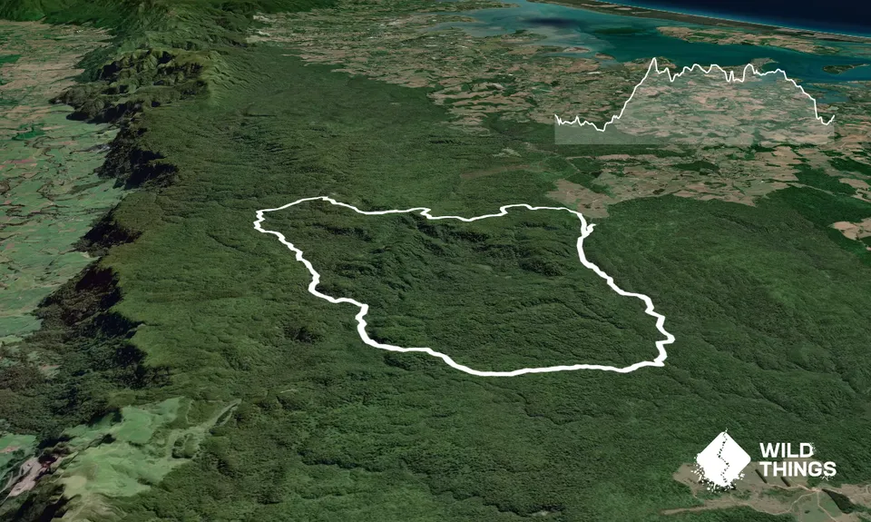
This loop joins three well-known tracks in the Kaimais. The North-South, Te Tuhi trail (West - East) and the Leyland O'Brian tramway. Another notable feature is the recent (2019) hut, Te Whare Okioki, which provides an opportunity for a stop, refreshment and perhaps a bit chin-wag with the guests.

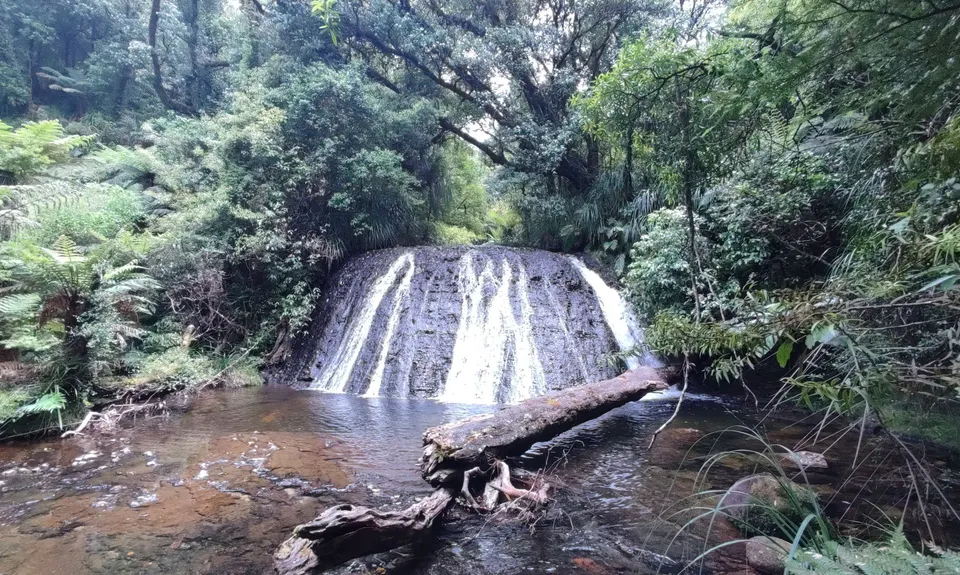
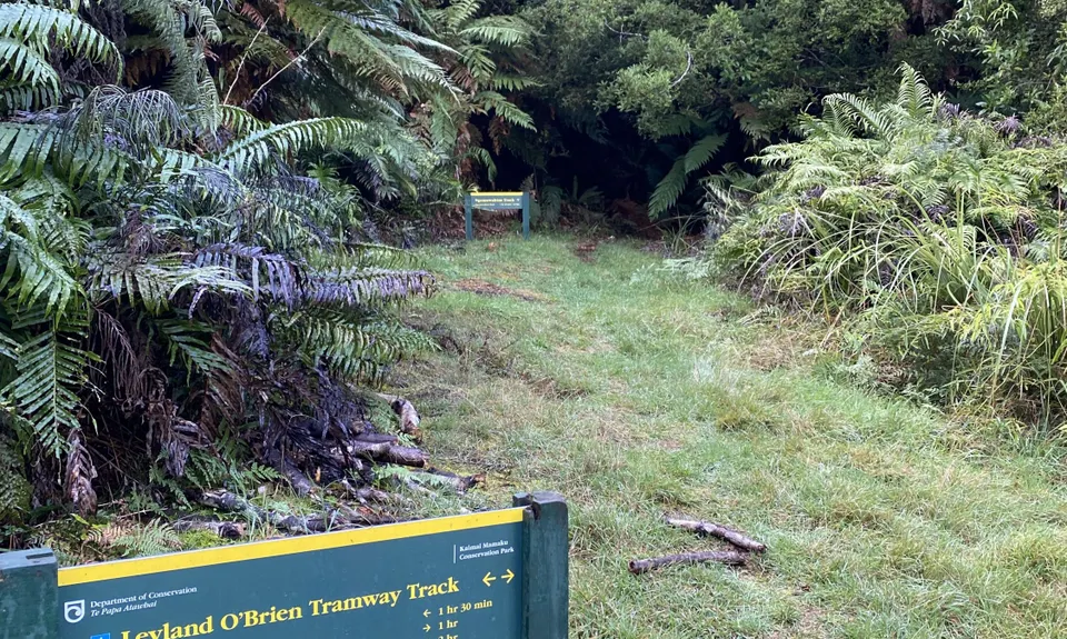
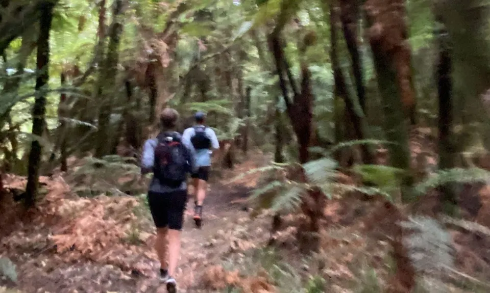
The begining of the loop starts at a carpark clearing at the very end of Whakamarama road. There are several paths that might take you on short forest walks, so it's important to find the correct route. It should be signposted as Leyland O'Brian Tramway trail. Set off in the clockwise direction, which is easier to start with, as it meanders alongside the Ngamuwahine River for the first 4km or so. You'll be required to cross the stream a few times, so be prepared to get your feet wet early on. This is the best maintained segment and a nice single track experience for a novice trail runners.

Bear slightly right at the Ngamuwahine track junction and keep following the Leyland O'Brian Tramway for another 3km. The terrain underfoot will become a bit more challenging, muddy and rooty. The real fun begins once you join the North-South trail. The trail is not as frequented and as a result is overgrown at places. There are also trees fallen across the path, so navigate carefully around them. This section up to the hut is more of a tramp than a run. It is exceedingly rooty and muddy, even days after rainfall. Take your time, as phone coverage is non-existent and broken or sprained ankles would present a serious problem.

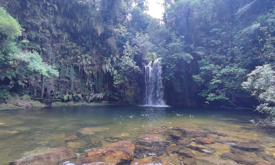
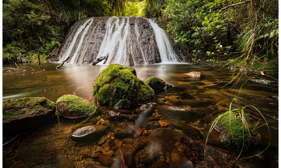
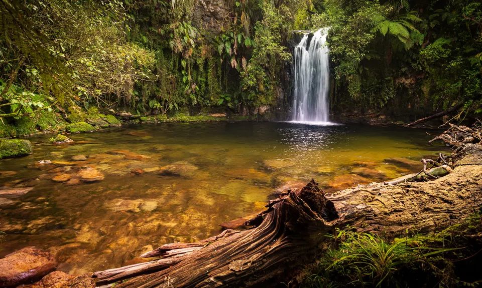
Te Whare Okioki hut is one of the most recent additions to the network in the Kaimais and is very solidly built from cinder blocks. It would offer a welcome shelter if the weather took a turn for the worst. Another 2k onward you'll come across a junction with the Te Tuhi trail. And unless you fancy extending your trip to the Wairere falls (another 1:15hrs one-way), then turn right onto the Ngamarama/Te Tuhi track. From then onwards, posted as 3hr walk (about half that when running), the track undulates up and down with some nice segments where you can enjoy a good single trail underfoot.

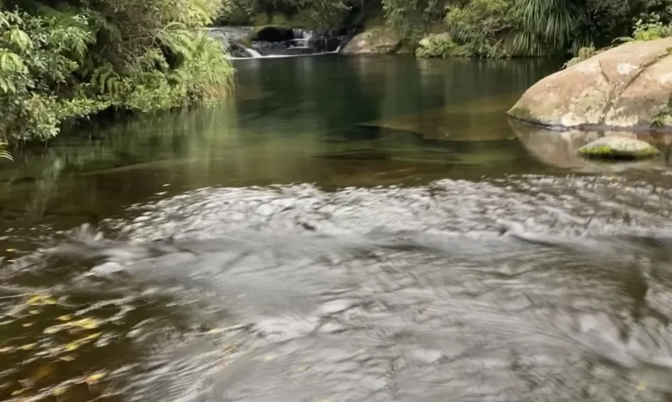
The track becomes less rooty but no less muddy, after a bit of rainfall. Just before the end, you'll descend about 50m down some steps, which is often the reason why some may prefer to run it in the clockwise direction. The last little nugget is by taking the long way to the carpark, at a junction at the bottom of the steps. This is a nice gravel single track with several boardwalks. A last little climb and you are back to the carpark, precisely 21.1k.

Part of the run follows the historic Leyland O'Brian tramway. Railway sleepers, wheels and carriage axles can be found on route.

There is sufficient parking for 10+ vehicles. Though as these trails are frequented by hunters, there might be a few overnight stayers.

34 km

36 minutes

With Permit

No

Moderate.

It's not too difficult to navigate, as long as you follow the main trail. Perhaps the trickiest is the starting point, as the carpark features several trailheads.

Non-existent.

Short-sleeved thermal top, Seam-sealed waterproof jacket, Gloves, Beanie/thermal headwear, Whistle, First aid kit, Extra food for emergencies, Survival blanket, Cellphone, Map, Gaiters

You'll be crossing plenty of streams on your way that offer clean water, coming from the forest.

Can become quite muddy. Gaitors might be an advantage.

Exposed roots are very slippery even days after a rainfall, so greater care is recommended.

Trail Legend

JF

Joe Fallowfield

has completed Whakamarama Loop twice in the last year.

Learn about Trail Legends.

You and Whakamarama Loop

As a VIP member you can record private notes for this trail, see all of your times and more.

Register Now

Already have an account? Login now

Trail Reviews

Great loop in either direction. I prefer anti-clockwise as it gives you the last few kms on the easier tramline section where you can open your legs. All pretty runnable other then a couple of km between the hut and the southern North South track folk. Great Kaimais loop. No phone reception at car park.

Gregory Bassam

September 17, 2023

Great loop track. Really enjoy this one.

Jaron Faber

August 21, 2023

The first 6/7km were all good, but then it’s relentlessly either technical or muddy. Making it quite slow going. It also didn’t help that I missed a turnoff and went several kms too far (it is well marked but I somehow how missed it) so that didn’t help my overall experience. It’s very nice bush though, cross a lot of streams. Wouldn’t recommend in winter. Even in summer I think it would be hard to run, but if technical is your thing you might enjoy it.

Holly Ross

July 16, 2023

Three stars for this review only due to the fact that the majority of the run was a hiking, having to try and navigate the incredibly boggy paths. Definitely suggest waiting for a long dry spell before going! I can see however that a drier path would make for a fun loop. I lost part of my soul up there yesterday after taking 5hrs trying to get through the swamps of sadness! 😂

Liv Flett

July 18, 2022

Login to submit a review

Trail Running Community

Find people who are interested in or have completed this trail run.

You must register or login to view this feature.

Register Now

Other trails nearby
Otainewainuku - Whataroa Falls

Otainewainuku - Whataroa Falls

Length: 8.8km

Level: Beginner

Mauao - Round, Up and Down

Mauao - Round, Up and Down

Length: 6.0km

Level: Beginner

McLaren Falls Lakeside Loop

McLaren Falls Lakeside Loop

Length: 5.3km

Level: Beginner

Henderson Tramline - Kaimai

Henderson Tramline - Kaimai

Length: 12.0km

Level: Intermediate

Find more trails and peaks nearby