Gobsmacking GertrudeVery Experienced
Submitted by Tony Sharpe
Back country - remote
Out and Back
Mountainous
Native bushRiversideLakesideOpen tussock/grasslandsOpen ridges/tops
Very Experienced
Not Suitable (Slow)
5:00 (Moderate)
3:30 (Fast)
-15.1%
+15.1%
IMPORTANT NOTE: Gertrude Saddle includes rocky alpine terrain and should only be attempted by experienced people and in good summer weather. Wet weather, snow or ice create treacherous conditions in any season
Fastest Known Times (FKTs)
Please set your gender to see your position on the FKT leaderboards.
The more , the harder the FKT will be to beat. Learn about Fastest Known Times.
Description
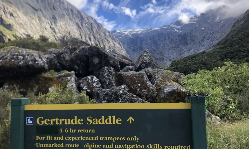
This route is not for the faint of heart and is a true alpine run/ scramble, and should be approached with the requisite experience, confidence, and only undertaken in favourable summer weather patterns. There have been fatalities by inexperienced people who underestimate Fiordland terrain and weather conditions. Pack and plan accordingly! Do not run an attempt in winter or autumn/spring-like snow conditions! Having said all that, in good weather most experienced Wild Things will have a ball here.
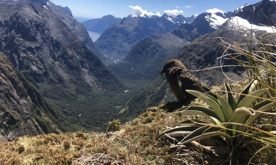
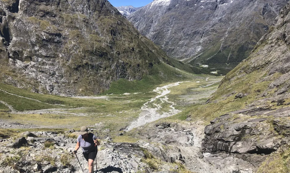
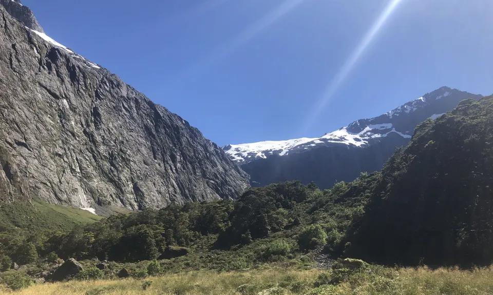
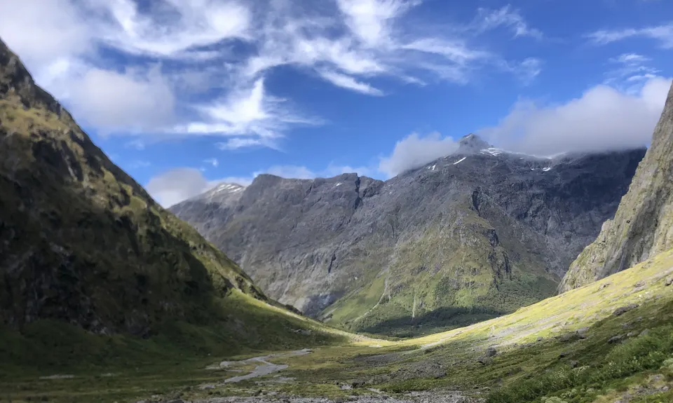
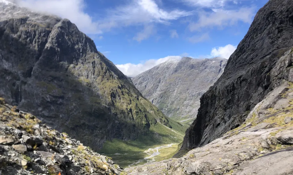
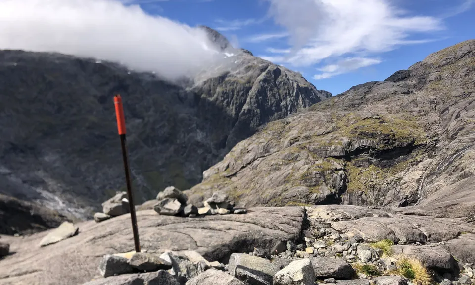
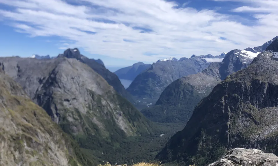
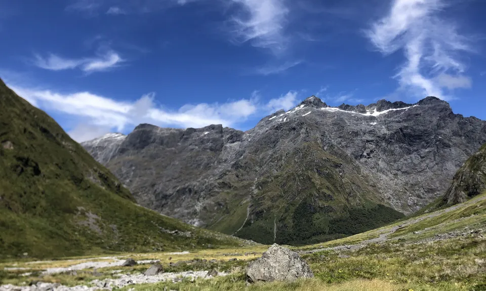
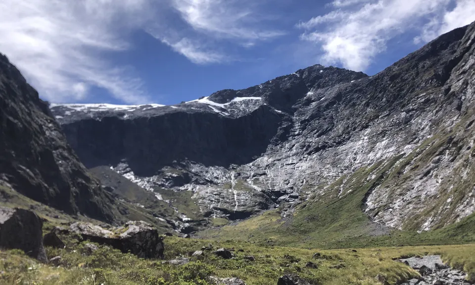
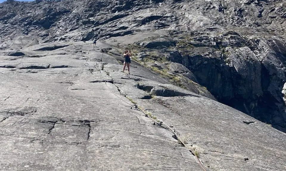
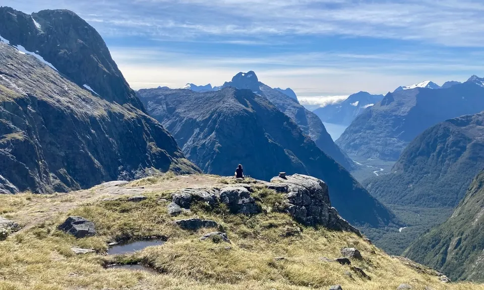
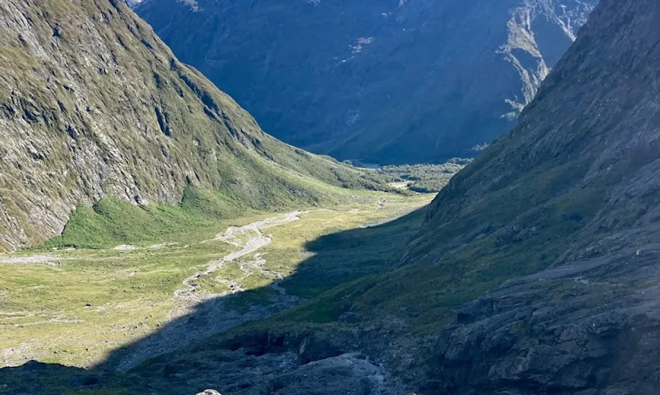
The route heads out from the Homer Hut area from the signposted entrance beside the highway, and hops up through alpine scrub, herbfields and large boulders. Reasonably runnable in here for the nimble of feet. As the valley closes in it steepens rapidly. Make sure you are following the fairly heavily marked route (poles, orange markers and cairns). Once clear of the vegetation zone the real fun starts. Steep terrain follows - rocky slabs, tiptoeing around bluffs and waterfalls, permanent steel ropes to assist (nothing technical, just to help) and more steep ascending will eventually head up to Gertrude Saddle, where you will gape at the views (which you will have because you only attempted this in good weather!) Some say this is the best daytrip view in NZ, it certainly has to be a contender).
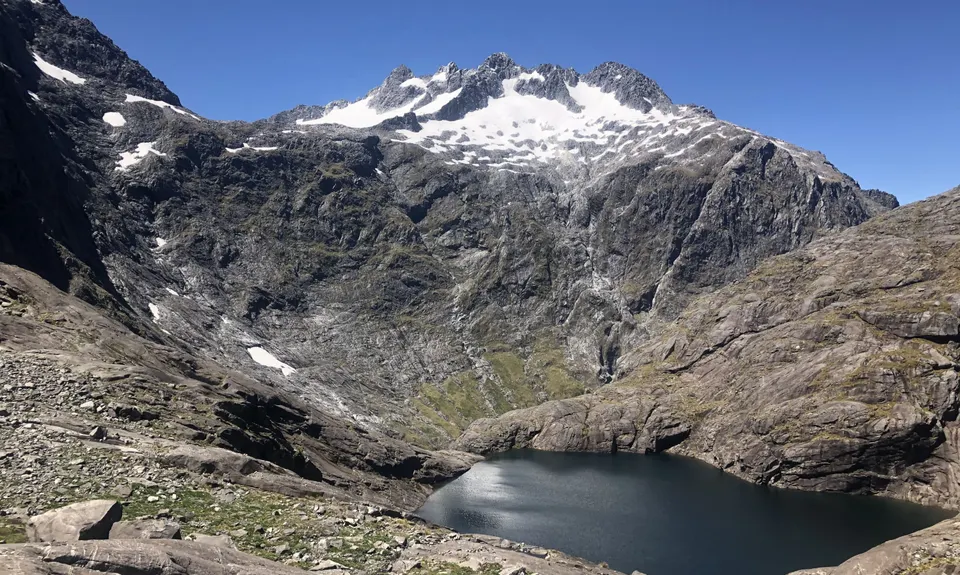
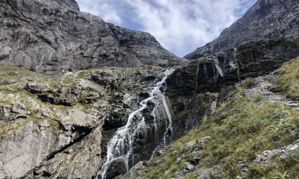
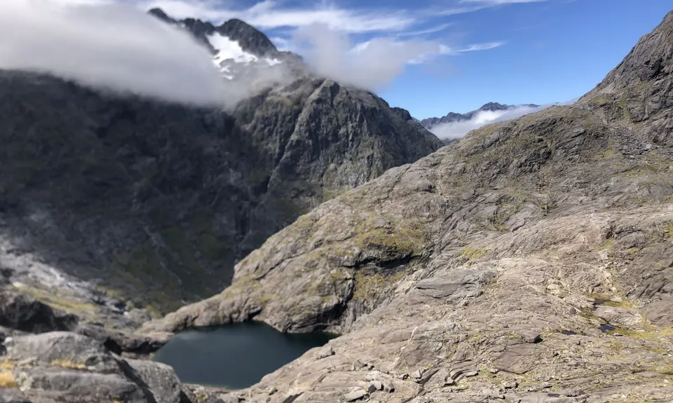
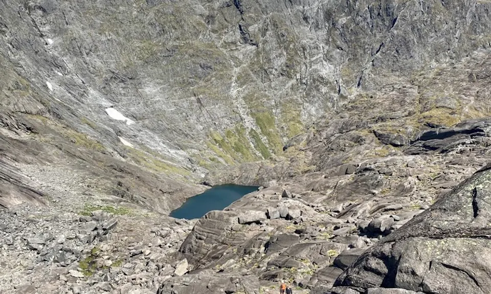
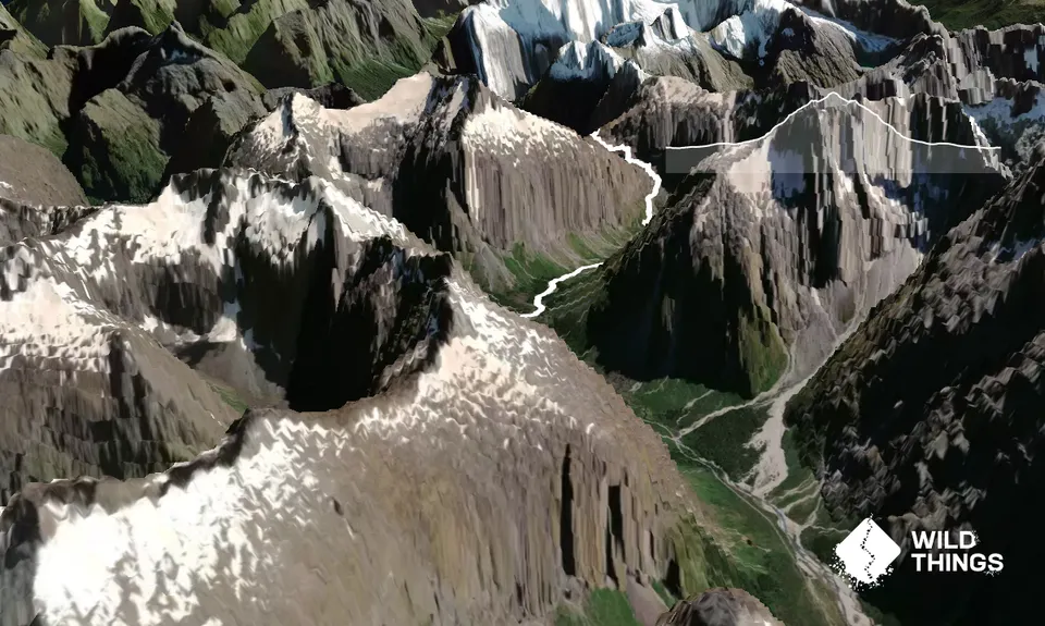
The crux of this route is going the right way around the waterfall as you ascend under bluffs below the Black Lake outlet. Do not miss the river crossing under the waterfall, marked with large orange triangles - especially coming back on the downhill. It may be helpful to familiarize yourself with the DOC video on their website about how to pick the correct route. No other route is safe on this section Above the waterfall area sidle scree and rocks and head up the classic Fiordland angled granite rock slabs following cairns and more orange triangles. Take care on any wet areas, it can be slippery. Then you'll reach Black Lake which is a great spot to catch breath and fuel up, before the last few scrambles and rocky bits up to Gertrude Saddle. Here you will find a world of goodness.
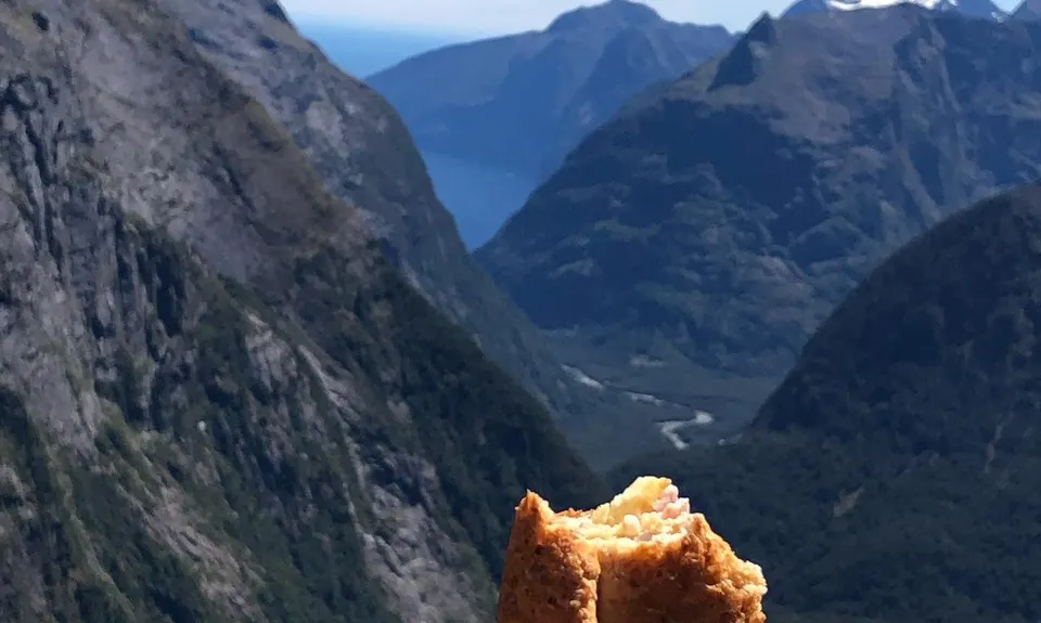
A short distance to the right (north) of the saddle there's an easy extra 50m bit of vert where your view of Milford Sound will be even better, but please do not be tempted to go further in either direction from Gertrude Saddle as this is mountaineering / climbing country beyond.
Trail Community
Features of interest
True Fiordland majesty Breathtaking viewpoint of Milford Sound and surrounds from high
Make Up of Run
Untracked / Route only: 30%
Technical Single Track: 70%
Route Data
Reviews:
Photos:
Your Trail Wishlist
All the runs that are on your To Do list (no limit).
Add to wishlist view wishlistWild Explorers
I did it!-
Access
There is only one road in and out and that is the magnificent Milford Highway. It's a fair way to drive and you'll likely stop a lot on the way up to soak up where you are. Make a full day of this, or two by booking accomodation at Homer Hut or Milford Backpackers.
Park up beside the highway near the NZ Alpine Club Homer Hut and follow the poled route from there
98 km
84 minutes
No
No
-
Staying Safe
Hard.
If you are not following cairns, poles and orange markets be sure to back track and find the last one
It's a well marked route, but please don't rush without spotting where you need to be
Non-existent.
Waterproof leggings, Thermal leggings, Lightweight fleece top, Short-sleeved thermal top, Long-sleeved thermal top, Seam-sealed waterproof jacket, Windproof jacket, Gloves, Beanie/thermal headwear, Personal Locator Beacon (PLB), Whistle, First aid kit, Extra food for emergencies, Survival bag, Survival blanket, Cellphone, Compass, Map, Headtorch and spare batteries, Gaiters.
Fiordland water is good to drink up here
This trail is only for fine weather summer conditions. Do not attempt in any other conditions, there are plenty of other options off the Milford Road if its not a nice summers day
Exposed cliffs, know the weather forecast and don't attempt outside summer conditions.
Use Mountain Safety Council intentions systems, tell someone you are going, and when you are due out
Have all the gear you'd need for a remote experience. -
Post run indulgence
Te Anau. All of it.
- Blog Posts and Articles
-
Sponsor this trail
See other runs nearby:
Kepler Track
Lake Marian Meander
Whisky Trail and Routeburn
The Routeburn
Milford Track
Caples Track - The Divide Version
South Mavora Lake Trail
Waiau River Loop
Deepest Darkest George
Henry the Hooligan!
Tour de Milford Haven
Te Anau Foreshore Trail
The Hollyford: Out and Back to Alabaster
Hollyford Road - Routeburn Loop via Deadmans and Pass Creek
Luxmore Hut Return
Routeburn: Divide to Conical Hill
Kiwi Burn Circuit
Boyd Creek Tops & Nature Walk
Key Summit Nature Trail Loop