Hollyford Road - Routeburn Loop via Deadmans and Pass CreekIntermediate - Experienced
Submitted by Sierra Alef-Defoe
Intermediate - Experienced
7 (Slow)
6 (Moderate)
5 (Fast)
-13.8%
+13.9%
Fastest Known Times (FKTs)
Please set your gender to see your position on the FKT leaderboards.
Men
There are currently no male FKTs for Hollyford Road - Routeburn Loop via Deadmans and Pass Creek.
Women
There are currently no female FKTs for Hollyford Road - Routeburn Loop via Deadmans and Pass Creek.
Filter FKTs
The more , the harder the FKT will be to beat. Learn about Fastest Known Times.
Description
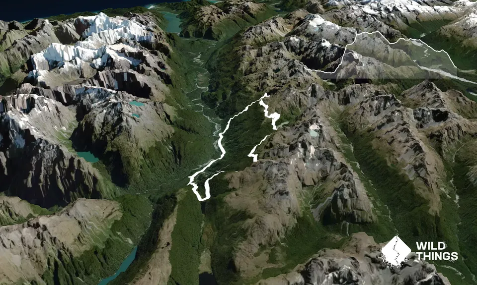
Looping the Routeburn & Hollyford Road adds a little variety for runners who do the Routeburn frequently and makes use of some lovely but less-traveled forest tracks; Deadmans & Pass Creek. Being a loop, it also offers logistical simplicity!
This loop can be started with either Deadmans or Pass Creek, but it's a good idea to park at Pass Creek and start up Deadmans, so that you get the 5 km run on the Hollyford Road out of the way at the beginning.Pass Creek is also earlier on the Hollyford Road so petrol-wise it makes more sense to leave a vehicle there.
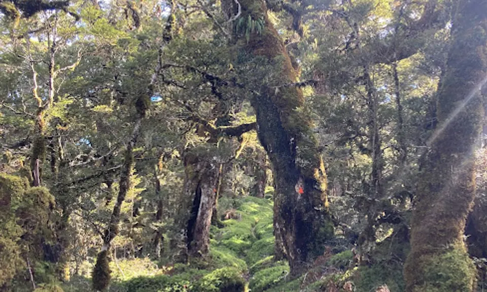
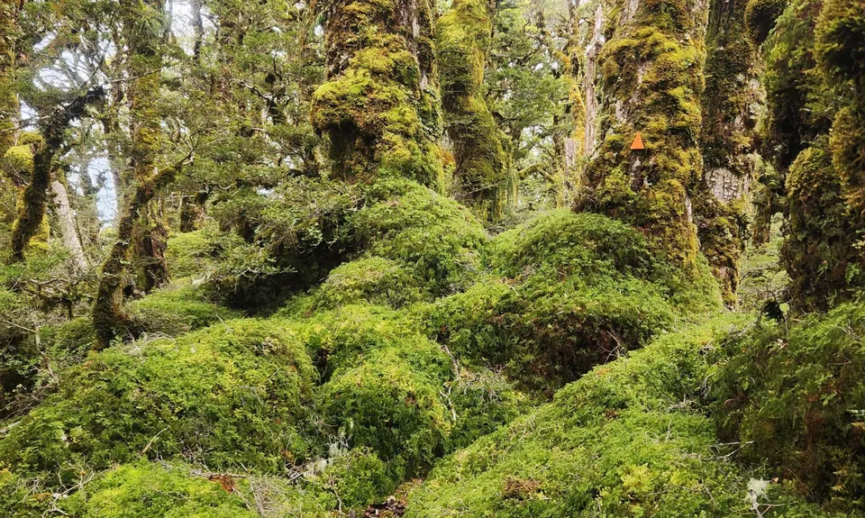
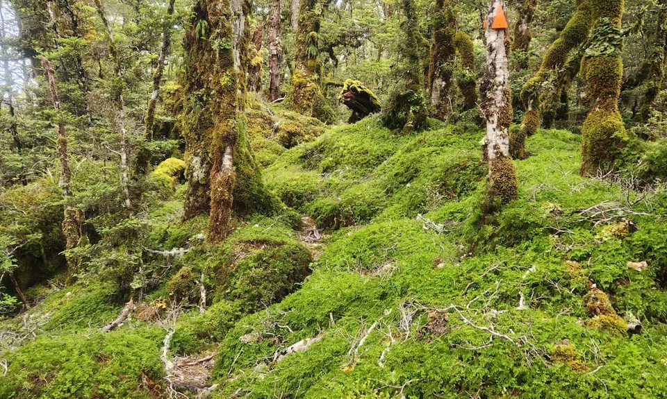
Start with a 5 km run down the gravel road, passing the old Gunns Camp, until you see the sign for Deadmans track on the right. Deadmans is a steep uphill on a forest trail. This track is prone to treefall, but has generally been maintained well enough that there's nothing too tricky to get around. While the DOC sign says 5 hours one-way, that's more of a round-trip time estimate.
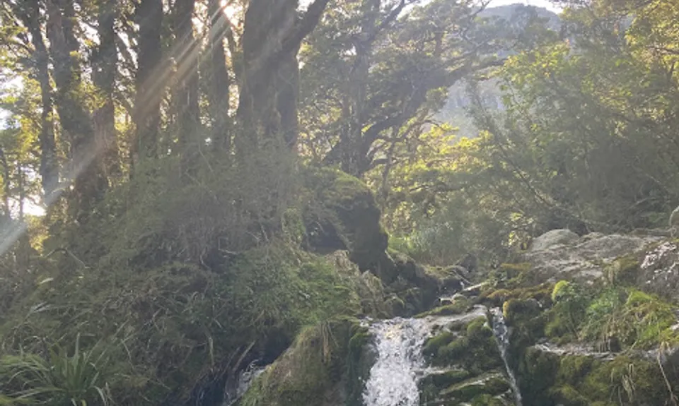
When you cross the streams, you're getting close to the Routeburn! Coming onto the Great Walk after this bush bash-y track feels like getting on a highway. Turn right. You'll emerge on a section of the Routeburn that is mostly quite run-able, a few KMs of sidling on well-formed track. There are a few streams where you can fill water along this section.
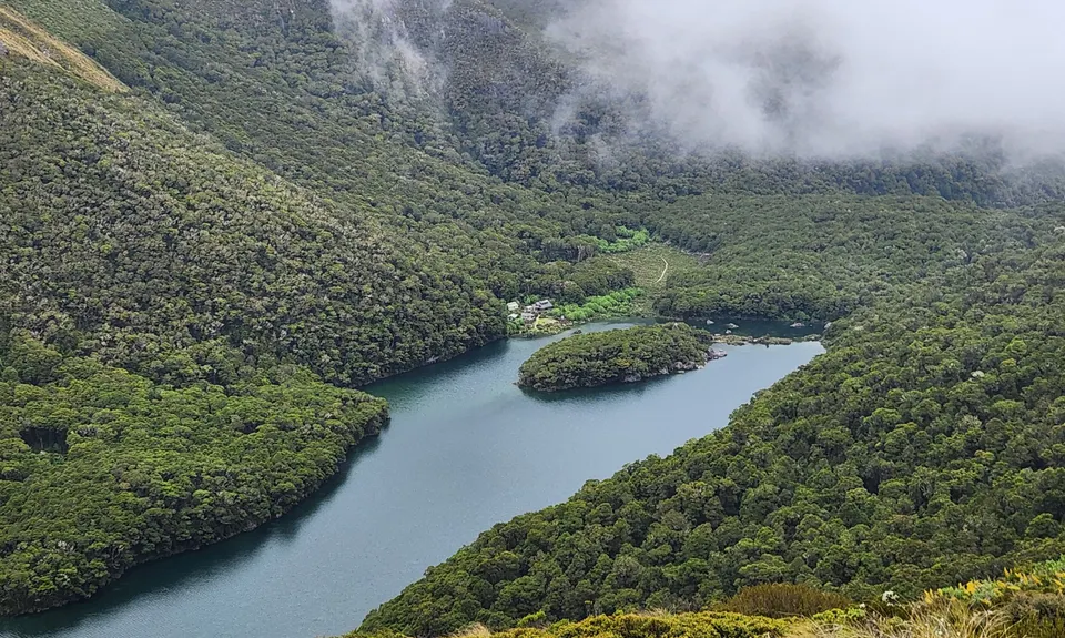
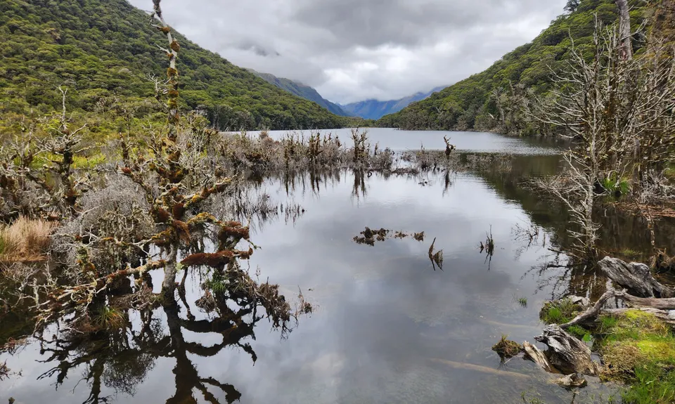
Then the track zig-zags down to Lake Mackenzie. Mackenzie Hut is a lovely place to have a break, take a dip in the lake, refill water, & use the toilet. Then continue on towards the old Howden Hut site.
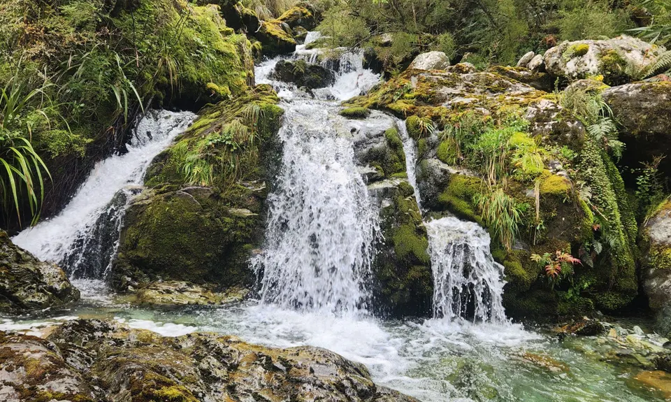
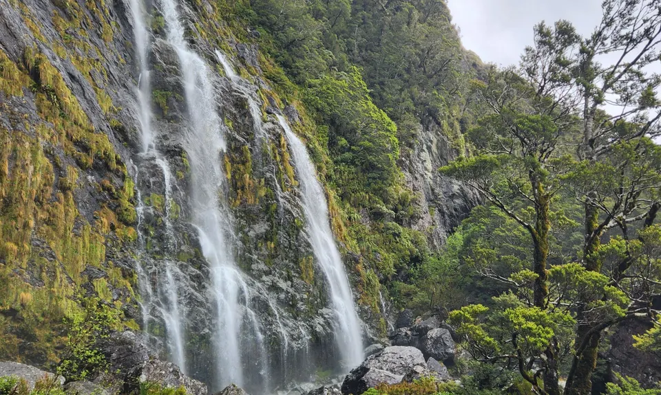
The most remarkable part of this section is Earland Falls, where you can expect to feel some mist from quite a distance away.
At the old site of Howden Hut, look for the sign for Pass Creek track (right next to where the track splits to Key Summit & the Divide).
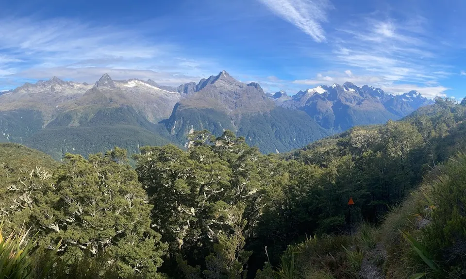
Now you're leaving the Routeburn Highway again, but you're nearly done: the DOC estimate of 2 hours for this track one-way is also a stretch. As this track is rarely used, expect some spiderwebs and treefall. But it's mostly less steep than Deadmans, and definitely shorter.
Then pop out of the bush to the Hollyford Road.
Trail Community
Features of interest
Earland Falls.
Make Up of Run
Technical Single Track: 20%
Moderate Single Track: 15%
Easy Single Track: 50%
Gravel Road: 15%
Route Data
Reviews:
Overlapping Runs
The following trails overlap with this run to some degree. You may wish to combine them but please note that to qualify for FKTs on these runs you should record a separate Strava activity for each

The Routeburn
Length: 32.00km
Photos:
Your Trail Wishlist
All the runs that are on your To Do list (no limit).
Add to wishlist view wishlistWild Explorers
I did it!-
Access
The trailhead for Pass Creek is about 3.5km down the Hollyford Road, and the trailhead for Deadmans another 5 km further.
There's a small space to park on the side of the road at either trailhead.
90 km
75 minutes
No
No
-
Staying Safe
Moderate.
The tracks are generally well maintained by DOC with signage and orange arrows, but it's always advisable to have an offiline topo app that you can check.
Non-existent.
Windproof jacket, Gloves, Personal Locator Beacon (PLB), Whistle, First aid kit, Extra food for emergencies, Cellphone, Map, Headtorch and spare batteries.
The track crosses streams fairly regularly; there is also a tank at Mackenzie hut (as well as running water from the taps October-April).
Snow, ice, and avalanche conditions are a consideration on the Routeburn in winter and spring. Deadmans and Pass Creek could become tricky during or after a storm with slips and treefall.
-
Blog Posts and Articles
-
Sponsor this trail
See other runs nearby:
Kepler Track
Lake Marian Meander
Whisky Trail and Routeburn
The Routeburn
Milford Track
Caples Track - The Divide Version
South Mavora Lake Trail
Waiau River Loop
Deepest Darkest George
Gobsmacking Gertrude
Henry the Hooligan!
Tour de Milford Haven
Te Anau Foreshore Trail
The Hollyford: Out and Back to Alabaster
Luxmore Hut Return
Routeburn: Divide to Conical Hill
Kiwi Burn Circuit
Boyd Creek Tops & Nature Walk
Key Summit Nature Trail Loop