Last Updated: 21st Sep 2023
The Hollyford: Out and Back to Alabaster
Last Updated: 21st Sep 2023
Open
Grunt Factor: 48 ?
Gnarl Factor: 15 ?
41.4km
645m
650m
161m
Last Updated: 21st Sep 2023
Last Updated: 21st Sep 2023
Open
Grunt Factor: 48 ?
Gnarl Factor: 15 ?
41.4km
645m
650m
161m
Back country - remote
Out and Back
Undulating, small hills only
Native bush
Riverside
Lakeside
Easy Single Track
Moderate Single Track
Average Uphill Gradient: +3.0%
Average Downhill Gradient: -3.0%
VIP Feature: Send this route to your Garmin account so you can follow the course on your Garmin device.
Login as a VIP to see the trailhead information.
6:30
Slow
4:00
Moderate
3:30
Fast
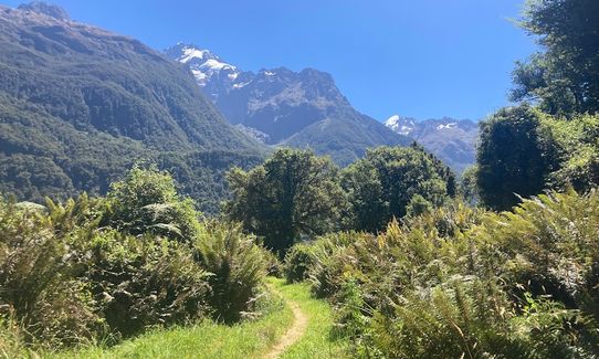
A trail made for running! This undultating forest track is so well-maintained, it could be a Great Walk. In good weather you won't even get your feet wet.
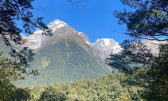
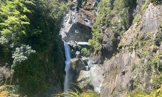
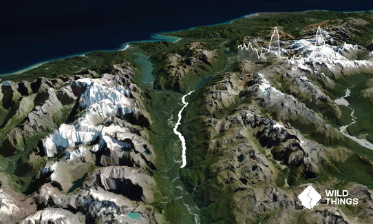
The trail is mostly forest-covered, roughly following the Hollyford River, passing waterfalls (make a tiny detour to find the Hidden Falls) and views of Mt Madeine & Mt Tutoko.
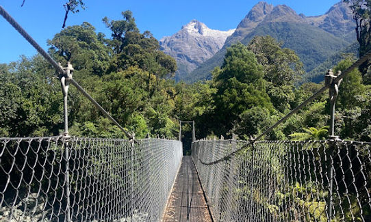
It's a relatively flat track with a high point of 168m at the cute "Little Homer Saddle." The track passes Hidden Falls Hut, which is a 5-min detour if you need a bathroom break, and terminates at Alabaster Hut, the turn-around point.
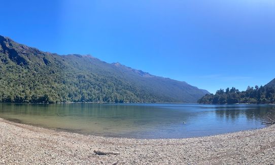
Bring sandfly repellant if you want to stop and enjoy Lake Alabaster. The Hollyford track goes on past Alabaster Hut all the way to the coast, but the aptly named "Demon Trail" and Pyke-Big Bay Route are not recommended for running!
Multiple waterfalls including Hidden Falls, views of Mt Madeline & Mt Tutoko, Lake Alabaster, Hollyford River
If you know of any public toilets near the trail start or on the route, please login and then let us know so we can update this section.
Plenty of parking available at the trailhead.
103 km
120 minutes
Unknown
No
Easy.
The trail is well-maintained and well sign-posted by DOC.
Non-existent.
Windproof jacket, Personal Locator Beacon (PLB), Whistle, First aid kit, Extra food for emergencies, Cellphone
Lots of streams, plus water tanks at both Hidden Falls and Alabaster huts.
The Hollyford is a gem in that it's possible to do all year. However wouldn't go out in rainy/stormy condition, the streams can flood and the track would become muddy.
There may be a bit of treefall. And if you stop for a while, sandflies!
Fastest Known Times (FKTs)
You and The Hollyford: Out and Back to Alabaster
As a VIP member you can record private notes for this trail, see all of your times and more.
Already have an account? Login now
Send to your phone
Scan the below QR code to open this trail on your phone.

Tip: position the QR code in your phone camera screen.


