Last Updated: 3rd Apr 2024
Up The Stony
Submitted by Chris Wheatley
Last Updated: 3rd Apr 2024
Grunt Factor: 31 ?
Gnarl Factor: 71 ?
18.0km
650m
650m
800m
Last Updated: 3rd Apr 2024
Submitted by Chris Wheatley
Last Updated: 3rd Apr 2024
Grunt Factor: 31 ?
Gnarl Factor: 71 ?
18.0km
650m
650m
800m
Front country - easily accessible
Out and Back
Undulating, some big hills
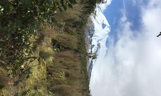
Native bush
Riverside
Moderate Single Track
Technical Single Track
Average Uphill Gradient: +7.9%
Average Downhill Gradient: -8.1%
VIP Feature: Send this route to your Garmin account so you can follow the course on your Garmin device.
Login as a VIP to see the trailhead information.
4:00
Slow
3:00
Moderate
2:00
Fast
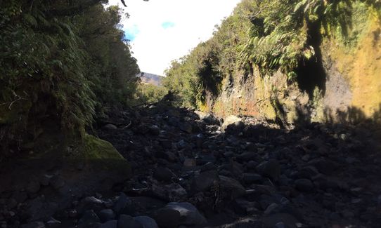
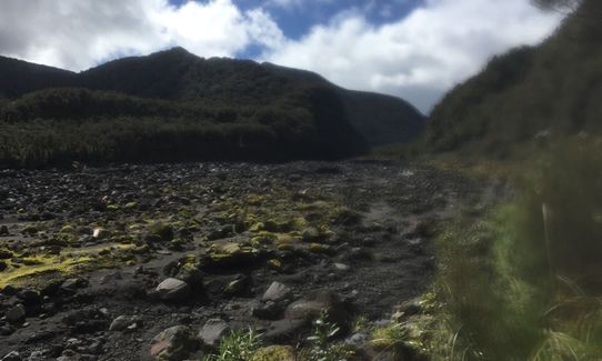
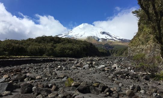
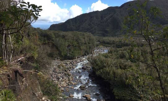
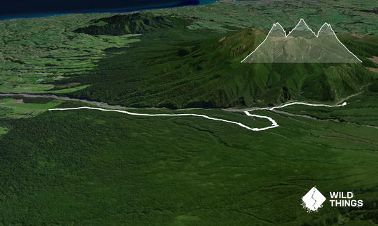
Start at the road end on the Puniho track. The trail follows the ridge next to the river and you stay on this up to the intersection with the Around the Mountain track. There used to be a track which takes you over into the stony river bed about half way up but this has been closed due to erosion of the river bank (I didn't get a chance to explore this bit). Once you get to the intersection the trail follows around the mountain and eventually into the Stony river bed. There are a few streams to cross including the Stony river and then the trail follows on towards Holly Hutt and Bells Falls. return via the same route.
The trail takes you into the Stony river bed - a beautiful spot. Can also continue up to Bells Falls (I didn't quite make it there on this run as they are approximately 0.5km further on). This track has it all - mud, boulders, streams to cross and ladders to climb all mixed in with stunning views!
If you know of any public toilets near the trail start or on the route, please login and then let us know so we can update this section.
Lots of parking on the grass at the road end
39 km
37 minutes
Unknown
No
Moderate.
Follow the orange triangle markers
Non-existent.
Waterproof leggings, Thermal leggings, Lightweight fleece top, Long-sleeved thermal top, Seam-sealed waterproof jacket, Gloves, Beanie/thermal headwear, Personal Locator Beacon (PLB), Whistle, First aid kit, Extra food for emergencies, Cellphone, Map
Holly hutt has rain water. Not sure of the quality of drinking water from the streams
Be really careful if its raining due to the streams
The Stony river and the other surrounding streams are notorious for rising extremely quickly with rain on the mountain.
Fastest Known Times (FKTs)
You and Up The Stony
As a VIP member you can record private notes for this trail, see all of your times and more.
Already have an account? Login now
Send to your phone
Scan the below QR code to open this trail on your phone.

Tip: position the QR code in your phone camera screen.


