Last Updated: 21st Sep 2023

Intermediate

Save Trail Save

I've done it Done

The Bullring Basher

Dunedin, Otago

Submitted by Steve Tripp

Last Updated: 21st Sep 2023

Intermediate

Save Trail Save

I've done it Done

Open

Grunt Factor: 57 ?

Gnarl Factor: 41 ?

37.0km

1770m

1760m

700m


Login as a VIP to see driving directions, distance and time.

Trail Map

Type of Run

Front country - easily accessible

Loop

Undulating, some big hills

Dog Friendly

Native bush

Plantation/exotic forest

Open ridges/tops

Run Makeup

10%
30%
40%
20%

Gravel Road

Easy Single Track

Moderate Single Track

Technical Single Track

Average Uphill Gradient: +9.6%

Average Downhill Gradient: -9.5%

Trailhead

Login as a VIP to see the trailhead information.

Estimated Times to Run

7:30

Slow

5:30

Moderate

3:45

Fast

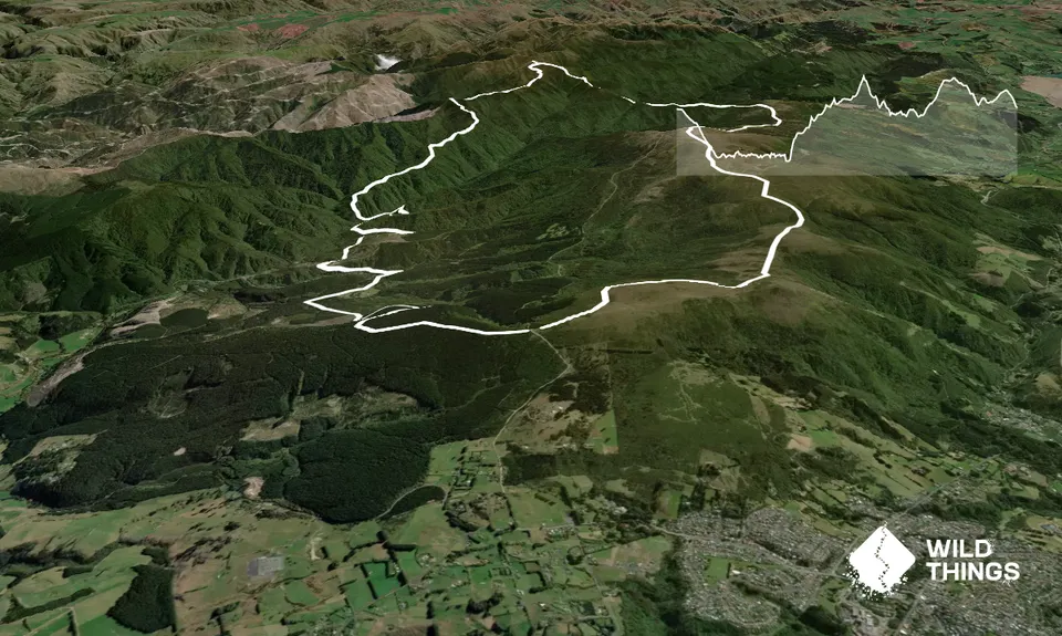
From the Bullring cross Whare Flat Rd and over the gate onto Longridge Rd. 1.5km down Longridge Rd turn right at Smeatons Rd. Smeatons turns into a single track. Follow this down the hill until it joins McIntyres Rd, another forestry track that takes you back onto Longridge again. Turn right and in 1km you will come out on Whare Flat Rd again. Turn right and go up hill for 200m to the turn off to the left onto Tunnel track.

Follow the most obvious bits of Tunnel track until you go past the tunnel, join the water race, and becomes Raceman's Track. Stay on the same contour for about 5km and then drop down to the left at the sign to Powder Ridge. Cross Silverstream and after about 500m there will be a turn off to the right to head up Powder Ridge. This is a lovely steep ridge climb through regenerating native bush for about 6km.

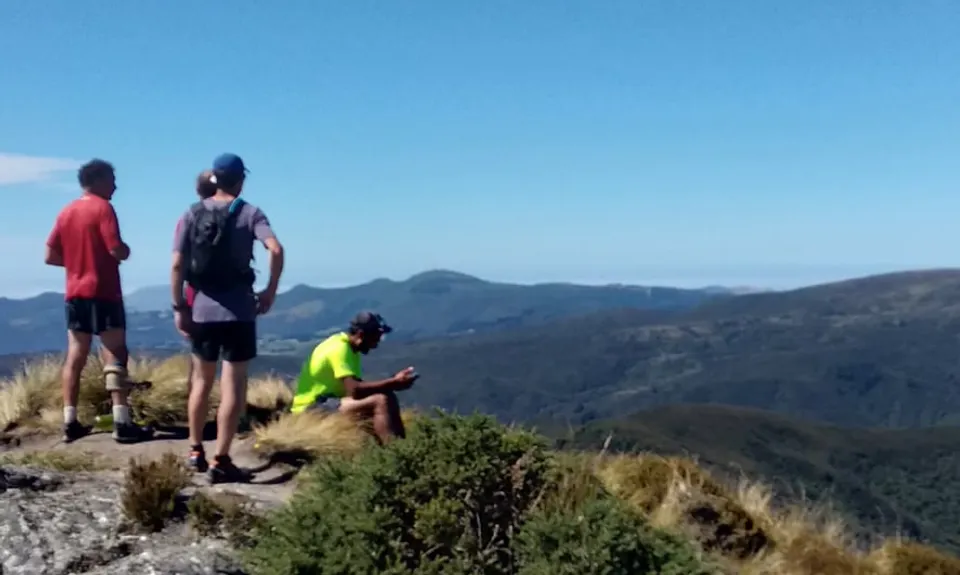
Powder Ridge meets Long Ridge at Bacon Knob and here you keep heading gradually up hill to meet the Silverpeaks Track near Pulpit Rock. Pop up to the top for the view. Turn right down the Silverpeaks Track and enjoy the glorious ridge running for about 4km until the Hightop Swampy track intersection. Turn right here and enjoy the mud and rock hopping of the Swampy Ridge track until you reach Swampy Summit. Follow the road then track towards Flagstaff and back down to the Bullring.

This trail includes the peaks Swampy Summit, Hightop and Pulpit Rock.

Includes 5km along a water race established in 1882 to provide water for Dunedin city

8 km

12 minutes

Yes

No

Moderate.

There's lots of side tracks so best to follow the GPX

Patchy.

Long-sleeved thermal top, Seam-sealed waterproof jacket, Gloves, Beanie/thermal headwear, Personal Locator Beacon (PLB), Whistle, First aid kit, Extra food for emergencies, Survival blanket, Cellphone, Map

Silverstream crossing at about 16km in is OK for drinking but after that there is nothing except very dirty puddles and swamp water. You need to carry enough for quite a few hours.

This route should always have a bit of mud. It can be really wild on the tops and very low visibility in bad weather. Any season is OK but check the weather report.

mud, steep slippery trails

Inch Bar
8 Bank St
Headquarters for Crush the Cargill and if the right person is on you might get the Crush the Cargill discount.

Trail Legend

DP

Daniel Pettigrew

has completed The Bullring Basher once in the last year.

Learn about Trail Legends.

Fastest Known Times (FKTs)

Can be run in either direction

You and The Bullring Basher

As a VIP member you can record private notes for this trail, see all of your times and more.

Register Now

Already have an account? Login now

Trail Reviews

Be the first to submit a review for The Bullring Basher!

Login to submit a review

Trail Running Community

Find people who are interested in or have completed this trail run.

You must register or login to view this feature.

Register Now

Overlapping Trails

These overlap with this trail to some degree. You may wish to combine them but please note that to qualify for FKTs on these runs you should record a separate activity for each.

Green Hill via Swampy

Green Hill via Swampy

Length: 30.0km

Level: Intermediate

Flagstaff Swampy Circuit

Flagstaff Swampy Circuit

Length: 14.7km

Level: Beginner - Intermediate

Whare Flat to Pulpit Rock

Whare Flat to Pulpit Rock

Length: 20.4km

Level: Intermediate

Other trails nearby
Purakaunui Beach Loop

Purakaunui Beach Loop

Length: 16.6km

Level: Beginner - Intermediate

Leith Saddle and Burns Track loop

Leith Saddle and Burns Track loop

Length: 10.0km

Level: Intermediate

Orokonui Heaven

Orokonui Heaven

Length: 10.0km

Level: Beginner

Nichols Fall Loop

Nichols Fall Loop

Length: 9.3km

Level: Beginner - Intermediate

Find more trails and peaks nearby