Last Updated: 21st Sep 2023

Intermediate

Save Trail Save

I've done it Done

2.8 Peaks Dunedin

Dunedin, Otago

Submitted by Jack Harris

Last Updated: 21st Sep 2023

Intermediate

Save Trail Save

I've done it Done

Open

Grunt Factor: 36 ?

Gnarl Factor: 28 ?

28.0km

1300m

1300m

700m


Login as a VIP to see driving directions, distance and time.

Trail Map

Type of Run

Urban fringe

Loop

Very hilly

Native bush

Plantation/exotic forest

Open ridges/tops

Run Makeup

20%
20%
40%
20%

Sealed Road

Farm Road / 4WD Track

Easy Single Track

Technical Single Track

Average Uphill Gradient: +9.3%

Average Downhill Gradient: -9.6%

Trailhead

Login as a VIP to see the trailhead information.

Estimated Times to Run

4:00

Slow

3:30

Moderate

2:40

Fast

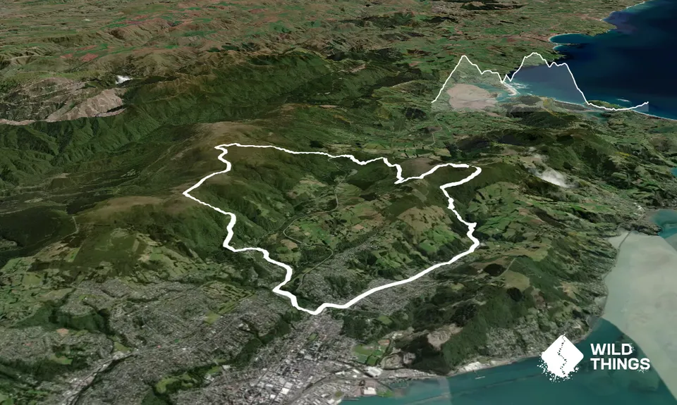
From Bethunes Gully head up to the Mt Cargill walk, the track is in good condition and mostly runnable with ~580m climbing in just over 4km.

From the Mt Cargill summit head down the gravel road, the turn off is very hidden with a small pink ribbon (likely to disappear) in overgrown vegetation, best to be using navigation to find this. If you miss it, it looks like you can connect the tracks again with the forestry road on your right further down the hill. The track is overgrown and you'll bash through a few bushes but it's all runnable and eventually you'll pop out on a forestry road, turn right and follow this for a few km.

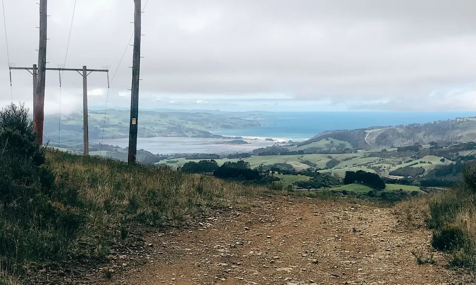
Eventually you'll come to a bit of a clearing with some big pylons and there's a track on your left; this is muddy, technical and covered in a few thorny things but again you can run a chunk of it and once you embrace the mud it's good fun with interesting boardwalk set ups. Stay right and carry on to the motorway.

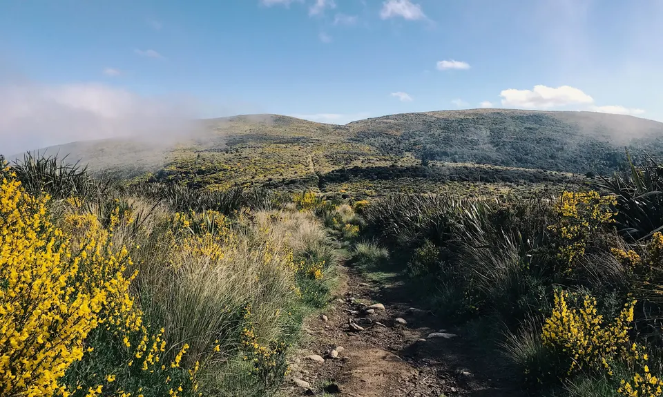
From here things get easier to navigate. Run up the Leith Saddle Track, then connect to the Swampy Ridge Track before cutting down the Pineapple Flagstaff track to get back to the road.

Head down Leith Valley and up North East Valley to get back to Bethunes Gulley, now you're off the hills push the pace on that flat stuff to finish strong.

Pop into the Bagel shop, Adjo, or Crusty corner on your way out of the valley to refuel.

This trail includes the peak Mount Cargill.

Plenty of carparks available

13 km

7 minutes

Unknown

No

Hard.

Generally good.

Long-sleeved thermal top, Seam-sealed waterproof jacket, Gloves, Beanie/thermal headwear, Whistle, First aid kit, Extra food for emergencies, Cellphone, Map

Not many water options

Very muddy if it's been wet. Wear trail shoes!

Very exposed on the ridges

Lots of opportunities to slip or hurt an ankle in the technical stuff

The ridgeline above Leith Saddle is very exposed. Cold and variable enough to get you in trouble any time of year.

The track from Mt Cargill over to the Leith Saddle is technical and not frequented, reception is likely poor so if you're taking this route let someone know that's where you're headed.

Trail Legend

FR

Finn Ryder

has completed 2.8 Peaks Dunedin 3 times in the last year.

Learn about Trail Legends.

You and 2.8 Peaks Dunedin

As a VIP member you can record private notes for this trail, see all of your times and more.

Register Now

Already have an account? Login now

Trail Reviews

Be the first to submit a review for 2.8 Peaks Dunedin!

Login to submit a review

Trail Running Community

Find people who are interested in or have completed this trail run.

You must register or login to view this feature.

Register Now

Overlapping Trails

These overlap with this trail to some degree. You may wish to combine them but please note that to qualify for FKTs on these runs you should record a separate activity for each.

Mt Cargill and Organ Pipes

Mt Cargill and Organ Pipes

Length: 10.5km

Level: Beginner - Intermediate

Leith Valley Swampy Circuit

Leith Valley Swampy Circuit

Length: 15.5km

Level: Beginner - Intermediate

Alternative Flagstaff Circuit

Alternative Flagstaff Circuit

Length: 14.4km

Level: Intermediate

Leith Saddle and Burns Track loop

Leith Saddle and Burns Track loop

Length: 10.0km

Level: Intermediate

Other trails nearby
Silverpeaks Pure

Silverpeaks Pure

Length: 24.6km

Level: Intermediate

Pineapple and Flagstaff

Pineapple and Flagstaff

Length: 7.6km

Level: Beginner - Intermediate

Signal Hill Big Easy

Signal Hill Big Easy

Length: 11.5km

Level: Beginner

Ross Creek and McGouns

Ross Creek and McGouns

Length: 10.9km

Level: Beginner

Find more trails and peaks nearby