Seal Point Rd to SandymountBeginner
Submitted by Mike Tennent
Beginner
1:20 (Slow)
1:00 (Moderate)
0:45 (Fast)
-13.5%
+10.1%
Fastest Known Times (FKTs)
Please set your gender to see your position on the FKT leaderboards.
The more , the harder the FKT will be to beat. Learn about Fastest Known Times.
Description
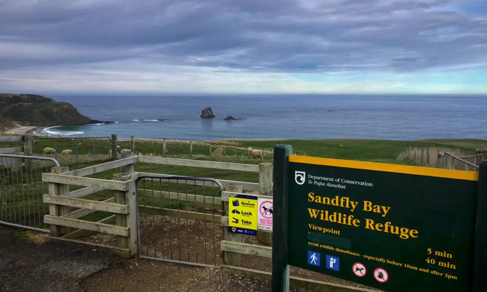
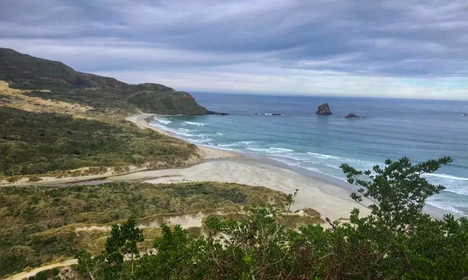
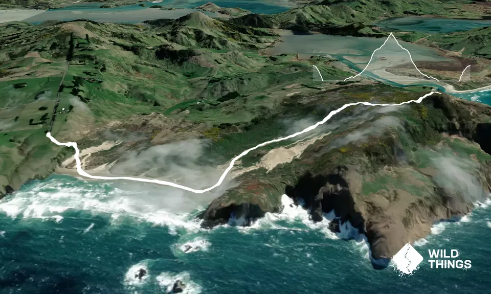
From the car-park on Seal Point Road, head along the well-formed track to the lookout and then on past it down the sandy trail to the beach. Once you get to the beach, take the time to look back up where you have just come from and be sure to save enough energy for the climb on the way back (105 metres vertical in 600m, mostly up soft sand). Then head along the beach giving the large black (and sometimes brown) lumps a wide berth... they are sea-lions and they are large (and smelly)!!!
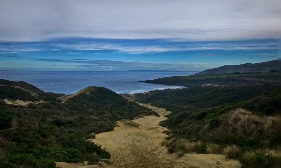
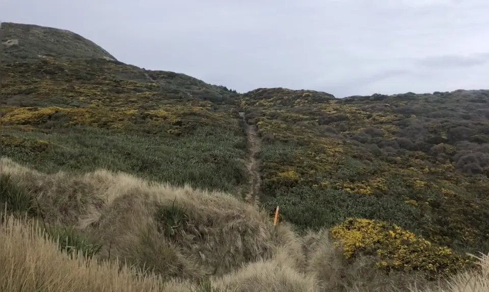
About halfway along the beach you will see some orange signs to your left... ignore these as they are signs telling you not to enter. Carry on down the beach until near the end where you will see another orange arrow, this time with a sign beneath it saying "Sandymount Track".... follow this and the orange poles up the climb from the beach. At times you will lose sight of the next orange pole, however if you look around you should be able to see the footmarks in the distance to guide you.
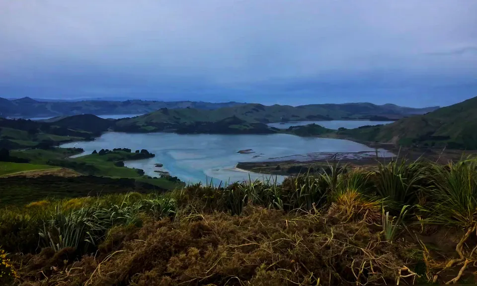
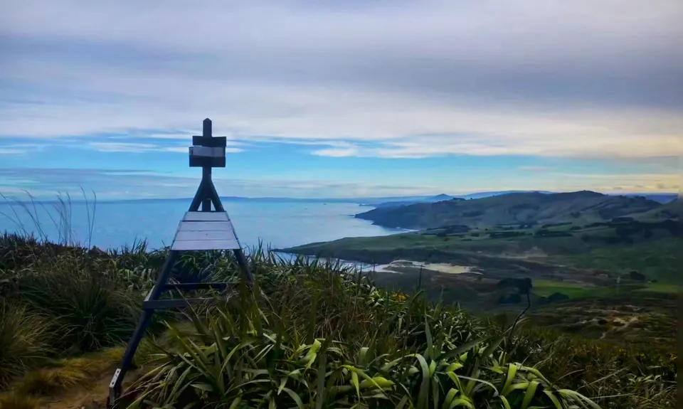
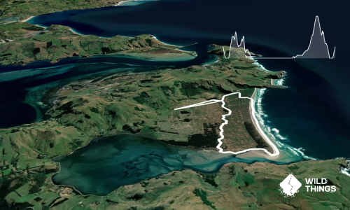
In the next 1.5km you will climb 220m vertical on medium to soft sand... so it will feel like 400m or more, after the initial climb there is a slight dip and then the final climb to the top of Sandymount, this final section has a couple of sandy bits, but overall is much better trail. At the top you have great views of the southern coast and the inlet and harbour. Well worth the effort. After that, retrace your steps to the start. There is an option to visit 'Lovers Leap' which has some great views and doesn't add too much on vert-wise!
Trail Community
Features of interest
Fantastic coastal views and get up close and personal to some mighty large sealions... yellow-eyed penguins if you're lucky!
Make Up of Run
Untracked / Route only: 20%
Moderate Single Track: 60%
Easy Single Track: 20%
Farm Road / 4WD Track: 0%
Gravel Road: 0%
Sealed Road: 0%
Route Data
Reviews:
Photos:
Your Trail Wishlist
All the runs that are on your To Do list (no limit).
Add to wishlist view wishlistWild Explorers
I did it!-
Access
At the end of Seal Point Road on the Peninsula. About 20 minutes from downtown Dunedin.
Plenty of parking at the end of the road. Don't know of any transport to and from.
15 km
21 minutes
No
No
-
Staying Safe
Easy.
Just stick to the beach until you see the large Orange Triangle and the sign, then as you head up the hill, if you lose sight of the next orange pole, remember that you are heading up, keep looking to the left and up and for footprints on the sand.
Very patchy.
Long-sleeved thermal top, Windproof jacket, Beanie/thermal headwear, Whistle, First aid kit, Extra food for emergencies, Cellphone, Map.
No drinkable water available
Should be ok year round. Very first part is through farmland, but I don't think they close during lambing.
-
Sponsor this trail
See other runs nearby:
Karetai, Highcliff, Paradise and Greenacres
Green Hill via Swampy
Taieri Mouth Millenium Trail
Mt Cargill and Organ Pipes
Ross Creek and McGouns
Signal Hill Big Easy
Pineapple and Flagstaff
Slick and Quick Swampy
Silverpeaks Classic Loop
Flagstaff Swampy Circuit
Leith Valley Swampy Circuit
Alternative Flagstaff Circuit
Purakaunui Beach Loop
Leith Saddle and Burns Track loop
Ross, Pineapple, Frasers loop
Graham's Grunt
Karetai Soldier
Coasting
Racing to Rain Gauge
2.8 Peaks Dunedin
Nichols Fall Loop
The Bullring Basher
Greengauge Loop
Chalkies Loop
Orokonui Heaven
The 3 Peaks
3 Peaks Plus 1