Last Updated: 6th Feb 2024

Beginner - Intermediate

Save Trail Save

I've done it Done

Racing to Rain Gauge

Dunedin, Otago

Submitted by Issy Whitaker

Last Updated: 6th Feb 2024

Beginner - Intermediate

Save Trail Save

I've done it Done

Open

Grunt Factor: 21 ?

Gnarl Factor: 33 ?

16.0km

650m

630m

647m


Login as a VIP to see driving directions, distance and time.

Trail Map

Type of Run

Urban fringe

Loop

Undulating, some big hills

Dog Friendly

Native bush

Riverside

Open tussock/grasslands

Open ridges/tops

Run Makeup

25%
25%
20%
30%

Gravel Road

Farm Road / 4WD Track

Easy Single Track

Technical Single Track

Average Uphill Gradient: +10.9%

Average Downhill Gradient: -7.6%

Trailhead

Login as a VIP to see the trailhead information.

Estimated Times to Run

2:30

Slow

2:00

Moderate

1:20

Fast

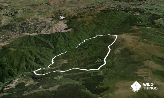
At the junction of Flagstaff-Whare Flat Road and Rollinsons Road, start with a cruisy descent down a very quiet gravel road for about 3.5km before turning right on Silverstream Valley Rd where you will come to Silverstream carpark. This is the start of Raceman's track along an old abandoned water race. At the beginning make sure you stay close to the building to find the narrow track on the right hand side of the river.

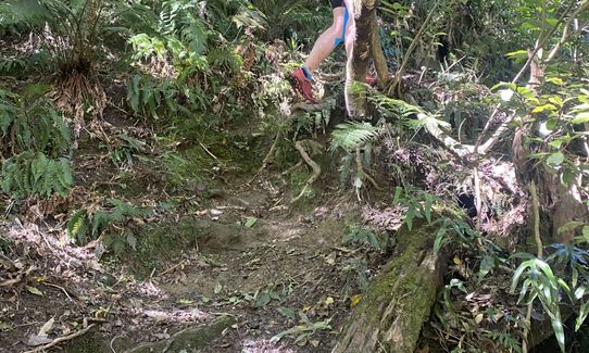
Head along the rooty and undulating singletrack. Turn left to cross the river at the first sign for Powder Ridge (If you accidentally go straight you should end up back on the route again). As you continue the tracks become more well signposted. There are a few easy/shallow river crossings to negotiate. Continue along Raceman’s Track which becomes flatter and easier going. A couple of other tracks break off to the right and left so it is handy to have the map or route on your phone/watch.

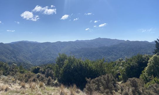
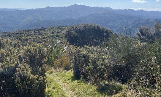
Just before the 9k mark you meet Rain Gauge Spur track. This is the beginning of an awesome 3km ascent to your final goal, the hairpin bend on Swampy access track. Initially you climb steeply up the side of the spur, before reaching the top and following it along through manuka forest and eventually emerging onto the tussock with awesome views back across the Silver Peaks.

Turn right down Swampy Access Track and cruise the 4k descent back to your car.
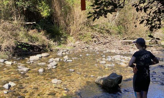
Abandoned water race

If you know of any public toilets near the trail start or on the route, please login and then let us know so we can update this section.

There are parks on the side of the road just before the junction and just after it.

9 km

14 minutes

Yes

No

Moderate.

Between the Silverstream carpark and the beginning of Rain Gauge Spur track (km 4 to km 9) there are a few tracks breaking off on the right and left so a map is handy. Even if you do take the wrong turn it is possible to find your way back to the route easily with a map.

Very patchy.

Long-sleeved thermal top, Seam-sealed waterproof jacket, Personal Locator Beacon (PLB), Whistle, First aid kit, Extra food for emergencies, Cellphone, Map, Headtorch and spare batteries

Along Raceman's track you have easy access to a free flowing clear river which you have to cross a couple of times. Essentially no water after km 9 once on Rain Gauge Spur.

There are muddy patches along the trail which could become deep after rain but not impassable. The last km of Rain Gauge Spur is out of the tree line so potentially could be very windy.

Patti's and Cream
176 Eglinton Road, Mornington, Dunedin
https://www.pattisandcream.co/
The best ice cream in Dunedin hands down. Olive serves home made ice cream in hand rolled waffle cones. She also makes a mean milk bun burger if you're after something more savory. Check her facebook page in case shes serving down by the beach in her Bedford food truck.

Trail Legend

HS

Hamish Sutherland

has completed Racing to Rain Gauge twice in the last year.

Learn about Trail Legends.

You and Racing to Rain Gauge

As a VIP member you can record private notes for this trail, see all of your times and more.

Register Now

Already have an account? Login now

Trail Reviews

To avoid the road section, I did a variation starting at the carpark but going up Tunnel Track to Steve Amies, followed Steve Amies to Rollison Rd, up Rollison Rd to Rain Gauge Track and followed Racemans back to the carpark (anticlockwise). Definitely the harder way of doing it but beautiful - alot of walking up hill and a little down on tecnnical sections. Around the same distance. Was nice to have the easy running along the valley at the end. This route cuts the road running to 1-1.5km.

Anaya Smiley

August 31

Really enjoyed the Rain Gauge uphill and Racemans is always a pleasure to run (and quite quick due to the flat gradient). I didn't mind the gravel road decents at the start and finish. Bombing down each of those made for a brisk warm up and cool down!

Daniel Pettigrew

March 16, 2024

This could quite easily have been a wonderful 5 star rating bar one thing... but first let me say there is a wonderful run along a riverside and an old water race, then a true WT knarly climb that goes on forever and spits out some stunning views... unfortunately these wonderful bits of trail are bookended with 3.5km at the start and 4km at the end of boring as downhill gravel road.

Mike Tennent

January 17, 2021

Login to submit a review

Trail Running Community

Find people who are interested in or have completed this trail run.

You must register or login to view this feature.

Register Now

Other trails nearby
Silverpeaks Classic Loop

Silverpeaks Classic Loop

Length: 24.8km

Level: Intermediate

Pineapple and Flagstaff

Pineapple and Flagstaff

Length: 7.6km

Level: Beginner - Intermediate

Signal Hill Big Easy

Signal Hill Big Easy

Length: 11.5km

Level: Beginner

Ross Creek and McGouns

Ross Creek and McGouns

Length: 10.9km

Level: Beginner

Find more trails and peaks nearby