Purakaunui Beach LoopBeginner - Intermediate
Front country - easily accessible
Loop
Undulating, some big hills
Native bushPlantation/exotic forestBeachCoastal
Beginner - Intermediate
3:00 (Slow)
2:15 (Moderate)
1:30 (Fast)
-8.5%
+4.4%
Can be muddy if it has recently rained.
Fastest Known Times (FKTs)
The out and back to Mapoutahi Pā needs to be done for a valid FKT time.
Please set your gender to see your position on the FKT leaderboards.
The more , the harder the FKT will be to beat. Learn about Fastest Known Times.
Description
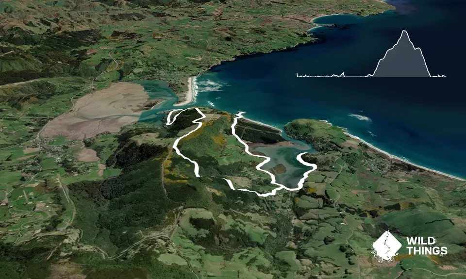
Leaving the carpark turn right and head back along Bay Road long on to the gravel part of the road and follow this until you reach a gateway with Private on it, if you look to the right you will see the trail that heads along the coast, follow this.
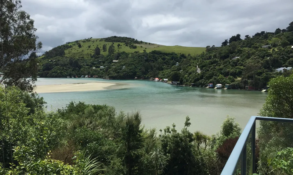
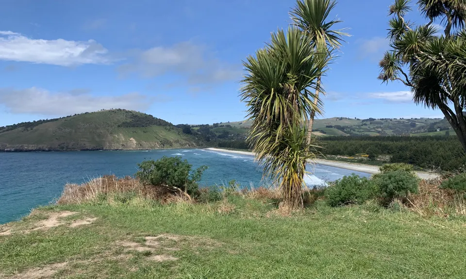
This will spit you out on a road just before a causeway across the lagoon, head right and follow the road for the next 5km or so…. Right around the bay and through the forest to the beach.
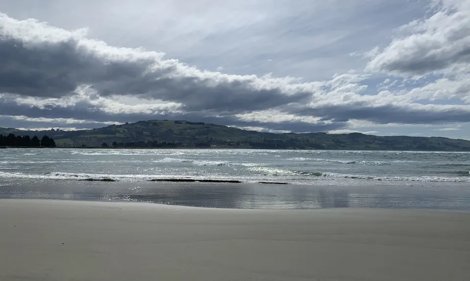
Take a left at the beach, you can head out onto the peninsula and check out the Pā (needed for an FKT time), otherwise head over the steps onto the next beach and head along it.
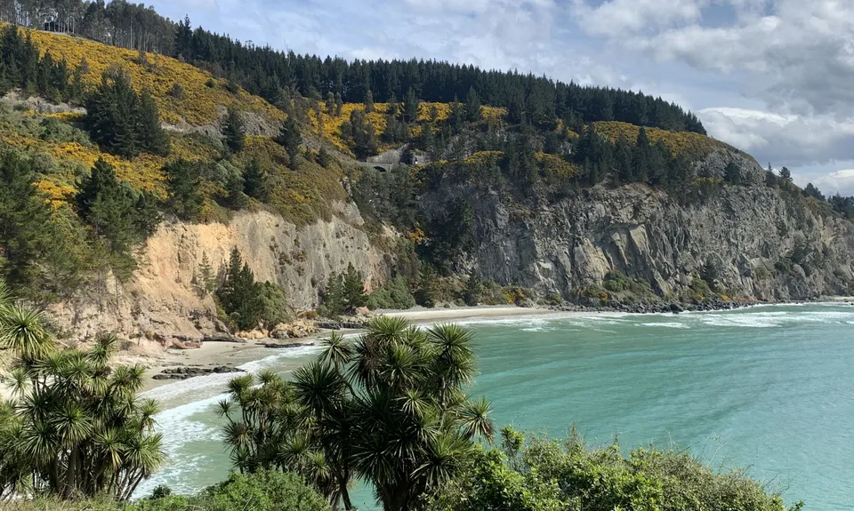
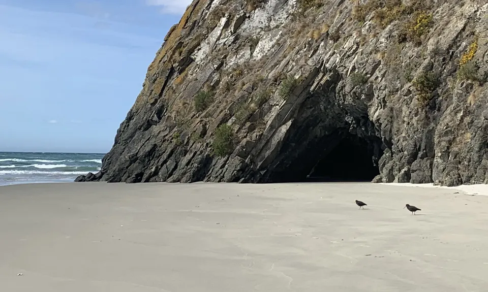
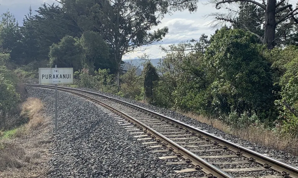
After a while you will need your rock hopping skills, it is very achievable, but you just need to take care… especially if they are wet. Once you have negotiated the rocks head along the sand. Enjoy the great wee caves at the point and head all the way along the beach until you see a path up left marked by a post. Head up there and find you way onto the road. The road turns from gravel to seal and about 1km along the road take a left onto White Road (even though it says ‘No Exit’) and head up over the railway line, keep going up until you pass a house on your right. Just on the right around the corner beyond the house you will see the sign for Mopanui Ridgeline Track… over the stile you go and follow this track. A bit of climbing (ok quite a lot) follows… mostly through open trail but in the middle is a lovely bush section. Once through the bush you hit one of those big long straight climbs… keep going until the trail meet the road.
As soon as it does look left and you will see the entry to McKessar Track. Over the stile again and follow the trail all the way down to it entry… then head over the railway line, down the 4WD trail opposite and onto the road. Follow the road down to about 100m from the causeway you crossed earlier… then retrace your steps to the start."
Trail Community
Features of interest
If you are lucky you may see a Sea-lion or penguin while crossing Purakaunui beach.
Make Up of Run
Untracked / Route only: 15%
Technical Single Track: 0%
Moderate Single Track: 20%
Easy Single Track: 15%
Farm Road / 4WD Track: 20%
Gravel Road: 30%
Route Data
Reviews:
Photos:
Your Trail Wishlist
All the runs that are on your To Do list (no limit).
Add to wishlist view wishlistWild Explorers
I did it!-
Access
Bay Road is a gravel track which runs to the left of the Purakaunui Inlet. This is the start of the track. After Approximately 300m on the gravel track, it turns into single track which runs along the edge of the inlet.
Parking is easily accessible. Traveling right along Bay Road for approximately 100m, there is a small car park on the left of the road, on the edge of the water.
24 km
30 minutes
No
No
-
Staying Safe
Moderate.
Make navigation of this route super-easy by using the Capra app on your phone. View on Capra .
While running from Purakaunui Beach to Doctors Point Beach, keep a lookout for an exit to the left which leads you onto Doctors Point Road. This exit is relatively concealed in the long grass on the left of the beach. Also, there is a small section of forest just before you reach the ascent to the highest point. The track is not overly clear, but there are colour tags on the trees to help you.
Generally good.
Seam-sealed waterproof jacket, Windproof jacket, Whistle, First aid kit, Extra food for emergencies, Cellphone, Map, Headtorch and spare batteries.
There is NO availability of water.
Can be muddy a slippery after rain, but only on the downhill. Requires shoes with good grip.
Best to do at low tide.
-
Sponsor this trail
See other runs nearby:
Karetai, Highcliff, Paradise and Greenacres
Green Hill via Swampy
Taieri Mouth Millenium Trail
Mt Cargill and Organ Pipes
Ross Creek and McGouns
Signal Hill Big Easy
Pineapple and Flagstaff
Slick and Quick Swampy
Silverpeaks Classic Loop
Flagstaff Swampy Circuit
Leith Valley Swampy Circuit
Alternative Flagstaff Circuit
Seal Point Rd to Sandymount
Leith Saddle and Burns Track loop
Ross, Pineapple, Frasers loop
Graham's Grunt
Karetai Soldier
Coasting
Racing to Rain Gauge
2.8 Peaks Dunedin
Nichols Fall Loop
The Bullring Basher
Greengauge Loop
Chalkies Loop
Orokonui Heaven
The 3 Peaks
3 Peaks Plus 1
Silverpeaks Pure