Tawarau RiverIntermediate
Submitted by Jonathan Drake
Front country - easily accessible
Combo
Undulating, some big hills
Native bushPlantation/exotic forestRiversideOpen farmlandsOpen tussock/grasslands
Intermediate
Not Suitable (Slow)
7:00 (Moderate)
5:00 (Fast)
-8.4%
+9.1%
Please note that the first section of the track while a marked DOC track is across private farm land and that access may be limited at times of the year such as lambing season. There is a notice at the start of the track to inform the farm manager of access, I spoke to a farmer leaving 248 Speedies Road (adjacent to the car parking position) to advise of my intents. I would seek out a farm worker to advise them of intentions before entering.
Fastest Known Times (FKTs)
Please set your gender to see your position on the FKT leaderboards.
Men
Women
There are currently no female FKTs for Tawarau River.
Filter FKTs
The more , the harder the FKT will be to beat. Learn about Fastest Known Times.
Description
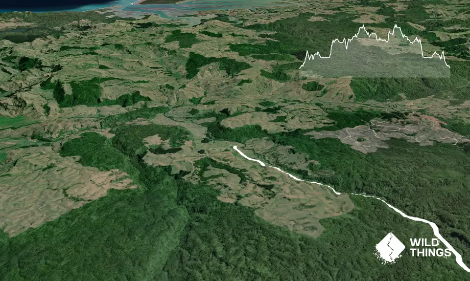
From the farm gate you follow a farm vehicle track along and then up into the hills.
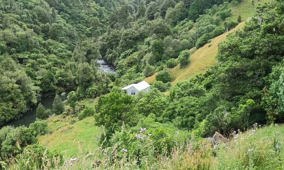
Cresting the first hill, this track gradually turns from a wide dirt track to a two-wheel then grassed track before gradually narrowing to a single track as you wind your way along the hillside. The formed track drops down to a hut in the gully below you but resist the temptation to follow it, keeping a close eye on your markers you will see the trail step off onto a grassed step towards a bushed gully area.
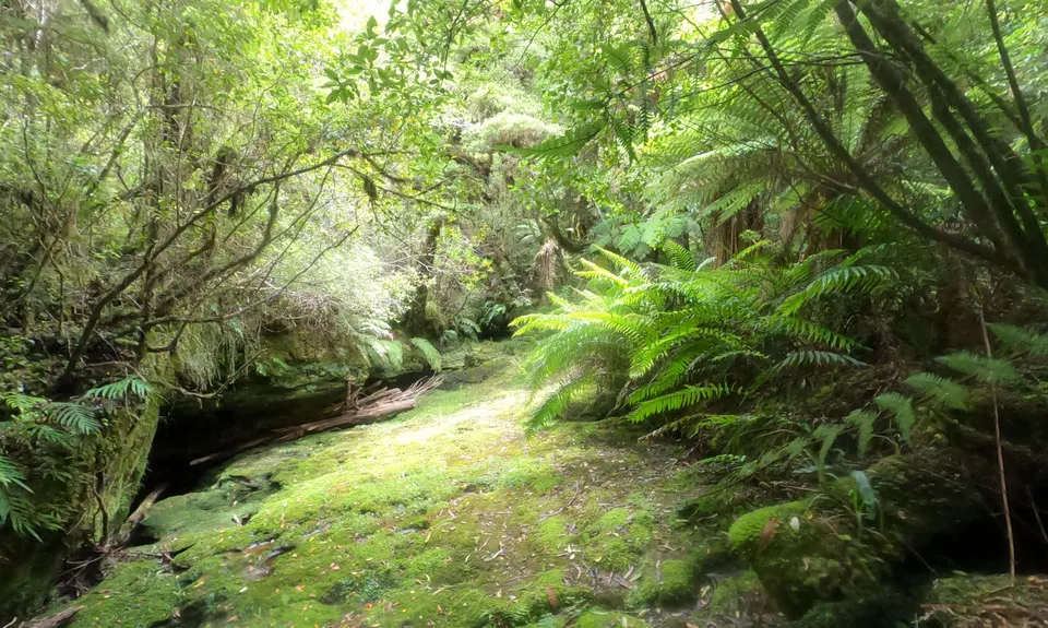
Following from here through more farmland you will eventually come to a farm gate on the edge of native bush and enter a wide track of gradual downhill on leaves and litter, a good opportunity to open up for a while although there are the odd hollows and bogs in the path along the way.
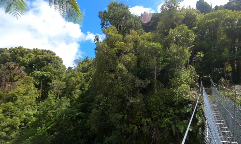
From here the trail starts to get a little more technical in places. You will come to an open glade (Blackberry Flat) that you go through the middle of before picking up the bush trail again. After that, a short section of technical downhill will see you come to a suspension bridge.
There is a fork near here where track continues along the gorge towards Were Road, however, you will be crossing the suspension bridge. Another short technical section uphill and some moderate uphill running will bring you through to open grass track and then forestry road.
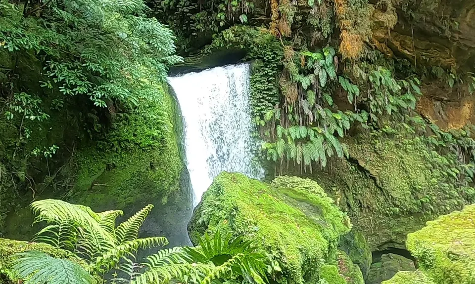
A first intersection has a left for Te Anga Road – stay right for Appletree Road and Double Falls. Another intersection follows shortly with signs for both Appletree Road to the left and Double Falls to the right – follow Double Falls in the first instance, this spur track will take you through basic vehicle track before a climb down to the falls.
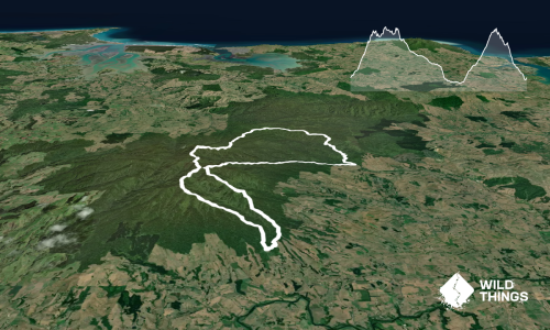
Returning as you came, you then continue on the new trail towards Appletree Road. A good couple of kilometres of moderate bush running will then bring you to the highest point of the route and a fork, and onto a loop. Keeping to the left will eventually bring you along to more vehicle track and a nice downhill run before you are back into the bush.
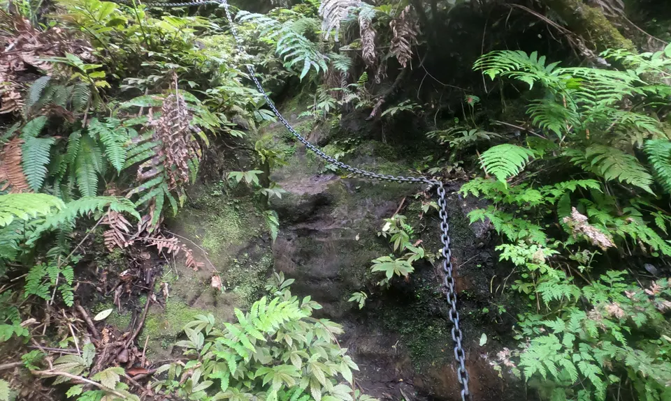
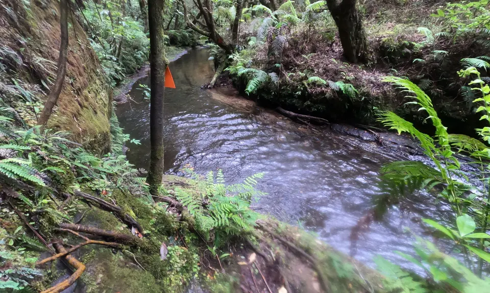
From here you are on trails alongside and crossing the river, both by bridge and ford. A spur track to Tawarau Falls comes up and you descend the hill for a view of these beautiful falls, and then a long climb up again hanging to the chain anchored to the rock.
Continuing from the spur along the track you will eventually close the loop returning to the highpoint fork, and from here retrace your steps back to the start.
Trail Community
Features of interest
This route follows in large part the Tawarau River gorge and then tracks alongside the upper Tawarau River, and noticeable features relate to the river. There is a basic suspension bridge across the river gorge a few kilometres in, alongside visits to Double Falls and Tawarau Falls, and a long section of trail alongside and crossing the river. River crossings both by bridge and wading!
Make Up of Run
Technical Single Track: 20%
Moderate Single Track: 35%
Easy Single Track: 30%
Farm Road / 4WD Track: 15%
Route Data
Reviews:
Photos:
Your Trail Wishlist
All the runs that are on your To Do list (no limit).
Add to wishlist view wishlistWild Explorers
I did it!-
Access
The start is off Speedies Road near its end. A short (50 metres or so) walk from the parking location detailed is a farm gate at the top of a small rise, with a shearing shed and stock pens to the left and Speedies Road bending up the hill to the right. This gate is the start point for the trail.
Speedies Road is reached by travelling through Waitomo on Te Anga Road. A little after passing the Marokopa Falls Trail the road goes down a hill with a bridge on the left, take this to progress onto Speedies Road then follow it to the parking place.There is an aging DOC sign "Tawarau Access Parking" on the left hand side a little over 2.5km along Speedies Road. Park here in available space on the grass alongside the road.
102 km
101 minutes
No
No
-
Staying Safe
Moderate.
The route is generally very well marked with orange triangles, with orange triangles throughout and with orange triangles on large white-painted posts in the farmland.
Take care on the farmland not to drop down the 4WD track towards the hut you will see - here the track goes along a small shelf overgrown with thistle. Note that the track the goes towards a bush-covered gully - the track is not specifically marked at this point but you can safely enter the small amount of bush and while it is difficult to see where you are placing your feet in the undergrowth, the creek through the gully is a shallow trickle and it is easy to walk through here.
After crossing the suspension bridge you will get to an open area known as Blackberry Flat, the marker at the other end of the glade is not immediately obvious but continue through the middle of the flat and you will soon see it.
At the far end of the trail alongside the river there are a number of river crossings, be very conscious of your markers and where you see any oversized ones look for the markers across the other side of the river indicating your crossing point.Non-existent.
Waterproof leggings, Long-sleeved thermal top, Seam-sealed waterproof jacket, Gloves, Beanie/thermal headwear, Personal Locator Beacon (PLB), Whistle, First aid kit, Extra food for emergencies, Survival blanket, Map, Gaiters.
You will be traversing alongside or over a lot of water, although a lot of it is not accessible and on a warm dry day it's recommended to carry plenty with you. However around the back loop of the course there are a number of river crossings where it would be easy to replenish flasks if you're comfortable standing midstream. There's also a waterfall flowing down rocks adjacent to the path which you could fill from.
There are sections of the trail that would be extremely boggy in winter.
River crossings included knee-high wading in normal conditions and caution would be required following heavy rains.
-
Post run indulgence
Te Toi Coffee
Te Anga
Very close to Speedies Road, although at time of writing is temporarily closed (probably due to COVID tourism downturn)Huhu Cafe
Waitomo
http://www.huhucafe.co.nz/
Your first major stopping point on the return to civilisation, and you will finally be back in mobile phone coverage.Michael's Milk Bar
Otorahanga
A great place to stop on the return for a classic Kiwi thickshake or any other dairy essentials required - Blog Posts and Articles
-
Sponsor this trail
See other runs nearby:
Bell Blast
Hilly Hakarimata
Lake Ngaroto
Pukemokemoke Loop
Nikau Loop & Kaiwhaniwha Caves
Harker Reserve to Vivian Falls
Ruapane Leg Burner
Karamu Walkway South
Lake D Dash
Pipiwharauroa Trail
Karakariki Track
Pukekōhatu Pack Ponies
Pirongia Loop of Insanity.
Over and back on the Wairere Traverse
Hapuakohe Hills
Waiotahi Karaka Trail
Pirongia Trail Run - Munter
Karamu Walkway North