Wild Things - New Zealand's trail running community
New Zealand's trail running community

Login


don't have an account?

Hapuakohe Hills, Waikato

Trail Directory proudly supported by Further Faster

Update Your Header Picture

Hapuakohe HillsIntermediate

Submitted by Ryan Hattle

Info Info
Map Loading

Trail Information

22.90km

1955m

1865m


Waikato

Hamilton

Front country - easily accessible

Point to Point (one way)

Very hilly

Native bush
Plantation/exotic forest
Open farmlands

Intermediate

Not Suitable (Slow)
6 (Moderate)
4:30 (Fast)

-16.8%

+17.6%

Download PDF Guide

Fastest Known Times (FKTs)

Please set your gender to see your position on the FKT leaderboards.

Men

Women

There are currently no female FKTs for Hapuakohe Hills.

Filter FKTs

The more , the harder the FKT will be to beat. Learn about Fastest Known Times.

Missing your time?

Register or login as a VIP and get yourself on the FKT leaderboard!

Register Now

Description

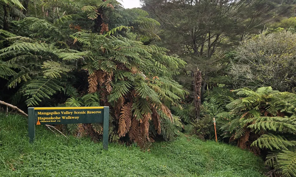
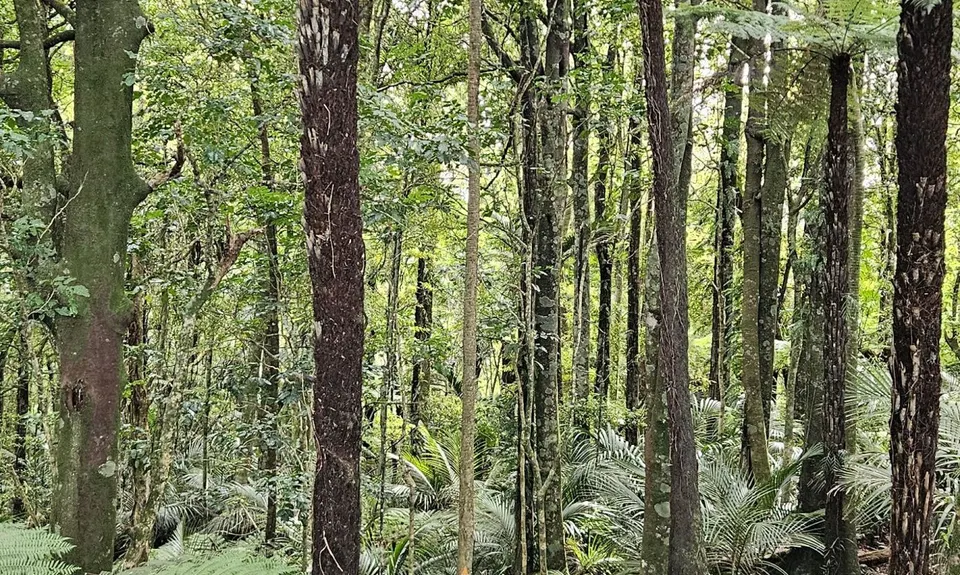
Start at the DOC sign for the route. For the first 0.8km you will be following a farm track. Follow the orange pole markers until you climb a stile and enter the bush (Mangapiko Valley Scenic Reserve).

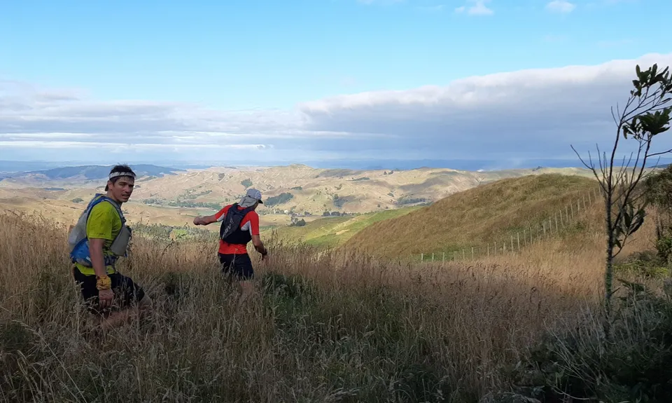
You climb about 120m through a mature forest before the track emerges at a farm fenceline and offers broad views across the hills and Hauraki Plains to Mt Te Aroha and the Kaimai Range. The track follows the fenceline for about 500m with continued views to the east and then ducks back into the bush for a short way before emerging again at the fenceline.

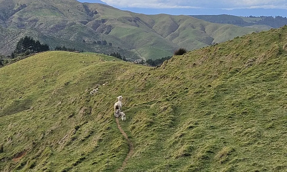
From here it’s a short but steep climb up private land to Pukeitionga Station (510m) which offers extensive views out west over the Waikato to Mt Pirongia and east to the Hauraki Plains. The track then heads back into the bush and down a few steep and slippery slopes.

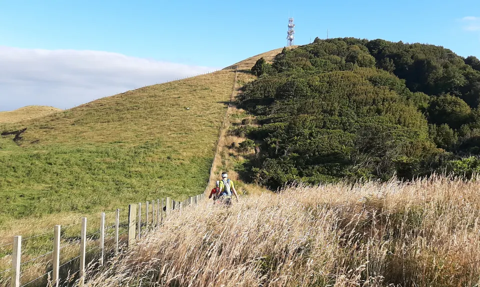
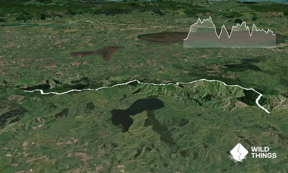
The track continues north until a steep ascent to a radio station at the summit of Maungakawa Peak (535m), the highest point of Hapuakohe Walkway which offers views north to the Firth of Thames. You briefly follow a farm track before the track enters the bush again. It can be easy to miss the bush entry, but it is marked with an orange arrow.

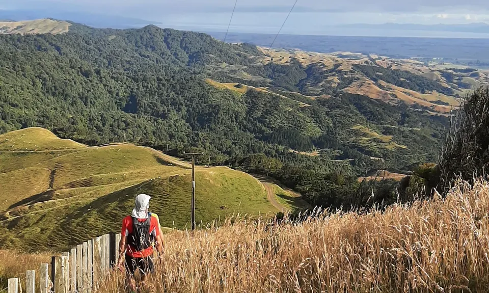
The track then heads north to Ohinewai Rd (9.4km) steeply dropping 380m, before climbing back up 100m to the road. You cross the road and continue to climb another 120 meters.

The next 5km is very steep, technical, and overgrown. There is a section through here where the trail follows a fence line on the eastern side.

At about 15km there is a very steep descent down a rutted long grass paddock. Keep an eye out for where the trail re-enters the bush at the bottom of this.

Some more steep downward climbing before the last long climb (200m). From here until the end there are some really nice, fun runnable sections of single trail if your legs haven't had enough. From 21.8km to the finish is a nice run through some pine forest.


Trail Community

Find people who are interested in this run.

You must register or login to view this content.

Features of interest

You do pass one small, but pretty waterfall on route.


Make Up of Run

Technical Single Track: 36%

Moderate Single Track: 30%

Easy Single Track: 21%

Farm Road / 4WD Track: 13%


Route Data

Reviews:

You must register or login to view this content.

Photos:

You must register or login to view this content.

Your Trail Wishlist

All the runs that are on your To Do list (no limit).

Add to wishlist view wishlist

Your Trail Dreamlist

The runs you most want to do (limited to 10).

Add to dreamlist view dreamlist

Wild Explorers

I did it!
  • Access

    The start of the route is located at the end of Mangapiko Valley Road (6km from turn off from Waiterimu). Follow it all the way to the end until you get to to a farm gate.

    You can park inside the paddock where the sign for the trail is, just remember to shut the gat behind you. Additionally running this route as a point-to-point will mean leaving a car or organising pick up from the finish which is at the end of North Road of State Highway 27.

    54 km

    46 minutes

    No

    No

  • Staying Safe

    Moderate.

    The route is marked with orange triangles, however there are sections that are very overgrown and rough going, so it can be easy to go off track. If you don't see another orange marker, just back track a bit and you should be able to look around and spot the next one.

    Patchy.

    Long-sleeved thermal top, Seam-sealed waterproof jacket, Gloves, Beanie/thermal headwear, Personal Locator Beacon (PLB), Whistle, First aid kit, Extra food for emergencies, Survival blanket, Cellphone, Map, Headtorch and spare batteries, Gaiters.

    A lot of this route is along a ridge line with no water. There are sections where you drop down and cross several small streams around 8.8km, 11.4km and 16.7km. Another option would be to drive to Ohinewai Road where the trail crosses and leave extra water and food here for when you pass through, it just means a bit more logistics.

    Potentially some muddy slippery sections after rain

    Some very steep technical downs and ups.

  • Post run indulgence

    Native Tree Cafe
    7 Church Road Mangatarata, RD6, Thames 3576
    https://www.facebook.com/NativeTreeCafe
    Right at the bottom of the road where you finish. Nice outdoor area to chill with a coffee after you day out. There have pretty tasty pies. They do close at 3:30pm though, so run fast.

    The Cornerstone Cafe
    26 State Highway 25, Mangatarata 3576
    https://thecornerstone.nz/wp-content/uploads/2020/05/Lunch-Menu-2020.pdf
    Close to finish of run, good reviews on google.

    Woodturners cafe
    3815 State Highway 2, Thames 3576
    Close to finish of run, good reviews on google.

  • Blog Posts and Articles
  • Sponsor this trail

    If you are interested in learning about sponsorship opportunities, please get in touch below:

    Submit

Got a favourite trail? Tell us about it.

Share the love and add your favourite trail(s) to our growing trail directory.

Submit A Trail

Become a member today

Start enjoying the many benefits to becoming a member of our thriving community.

Become a member

Great brands at great prices with our VIP member's discount

Stay up to date

Sign up to our newsletter for latest offers and trail guides

Share this trail with a friend:

VIP Membership

Please register as a VIP or login to your VIP account to view this content.

Cancel Login Register

Membership Required

You can see up to three trail guides without being logged in but after that we require you to be logged in to your Free or VIP account. If you don’t yet have an account you can register here.

Login Register