Round Ruapehu (RTM Track)Experienced
Submitted by Mal Law
Back country - remote
Loop
Undulating, some big hills
Native bushOpen tussock/grasslandsVolcanic
Experienced
18:00 (Slow)
15:00 (Moderate)
12:00 (Fast)
-8.0%
+7.3%
Fastest Known Times (FKTs)
Please set your gender to see your position on the FKT leaderboards.
The more , the harder the FKT will be to beat. Learn about Fastest Known Times.
Description
This is a super-serious run and should only be attempted by strong, experienced runners.
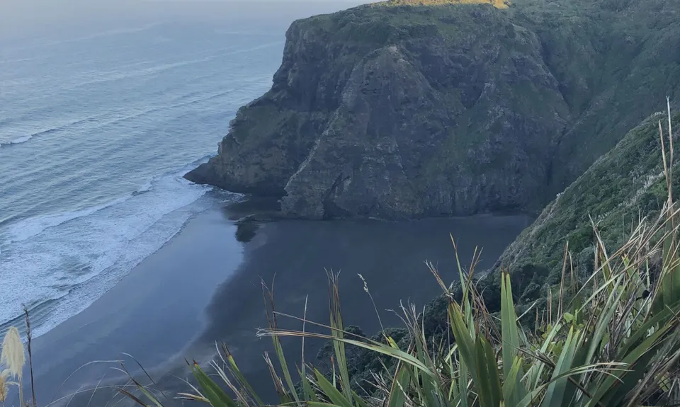
The best time to run the circuit is between October - May, as this is an all-day affair you'll want to maximize daylight hours, and being a remote alpine environment, bad weather can also make this run dangerous. Plenty of food, thermals and a wind-proof jacket are essential. Ruapehu's east-side is particularly remote.
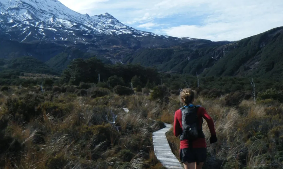
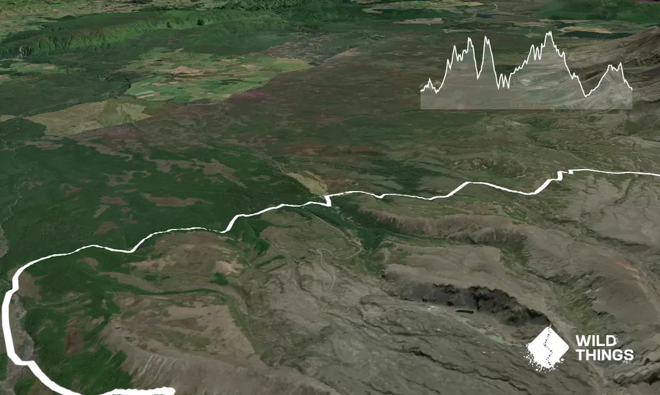
Begin your run along the Lower Silica Rapids/Whakapapaiti track, through lush beech forest and crossing several bridged stream crossings until you reach the Whakapapaiti Stream. You will cross to the far side, where you make your way through muddy tussock lands (some on boardwalk). Re-cross at the forked section of the stream shortly before reaching the hut. About 2 hours in, you should wake up the trampers and invite yourself in for some morning coffee fresh off the primus.
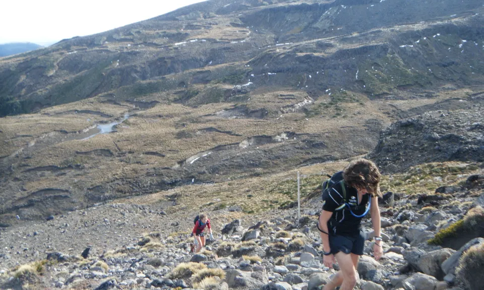
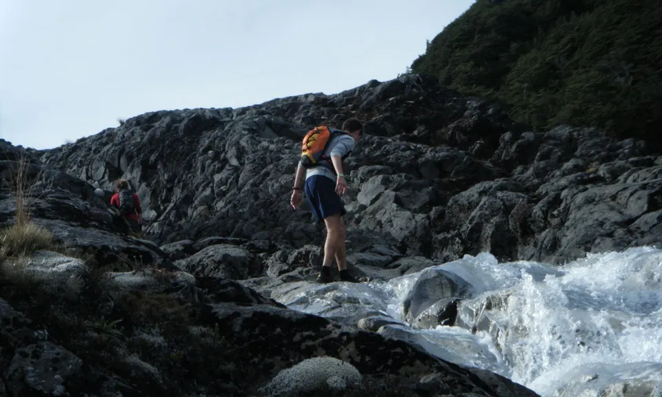
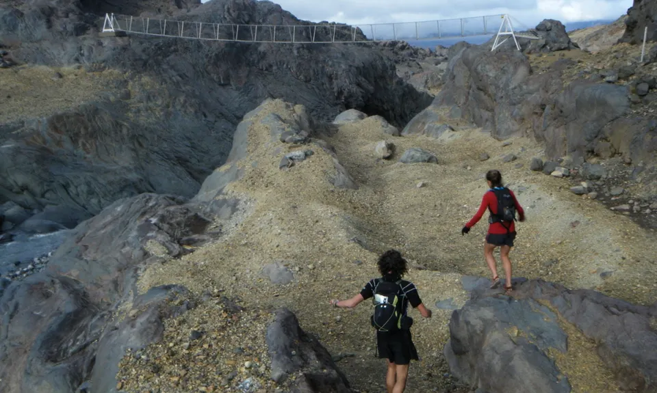
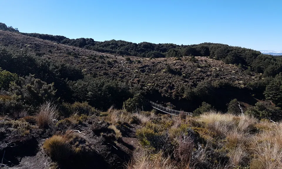
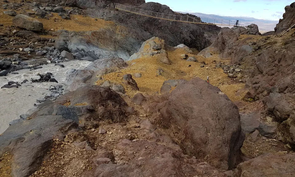
Continue on the trail and you'll soon intersect the Round the Mountain circuit track. Turn right and begin 'The Goat' section - steep, gnarly gullies will work you up and down, but with any luck, stunning views of Paretetaitonga will inspire you onwards. The trail swings you down a spur where you pass the pristine Lake Surprise and descend a steep gulley to Mangaturuturu Hut. Follow the boardwalk to the river, cross, and the trail continues to the left, towards the Cascades waterfall. This steep waterfall face is a tough climb which will reduce even elite runners to a walk.
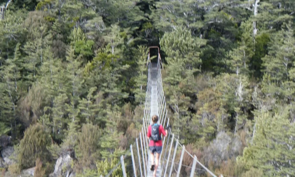
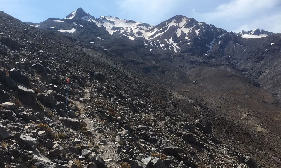
Jog down Ohakune Mountain Rd for 3km, and reconnect the track at car park to your left. The section to Mangaehuehu hut is a well groomed trail, and features a 39m waterfall - Ruapehu's highest, a 3-wire bridge crossing, and some interesting sub-alpine running through alpine herb fields. Refill your bladder here before heading into the wilderness that is the Rangipo desert. The trail turns into a poled route shortly after leaving the hut, so a compass would be useful in low visibility conditions. The Waihianoa glacial valley is spectacular, stop for a moment to take it in. Then blitz the descent and carry your momentum up the following, grueling, ascent. Apart from this workout, climbing is moderate; simply follow the undulating traverse across barren desert towards Rangipo hut.
Once you reach the Tukino Ski field road you are on the home-straight, only 27km of relatively fast running remains. The landscape is vast and exposed. Don't venture all the way to Waihohonu hut, instead cut the corner to the left and clip onto the Tama Lakes track and begin the gradual ascent on good trail to Tama Saddle. Switch on the headlamps (if they've not already been on for hours!) and finish strong along the easy board-walked and gravelled track. Listen out for the gushing Taranaki Falls, and flickering lights of the Chateau. You've done it, a complete circumnavigation of the North Island's most predominant mountain. 'One does not simply walk into Mordor - one simply runs!'
(Thanks to Alastair McDowell for the original version of this guide)
Trail Community
Features of interest
This is a classic circumambulation of the North Island's highest mountain. It is wild and stunningly beautiful in an often bleak kind of way. A true adventure amongst uniquely Kiwi volcanic vistas.
Make Up of Run
Technical Single Track: 40%
Moderate Single Track: 15%
Easy Single Track: 40%
Sealed Road: 5%
Route Data
Reviews:
Overlapping Runs
The following trails overlap with this run to some degree. You may wish to combine them but please note that to qualify for FKTs on these runs you should record a separate Strava activity for each

RTM - East & North
Length: 45.00km
Photos:
Your Trail Wishlist
All the runs that are on your To Do list (no limit).
Add to wishlist view wishlistWild Explorers
I did it!-
Access
From SH47 (National Park - Turangi road) head up the Bruce Rd to The Chateau. A couple of hundred metres past the hotel, on the right hand side of the road is a car park for the Lower Silica Rapids/Whakapapiti Track. This is your start point.
Plenty of parking at the track start. Take the usual precautions regarding valuables.
16 km
13 minutes
No
No
-
Staying Safe
Moderate.
The RTM track is for the most part clearly signposted but sections, particularly the eastern (Rangipo Desert) side can be tricky in poor visibility. Keep an eye on the map and a close eye out for track junctions.
Patchy.
Waterproof leggings, Thermal leggings, Lightweight fleece top, Long-sleeved thermal top, Seam-sealed waterproof jacket, Gloves, Beanie/thermal headwear, Personal Locator Beacon (PLB), Whistle, First aid kit, Extra food for emergencies, Survival bag, Cellphone, Compass, Map, Headtorch and spare batteries, Crampons / microspikes (for winter conditions), Gaiters.
Water is not so much an issue, you can fill up at each hut (spaced roughly 2-3 hrs run apart), and also from streams and rivers, all of which are pretty clean.
This is a very exposed route that is truly alpine in parts. Do NOT attempt in bad weather or in winter. After heavy rain some river crossings could be very dangerous so if in doubt wait and check with the DoC office at The Chateau before starting
The exposed weather and also the sharp rocky terrain - this is not a nice trail to take a tumble on. Check conditions with DoC before setting off and leave your intentions with someone.
-
Sponsor this trail
See other runs nearby:
Whakapapaiti Loop
Taranaki Falls & Tama Lakes
Ngauruhoe
Tongariro Northern Circuit
Tongariro Switcheroo
Ketetahi Carpark Time Trial
Taranaki Falls Beauty
Whakapapanui Track
Sash and Door Trail
Silica Rapids trail
Ruapehu Mile Higher Club
Tupapakurua Falls
T42 Traverse
The Great Pinnacle
Tama Traverse