Last Updated: 21st Sep 2023

Intermediate - Experienced

Save Trail Save

I've done it Done

Tama Traverse

National Park, Manawatu - Wanganui

Submitted by Jonathan Drake

Last Updated: 21st Sep 2023

Intermediate - Experienced

Save Trail Save

I've done it Done

Grunt Factor: 70 ?

Gnarl Factor: 54 ?

36.1km

1650m

1650m

1623m


Login as a VIP to see driving directions, distance and time.

Trail Map

Type of Run

Back country - remote

Combo

Very hilly

Native bush

Open tussock/grasslands

Open ridges/tops

Volcanic

Run Makeup

40%
20%
10%
30%

Easy Single Track

Moderate Single Track

Technical Single Track

Untracked / Route only

Average Uphill Gradient: +9.1%

Average Downhill Gradient: -9.1%

Trailhead

Login as a VIP to see the trailhead information.

Estimated Times to Run

Not suitable

Slow

8:00

Moderate

5:30

Fast

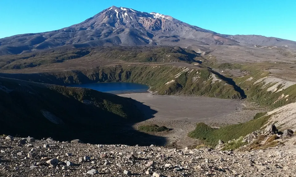
The start of the route is simple to navigate as you follow the track out from Whakapapa following signs for Tama Lakes and the the trail up the early ridgeline above Lower Tama Lake. This is all poled with trail markers.

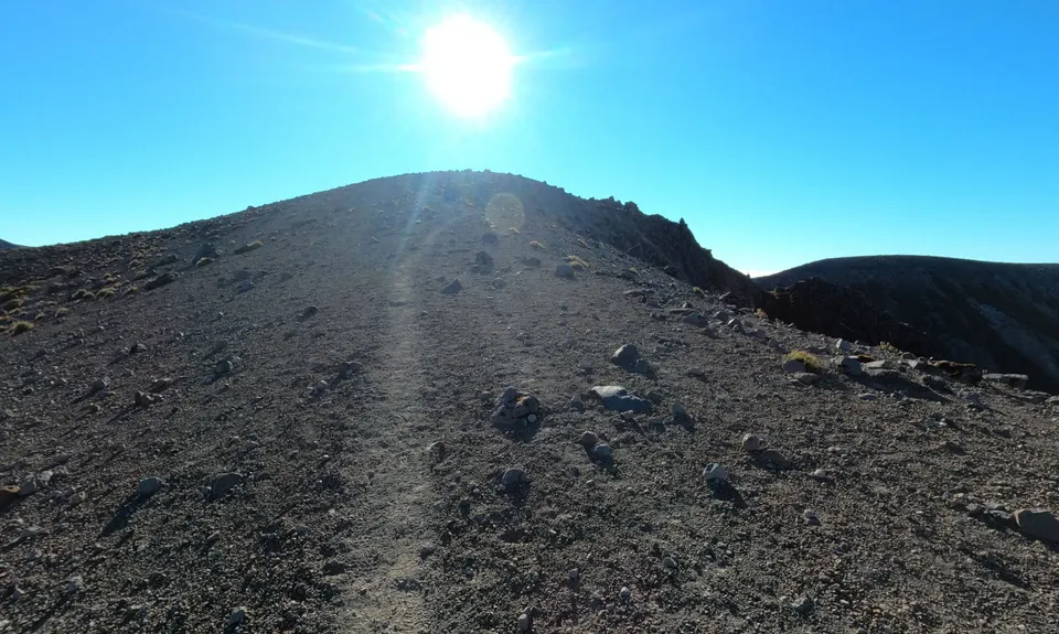
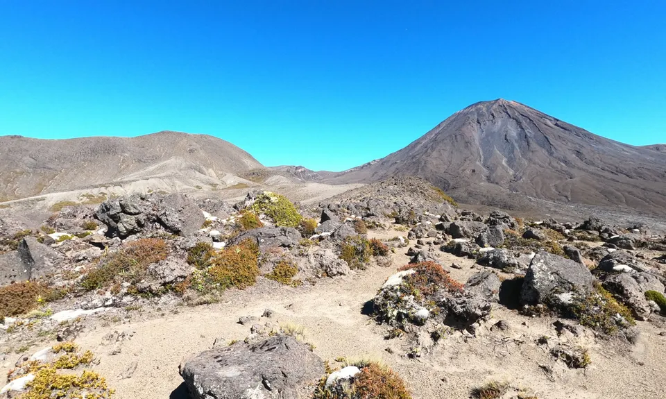
Reaching a small summit at the end of the Tama Lakes track and the end of trail markers, there are still some tracks ahead formed by people passing. On the left there is one gentle ridgeline running away towards Ngauruhoe but your route lies directly in front of you and here the trail starts to get more challenging.

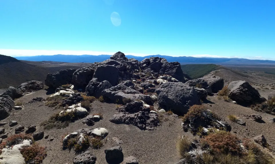
You'll proceed down from the summit entering into rocks and down to one small saddle before up and then down again, then another bigger climb to the unnamed 1450m peak shown on the NZ Topo Map.

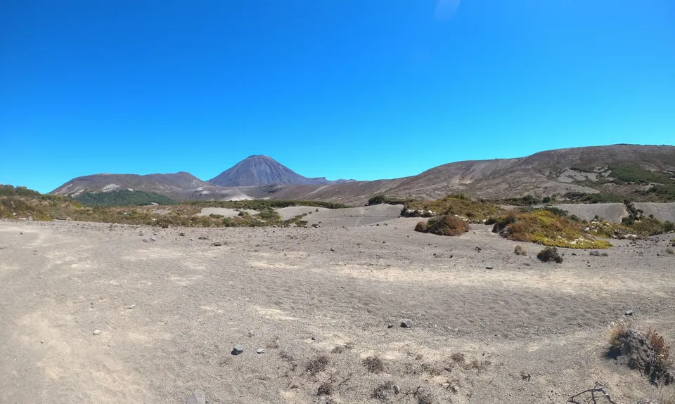
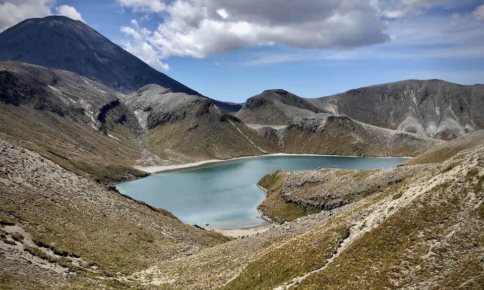
Angling away slightly left from here down the ridgeline you'll drop to a flatter area crossing below Upper Tama Lake and then angle tighter left to follow a longer ridgeline alongside Upper Tama Lake and the floodplain above it, then approaching a subsidiary peak known as "The Siddle". This will be your toughest climbing of the outing.

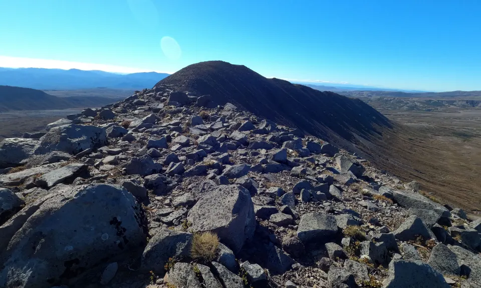
Then from The Siddle you angle right towards the southeast to drop slightly to a small saddle and approach the now obvious Tama summit. From Tama angle away left and pick a way down the jumble of rocks below you and in the direction of a long ridgeline running off into the distance on a southwest line.

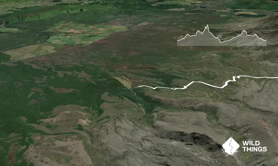
Pick your way along the ridgeline. This is jumbled with rocks at times but reasonably straightforward running and easy navigation keeping near the top and generally just to the right of the ridgeline. You may frequently be able to make out the footprints of hikers that have come this way. Eventually, you'll find yourself dropping down into the forest and a sea of orange markers as you join the Northern Circuit trail, follow this to the right and down the hill in the direction of Waihohonu Hut.

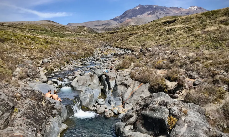
Here, either at the hut or the stream just before it is your only opportunity on this route to replenish water supplies. From the hut follow the track back in the direction of Whakapapa for about 7km.

The route then leaves the trail and strikes out across tussock back towards the Tama Lakes ridgelines. This point is directly after climbing a straight rutted section of the track then coming onto a plain, and if you're looking for it to the right you'll see the vestiges of a trail branching off into the tussock. This disappears very quickly though and you will be picking your own way across the tussock in the direction of the ridgeline in front of you. (Anyone doing this in the opposite direction would be coming off the ridgeline roughly in the direction of The Pinnacles on Ruapehu).

The long climb up the ridgeline will eventually bring you back to the subsidiary summit where you dropped down to cross below Upper Tama Lake and from here you can retrace your steps back to the Tama Lakes Track. From there it is a simple return to Whakapapa Village.

This trail includes the peak Tama.

The route takes you around Tama Lakes and up close to the southern and eastern flanks of Ngauruhoe, with Ruapehu in the distance, and on a clear day to views of the Kaimanawa ranges standing out in the distance when you summit Tama. As you proceed down the long ridge from Tama the silence is broken when you pass Waihohonu Springs and hear the stream babbling along in the valley a hundred meters below you.

You may be able to park directly on the trail head, otherwise there is plenty of parking around Whakapapa Village within short walking distance.

16 km

12 minutes

Unknown

No

Very hard.

A lot of the harder navigation is along ridgelines so that does help with bearings. However, as there are a number of different ridges around the area it's important to keep your orientation and be clear on your route plan. Review a Topo Map carefully before the trip and taking one with you. That said, the section between Tama Lakes track and Tama Summit is the only part of the route that requires careful navigation.

Very patchy.

Waterproof leggings, Thermal leggings, Short-sleeved thermal top, Long-sleeved thermal top, Seam-sealed waterproof jacket, Gloves, Beanie/thermal headwear, Personal Locator Beacon (PLB), Whistle, First aid kit, Extra food for emergencies, Survival bag, Cellphone, Map, Gaiters

There is very limited availability of water and the track is long and exposed so you should carry plenty. There is the opportunity to replenish at Waihohonu Hut or the stream nearby, but that is the only place you can be assured of water.

While not going to the more glorified tops of Tongariro National Park you will be proceeding across exposed and remote alpine ridgeline and should take all the appropriate precautions.

You will be picking your way up or down a few hillsides of tumbled rock as you go.

You and Tama Traverse

As a VIP member you can record private notes for this trail, see all of your times and more.

Register Now

Already have an account? Login now

Trail Reviews

Be the first to submit a review for Tama Traverse!

Login to submit a review

Trail Running Community

Find people who are interested in or have completed this trail run.

You must register or login to view this feature.

Register Now

Overlapping Trails

These overlap with this trail to some degree. You may wish to combine them but please note that to qualify for FKTs on these runs you should record a separate activity for each.

Taranaki Falls & Tama Lakes

Taranaki Falls & Tama Lakes

Length: 18.5km

Level: Beginner

Tongariro Northern Circuit

Tongariro Northern Circuit

Length: 44.5km

Level: Intermediate

Tongariro Switcheroo

Tongariro Switcheroo

Length: 32.0km

Level: Very Experienced

Other trails nearby
Dome If You Want To

Dome If You Want To

Length: 13.6km

Level: Intermediate

Ruapehu Mile Higher Club

Ruapehu Mile Higher Club

Length: 32.0km

Level: Intermediate - Experienced

Hauhangatahi Wilderness

Hauhangatahi Wilderness

Length: 14.6km

Level: Beginner - Intermediate

Whakapapanui Track

Whakapapanui Track

Length: 6.3km

Level: Beginner

Find more trails and peaks nearby