Wild Things - New Zealand's trail running community
New Zealand's trail running community

Login


don't have an account?

Ruapehu Mile Higher Club, Manawatu - Wanganui

Trail Directory proudly supported by Further Faster

Update Your Header Picture

Ruapehu Mile Higher ClubIntermediate - Experienced

Submitted by Jonathan Drake

Info Info
Map Loading

Trail Information

32.00km

2000m

2000m


Manawatu - Wanganui

National Park

Front country - easily accessible

Combo

Mountainous

Native bush
Riverside
Open tussock/grasslands
Open ridges/tops
Volcanic

Intermediate - Experienced

Not Suitable (Slow)
7:30 (Moderate)
5:00 (Fast)

-12.1%

+12.1%

Download PDF Guide

Fastest Known Times (FKTs)

Please set your gender to see your position on the FKT leaderboards.

Men

Women

There are currently no female FKTs for Ruapehu Mile Higher Club.

Filter FKTs

The more , the harder the FKT will be to beat. Learn about Fastest Known Times.

Missing your time?

Register or login as a VIP and get yourself on the FKT leaderboard!

Register Now

Description

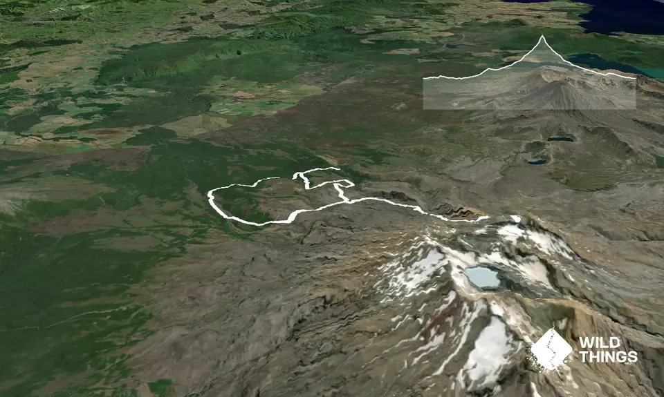
This route will take you from Whakapapa Village to summits of Ruapehu. It is a combination of alpine valley trail, parts of Bruce Road between Whakapapa and Iwikau villages, marked trail from Iwikau to near the top of Whakapapa Skifield, and unmarked trail to the summits. The recommended route direction puts more of the road running on downhill meaning less time on the road and more time on the trails! The track entrance is opposite the Fire Station, a couple of hundred metres up the road from The Chateau. Head west on Lower Silica Rapids Track you before a large bridge crossing of Waikare Stream. Here Silica Rapids Upper Track, which you’ll be returning down much later in the day, is on your left.

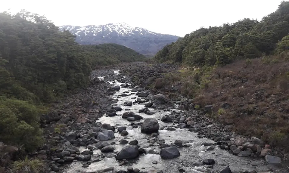
Continue ahead on Whakapapiti Valley Track out onto boardwalk at the edge of a plateau from where you get the first stunning views of Ruapehu above you and continue into Whakapapaiti Valley. A continuous but gentle climb takes you up the valley, with one crossing of the Whakapapaiti Stream – this should be about knee height in summer but can be higher after rain. Eventually you will arrive at Whakapapaiti Hut, where there are basic toilet facilities – although the water here is not recommended for drinking.


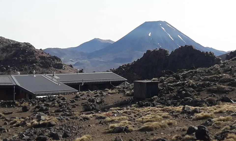
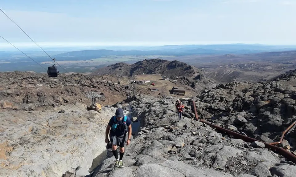
Passing Whakapapaiti Hut you quickly reach the Round the Mountain Track which you will take to your left and onto a zig-zag climb to plateau where the track will then lead you to Bruce Road. Follow Bruce Road up to the ski village. There is the potential for a toilet and water stop here, if you have access to one of the Ski Lodges – a potential summer accommodation option! Continue onto the marked trails alongside the skifield pylons to just below the top gondola station, also a good place to refill water and use the facilities.

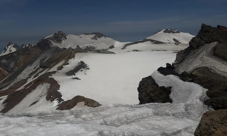
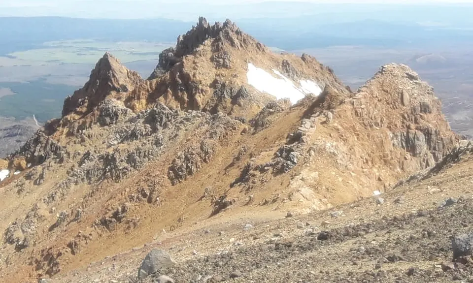
As the Ruapehu summit plateau is wide and circled with a number of summits, there are a couple of options at this point. You can continue to follow the marked trail below the gondola house to Tukino peak as per the GPX and map, this starts along the path that Ruapehu Alpine Lifts have signposted as “Sky Walk”. This is the most direct climb. An alternate route to Dome Summit starts above the gondola and is described in one of the links included. This will take you to a more central position above the summit plateau and crater lake.


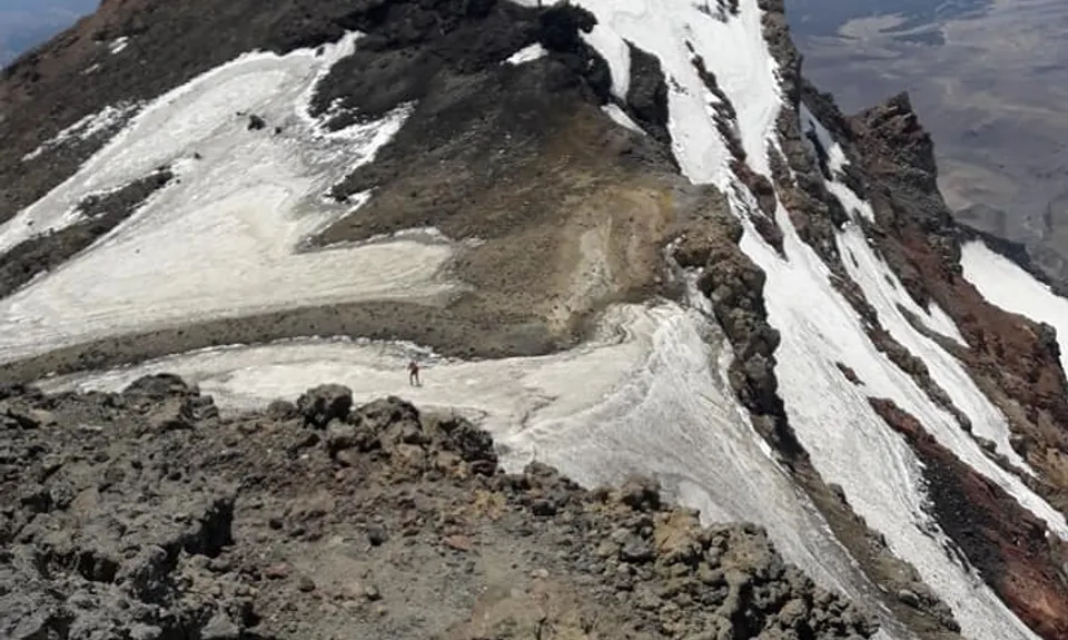
Note that the final part of the GPX trace is a straight line that approximates the approach to Tukino Peak but shouldn’t be followed precisely. The trail from the upper Gondola house is initially marked with orange blazed steel poles for much of the climb. Eventually the marked trail runs out and you are following a rough trail towards the peaks you can now see above you. Leftmost and above is Te Heu Heu and to the right slightly Tukino. Take care to follow the trail outline and other’s footprints where possible. Some of our group made the mistake of approaching Te Heu Heu directly and ended up rock climbing but followed carefully the trail naturally angles across on a simple hike up to Tukino – and then you emerge on top of the world at 2700 metres!


Head back down carefully to follow the track as it’s easy to run the wrong way down a ridgeline and face a long climb back up. Other than that you are retracing your steps back down to Bruce Road.

Continue down Bruce Road until you reach the Silica Rapids track on your left, then follow that back to your starting point.


Trail Community

Find people who are interested in this run.

You must register or login to view this content.


Make Up of Run

Untracked / Route only: 5%

Technical Single Track: 10%

Moderate Single Track: 20%

Easy Single Track: 50%

Sealed Road: 15%


Route Data

Reviews:

You must register or login to view this content.


Overlapping Runs

The following trails overlap with this run to some degree. You may wish to combine them but please note that to qualify for FKTs on these runs you should record a separate Strava activity for each

Whakapapaiti Loop

Whakapapaiti Loop

Length: 18.50km

Silica Rapids trail

Silica Rapids trail

Length: 7.80km


Photos:

You must register or login to view this content.

Your Trail Wishlist

All the runs that are on your To Do list (no limit).

Add to wishlist view wishlist

Your Trail Dreamlist

The runs you most want to do (limited to 10).

Add to dreamlist view dreamlist

Wild Explorers

I did it!
  • Access

    The trail head is opposite the Whakapapa Fire Station, about 500m up the road from The Chateau.

    Street parking is available in the immediate vicinity.

    16 km

    13 minutes

    No

    No

  • Staying Safe

    Moderate.

    Take care to follow the marker poles on the trails, particularly from above Iwikau village. When the marker poles run out, the trail outline is rough but can be followed with care. There is one place where one small rock climb is required, but otherwise careful hiking is all that is needed - or you have gone off track.

    Perfect throughout.

    Waterproof leggings, Thermal leggings, Short-sleeved thermal top, Long-sleeved thermal top, Seam-sealed waterproof jacket, Windproof jacket, Gloves, Beanie/thermal headwear, Whistle, First aid kit, Extra food for emergencies, Survival blanket, Cellphone, Map, Crampons / microspikes (for winter conditions), Gaiters.

    Water is available on tap at the top gondola station, along with toilet facilities. While there is water on tap at Whakapapaiti Hut this isn't recommended for drinking without boiling.

    This route should only be attempted in summer and in good conditions.

    Ruapehu is both a high mountain, and a volcano so there are risks related to alpine conditions and weather as well as of eruption. Check safety and weather advisories in advance.

  • Post run indulgence

    Pihanga Cafe & T-Bar
    Inside Chateau Tongariro, Whakapapa Village
    https://www.chateau.co.nz/food-drinks/pihanga-cafe-and-t-bar/
    Handy for a pizza or quick meal and drink

    Tussock Bar & Restaurant
    Whakapapa Village
    https://www.chateau.co.nz/food-drinks/tussock-bar-restaurant/
    A good bar for drinks and or meal and that all important post-run debrief!

  • Blog Posts and Articles
  • Sponsor this trail

    If you are interested in learning about sponsorship opportunities, please get in touch below:

    Submit

Got a favourite trail? Tell us about it.

Share the love and add your favourite trail(s) to our growing trail directory.

Submit A Trail

Become a member today

Start enjoying the many benefits to becoming a member of our thriving community.

Become a member

Great brands at great prices with our VIP member's discount

Stay up to date

Sign up to our newsletter for latest offers and trail guides

Share this trail with a friend:

VIP Membership

Please register as a VIP or login to your VIP account to view this content.

Cancel Login Register

Membership Required

You can see up to three trail guides without being logged in but after that we require you to be logged in to your Free or VIP account. If you don’t yet have an account you can register here.

Login Register