Please note: all peaks in the Tongariro National Park are sacred to the local hapū Ngāti Hikairo Ki Tongariro, who ask that we show respect by not climbing them. Access is not actually banned, so this is a conscience call for all trampers and runners.
This circuit traverses Mts Tongariro and Ngaruhoe on a variety of terrain (some of it untracked) from Whakapapa, requiring no backtracking, and combining 'touristy' sections of this famous pleateau with some remote untracked wilderness. Good to start early.
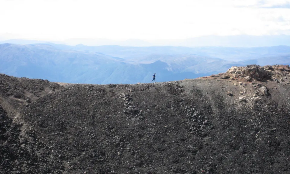
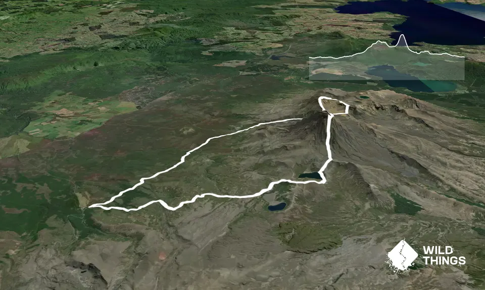
From the Chateau/Skotel, head out on the lower track towards Mangatepopo Hut near where you join the famous Tongariro Crossing track (which will be crowded if you slept in!) and follow it up to the top of the 'Devil's Staircase'. Leave the track here and strike out north on top of the untracked ridge up Mt Tongariro (this ridge dominates the skyline all the way up the Mangatepopo valley). The ridge has some nice rock scrambling in places and you can expect to be alone on this section.
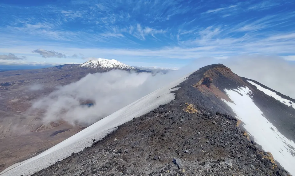
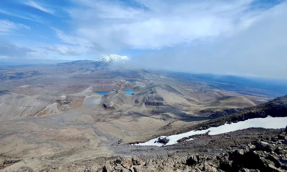
From Tongariro summit run back down the tracked ridge to Red Crater, then run back along the crowded Tongariro Crossing track to the trail that leads up Mt Ngaruhoe. Climb this volcano by the standard route - using as much of the rock band as possible (600m, 40-80 mins). After checking out the inner crater, return north-east to the steaming outer rim, and run around to the high point on the far (Ruapehu) side of Mt Ngaruhoe (see pic). Then drop off the edge - take a bearing on the Upper Tama lake and begin the steep, airy descent of the untracked `dark side' of Ngaruhoe, which is steeper and longer than the popular northern side - it's highly unlikely you will meet anyone else here. Avoid getting into the big central gully which has bluffs, and loose rock - probably best to tend right to descend on a steep scree face; left is also possible but of mixed quality.
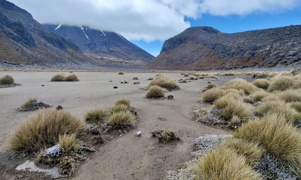
At the bottom is nice running cross country and over a (sometimes dry) tarn to two low adjacent cols above the Upper Tama Lake - pop over the left-hand col, which has a soft 60 metre descent to a remote and sheltered/bushy sandy beach on the northern edge of Upper Tama lake (refreshing swim on a hot day). Head left around the lake shoreline - some obstacles can be bypassed by clambering up a few metres and/or getting wet - then head for the obvious low saddle. From here climb up around the lake over some low hills (runnable) to where you join the standard track from the Upper Tama Lake. A cruisy and mostly downhill hour-long run back to the Skotel/Chateau.
Central volanic plateau's famous lakes and active vents, plus some alpine lakes, a remote sandy beach by a lake, and the `dark side' of Mt Doom (Ngaruhoe).
If you know of any public toilets near the trail start or on the route, please login and then let us know so we can update this section.
Plenty of parking in the village and near the track.
16 km
12 minutes
Unknown
No
Moderate.
Make sure you take the lower track to Mangetepopo (which drops down from the Skotel; not the upper track - which is the one you'll return on).
Some navigation required on Tongariro and more importantly on the descent of the southern side of Ngaruhoe (would not be a good place to get lost in cloud). If it's cloudy, the `Northern circuit' would be a good back-up option. Carry a map and compass.
Plenty of streams (also water at Mangatepopo Hut).
As a run, this is really only feasible for the warmer months, since the peaks will be plastered in snow in winter/spring.
Even in summer this is a fine-day trip only, and the weather can change up there very quickly.
Take particular care on the descent of the south side of Ngaruhoe.
Do you have a suggestion on where to go afterwards for the best coffee / cake / breakfast / brunch / beer?
These overlap with this trail to some degree. You may wish to combine them but please note that to qualify for FKTs on these runs you should record a separate activity for each.
We don't store or share your location; it's only used for these features. You can continue without it, just without distance sorting and live map features.
Send to your phone
Scan the below QR code to open this trail on your phone.
Tip: position the QR code in your phone camera screen.