Last Updated: 27th Mar 2024

Intermediate

Save Trail Save

I've done it Done

Dome If You Want To

Iwikau Village up to the Ruapehu Summit Plateau

Waterfalls Track

National Park, Manawatu - Wanganui

Submitted by Jonathan Drake

Last Updated: 27th Mar 2024

Intermediate

Save Trail Save

I've done it Done

Grunt Factor: 39 ?

Gnarl Factor: 76 ?

13.6km

1310m

1300m


Login as a VIP to see driving directions, distance and time.

Trail Map

Type of Run

Front country - easily accessible

Combo

Very hilly

Open ridges/tops

Volcanic

Run Makeup

15%
40%
45%

Easy Single Track

Moderate Single Track

Untracked / Route only

Average Uphill Gradient: +19.3%

Average Downhill Gradient: -19.1%

Trailhead

Login as a VIP to see the trailhead information.

Estimated Times to Run

7:00

Slow

5:00

Moderate

4:00

Fast

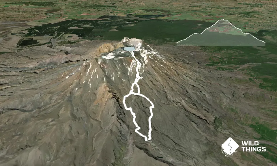
Please note that the GPX trace is a little messy in a couple of places, and imperfect for the upper reaches as this is unmarked trail and the best path may depend on conditions and how much ice cover there is.

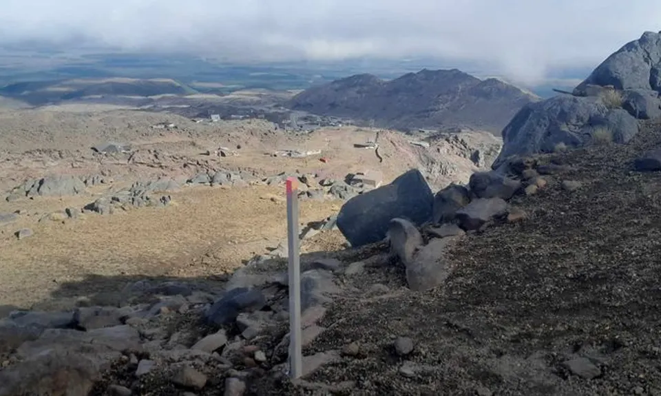
The route initially follows the Waterfalls Track roughly below the gondola line and to the Sky Waka base station. You'll start out following the 4WD road as it winds up the hill. You'll shortly reach a flat area where the road splits three ways. To your right there's a section up to the Ruapehu Ski Club lodge you can see above you and to the left a section drops down to above the Rangitira Express chairlift top station. Keep to the middle road section. This eventually runs out into trail, and from here you can follow a series of pink topped marker poles up the valley, eventually coming up next to the Sky Waka top station. This is a good place for a toilet stop, or to fill up water bottles (during Sky Waka operating times).

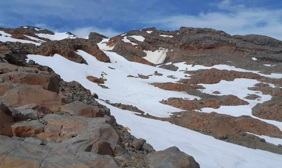
From here, the GPX follows the ridgeline (Restful Ridge) from immediately to the right of the gondola station. An alternative route to avoid rock scrambling is to take up the same route as down on the trace. If following the ridgeline, follow the pink markers on from the Sky Waka - the ones directly to the right (a separate set below the gondola station run up towards other peaks, different from this route). The markers will shortly lead you across a small stream in the rock face, from here you angle around left and scramble up to the ridgeline then follow this upwards. (Note that the GPX has a couple of side spurs here as I was exploring).

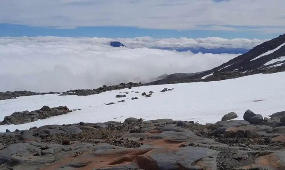
Follow along the ridgeline and you'll eventually find a unmarked but well worn track join from the left coming up from the valley. You will follow this track from here - while unmarked it is frequently visible where the surface is dusty, and keeping an eye out you can see that small cairns have been erected on larger boulders as a guide. There are times however where the trail may peter out, particularly where there are sections of ice, however keep moving upwards in the same general direction and you'll generally pick it out - or follow broadly the GPX. You'll also see above you the 2642m unnamed but topo referenced peak that is your destination and can track towards it.

Reaching that point you will have a great view over the Ruapehu Summit Plateau. To your left is a small knob that is a worthwhile viewing and resting point. To the right, the ridgeline runs down and then up again in the direction of the Dome summit which is your ultimate destination. Follow this out and then back. Descend down again the same general path you ascended on, in the direction of the Sky Waka station.

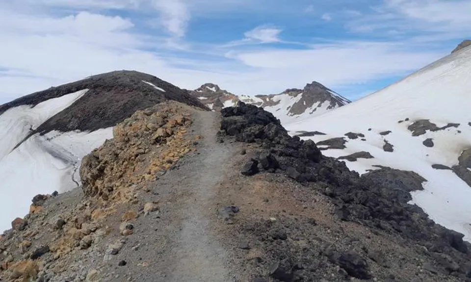
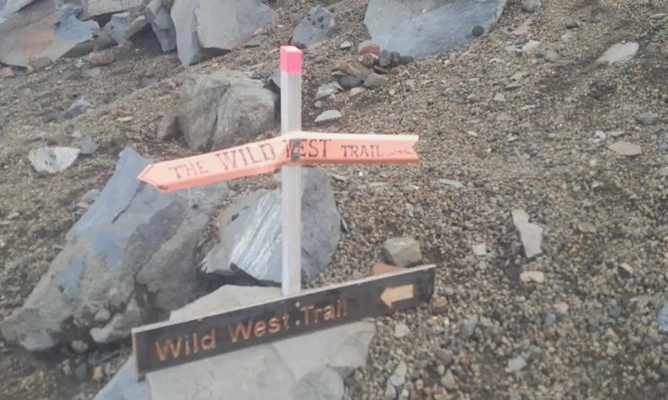
The published route varies on the way down by heading straight down the valley path to the gondola on a more gradual ridgeline. Return to the Sky Waka station if a rest stop is needed, otherwise before the station pick up the pink marker poles that you earlier followed from the right of the station, and continue to follow these. This will take you along the Wild West Trail, with a clearly marked descent back to Iwikau Village.


Please respect the history and culture of the area.

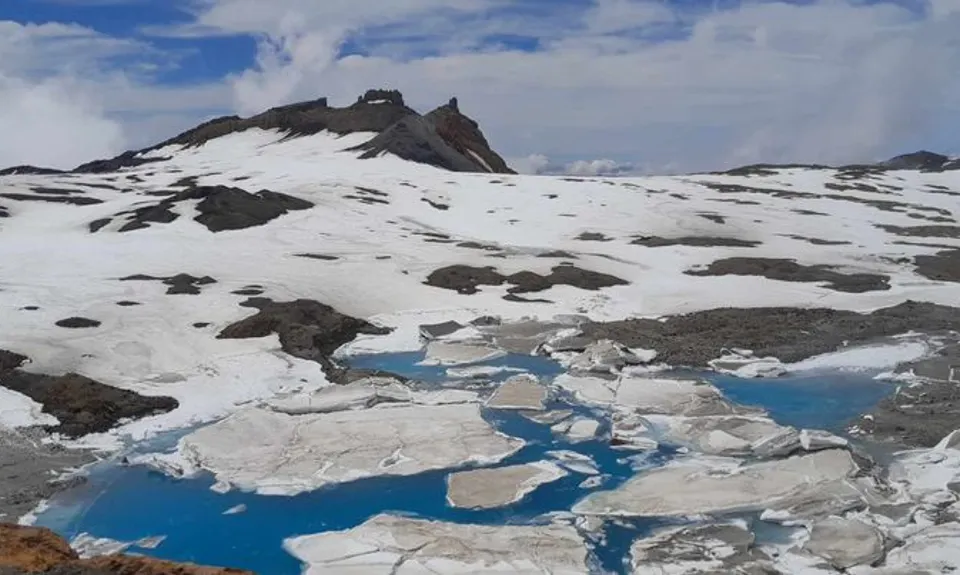
All waterways including the lakes on Tongariro and his peaks Ngāuruhoe and Ruapehu are sacred to local iwi, Ngāti Hikairo ki Tongariro.

Kaumātua Te Ngaehe Wanikau asks visitors to the area to respect the sanctity of the maunga tapu (sacred mountains) by not touching or entering any of the waterways including the alpine lakes.

This trail includes the peak Dome.

Too many to name them all! On a good day, great views of Ngāuruhoe and even Taranaki, and over the plains below Ruapehu. You'll see the Pinnacles in fine relief, and have good views of Crater Lake, Cathedral Rocks, Tukino and Te Heuheu, Paretetaitonga, Te Ataahua and Tahurangi, and Meads Wall. And of course, the Dome!

In summer there is plenty of parking available at the top of the Bruce Road and adjacent to Iwikau Village.

5 km

No

No

Moderate.

Keep an eye on the pink topped markers on the lower reaches.

On the upper reaches, use a combination of following the worn track, tracking to the cairns, GPX trace (as a broad guide), topo map, and your own sense-making working up the ridgelines to the summit.

Patchy.

Waterproof leggings, Seam-sealed waterproof jacket, Gloves, Beanie/thermal headwear, Personal Locator Beacon (PLB), Whistle, First aid kit, Extra food for emergencies, Survival bag, Cellphone, Map, Gaiters

Water is available the the upper gondola station (SkyWaka Knoll Ridge Cafe) during operation hours.

This is a route highly subject to seasonality, and generally a summer route subject to good weather conditions.

Depending on the season and conditions there will be some ice sheets around or across the route so be prepared to navigate these. Generally the route is rocky and rugged but not extreme. The tops are very exposed to any adverse weather conditions.

Sky Waka Pinnacles Cafe
Knoll Ridge, Ruapehu
https://www.mtruapehu.com/passes/summer-sightseeing
For the more casual WildThing, this is a great place to stop off for a meal or even a beer!

You and Dome If You Want To

As a VIP member you can record private notes for this trail, see all of your times and more.

Register Now

Already have an account? Login now

Trail Reviews

Be the first to submit a review for Dome If You Want To!

Login to submit a review

Trail Running Community

Find people who are interested in or have completed this trail run.

You must register or login to view this feature.

Register Now

Overlapping Trails

These overlap with this trail to some degree. You may wish to combine them but please note that to qualify for FKTs on these runs you should record a separate activity for each.

Ruapehu Mile Higher Club

Ruapehu Mile Higher Club

Length: 32.0km

Level: Intermediate - Experienced

Ruapehu Mile Higher Club

Ruapehu Mile Higher Club

Length: 32.0km

Level: Intermediate - Experienced

Ruapehu Mile Higher Club

Ruapehu Mile Higher Club

Length: 32.0km

Level: Intermediate - Experienced

Other trails nearby
Hauhangatahi Wilderness

Hauhangatahi Wilderness

Length: 14.6km

Level: Beginner - Intermediate

Silica Rapids trail

Silica Rapids trail

Length: 7.8km

Level: Beginner

Tongariro Northern Circuit

Tongariro Northern Circuit

Length: 44.5km

Level: Intermediate

Sash and Door Trail

Sash and Door Trail

Length: 21.0km

Level: Beginner - Intermediate

Find more trails and peaks nearby