Last Updated: 27th Mar 2024

Intermediate

Save Trail Save

I've done it Done

Tongariro Twist

Mangetepopo Hut and Mount Tongariro

Tongariro Alpine Crossing

National Park, Manawatu - Wanganui

Submitted by Jonathan Drake

Last Updated: 27th Mar 2024

Intermediate

Save Trail Save

I've done it Done

Open

Grunt Factor: 36 ?

Gnarl Factor: 62 ?

17.5km

1035m

1040m


Login as a VIP to see driving directions, distance and time.

Trail Map

Type of Run

Front country - easily accessible

Loop

Undulating, some big hills

Open tussock/grasslands

Open ridges/tops

Volcanic

Run Makeup

40%
12%
8%
40%

Easy Single Track

Moderate Single Track

Technical Single Track

Untracked / Route only

Average Uphill Gradient: +11.8%

Average Downhill Gradient: -11.8%

Trailhead

Login as a VIP to see the trailhead information.

Estimated Times to Run

6:00

Slow

4:30

Moderate

3:30

Fast

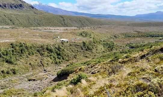
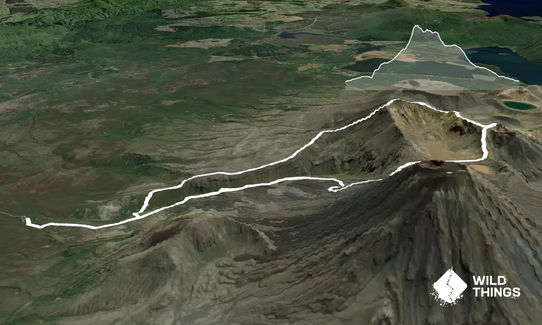
Starting at the Tongariro Alpine Crossing trail head, you follow the main trail as far as the fork for the Mangetepopo Hut. Take the fork towards the hut, and then pass the hut on the right hand side. You'll find a small gravel track in the grass behind the hut. Follow this track down to the gully below, and then up the bank up the other side. The formed track tapers out but you can see the footsteps of other travellers.

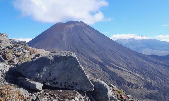
Keep heading up the incline towards the ridge, angling slightly towards the right as you go. Once you make it up to the ridgeline above the Mangetepopo Hut, follow the ridgeline up for some time. There is some form of trail much of the way due to other travellers, but no formal trail markings. Just keep following the ridgeline up. You'll eventually reach a flat, rounded hill (pt 1409) and drop down slightly before continuing on up. After this point, at about 1500m elevation, the terrain steepens. You'll angle around slightly left to a NE line and straight up a steeper ridgeline, now rock climbing. The Tongariro summit ridgeline will come in to view slightly to the right of this line, and you will angle up to that ridgeline running roughly true E. Eventually you'll make it to the top of this bank and to the summit ridgeline.

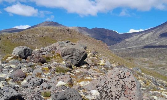
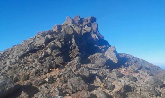
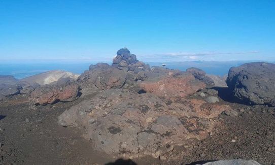
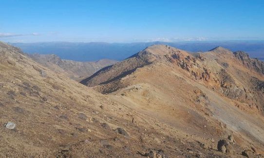
At this point there is a long section of rough rock along the ridge, you make your way along the east side of this on a roughly formed track. Eventually the surface evens out and you come to the relatively simple and flat Tongariro summit. From here, continue in the same direction down the flank of the summit towards the long ridgeline in front of you. This is the Mount Tongariro Summit Route and you can follow the trail along for same way. Where it disappears into rock, simply continue following the ridgeline along. If in doubt keep slightly to the left of the top of the ridge, as it drops off on the right. This will eventually bring you to the Tongariro Alpine Crossing route next to Red Crater. Take a quick trip left up to the cairn above Red Crater, because it would be wrong not to when you're that close!

Then head back down and follow the Tongariro Alpine Crossing route down the hill at back to the trail head at Mangetepopo.


Please respect the history and culture of the area.

All waterways including the lakes on Tongariro and his peaks Ngāuruhoe and Ruapehu are sacred to local iwi, Ngāti Hikairo ki Tongariro.

Kaumātua Te Ngaehe Wanikau asks visitors to the area to respect the sanctity of the maunga tapu (sacred mountains) by not touching or entering any of the waterways including the alpine lakes.

This trail includes the peak Mount Tongariro.

Mangetepopo Hut, Tongariro summit, Red Crater, South Crater, and the Mangetepopo Valley. With stunning views of Ngauruhoe in good conditions.

Shuttle services can be arranged although getting a ride in is straight forward, out less so. It's possible to park directly on the trailhead but there is a 4 hour limit, so either be a fast runner or go at one or the other ends of the day when it's not busy.

5 km

No

No

Hard.

Generally good.

Seam-sealed waterproof jacket, Gloves, Beanie/thermal headwear, Personal Locator Beacon (PLB), Whistle, First aid kit, Extra food for emergencies, Survival bag, Cellphone, Compass, Map, Gaiters

The only water availability is at Mangetepopo Hut, too near the trailhead to be of much value.

This is a summer route for runners as much of it will be covered in snow and ice in winter.

The route goes off marked trails and along exposed ridgelines with some technical ascent.

You and Tongariro Twist

As a VIP member you can record private notes for this trail, see all of your times and more.

Register Now

Already have an account? Login now

Trail Reviews

Be the first to submit a review for Tongariro Twist!

Login to submit a review

Trail Running Community

Find people who are interested in or have completed this trail run.

You must register or login to view this feature.

Register Now

Overlapping Trails

These overlap with this trail to some degree. You may wish to combine them but please note that to qualify for FKTs on these runs you should record a separate activity for each.

Ngauruhoe

Ngauruhoe

Length: 15.2km

Level: Intermediate

Tongariro Northern Circuit

Tongariro Northern Circuit

Length: 44.5km

Level: Intermediate

Tongariro Switcheroo

Tongariro Switcheroo

Length: 32.0km

Level: Very Experienced

Ngauruhoe

Ngauruhoe

Length: 15.2km

Level: Intermediate

Tongariro Northern Circuit

Tongariro Northern Circuit

Length: 44.5km

Level: Intermediate

Tongariro Switcheroo

Tongariro Switcheroo

Length: 32.0km

Level: Very Experienced

Other trails nearby
Whakapapaiti Loop

Whakapapaiti Loop

Length: 18.5km

Level: Beginner

Dome If You Want To

Dome If You Want To

Length: 13.6km

Level: Intermediate

Whakapapa/Wairere off the beaten track

Whakapapa/Wairere off the beaten track

Length: 8.9km

Level: Intermediate

Sash and Door Trail

Sash and Door Trail

Length: 21.0km

Level: Beginner - Intermediate

Find more trails and peaks nearby